Denali

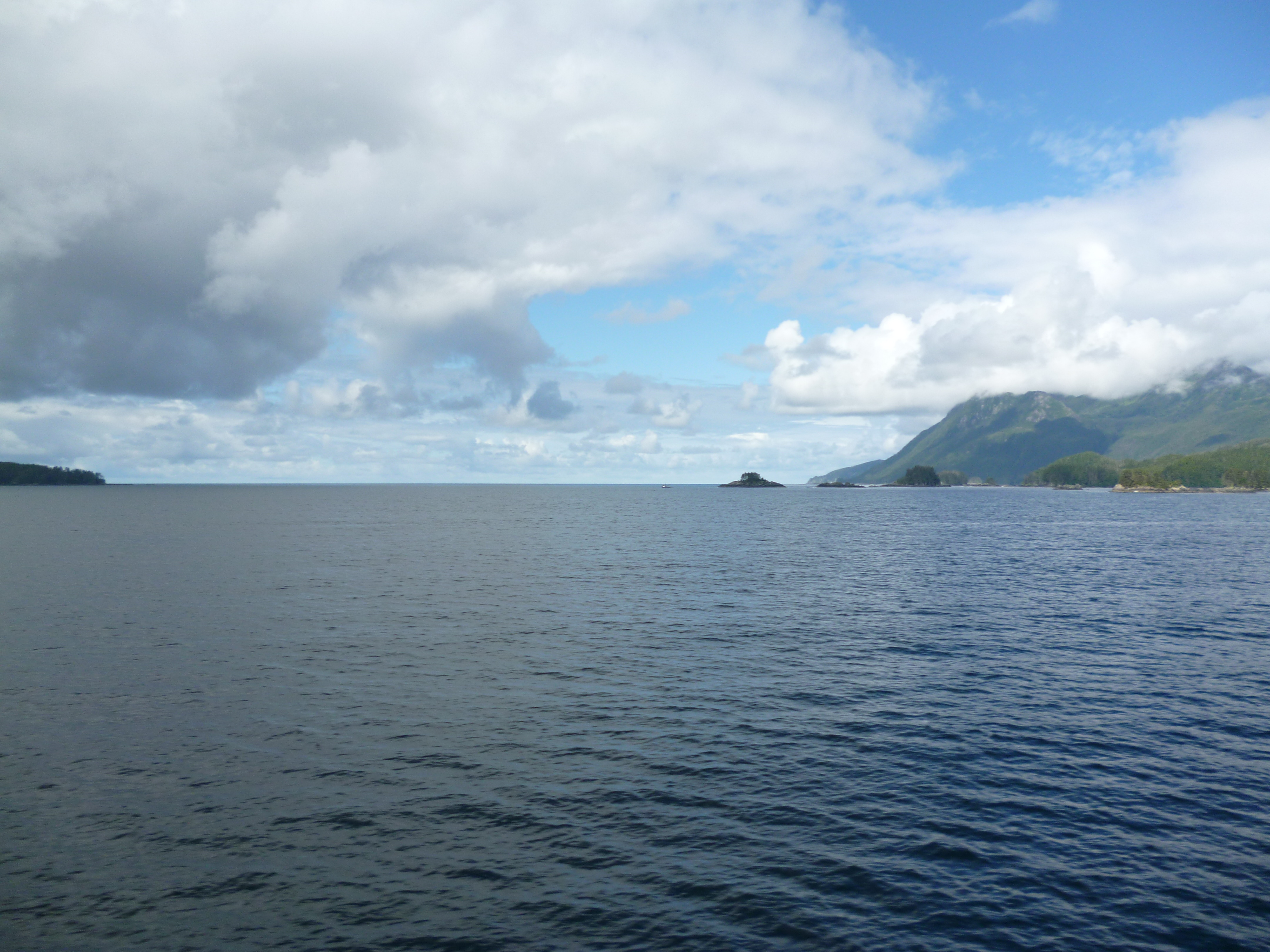
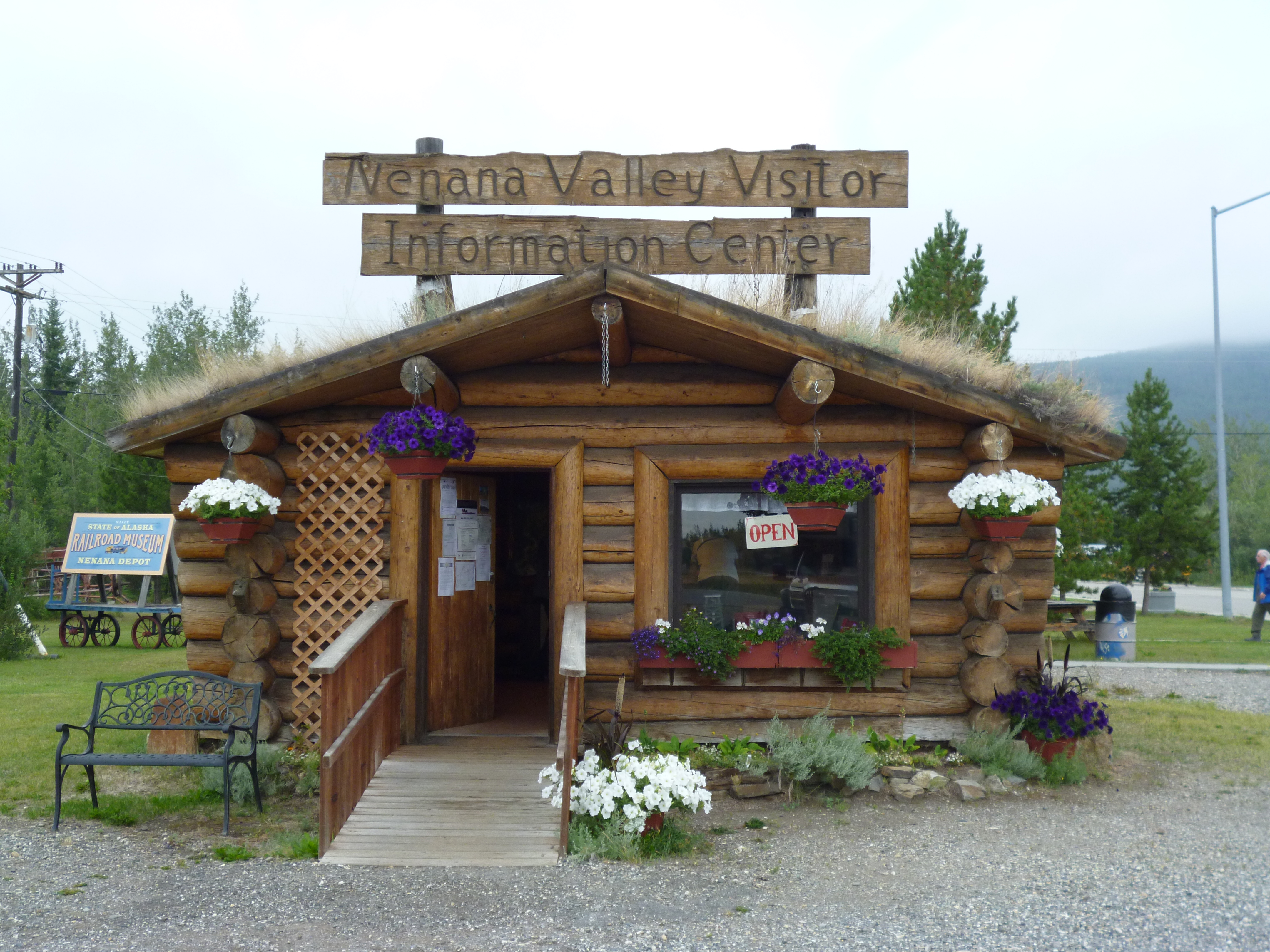
We headed south from Fairbanks to Denali on a nice rainy day. The two hour drive was mostly in thick fog and rain, but very relaxing. We stopped in the small town of Nenana, which is about the halfway point along the Park Highway to Denali. It is strategically situated at the confluence of the Tanana, Nenana, Yukon and Chena Rivers with barge operations from a train depot that runs from Seward to Fairbanks on the Alaskan Railroad. The visitor center was a great source of information.

P1050217

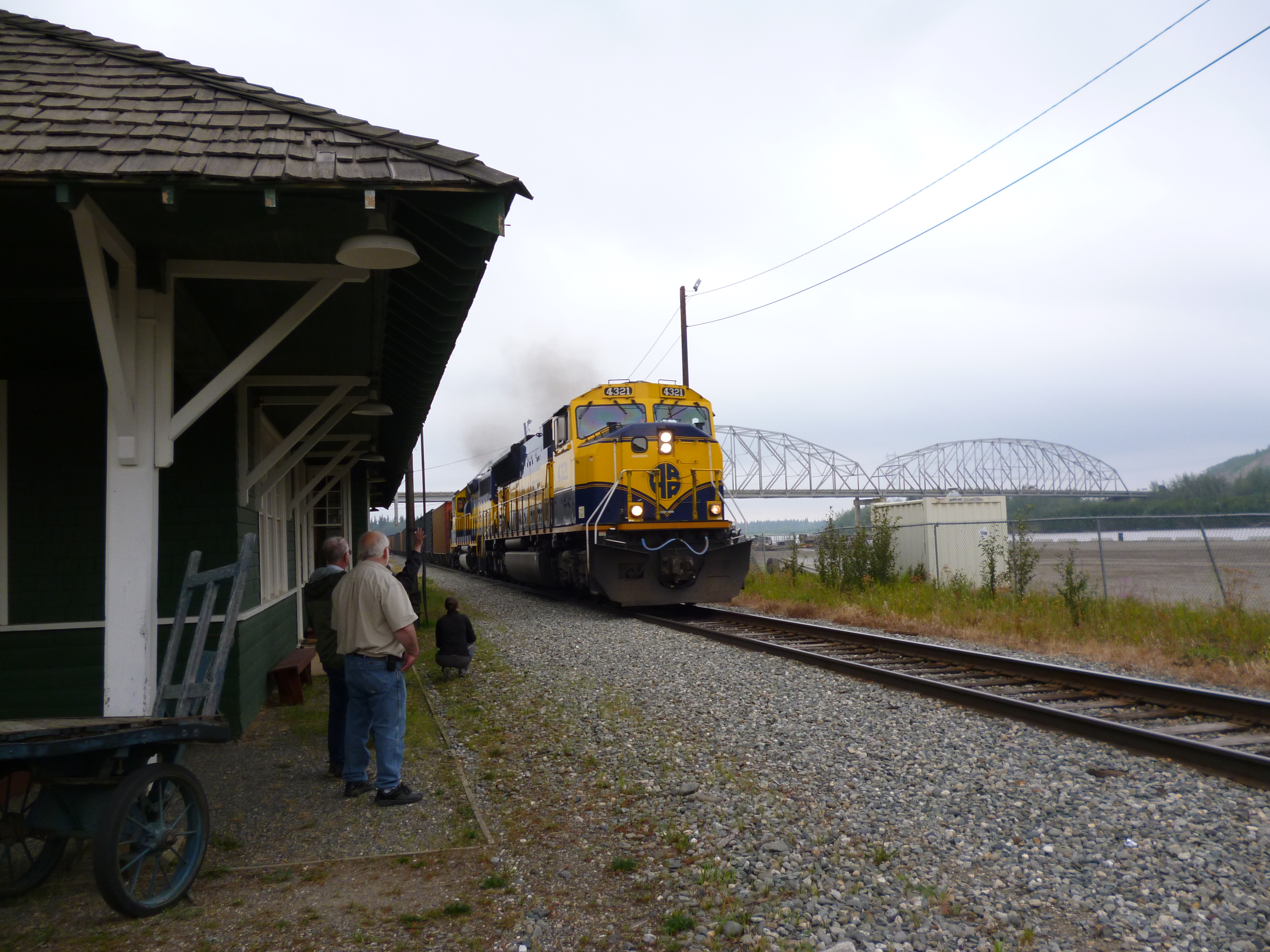
This small town was the logistic launching point for a few of the gold rushes into the interior of Alaska, where most of the goods arrived by train and were then transported along the rivers to their final destination. A train came through as we were visiting the train depot museum.

P1050224

Nenana has the Ice Classic, where folks have been guessing since 1917 when the winter ice on the Tanana River breaks and begins to flow. They mount a huge tripod into the ice in the middle of the river and connect a cable from it to a tower that records the official time, down to the month, day, hour and second, once the tripod moves 100 feet from the tower. It’s a huge deal and they publish the names and time entries in a book for every year that is at least 2 inches thick in very small print. The winner gets the lottery prize money, which in 2015 was $330,330. We bought two $2.50 tickets for the 2016 Ice Classic as part of our retirement investment plan – lol.

P1050226

Given the river history of the town, they also have the 800 mile river race in some pretty fast, very low draft boats that are averaging nearly 40 mph for the entire run. We didn’t see all the rules, but alcohol ballast must have been one of them.

P1050228

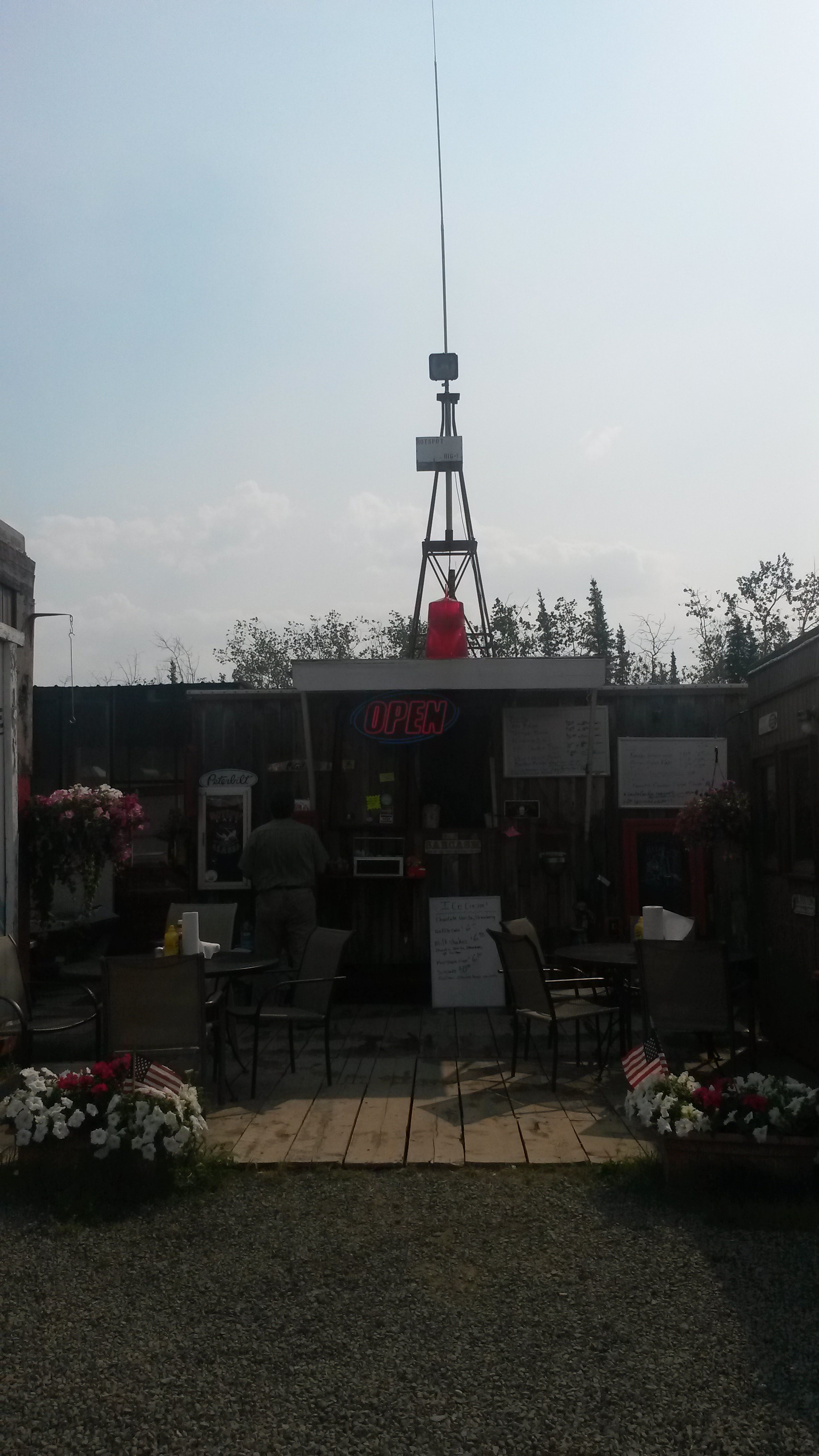
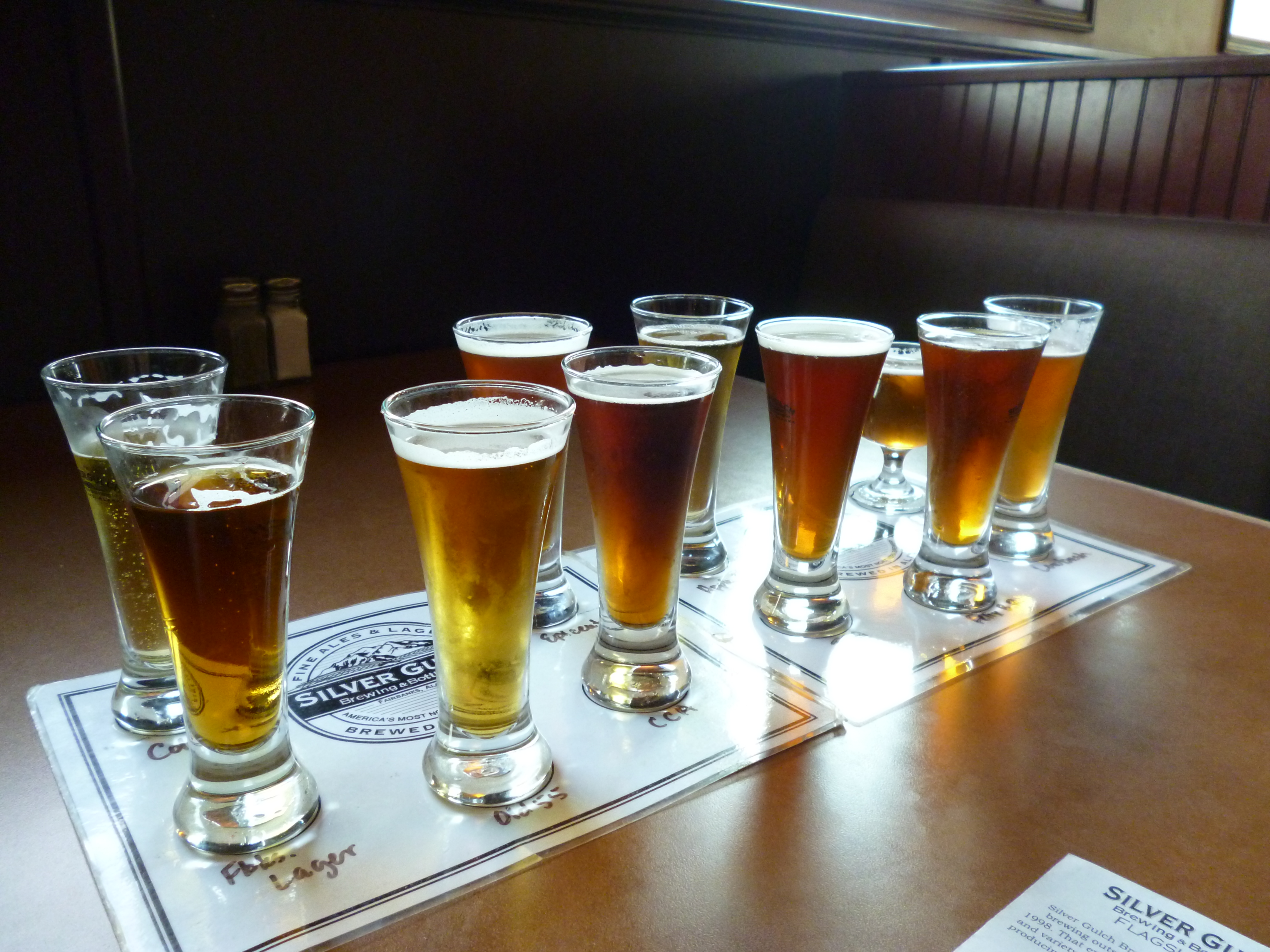
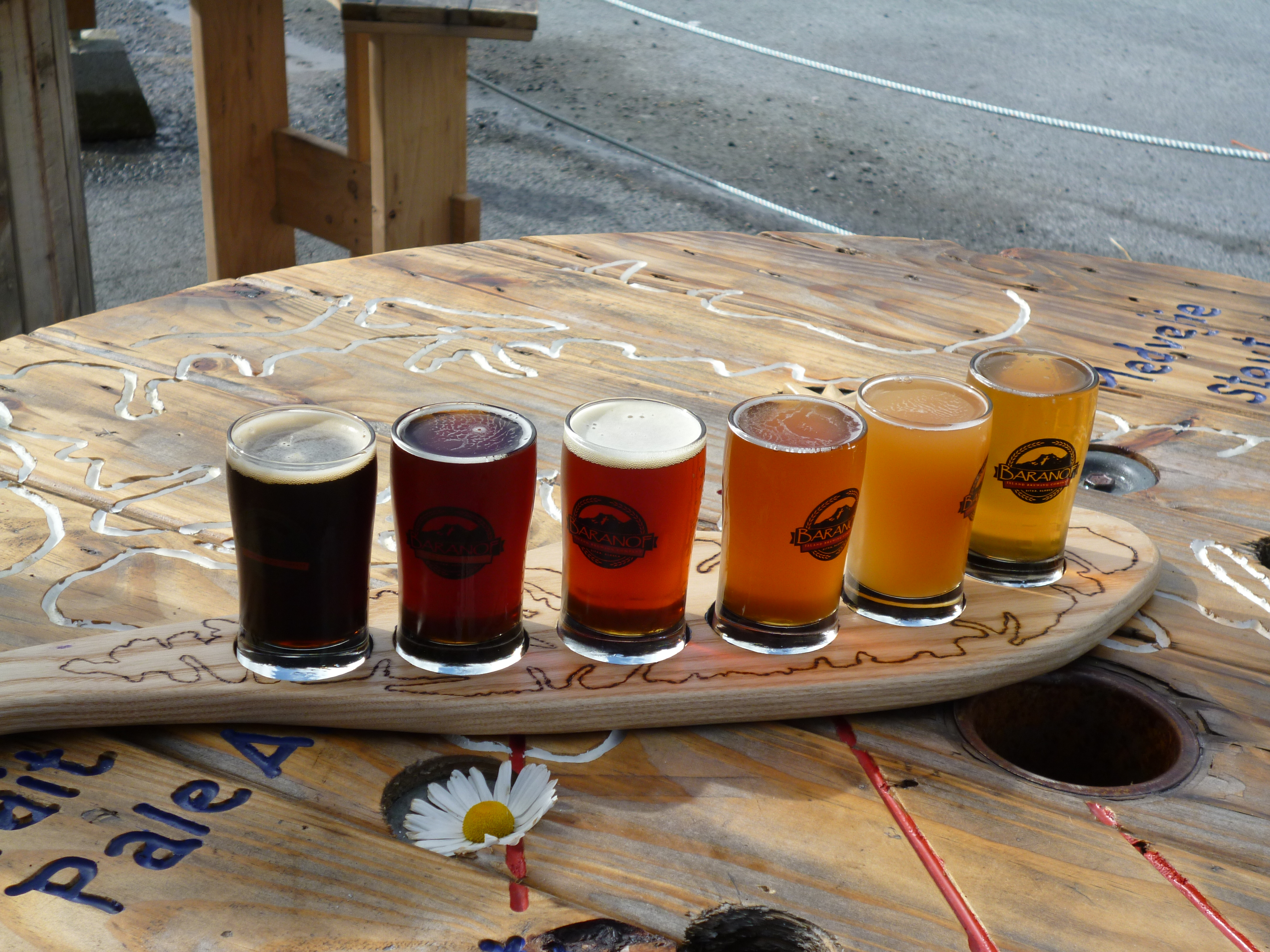
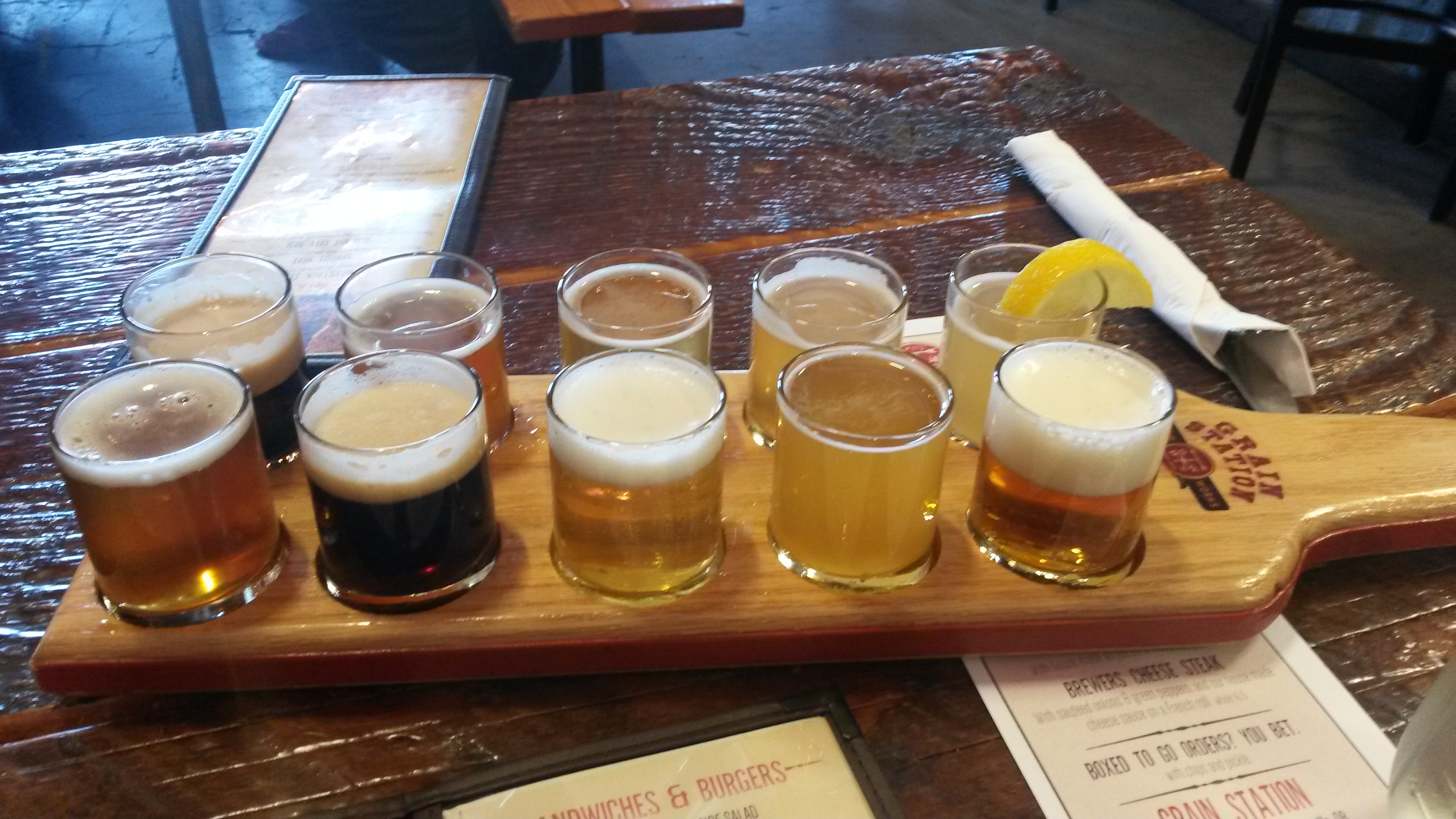
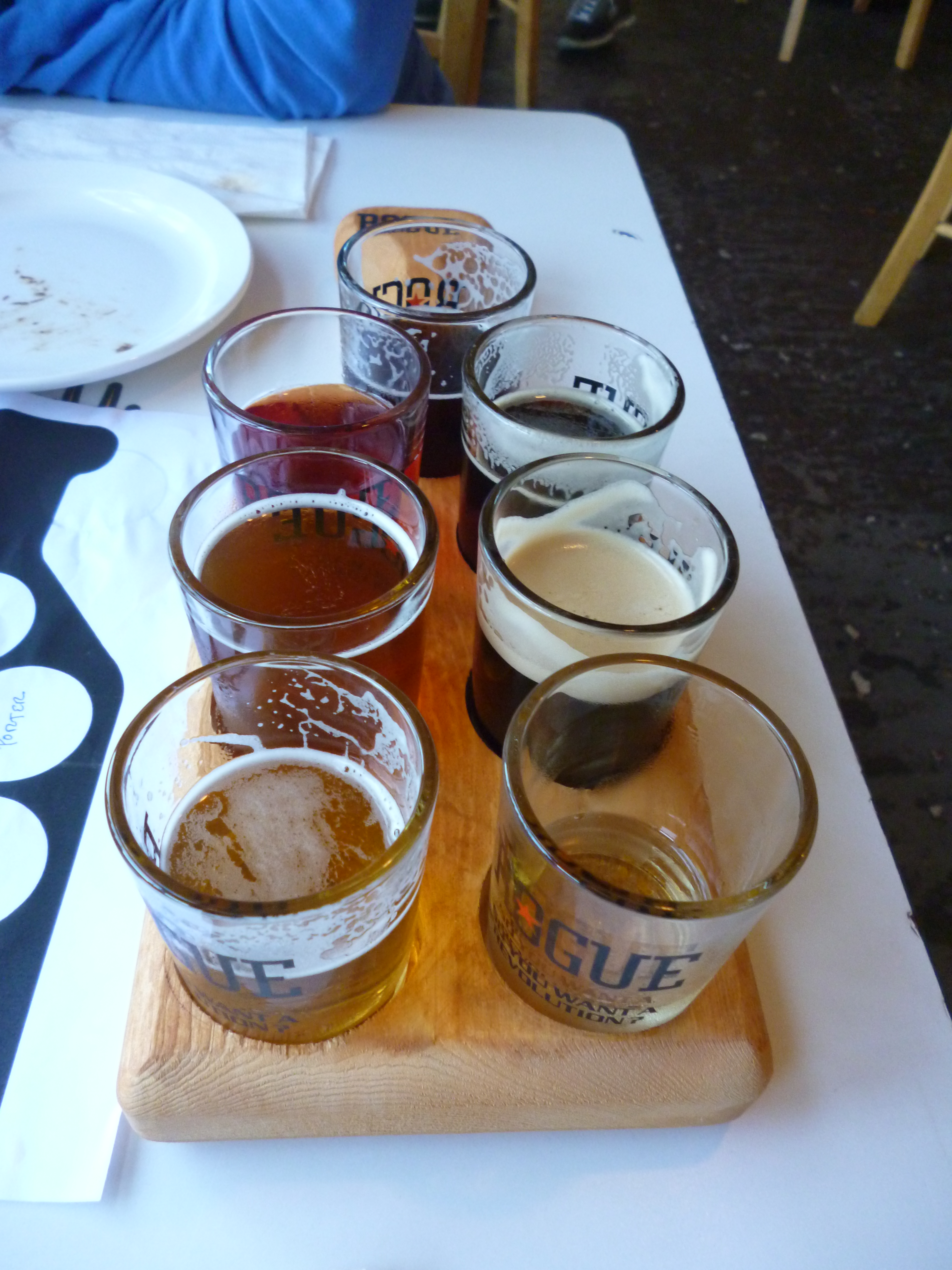
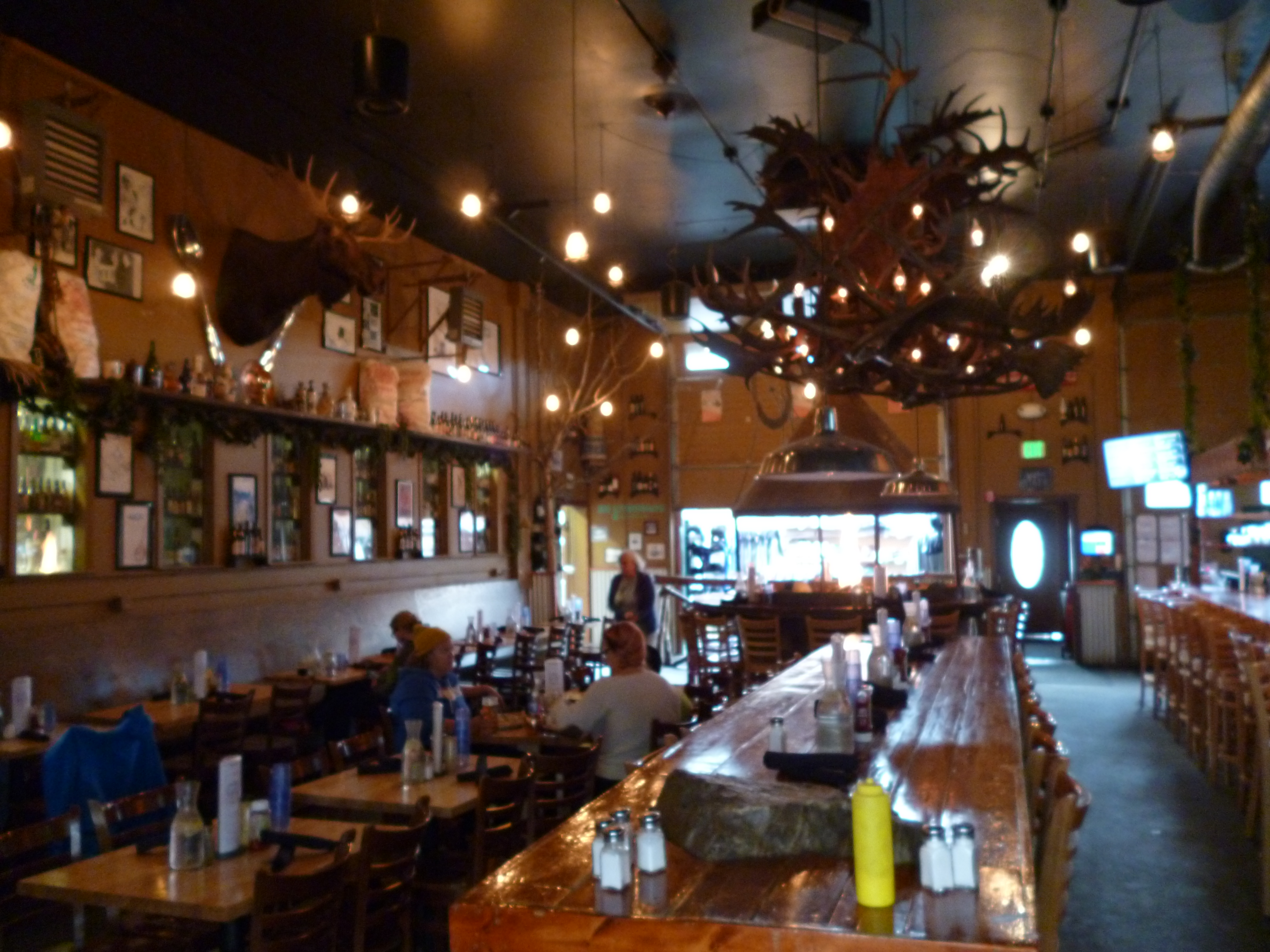
Before entering Denali National Park we happened to pass the 49th State Brewery and stopped in for a sample of their beers and a bite to eat. The place was very interesting and their beers were pretty tasty.

P1050348

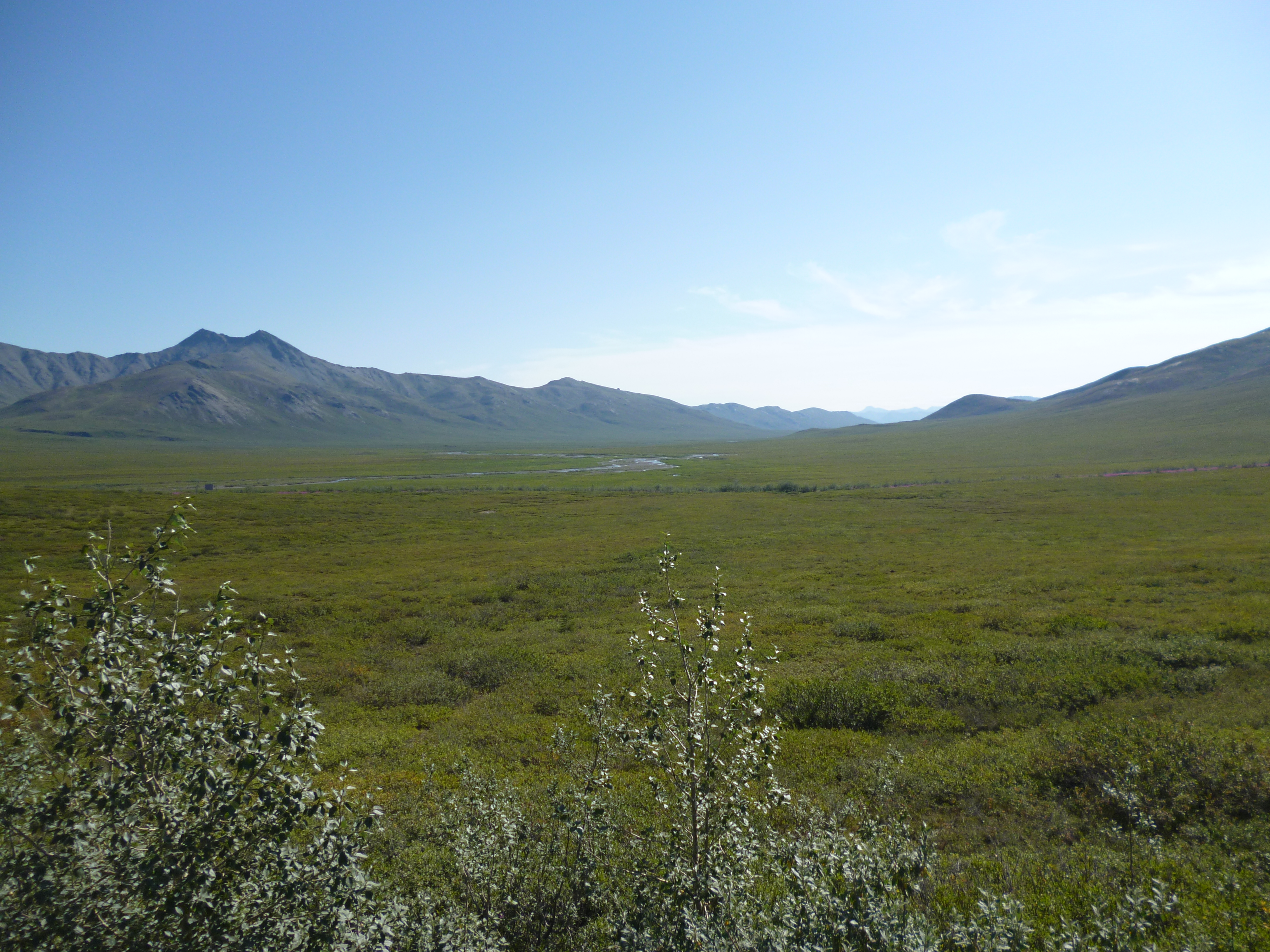
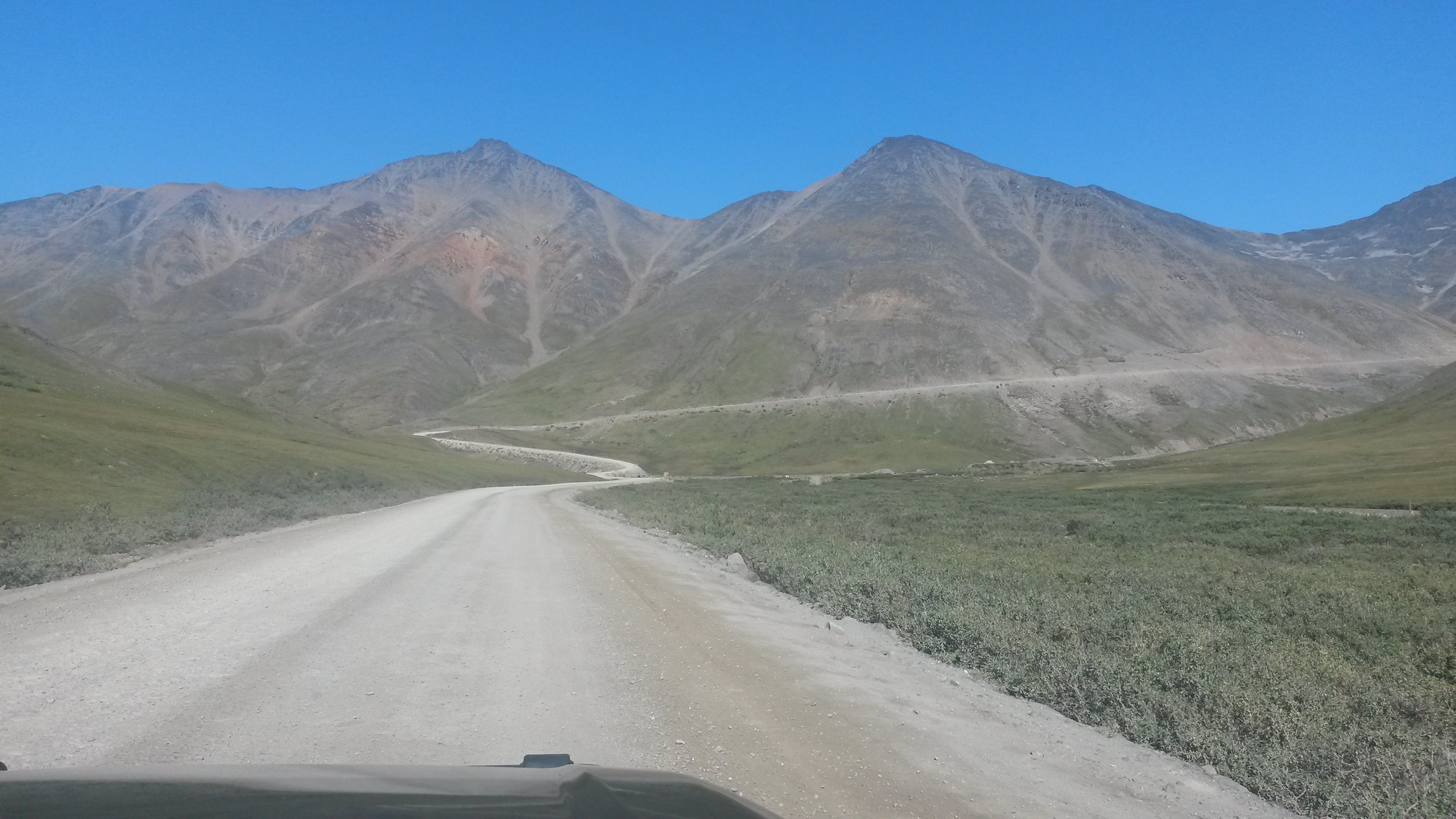
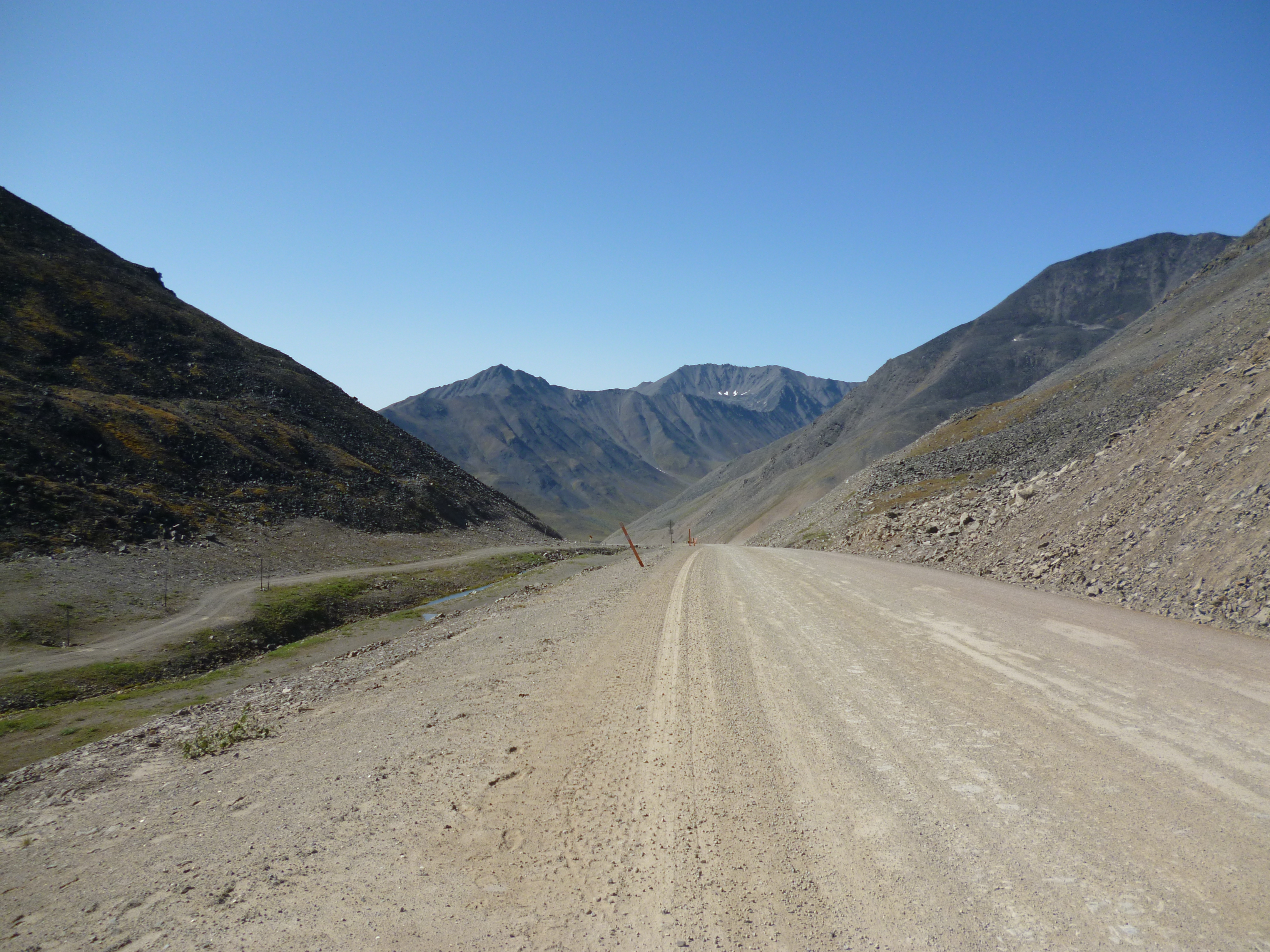
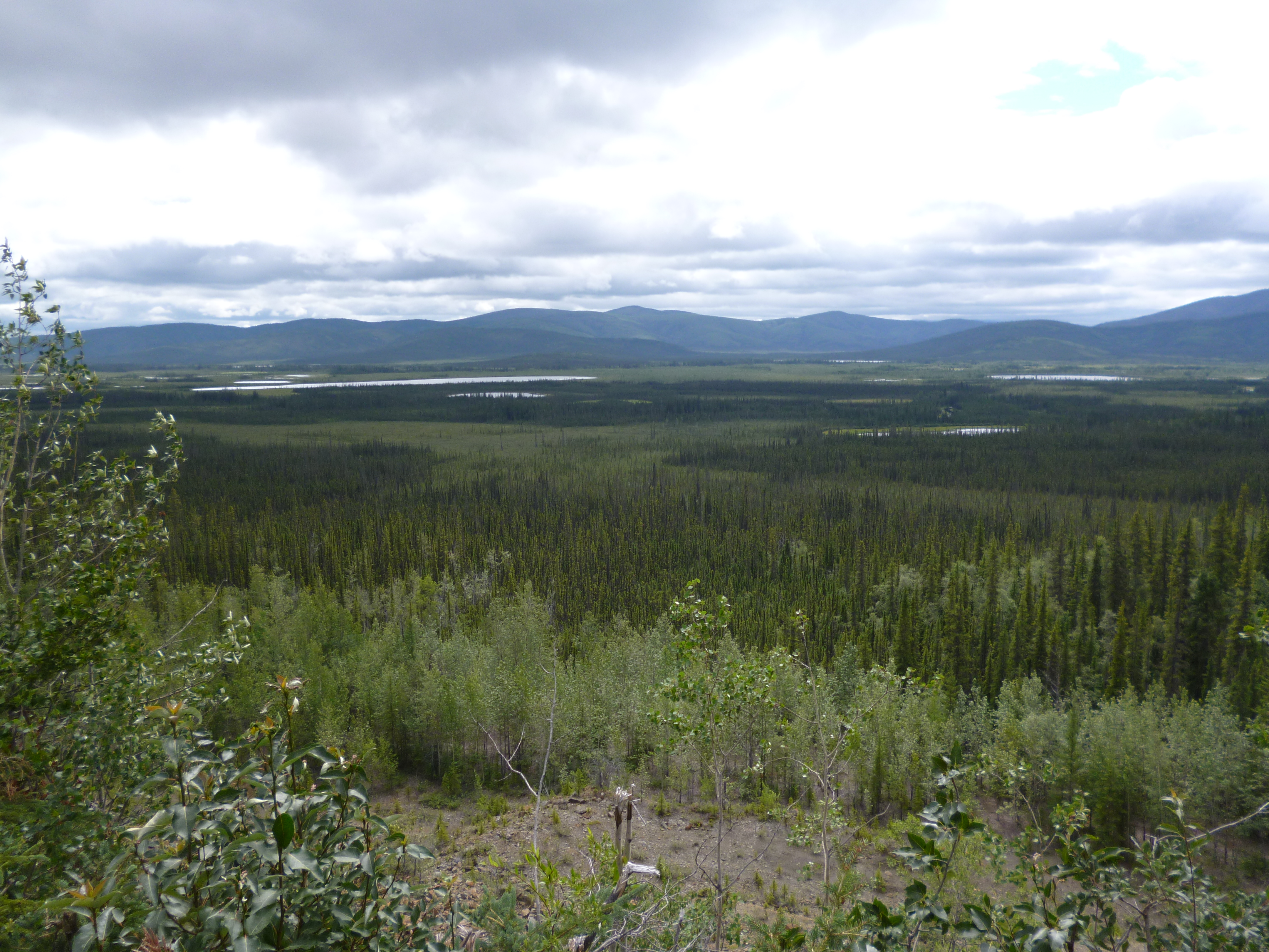
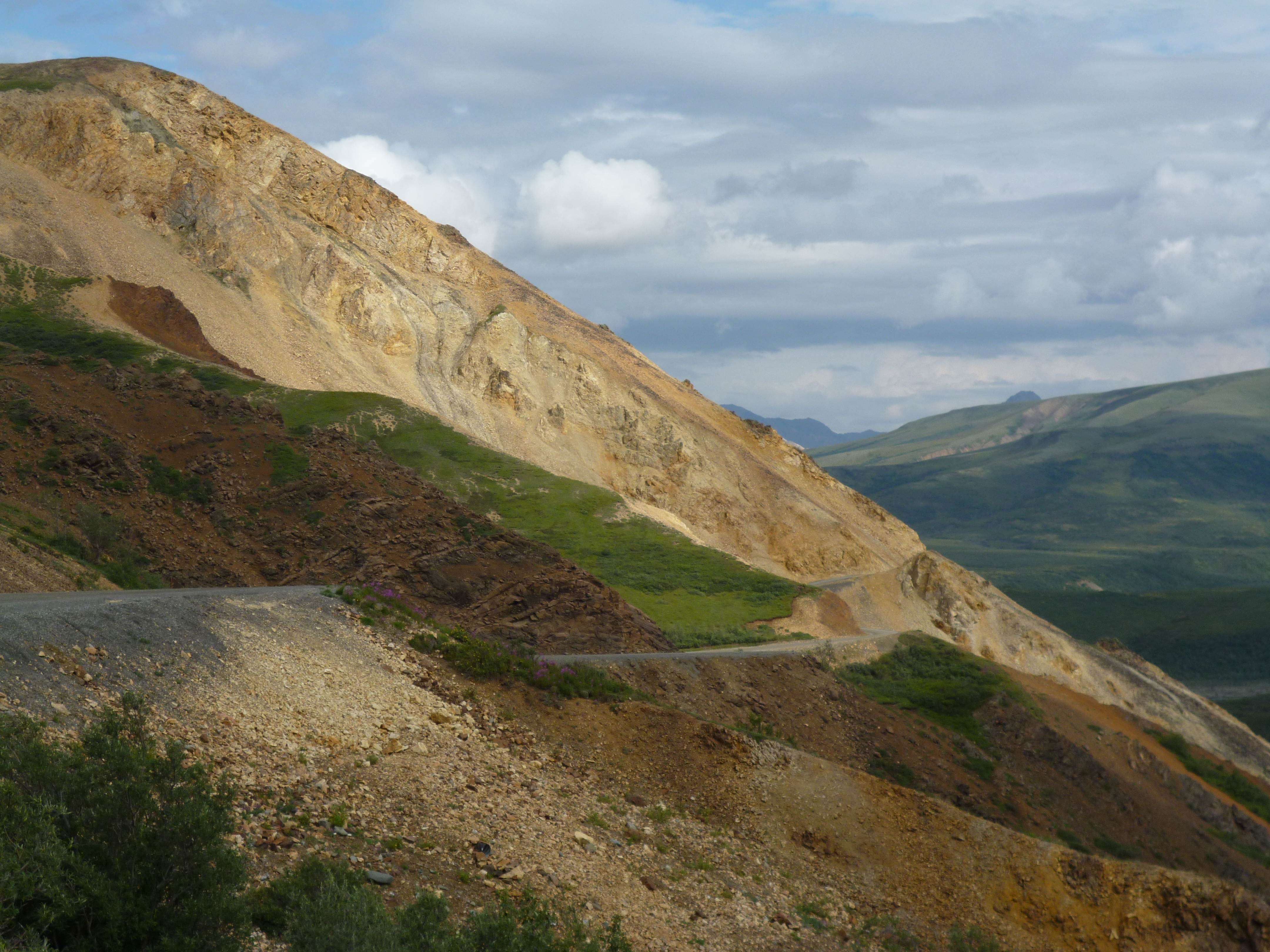
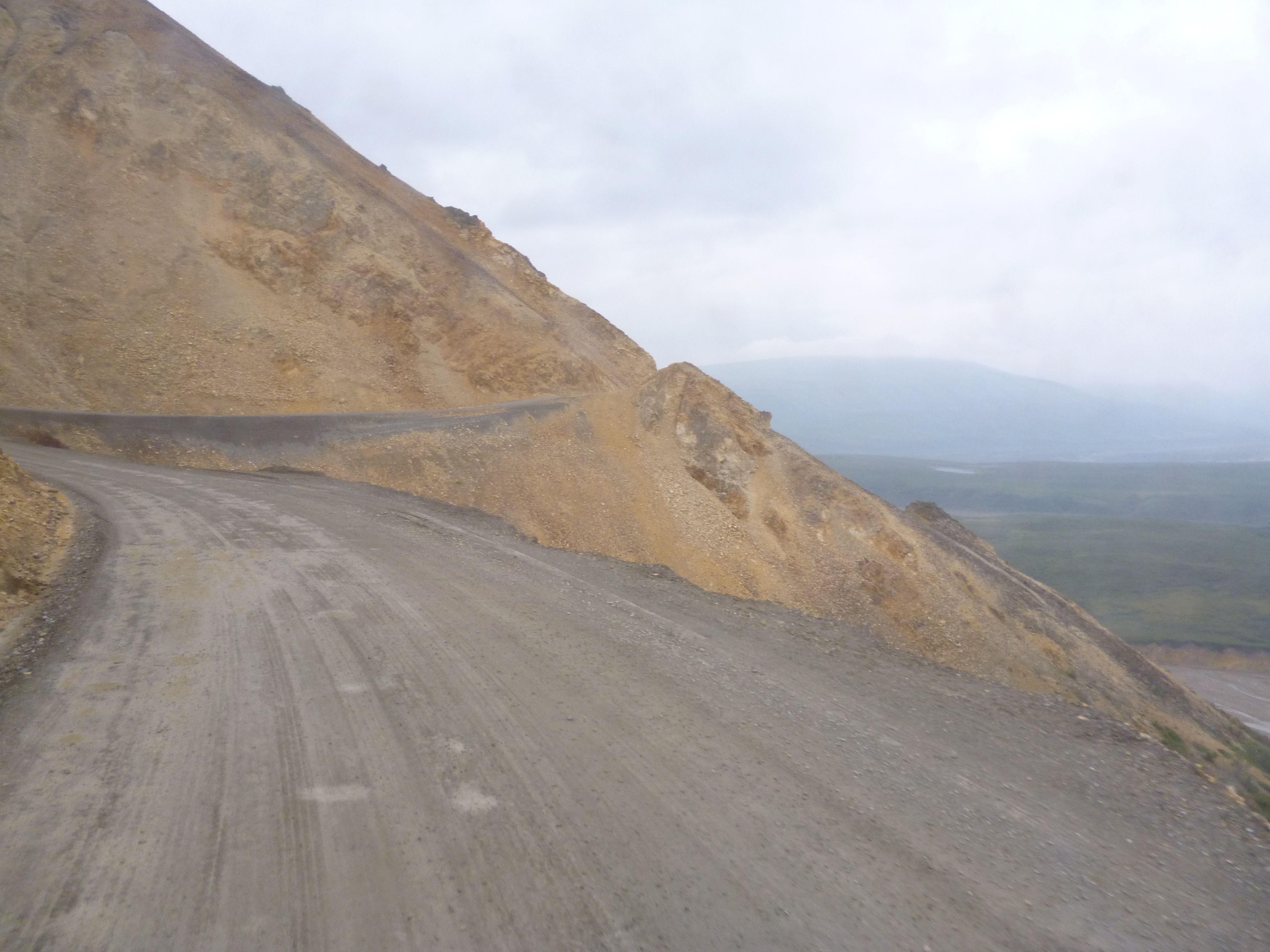
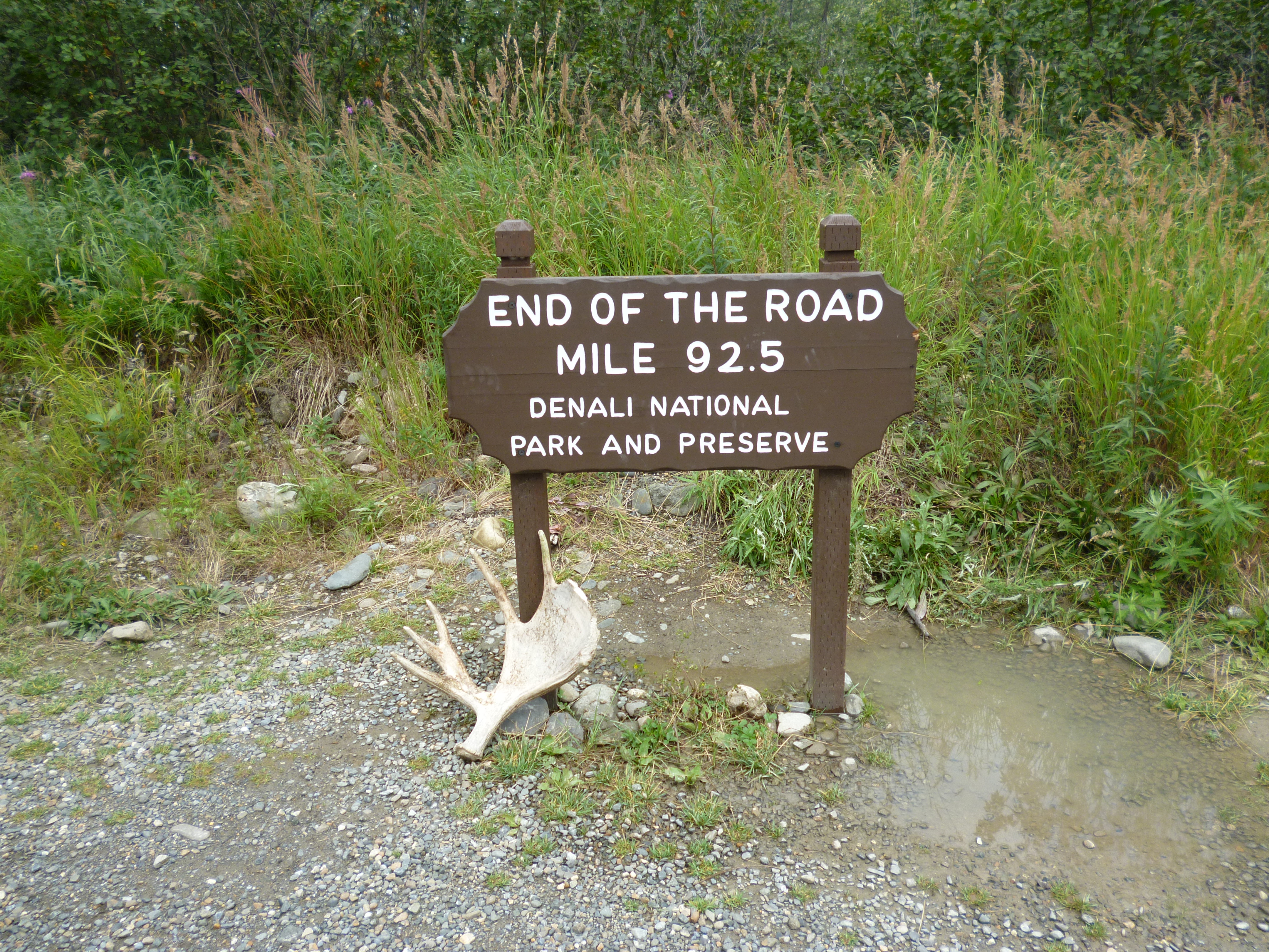
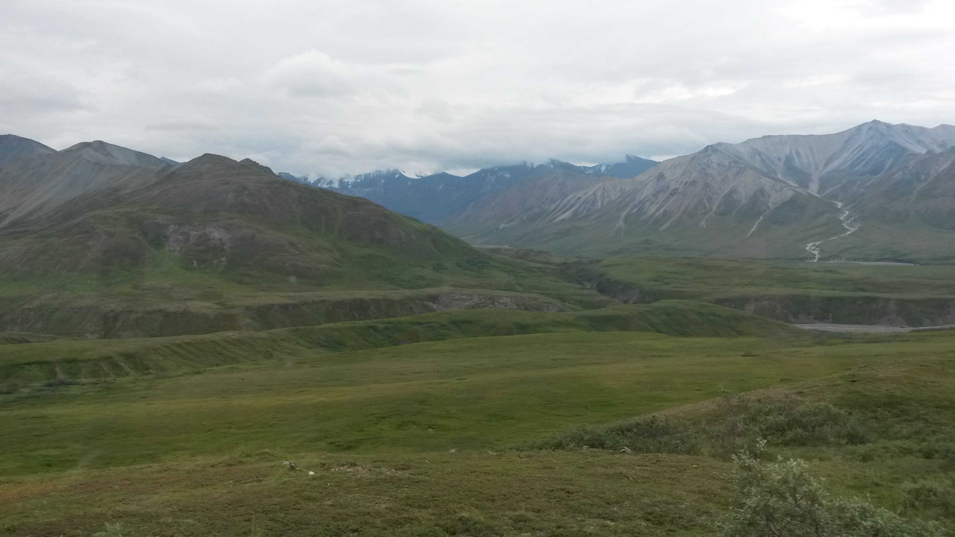
Denali National Park is roughly the size of Massachusetts, but it has only one road and the general public can only travel to mile 15 of the 92.5 miles along the road. There is a ranger station at mile 15 that enforces the travel restrictions.

P1050324

You have to take a park shuttle to go further into the park, and they run very regularly. After visiting Yellowstone and Yosemite, I think Denali has the right idea. The interior of the park is just for bikers, backpackers and those going on one of the many shuttle bus excursions. The restriction is on all motorized vehicles: cars, motorcycles and even snowmobiles in the winter. The beauty of the park is incredible, and the lack of cars makes the wilderness experience much better than at any other National Park we’ve been to yet.

P1050300

P1050267

P1050302

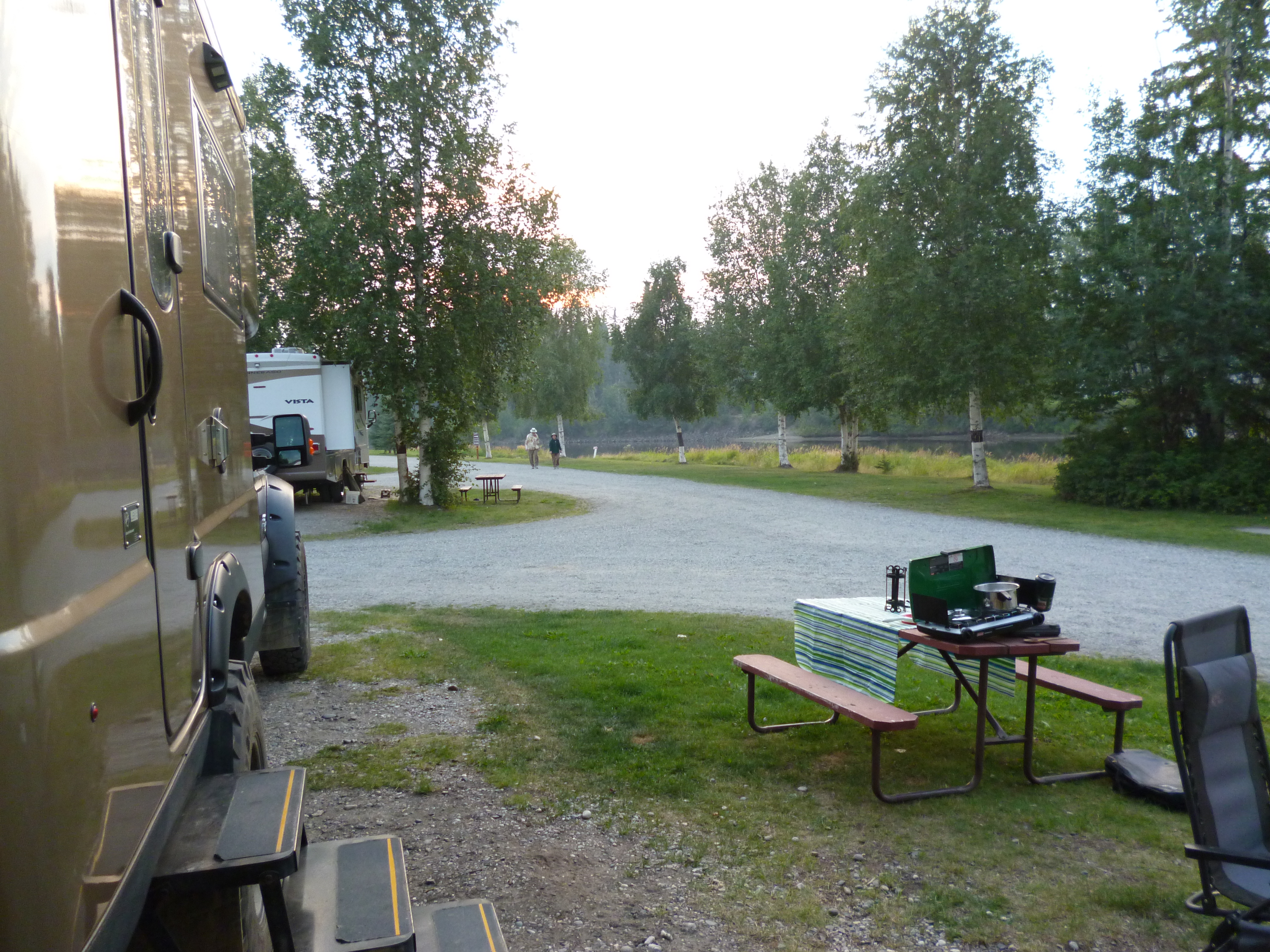
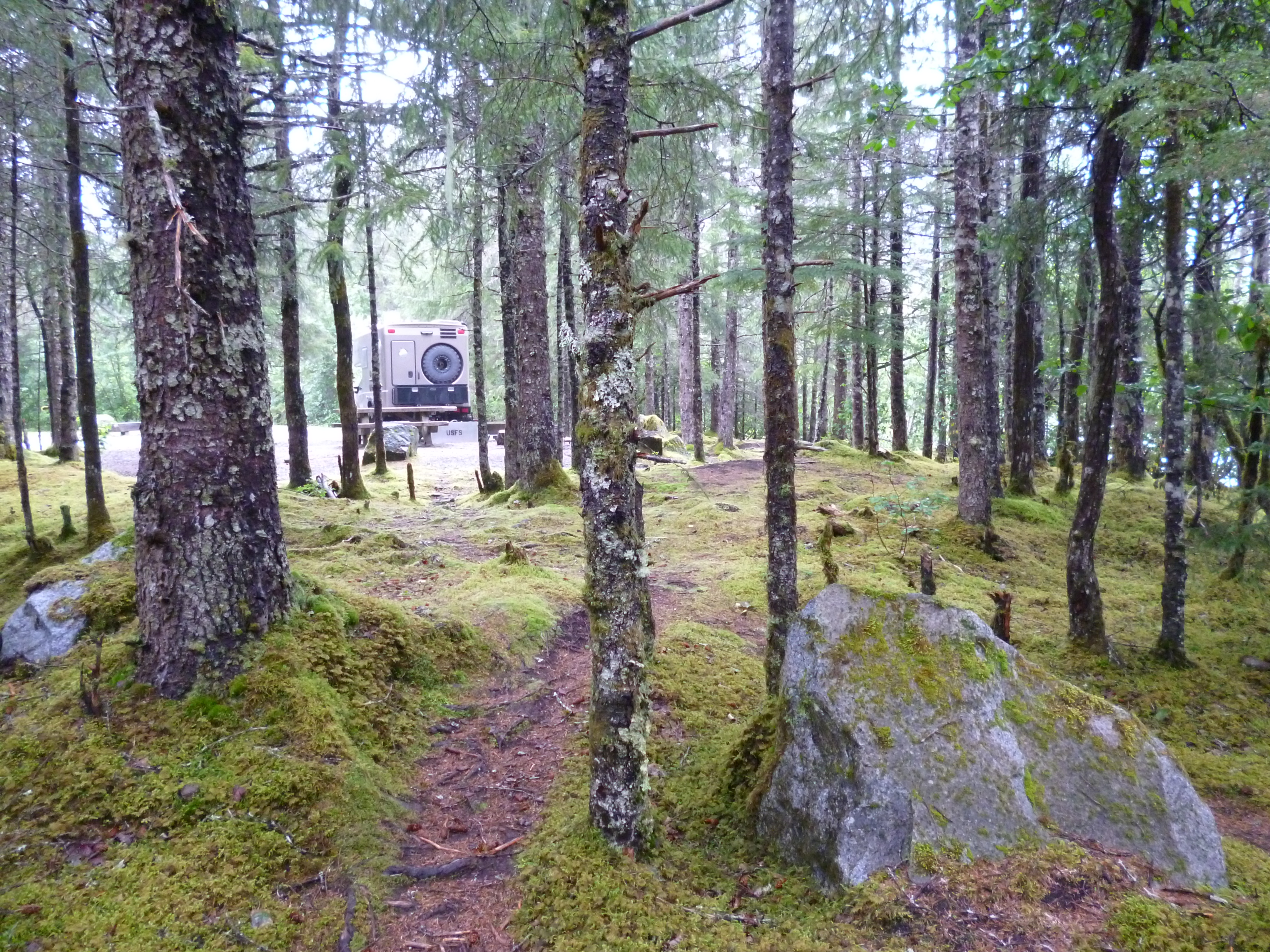
Since this was our first time to the park, we camped at the Savage Creek campground at mile 12 along the road. This is the furthest campground into the park you can drive into and still have the freedom to drive in and out. There are campgrounds beyond mile 15, but once you are there you have to stay there your entire duration, using the park shuttles as the only mode of transport. A few campsites further in can only be accessed by shuttle buses. I guess that would rule out the Roamer. Now that we know what to expect, we may use the shuttles next time, but we didn’t know so we did the Savage Creek option this time.
P1050236

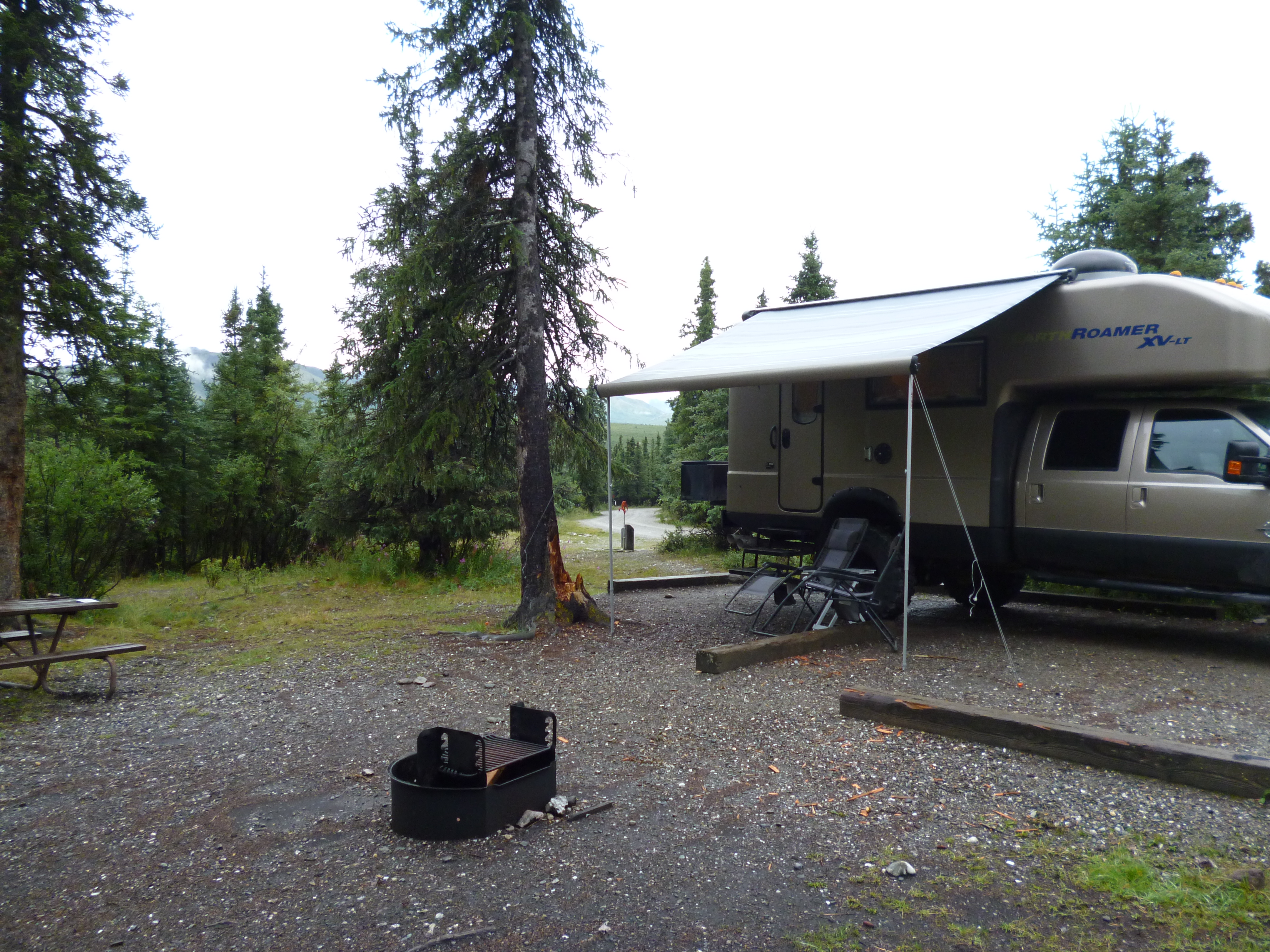
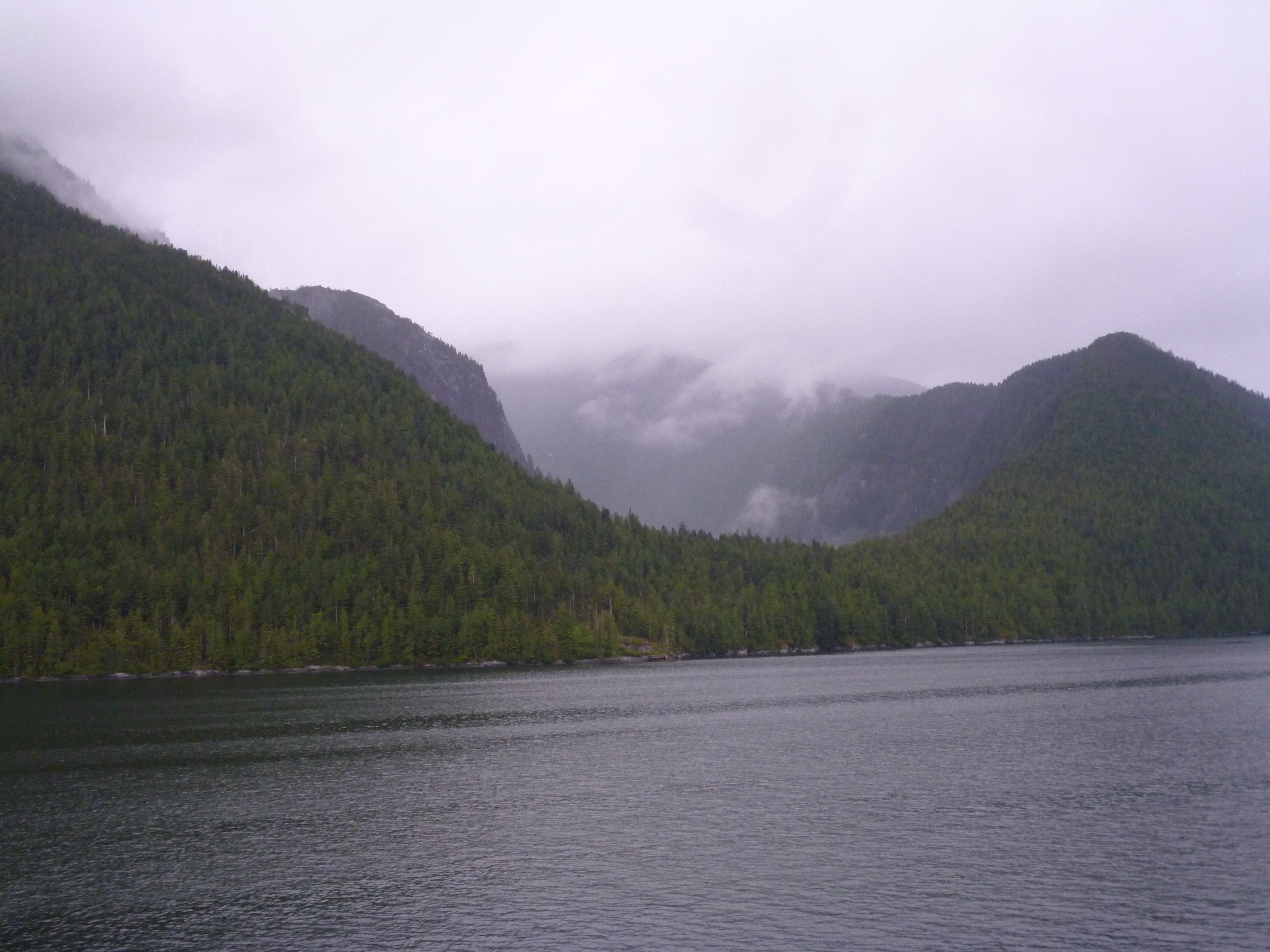
The rain from Fairbanks down to Denali had nearly stopped by the time we arrived but the fog and clouds around the campground were awesome. We did a nice hike along the creek near the campsite, where they had boards telling the history of the first 1917 park camp at the same site along the walk.

P1050237

20150728_053244

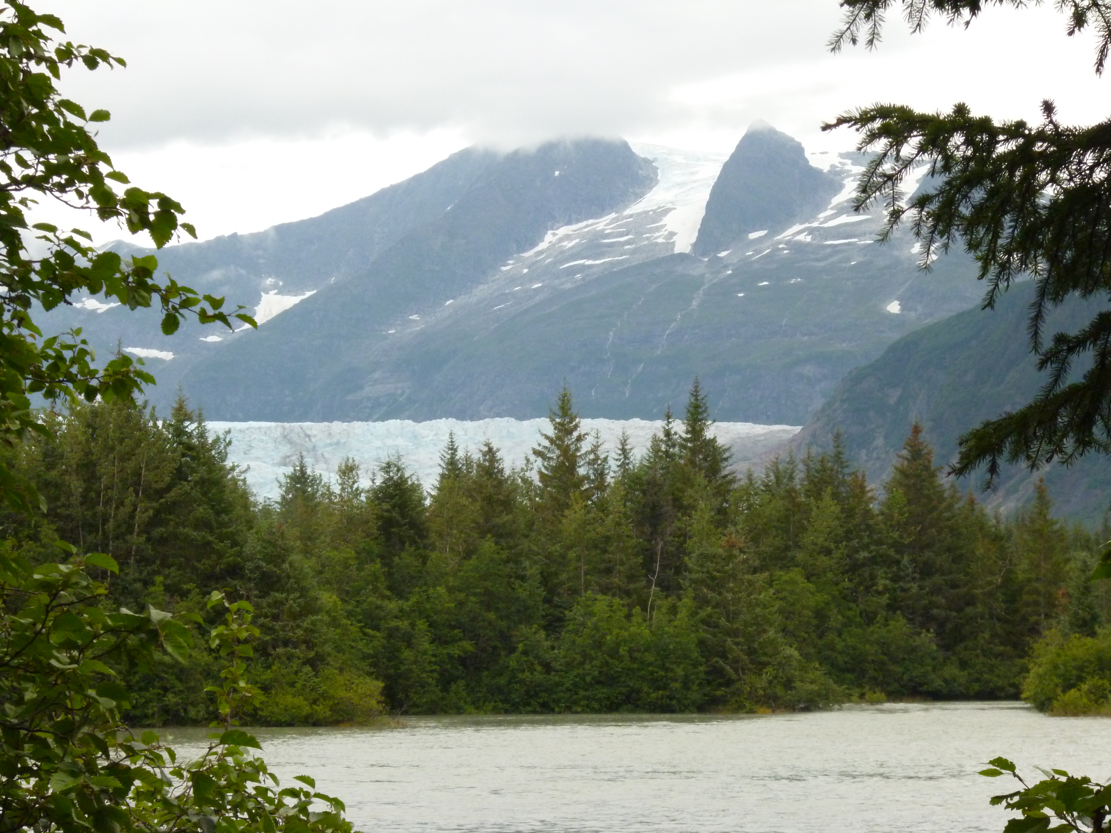
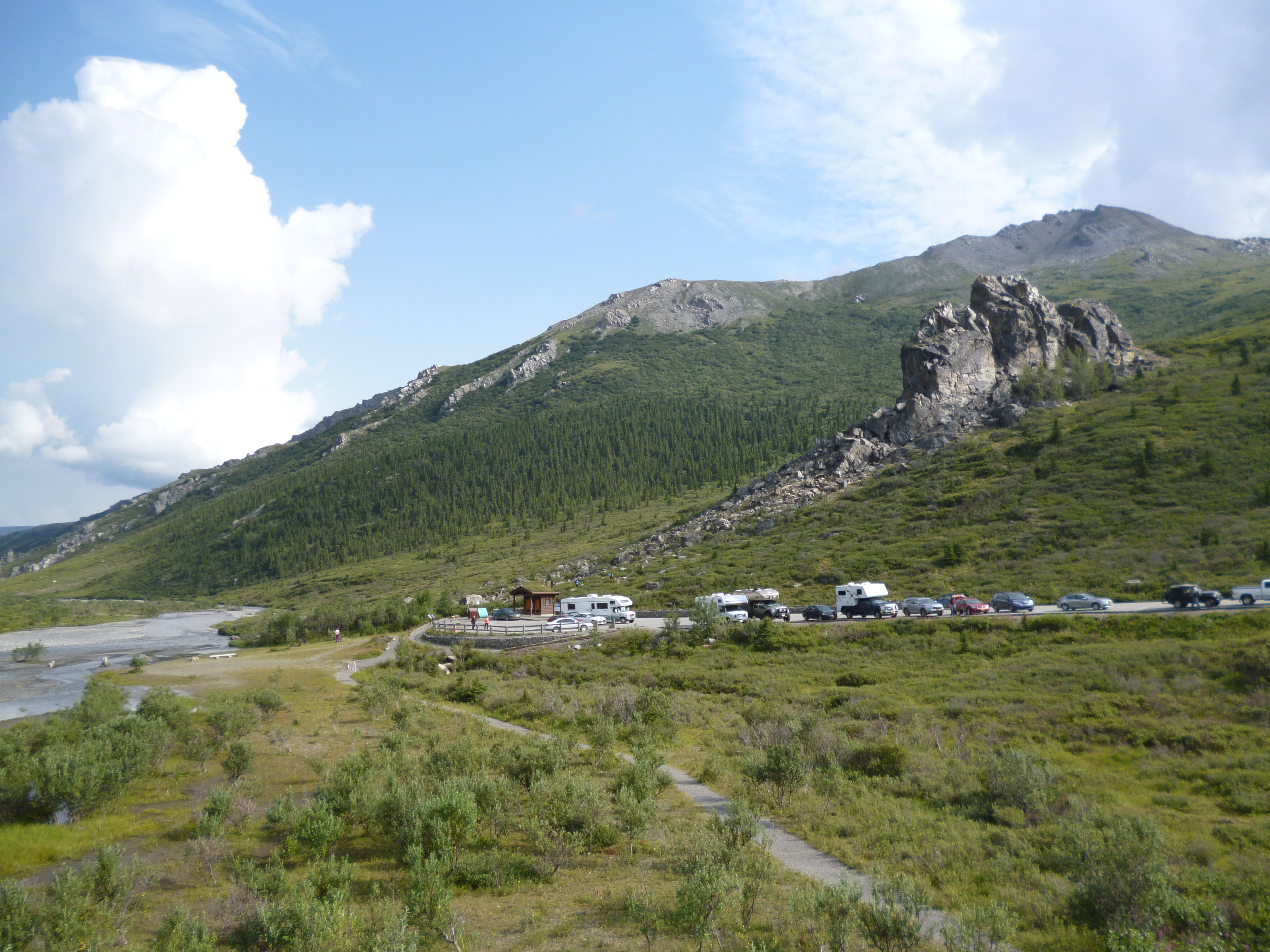
We signed up for an 11-hour bus tour to the end of the road and back to see as much of the park as we could for this first time. The forecast was for rain all day. It drizzled in the morning but the clouds began to break when we reached the end of the road, and it was sunny on our way back.

P1050305

P1050250

P1050270

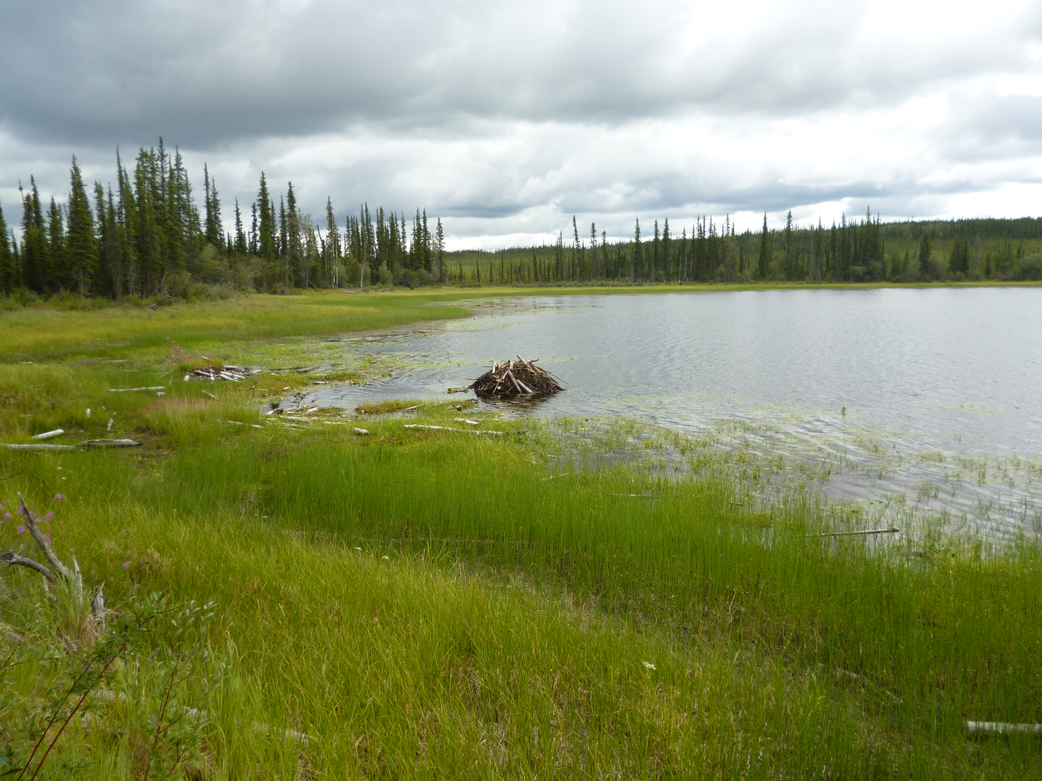
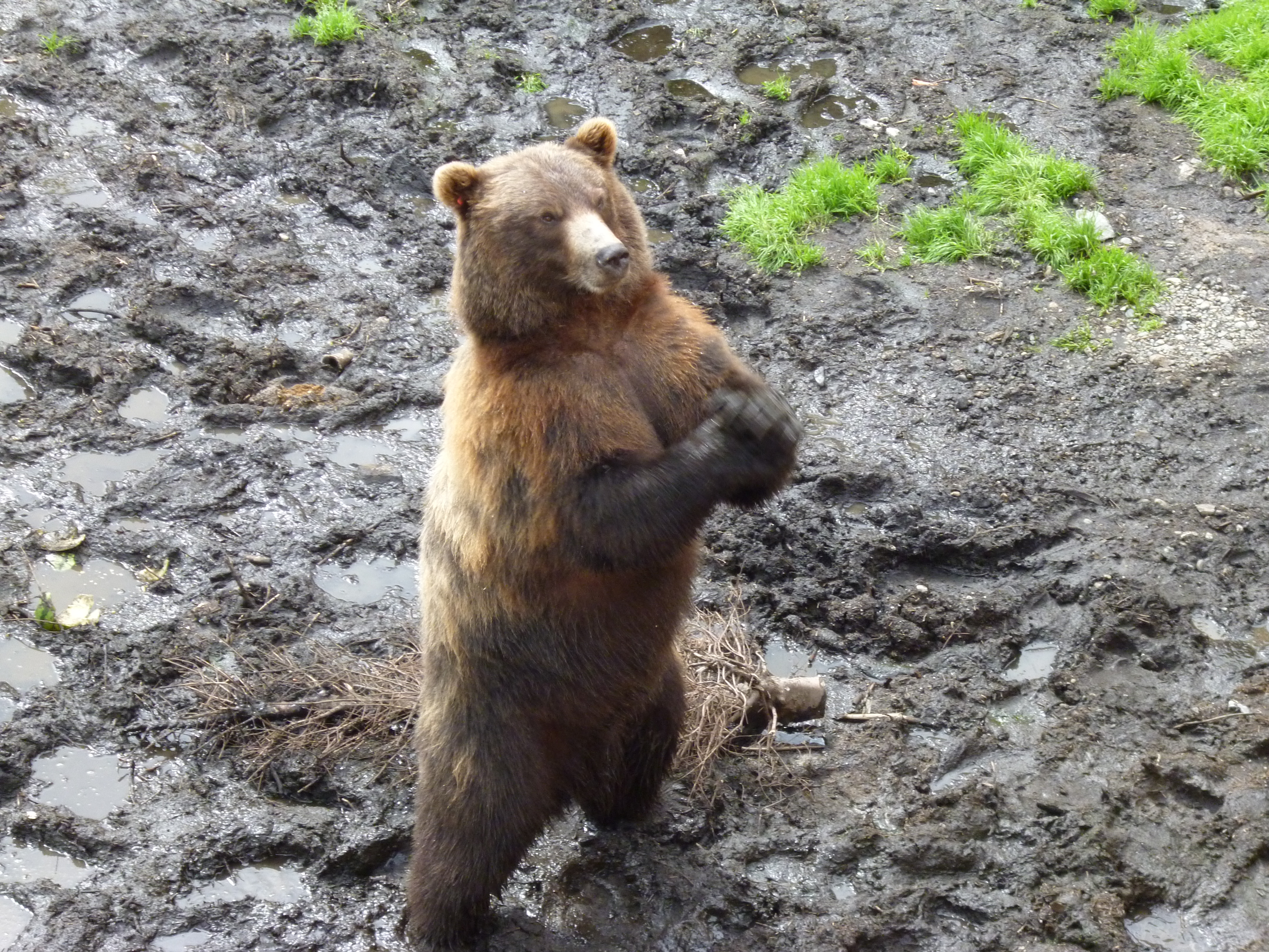
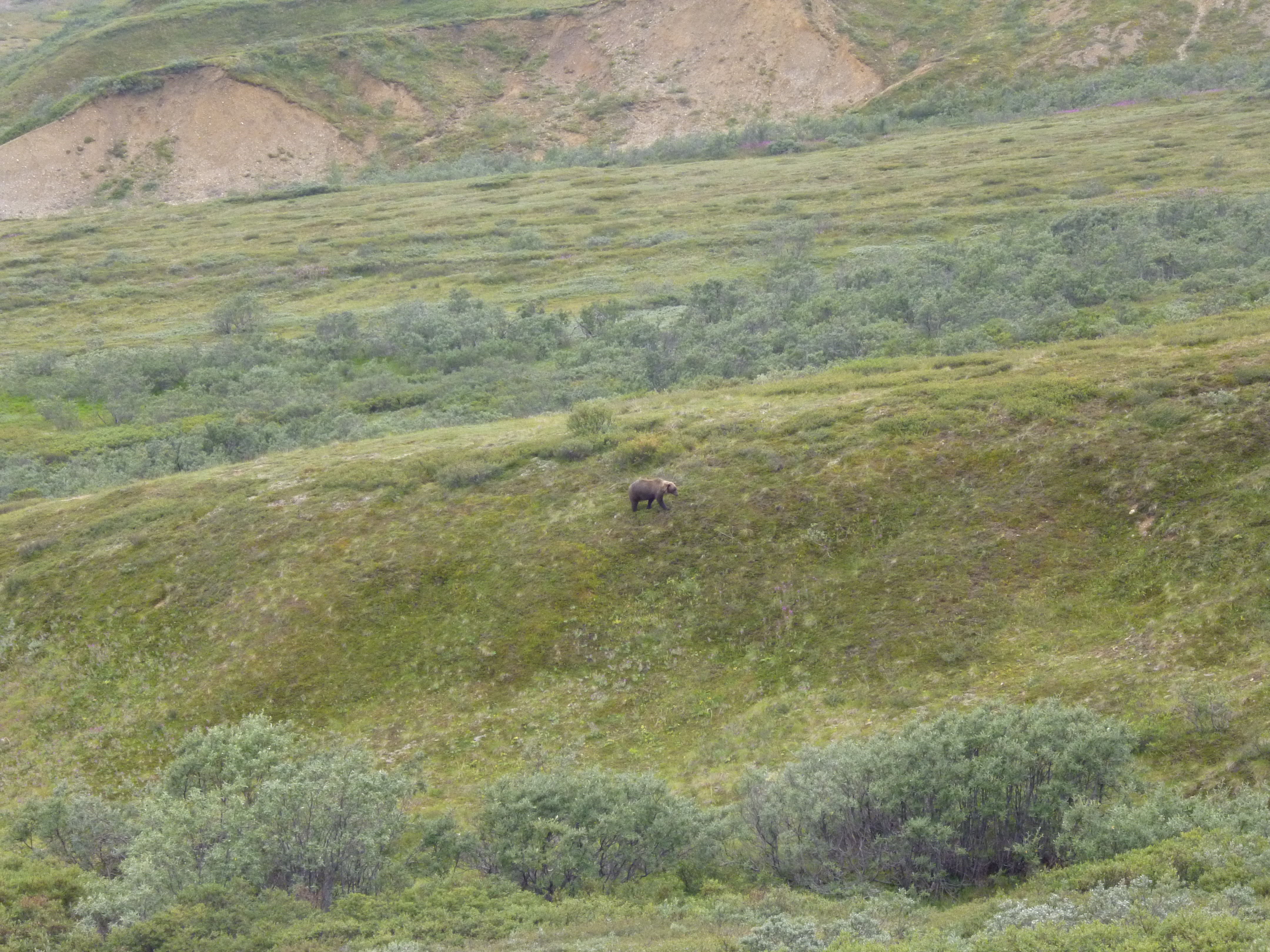
The cool, moist morning weather meant that all of the animals were out. We saw many moose, grizzlies, Dall sheep and caribou during our trip. The park was originally set up to protect the Dall sheep because mining hunters were killing them by the thousands to feed the miners and to force the price up by killing more than required. We saw about 20 sheep dotting the steep rock cliffs way up in the mountains along the route. The tundra ground is covered in berries and the bears were just hoover-ing up as much as they could to pack on the winter weight. We ate a few blueberries on our hikes and they are almost ripe, but I guess the bears aren’t too picky.

P1050306

P1050294

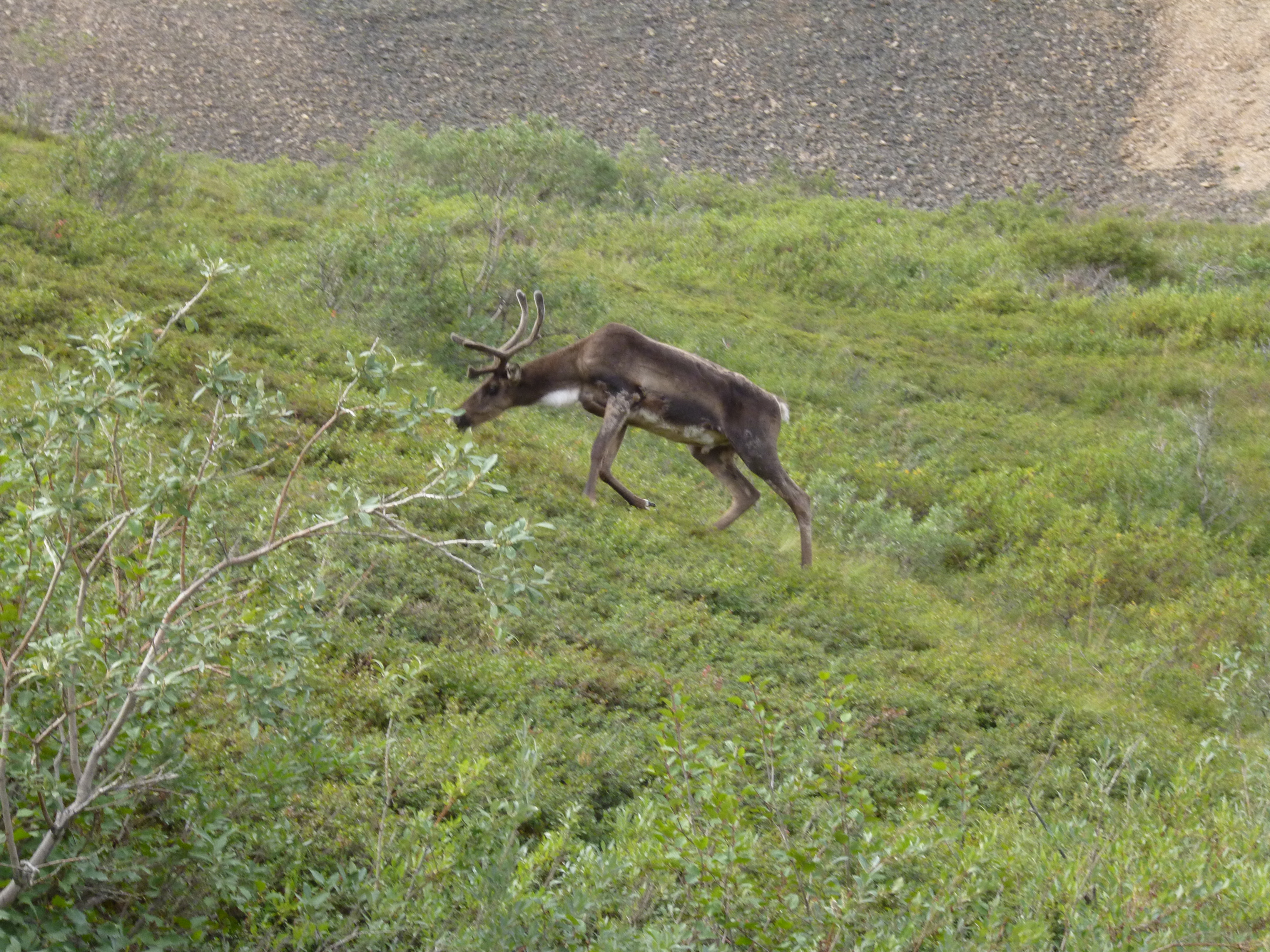
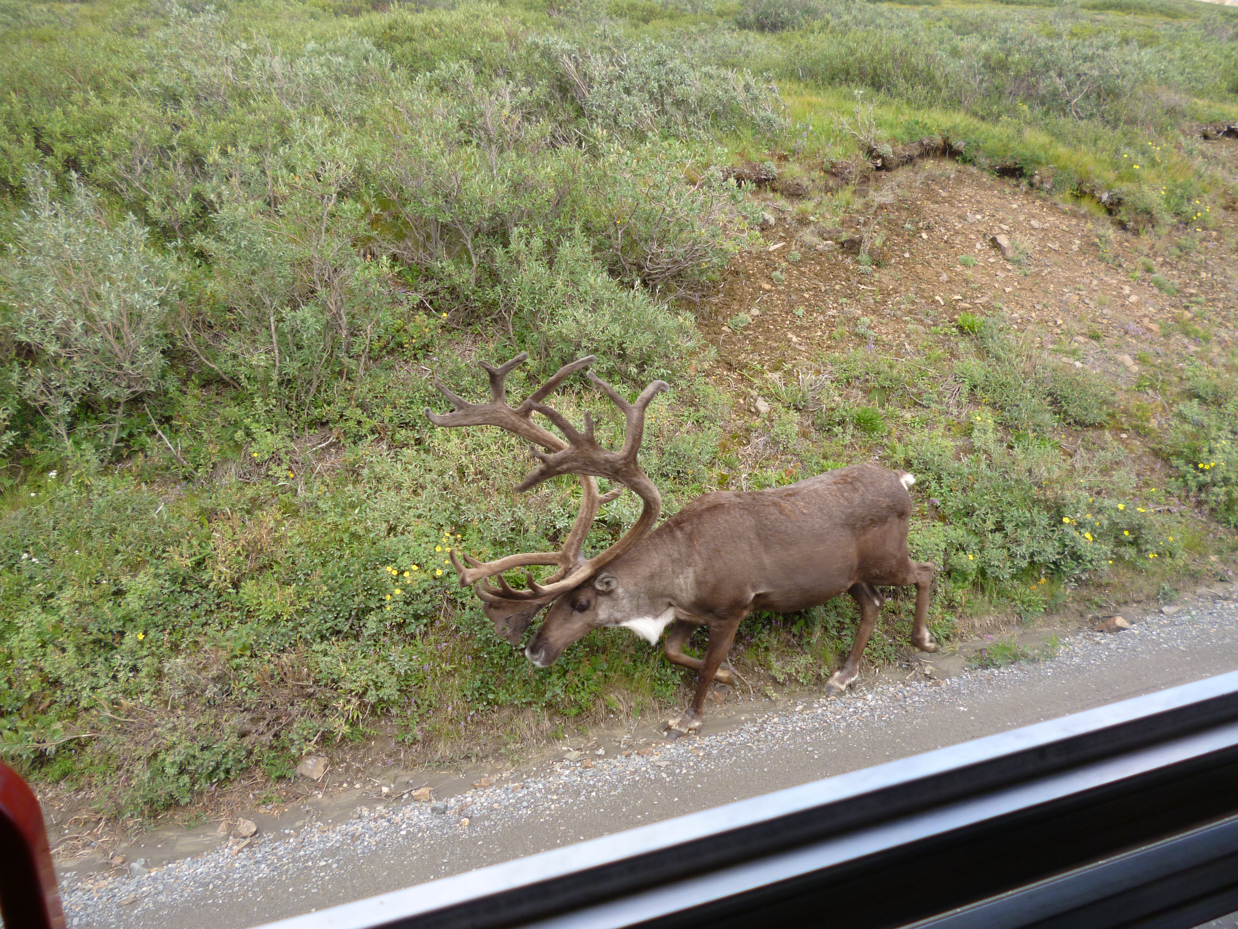
This caribou, with an awesome rack, walked right past our bus.

P1050301

We didn’t get to see Mt McKinley because of the clouds, but a picture board below the actual landscape at one of the stops showed what it would have looked like. At 20,320 feet, the mountain would be hard to miss.

P1050283

Mining operations at the end of the road were shut down in the 1980s, but a few claims are still held privately, with a grass runway back there to help service the folks who live back there still.

P1050271

We found out during our tour that this year had an unusual late freeze in mid June that killed nearly all of the mosquito population. It would explain why we have never had a problem sitting outside in the evenings. It’s the best it’s ever been the locals say.

Most of the folks who first visited the park came by train. Given the restrictions on cars, maybe our next visit will be by train from Seward and then camp at one of the more interior camps.

P1050328

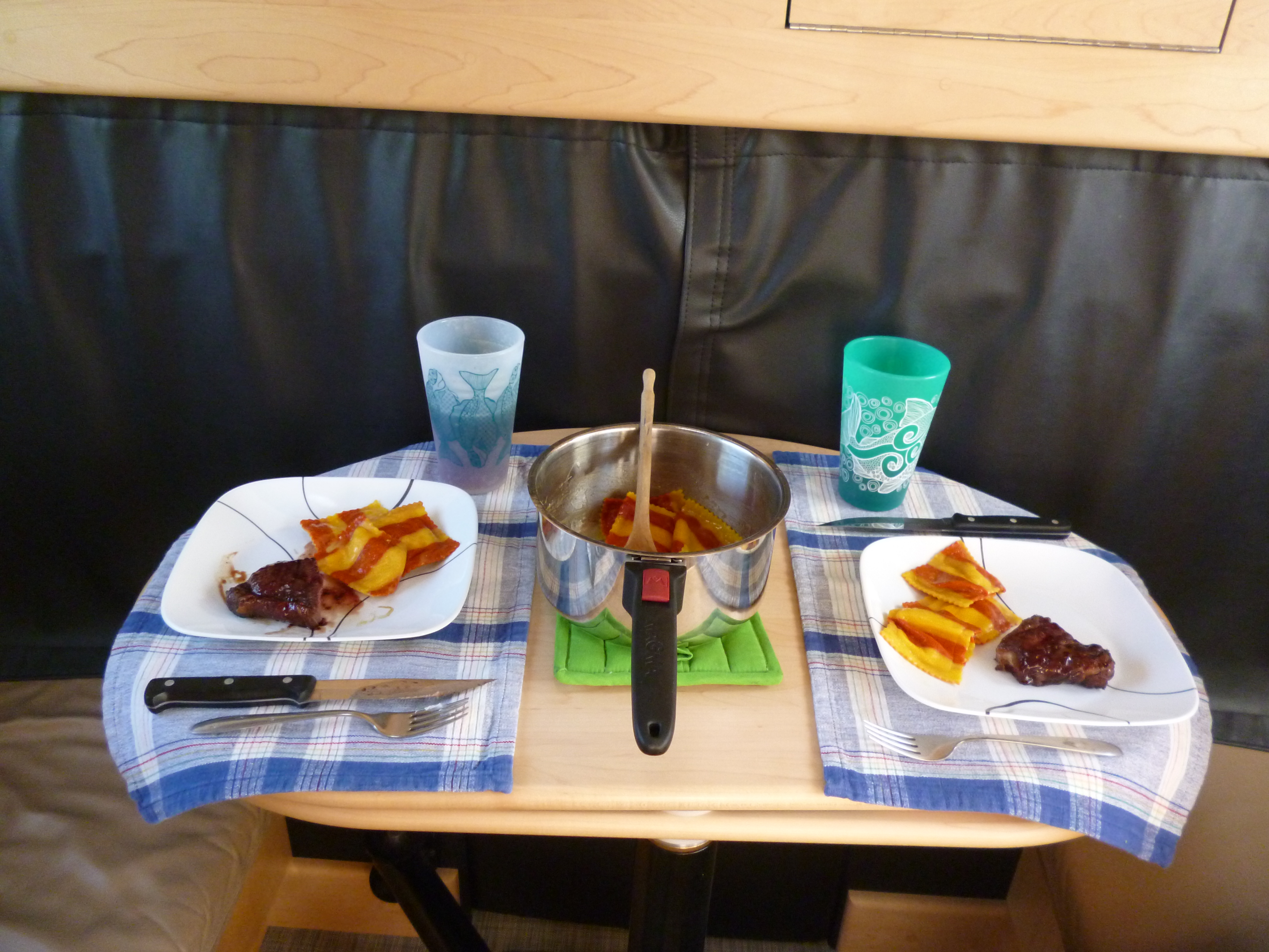
The next day began sunny so we started the day with reindeer breakfast sausage and eggs. The sausage had a hint of sage and were really good. Between yak and reindeer I think both of us would pick the reindeer – very tasty.

P1050315

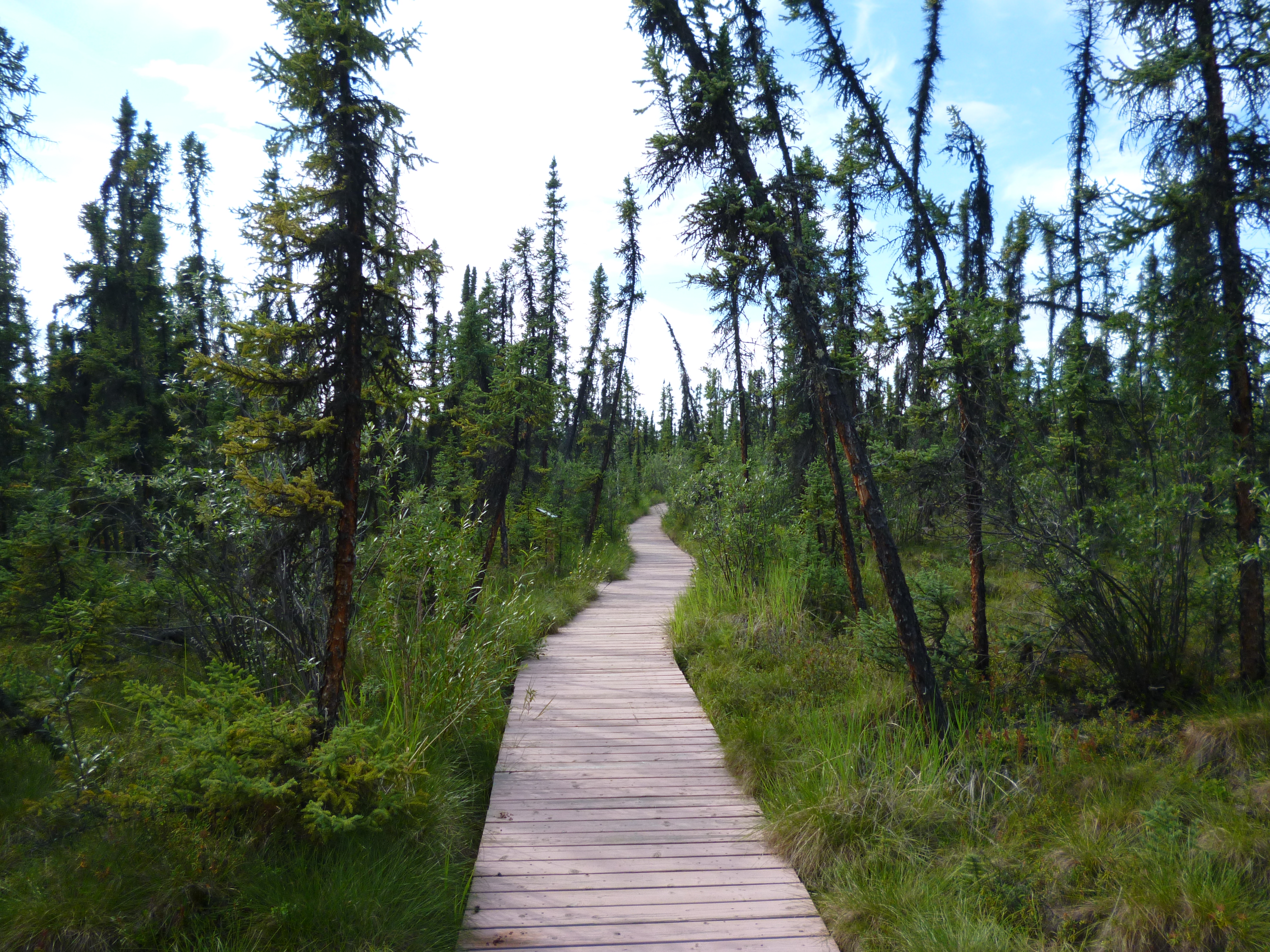
We then headed to a trailhead to hike a stretch of the Savage River. The hike was beautiful.

P1050321

P1050320

P1050325

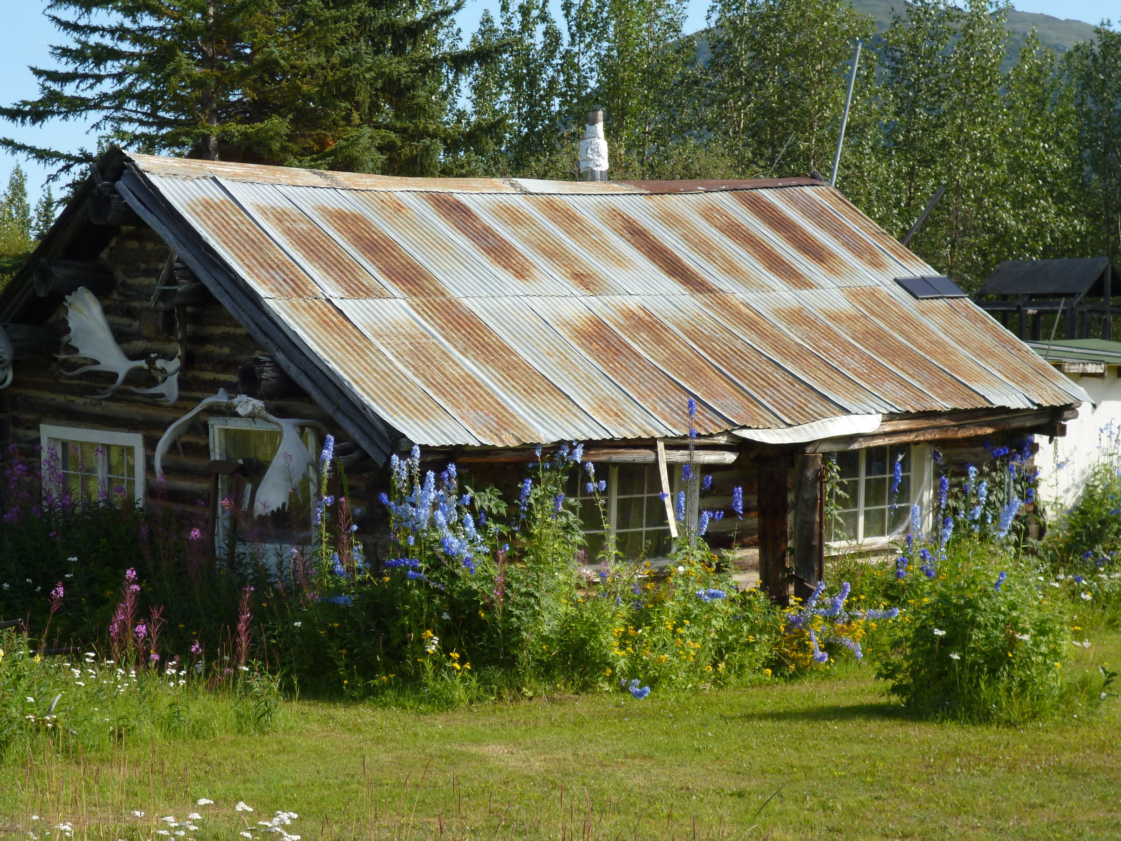
Everything at the park is given that frontier look. Even the outhouses have grass roofs.

P1050326

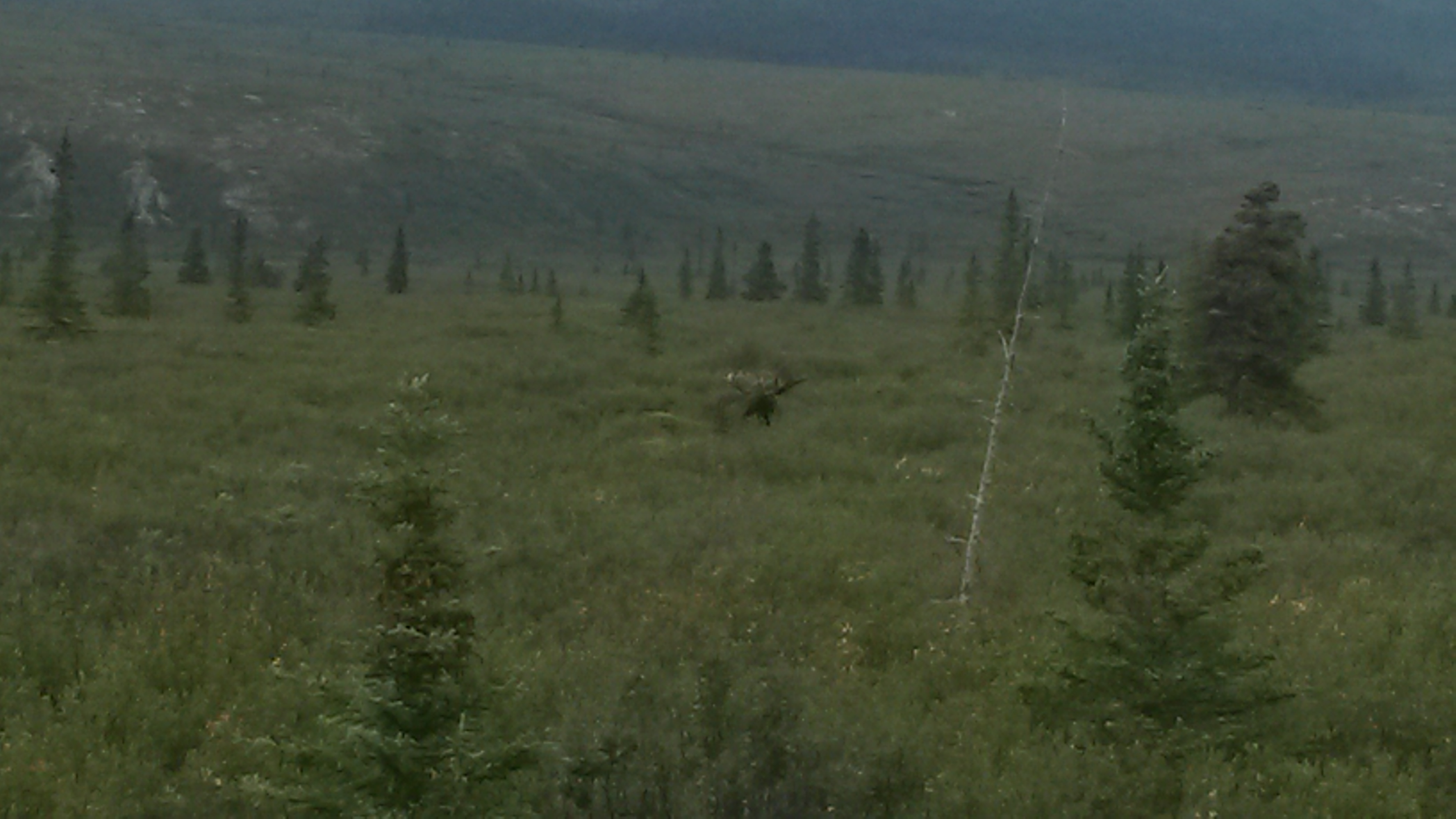
On our way back we saw our first bull moose in the field eating willows. He was about 100 yards out and his rack was huge. We sat there in our car with another shuttle bus for some time. However, another car pulled up and the folks got out. The moose instantly took notice, stopped eating and locked onto them. The park tries really hard to keep the animals wild by preventing them from associating people with food, or in the case of the grizzlies, as food. As we pulled away a ranger was approaching and I’m sure he made them get back into their car.

20150729_114246

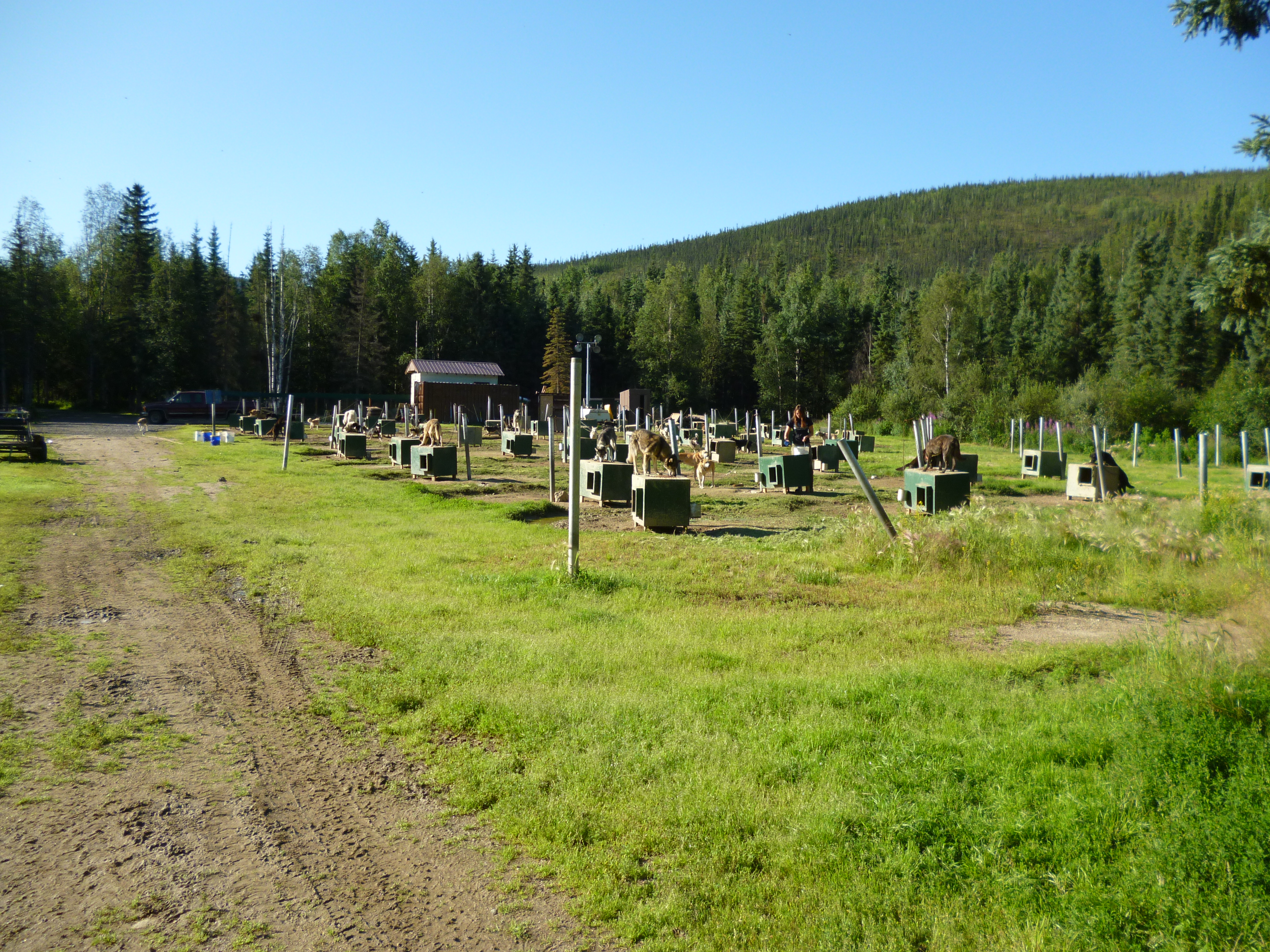
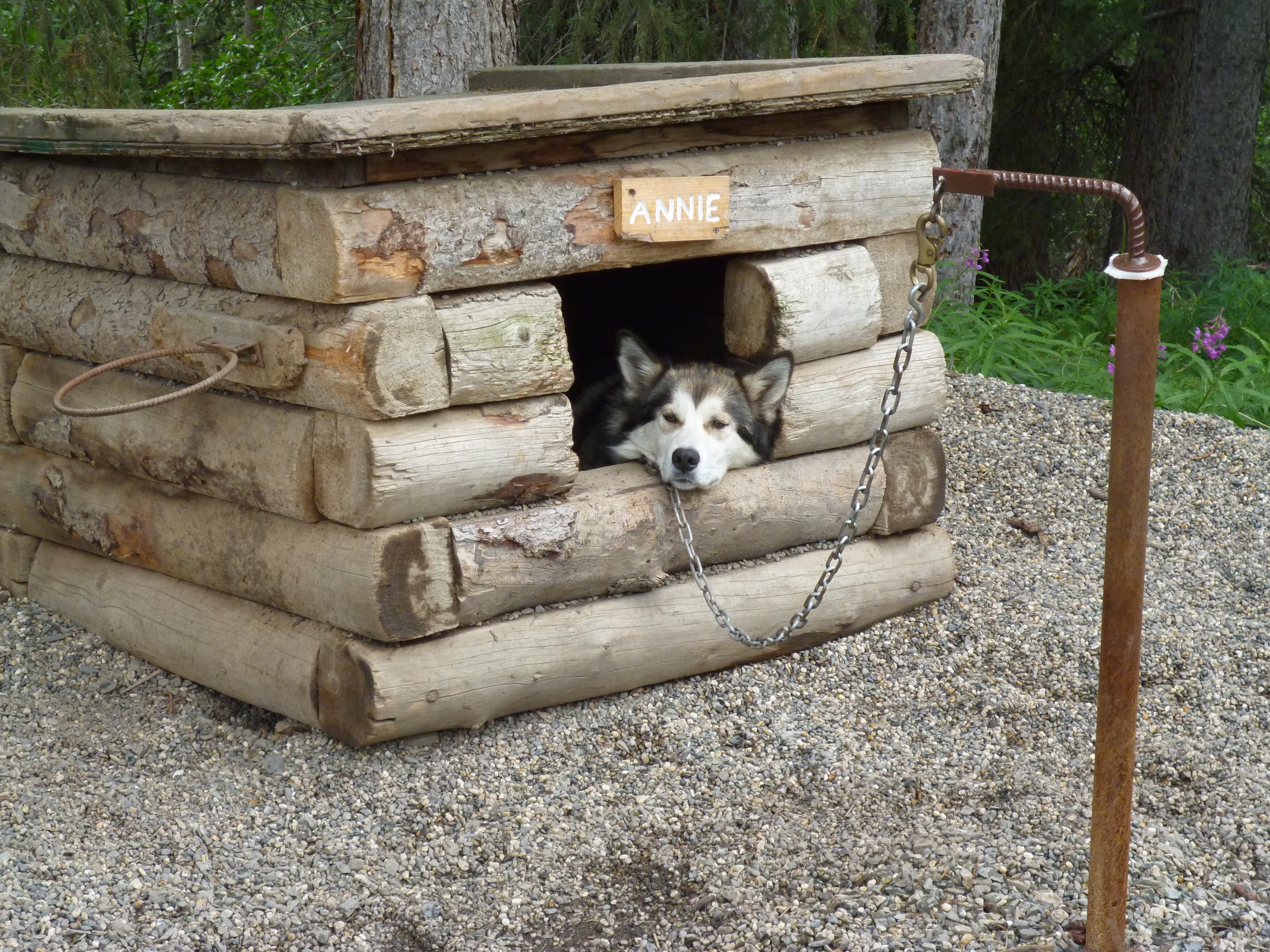
The park has their own sled dogs that help to patrol the park in the wintertime. We went to the doggie demo to learn more about the dogs and the rangers that utilize the dogs in the winter. The dogs cover over 3000 miles in the winter, and seeing the park, it’s definitely the way to go – by sled dog. The Alaskan huskies are a working dog where the sleds are packed with supplies of 50 to 100 pounds per dog to pull through the snow. Their coats are said to be ideal for -10 degrees. They were looking a little relaxed when we arrived.

P1050337

They did a sled demo with five of the dogs. All of the dogs were howling to be one of the five picked to pull the sled.

P1050345

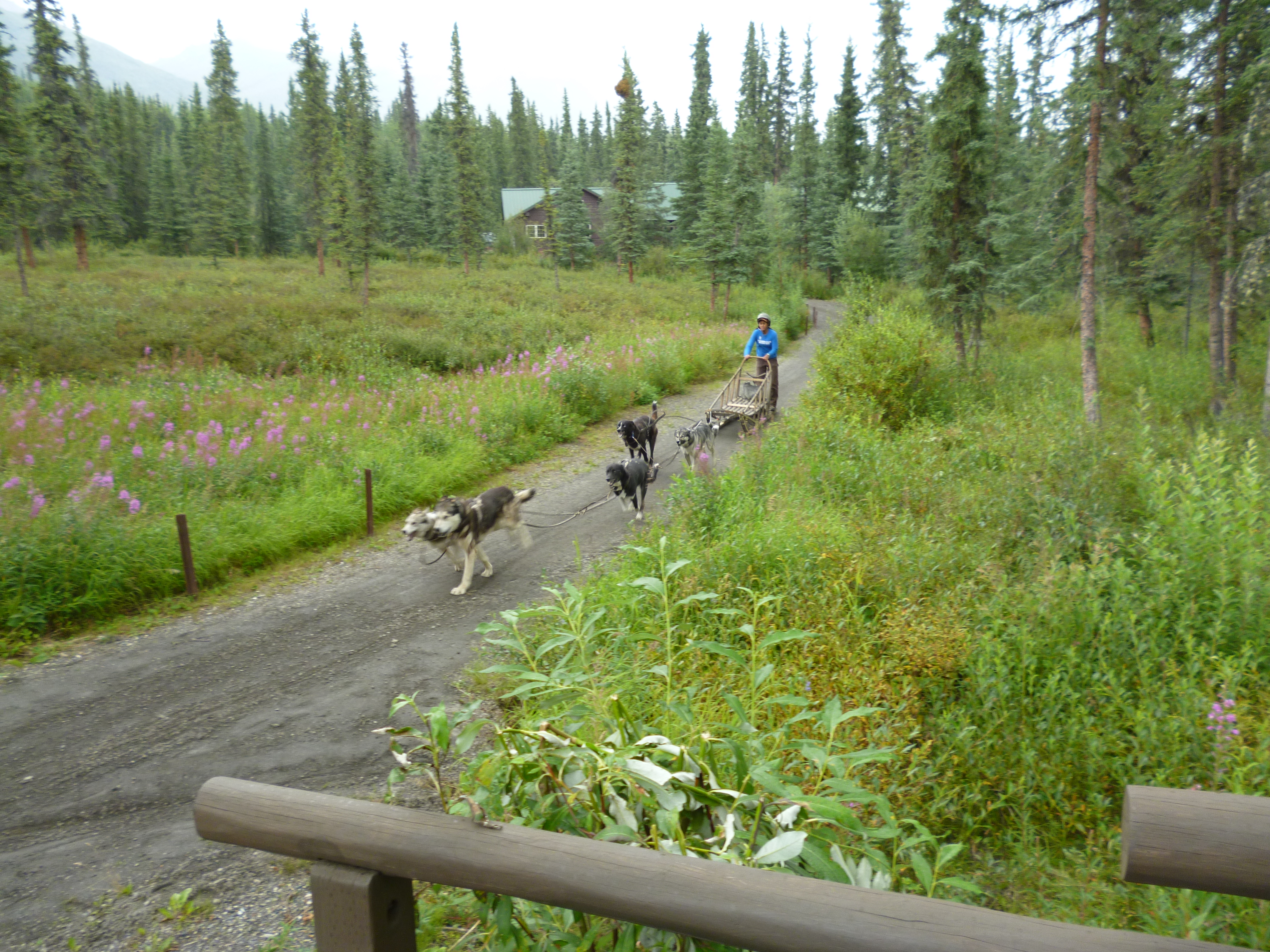
They cover 25 miles a day and ranger cabins are spaced that far apart through the park so that they can patrol the area all winter long.
Maybe we’ll get to see the mountain peak during our time in Alaska, maybe not. Either way Denali is a great park that we’ll be back to visit again. Like the film at the visitor center explained about climbing Denali, because of the altitude (no oxygen bottles allowed), weather and route conditions, relative to all of the other great mountains, including Everest, Denali should be considered a final exam and not a starting point for beginners.

20150728_142122

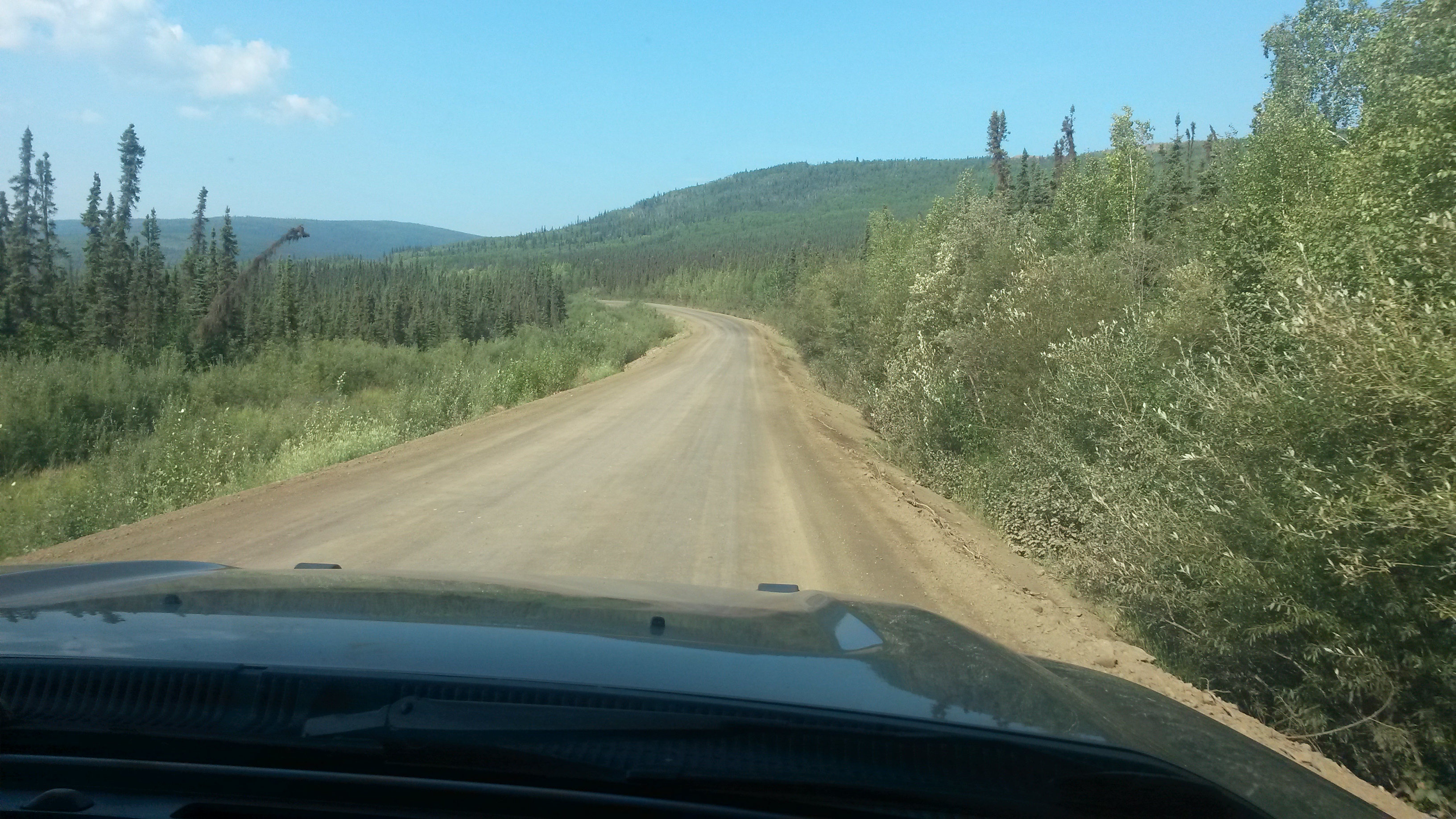
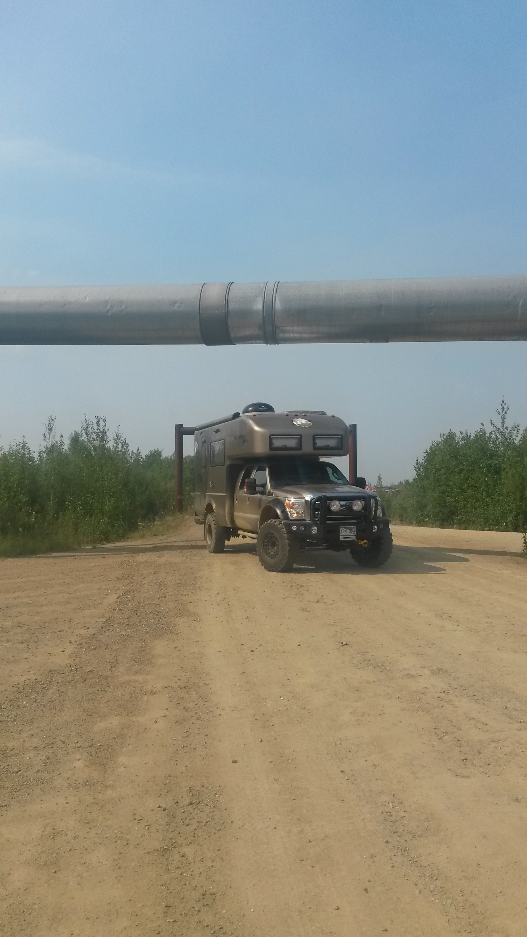
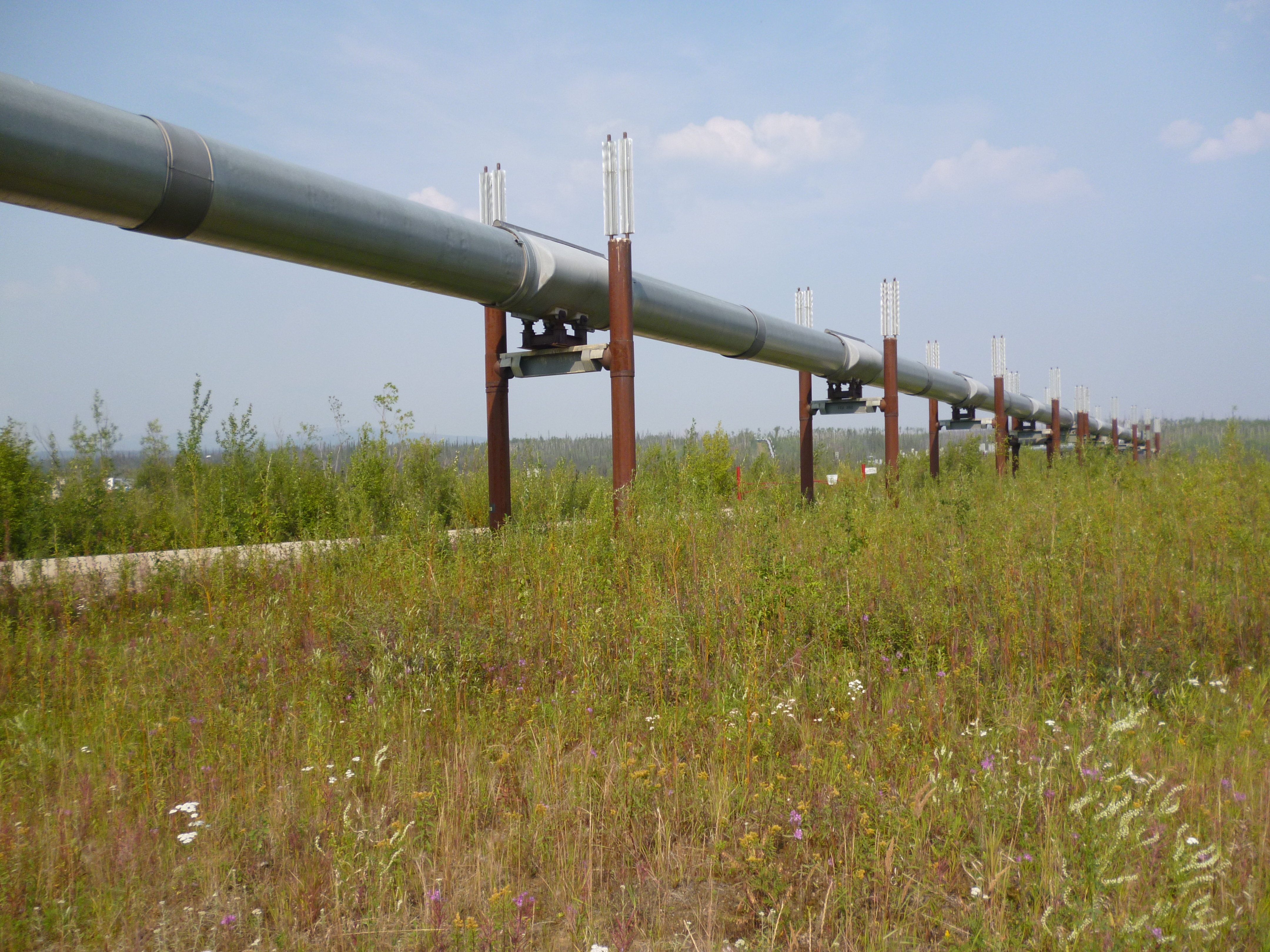
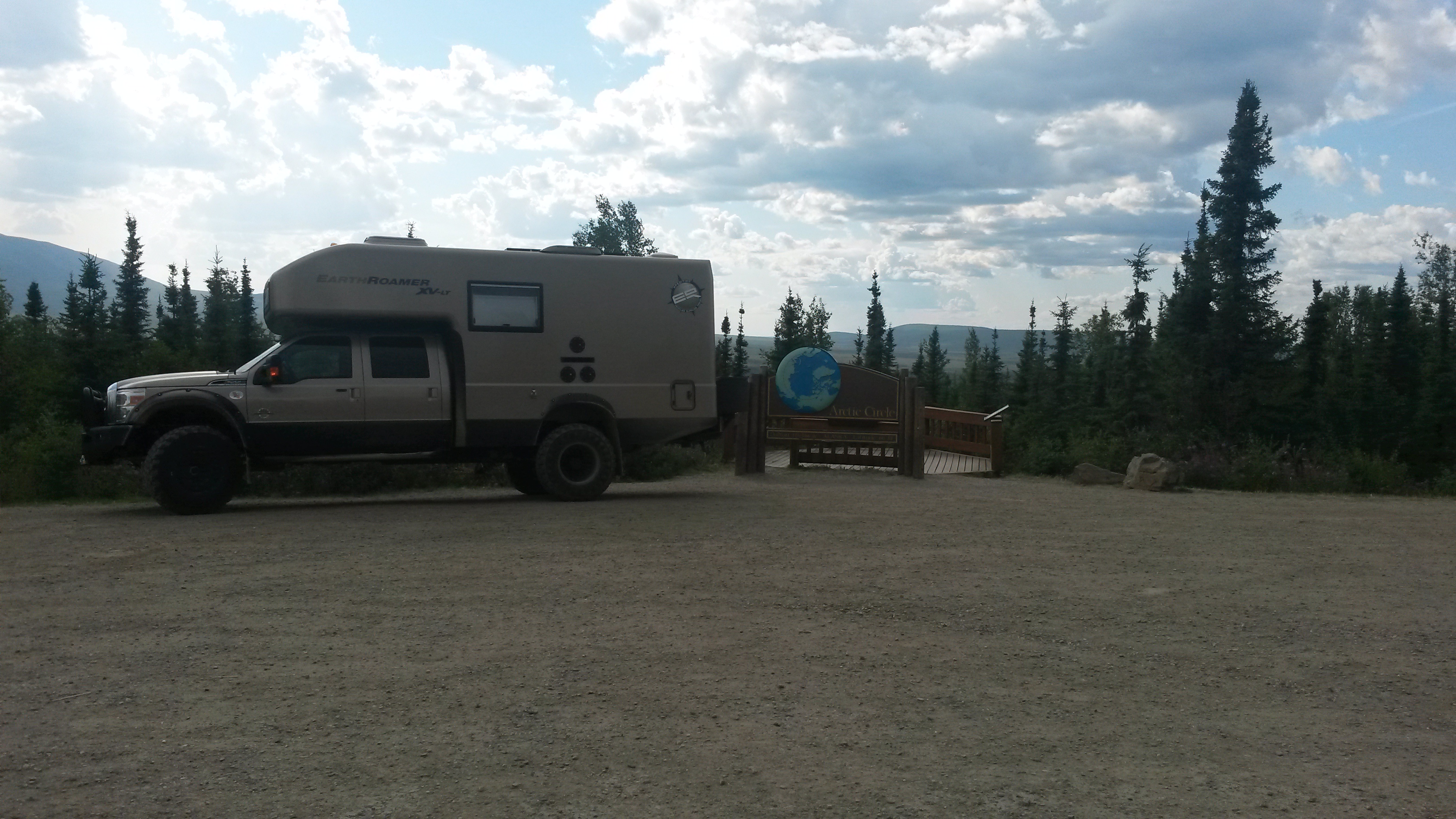
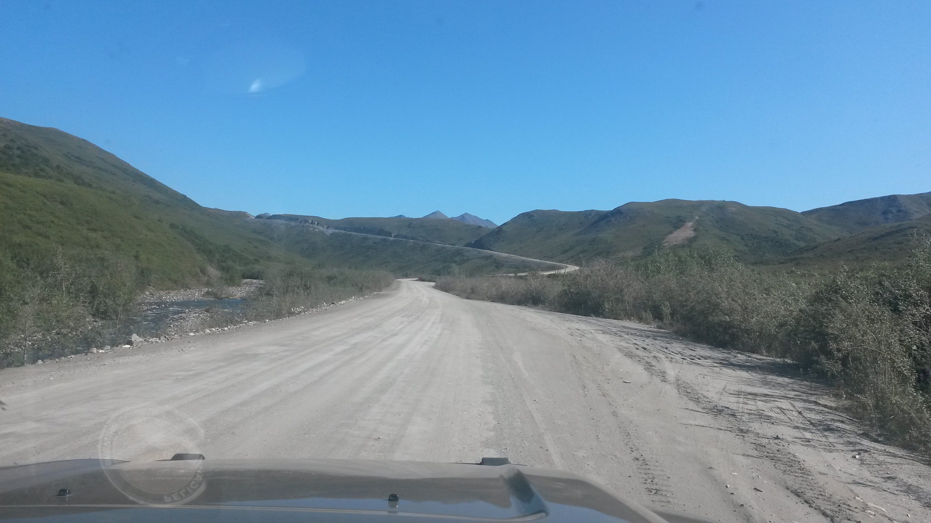
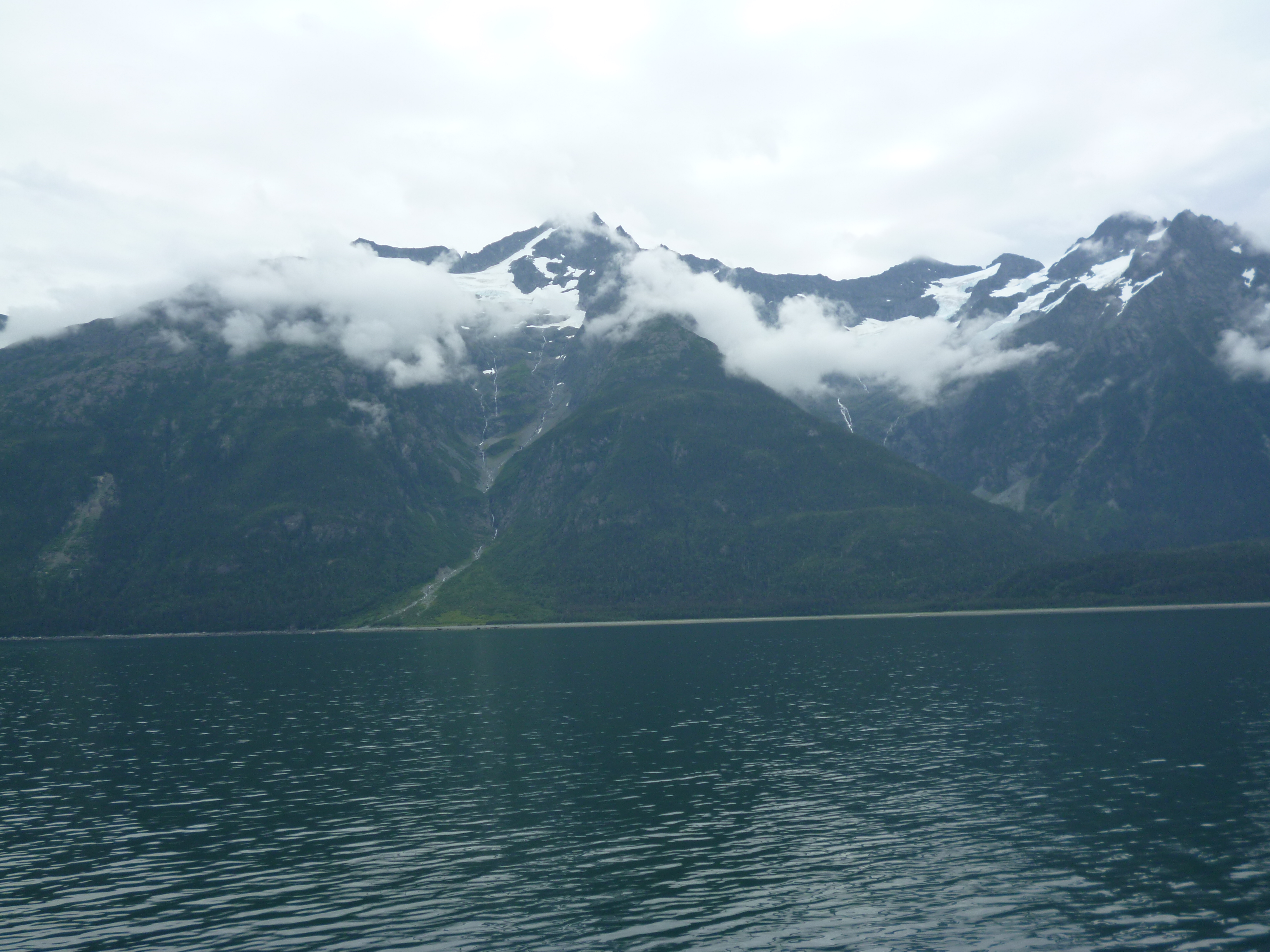
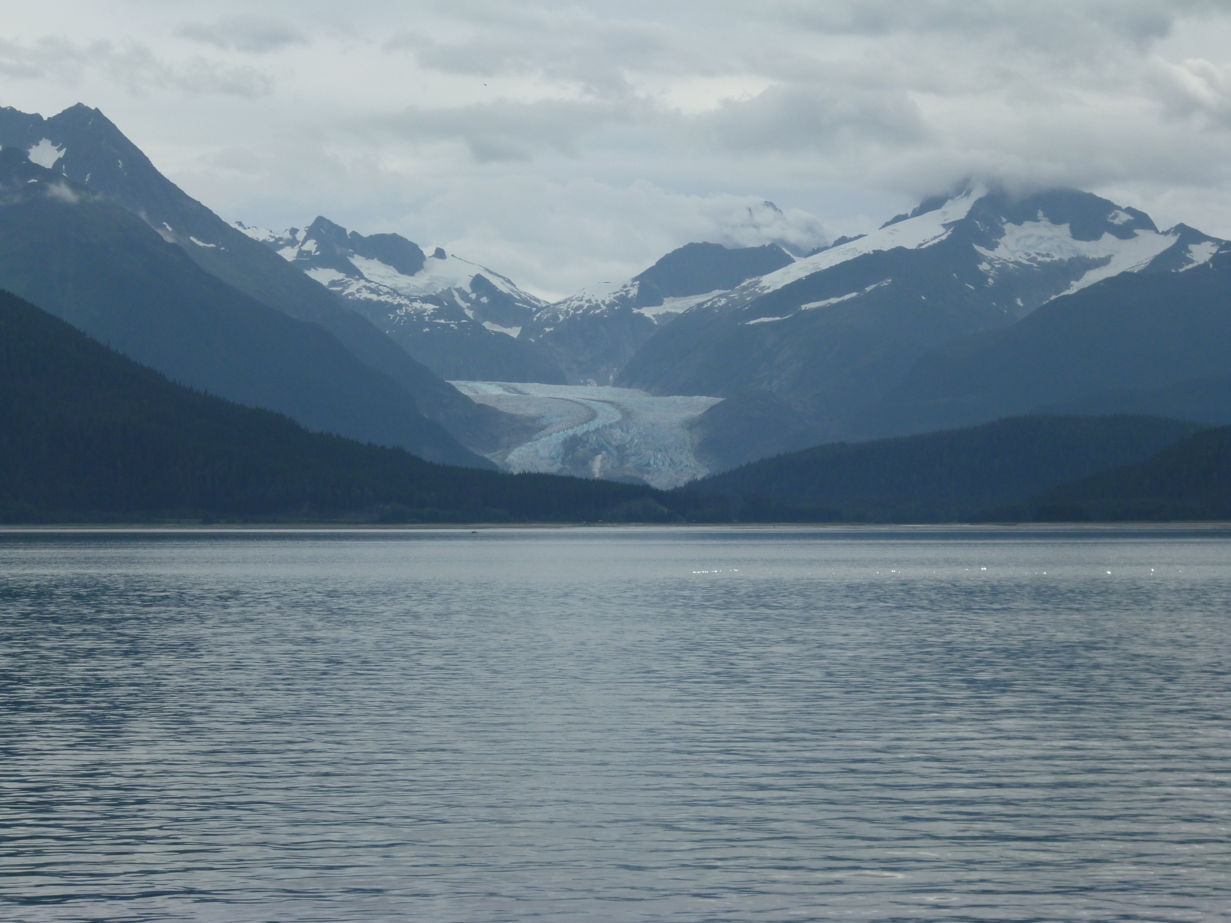
We’re off to Wrangell-St Elias NP now to see some more glaciers. It’s mostly dirt roads from here so it should be fun.

Arctic Circle

Before heading north to explore the Dalton Highway and the Arctic Circle, we spent a couple of days exploring Fairbanks. One of the things you don’t normally see further south are the electrical plug outlets in the parking lots so that folks can keep their car engines warm in the sub-zero winters.

P1050118

We checked out the UAF (University of Alaska Fairbanks) museum. They had the things you would expect like whale and dinosaur skeletons.

P1050126

What was an interesting exhibit was the “Vogel – 50 for 50” exhibit. Herb and Dorothy Vogel were New York City residents since the 60s, he a postal worker and she a librarian. Over the decades they amassed one of the largest private collections of art, all from aspiring artists in NYC over all those years, jammed into their little NYC apartment. They turned over their priceless collection to the National Gallery of Arts and 50 pieces of their collection were sent to a gallery in each of the 50 states. Due to their very limited income they were pretty innovative on their acquisitions, for example trading cat sitting for a piece from one artist, or collecting the working sketch instead of the final piece.

P1050121

In another gallery we came across a 1985 version of the American Gothic. The picture seemed kind of fitting for our current RV lifestyle. Our Roamer needs a bigger dish – lol.

P1050132

We then headed north out of Fairbanks to the Dalton Highway, which was constructed to support the building of the Alaskan Pipe Line all the way up to the Arctic Ocean. The road is notorious for being tough on vehicles, but is still well traveled by big trucks hauling supplies north and south, so it is relatively well maintained. Once again the gravel sections were much more enjoyable to drive on.

20150724_125459

We did not travel the 498 miles from Fairbanks to Prudhoe Bay, but we did go 2/3rds of the way to Atigun Pass on the Alaskan Continental Divide in the Brooks Range. Our furthest point north was 129 miles north of the Arctic Circle.

There are very few inhabited places once you get north of Fairbanks, so we stopped at most of them to check them out. One was the Arctic Circle Trading Post that had a collection of Police Insignia sent to them from all over tacked to their beams. They also had a great sticker that said, “There is not a single mosquito in this town, they are all married and have many children”. However, relative to the mosquitoes, we sat out in the evenings at both campsites for hours and mosquitoes were never a problem. It must be an OFF year – lol.

P1050145

We also stopped at the Yukon River bridge crossing, where the bridge road surface was made of wood planks. Given the trucks, and the loads they pull on this road, the surface must have been very thick wood planks. The pipeline runs under the bridge so you can drive under the pipe here. It’s huge, about 6-foot in diameter, and has been sending oil 800 miles from the Arctic Ocean to the southern Alaska coast since 1977. It really is an engineering marvel.

20150724_140744

20150724_140904

P1050149

There must still be a few fires in western Alaska that created a hazy horizon as we moved north, but the area was still beautiful. It was smoky from just north of Fairbanks to just below the Arctic Circle on the way up.

P1050158

We also stopped at the Hotspot Cafe for a nice vanilla ice cream shake. With the sun beating on you for 20+ hours a day in the dry air, a shake hit the spot.

20150724_150907

We hit the Arctic Circle latitude, 66 degrees and 33 minutes north for our first night’s camp. There was free camping there and the spots were a nice change to those in Fairbanks. It’s amazing to think that when you are on the Arctic Circle you are still as far away from the North Pole as you are from the California – Oregon border. Wow, the North Pole is way, way up there.

20150724_171011

P1050167

The Arctic Circle area was not what I expected. Somehow I figured once we got to the Arctic Circle a huge herd of caribou would be wandering over the wide tundra under the watchful eyes of the local Eskimos. It was still boreal forest with the black spruce and many other trees, and more mountainous than I imagined.

We stopped in Wiseman, a small town of about 30 folks with a trading post and mining museum. We chatted with a couple of the locals on the town, where it was obvious that everyone knew exactly what each was doing most of the time.

P1050180

P1050181

The Dalton Highway did have some really nice paved sections to the road around Coldfoot, the town that has the Arctic Interagency Visitor Center. They had a great video on the making of the Alaska Pipe Line in the late 1970s.

20150725_101450

However, most of the road is gravel or packed dirt, with graders fixing sections all along the way while trucks blow by at 50 mph regardless of the road condition.

20150725_094903

The scenery gets incredibly beautiful as you approach the Brooks Range, the northern most mountain range in Alaska.

20150725_113822

The road also gets interesting with 10% and 12% grades for miles through the passes. This was the climb to the Chandalar Shelf where the tundra actually does begins.

20150725_124634

The tundra area was beautiful.

P1050189

This was the 12% climb to the Atigun Pass.

20150725_130353

The mountains that surround the area were just stunning.

P1050192

P1050195

We turned at that point and headed south again to Coldfoot. We’ll save the Sag River and the plateau into Prudhoe Bay for another trip. We camped at the Marion Creek Campground. We had yak steaks and lobster ravioli for dinner with a few Alaskan beers. Nobody said camping food couldn’t be awesome. The sun may go just below the horizon at this latitude now, but the light is similar to a cloud passing overhead. It’s nowhere near dark. Our solar panels were generating a charge 24 hours a day.

P1050204

On the way back south we spotted this mother moose and her two babies in the pond.

P1050207

We also saw two bears, one just sitting in the tundra not far from the road. This bear was in the 1000 pound category and made us wonder what a bicyclist would do at that point. I guess use your available food supplies like chaff as you pedal by and hope it loses interest in spandex – lol.

We also stopped at the Yukon River Camp for lunch. Pam had a salmon burger, I had salmon tacos and we both had the salmon soup, all very good choices.

We hit the smoke again at the Arctic Circle and all the way south of the Yukon River. It was kind of spooky driving into the smoke, but given that traffic was moving in both directions, we felt pretty good about continuing south.

20150726_110533

Rain started to fall, clearing the smoke out of the air and making the dirt road a blast to drive on in 4 wheel drive, humming at 50 mph through the forest. We got to the end of the highway and stopped for a photo of the rig covered with road grime.

P1050210

The mud was nearly welded on and reluctantly came off with a high pressure wash hose at the campground back in Fairbanks.

On the way back into town we hit the Silver Gulch brewery for a taste and a bite. They have a lot of choices in their flight and the Alaskan hushpuppies made with halibut were really good.

P1050211

Got a camp spot right next to the river tonight in Fairbanks and we’re heading for Denali tomorrow for a few days.

P1050215

Road to Fairbanks

We boarded our last ship for this trip out of Juneau heading for Haines. The sky was the clearest we had seen in days and even though we had already made this trip once before during our initial route, we were able to see the beauty of the mountains that we missed on the previous day in the rain.

P1050003

There were glaciers all along the way to Haines.

P1040999

Notice the fishing boat in the water to get an idea of the size of the mountains that enclose the channel up to Haines.

P1050005

So our island hopping, ferry-riding segment of our trip came to an end. The Alaskan Marine Highway system is a public transportation system that serves an important role of moving people and cargo along the highway. If you are looking to get to all of the islands and have the ability to relax and deal with the delays that will occur, then this is a great way to go. The crew are a friendly bunch of folks and know what they are doing. On every vessel we traveled was at least one plaque where the crew and vessel had come to the aid of another vessel along the waterways, saving the lives of the persons aboard a distressed vessel. The system may not have the punctuality of a railroad, but you will arrive safe and sound while passing through some of the most beautiful landscape in the world.

P1050006

We took off from Haines heading north. You have to pass through Canada to get to the central part of Alaska due to the mountains and glaciers that block any direct route that would allow you to remain in Alaska the entire way. The route was along the Haines Highway, a bypass created in the 1940s to establish a sea-based, land supply link to the Alaska Highway for Alaska during WWII. The road passes through British Columbia and the Yukon before re-entering Alaska. The scenery along this route is just breath taking.

P1050009

P1050014

We camped the first night at Kluane Lake at the Cottonwood Campground. Our spot was right on the lake. The lake had some of the glacial flour in the water to give the lake a vibrant shade of blue.

P1050027

We saw a juvenile grizzly bear in the brush about 20 feet from the Roamer when we entered the campground. It was only about the size of a full grown black bear and quickly dashed off when it noticed us, probably back up into the hills behind the campground.

P1050028

The next day we traveled across the Yukon and saw some of the local attractions, like the world’s largest gold pan. I want to see the gold nuggets that came out of that pan! The museum there also had an amazing collection of mounted animals. The original owner was a naturalist, and obviously a good hunter too.

P1050031

We hit the Alaska Highway at Haines Junction and headed towards the US border. The Alaska Highway is not that bad of a road. Maybe in the past it was, but since we have been traveling mostly back roads, we’ve been on much worse roads in the lower 48 than this. It is part paved and part gravel, where the gravel sections are actually the nicer sections of road to drive on.

20150720_112838

The paved sections have pot holes and uneven sections that are marked with flags to alert drivers. The road is a very passable road when traveling at the posted speed limits. Our vehicle did pick up a layer of road grime that luckily was nearly the same color. Other vehicles with lower suspensions and no mud flaps were just covered.

P1050045

We hit the Alaskan-Canadian border along the 141th meridian. A gap was cut through the forest along the border.

P1050048

Both border crossings were a breeze. Just inside Alaska, and covering about 1000 square miles, is the Tetlin National Wildlife Refuge, noted as an important migratory corridor for many animals and birds. The marshy area is forested by black spruce, which is a very odd looking tree. A tree with a 2 inch diameter trunk can be over 100 years old. This area has the record cold for Alaska at somewhere around -80 degrees, definitely long sleeve weather. The ranger, a native that grew up in the area, said they typically have 160 days below freezing.

P1050051

We did a couple of hikes in the area where the path was along boards to keep you from sinking into the peat moss soil. The ground was like a moss covered sponge, which when it thaws causes everything to move, including the roads. We saw a few beaver lodges, but no beavers.

P1050055

P1050056

The second hike had an interpretive trail that explained the many edible berries and plants along the way, which amazing enough was a lot. After they explain what is edible you realize there is food everywhere there. Even though it is late July, it’s still early spring here in the growing season and many of the berries do not ripen until late August, after the first frost.

P1050061

We camped the night at Deadman’s Lake campground within the NWR. There were forest fires in the area but the recent rains have put them all out. Hopefully that will hold true for the remainder of the trip.

P1050065

As we continued towards Fairbanks we spotted our first moose in the wild, a mom and baby along the side of the road. Similar to Sequoia with our bears, we then saw five moose that day during the drive, either along the road or standing in the ponds next to the highway.

P1050070

The vistas along the drive are just amazing. Pictures can’t do it justice given the grandeur of the area, with the beautiful mountains ranges and the wide forested valleys.

P1050069

We haven’t seen any yaks or reindeer, but we did stop at one of the noted butchers along the route and picked up some yak steaks and reindeer breakfast sausages to try. Cooked the yak tenderloins up and they were good.

20150722_173545

We camped outside of Fairbanks at the Chena Hot Springs for a night. The thermal hot springs were great to soak in until we turned into raisins.

P1050079

They also had an ice museum there with two local ice carvers that create some pretty impressive works.

P1050102

P1050091

We took a hike in the morning around a beaver pond and came out next to the sled dog camp right at feeding time. They have a golf cart that they pull in the summer and obviously a sled once the snow comes to the area to train for the Iditarod.

P1050111

One of the hardest things to get used to being this far north is that it does not get dark at night. The sun goes down, but it’s still pretty light outside. A local told us it will be another month before it gets dark enough to see stars at night. So much for the idea of seeing the northern lights this trip – lol. It will be even worse when we get up to the arctic circle for our next stop.

We are in Fairbanks now for a couple of days to relax and explore. I gave the Roamer a bath, Pam did laundry and we’re just catching up on emails and things in general, while we explore the city. We checked out the local migratory bird area today, their summer location, at what used to be the local dairy with an awesome barn. Some of the birds, like the Peregrine falcon and the flycatcher fly from here all the way to South America for their migration.

P1050114

In our quest for natural beauty and good beer, Pam found another Scottish Ale from the Kenai River Brewing Company, located down towards Anchorage. We’ll have to stop in when we get there.

P1050117

I’ve been enjoying the Alaskan Brewing Co. Amber and Icy Bay IPA. We stopped into the brewery when we were in Juneau. Alaskan is a pretty innovative brewery, driven mostly out of necessity to stay competitive while operating from effectively an island with no natural beer resources: hops, malts, etc, other than crisp, clear water.

For those worried about my Weber, the replacement grill is being broken in nicely with the various meats and fish we’ve been enjoying. It may not be as rugged as the first (yet), but it will hopefully make the entire trip without the need for repairs.

Sitka – Juneau

Getting to Sitka turned into a story all its own. Sitka was the capital of the 1800 Russian-American territory and the place where the transfer of power took place when Alaska was sold to the US. Therefore, it was rich with history and a place we wanted to see.

Our original ferry from Ketchikan to Sitka was cancelled so we were rerouted all the way to the end of the Bellingham route at Skagway and then back to Sitka on the return trip of the ship to Bellingham, adding two more interesting days to our ferry ride at no cost. However, on the return leg the ship developed an engine maintenance issue and was held in Juneau for repair, one stop short of Sitka. The ship was fixed, but we missed the tides so we were going to be held in Juneau for a few more hours, we thought.

By now we had gotten to know the crew pretty well so when I went to check on our departure one of the crew pulled me aside and gave me a, “now I’m not telling you what to do but….” talks. Turns out making it back to Bellingham on schedule is top priority and Sitka is way out of the way. The ship was going to be held in Juneau until the USCG could inspect the engine fix the next morning so all the stops between Juneau and Bellingham were going to be cancelled. All people and cars getting off at any of those stops were about to be booted off in Juneau.

The nice heads-up talk allowed Pam and I to go ashore to the terminal and work our re-rerouted plan with the great folks at the counter way before others even knew what was coming. Rebooking walk-on passengers is easy and even folks with cars not too bad, but getting a 26 foot camper rescheduled is not something that can be done easily, but it worked. Because we have no defined timeline for our trip we slid our three remaining ferry routes by a day and left the next morning on an express ferry to Sitka, with a free meal on the ship that night and reimbursed for the room from the Juneau to Sitka leg.

P1040942

The real bonus of the change is that the M/V Chenega makes the trip from Juneau to Sitka in 5 hours instead of the M/V Columbia time of 10 hours. We loaded the Roamer the next morning onto the ship and left the M/V Columbia and Juneau behind at very high speed.

P1040835

The trip to Sitka was beautiful. The sun finally broke through the clouds and the route cuts through some relatively small passages between the forest-covered islands to arrive at Sitka without having to travel any open ocean segments. Sitka is located on the Pacific Ocean side of the Baranof Island.

P1040841

P1040847

There are not many miles of paved roads in Sitka and our campground was literally at the end of the road.

P1040887

The Starrigaven campground, located less than 10 miles from downtown Sitka, is in a rain forest and was a nice spot while in Sitka. However, it did live up to its name the second night with a constant drizzle the entire night.

P1040852

P1040885

We drove to the other end of the road on the other side of Sitka, where the “Fortress of the Bear” is located, a bear rescue habitat that takes in displaced black and brown bear cubs. They have three black bear and five brown bear permanent guests that were great to see. They were mostly brothers and sisters from killed mother bears.

The black bears were similar in size to the ones we saw in California, 150 to 250 pounds, and were playing “king of the hill” for most of the time we were there.

P1040855

The grizzlies were just huge, where the big males were close to 1000 pounds and four feet tall at the shoulder.

P1040854

We were most impressed by how agile they were while climbing up, on and around the various things in their enclosures.

P1040859

The grizzlies had a volleyball tetherball filled with dog food for their snacking game in one of their enclosures.

P1040867

We got there just after lunch, and once the sun hit it was nap time.

P1040871

P1040868

The smaller female bear had learned to use sign language to ask the folks for more food since her brothers had eaten most of it.

P1040874

We visited the Alaska Raptor Center next. They rescue mostly eagles given the large number in the area, and other raptors as well. Many were permanent guests due to the injuries that landed them at the rescue center. The eagle enclosure had a fence around it to keep land predators out, but did not have a roof. The recovering birds could not fly away so the open enclosure allowed other local eagles to stop in and visit, which they did.

P1040878

We met a nice local couple at the Baranof brewery following our first day’s travels and traded them two nice filet cuts of meat we had for two huge salmon fillets and a couple of cooked crabs. We ate the crab that night at the campsite’s picnic table next to a nice campfire.

P1040883

We spent the next day in town, checking out the history of the area. At the end of town is the Sitka National Historic Park where the 1804 battle between the Russians and native Tlingit occurred. The park is also the home for many totem poles.

P1040904

P1040901

The Russians first settled Kodiak Island as their main base for fur trading, but moved to Sitka which was rich in sea otters. The sea otter has the densest fur on the planet, over 1 million hairs per square inch. They had a couple in the various museums and wow I could definitely see having a blanket of sea otter fur. One of the park rangers was a native and her mom made her a sea otter cuddle animal out of a sea otter pelt when she was a child. Wow, it was tough to put down.

P1040936

The Russians were not attempting to colonize Alaska and when the fur supply began to go away, coupled with financial issues at home, the Tsar decided to sell Alaska to the US in 1867. Sitka still has a very strong Russian community in the town as part of its heritage. The Russian Orthodox church in town was very beautiful, where many of the Tlingit converted to Russian Orthodox during the Russian rule of the area.

P1040931

As the political seat of the colony, Sitka also had a Bishop with the power of Russian royalty because there was no separation of religion and state. The Bishop’s house is today a part of the national parks to preserve the Russian heritage. The building is one of the very few remaining from the Russian rule and was build like a ship with interlocking wood planks and joints.

P1040924

P1040918

Wallpaper was used to cover the wall planks and seal the air gaps in the joints.

P1040926

The aquarium there was interesting that they had one of the few killer whale skeletons on display. They knew of the other one we had seen in Eden, Australia of “Old Tom”, the Alpha male killer whale for the pod that worked with the local folks to capture and kill local whales for the people and the killer whales to both use. The aquarium had a fish hatchery that trains others how to properly raise salmon for release to keep the billion or so salmon that are critical to the entire food chain.

P1040910

These Coho salmon were in tanks ready to be released next spring. The pink salmon were in the bay jumping and ready to start their spawning run up the local rivers in the coming weeks.

P1040912

The aquarium also had a chowder booth where the chowder was from a local bistro. It was clam and chorizo chowder with a chunk of rosemary potato bread on the side. I wasn’t sure on this combo, but boy was it good.

Our last stop was at the Sheldon Jackson Museum in town. Jackson collected many Alaskan native people artifacts between 1880 and 1900. The collection was impressive and included many daily life items such as baskets, boxes, tools, clothes and jewelry of the native peoples.

P1040933

Sitka was worth the adventure of getting there. A very interesting place that I found out has a lighthouse for sale as a residence for only $600k – lol. Maybe Alexander Baranof and I will just kick back in town and see what happens.

P1040930

We left Sitka on the M/V Chenega again and arrived back in Juneau for a couple of days to explore there before heading to the interior of Alaska.
We camped at the Mendenhall Lake Campground and the camp host gave us a great site.

P1040948

Here is the view from the campsite looking toward the Mendenhall Glacier.

P1040991

It would have been a top ten spot if someone had not taken my baby weber from our campsite while we were out sightseeing. We bought a new baby weber to replace the stolen one, but it’s not the same. I hope Karma kicks in real soon for whoever took it.

P1040992

We went to the Mendenhall Glacier and did a couple hikes around the area. The sun broke out from the rain clouds to really show the amazing color of the glacier.

P1040958

The waterfall of the mountain runoff was pretty spectacular too.

P1040971

P1040966

The downtown section of Juneau is small enough to cover the entire area on foot, so we did. We were warned that the downtown streets would be tight for a rig the size of the Roamer, but it was not an issue. They obviously have never driven through Moab before where mirror removal is highly likely. The buildings in town have a gorgeous backdrop of the mountains.

P1040979

There were five cruise ships in town, which made for a lot of folks walking around town. The folks were also taking advantage of the good weather to book flights on the boat planes that fly out of the downtown harbor.

P1040975

P1040978

We head for Haines tomorrow and the inland of Alaska. This will end the ferry section of the trip and begin the next leg of our summer journey.

Northbound Alaskan Ferry

The next leg of our trip is the ferry ride on a few of the Alaska Marine Highway ships with stops along the way to our final departure port into the heart of Alaska at Haines, Alaska. The most southern port on the highway, and our point of departure from the lower 48 was Bellingham, Washington aboard the M/V Columbia.

P1040728

These ships carry vehicles of every size from motorcycles to 18 wheelers. The upper deck is only cars, but the lower deck held every type of RV and truck. Here was one self-contained convoy that loaded during our trip. I wonder how easy it is to get the Smartcar loaded behind the cab?

P1040792

Our original plan was to get off at the first stop in Ketchikan, but the boat that was scheduled to take us from there was taken out of service. Therefore, we changed our route a few weeks before we left to go all the way to Skagway and then return on the M/V Columbia to Sitka, Alaska, our intended second stop. Because of this, our vehicle would be on the ship for 4 days (us too) so it was the second to the last vehicle loaded at Bellingham. A little further back and the roamer would have been swimming.

P1040785

Our M/V Columbia route took us from Bellingham to Ketchikan, to Wrangell, to Petersburg, to Juneau, to Haines and to Skagway over three days. At each port, vehicles got off and got on using just one door into the ship. The crew was amazing that they were able to off-load and load all the vehicles without moving ones already aboard around. We had to reposition the roamer at Skagway to make it easier to get off at Sitka. The roamer was the one of the few vehicles left onboard to make the return trip.

P1040824

We were worried that the freezer full of great food would not last for the three days without solar or external power. The camper batteries had gone down to 58% charge by Sitka and then re-charged to 92% during the brief time that I ran the roamer to reposition it on the ship to Sitka. You got to love this vehicle.

P1040827

The Alaska Marine Highway ships are not cruise ships, and the crew are state worker (no tipping allowed). While the commercial cruise ships docked in the downtown berths, our docks were typically a few miles away from town. This actually worked out better since it allowed us a nice hike at our stops to stretch our legs after just sitting, reading and chatting with the passengers and crew during the hours on the ship.

Many folks did not get rooms for the multi-day trip, instead they just threw up a tent on the aft decks to camp. The covered part of the outside aft deck even had heat lamps to keep the folks crashing in just sleeping bags on lounge chairs warm through the night.

P1040731

Luckily a room became available when we changed our itinerary so we had beds and a shower for the trip to Sitka. Given that the weather was a little damp most of the time aboard, a room was a very good thing.

P1040734

The first day aboard was a pure steaming day, no stops. We saw a few whales and many eagles on our way to Ketchikan. The waterway runs through the hundred of islands along the British Columbia and Alaska coast, some as big as Connecticut and others as small as a pile of rocks. We saw a whale breeching in one of the channels ahead, but then the ship turned and motored up the other side of the island. We never got a picture of the whales or their spout mist, but the landscape scenery was beautiful even during the foggy, drizzly days. I guess that’s an advantage of living in the desert. A nice rainy day is a wonderful thing.

P1040811

We got off the ship at Ketchikan while it was at port instead of a couple of days as originally planned.

P1040770

We visited the museums and visitor centers there that were quite interesting. The town is only about 4 streets wide and a salmon creek cuts through the back side of town, where the bars and brothels used to be located in years past.

P1040778

Now the buildings along Creek Street are historic (although I’m sure they were then too), and contain shops for the tourists. It was said that the men only talked about fishing while on Creek Street and only Creek Street while out fishing.

P1040776

The waterway varied in width from open ocean sections and far away islands to tight channels.

P1040742

P1040808

The Wrangell strait was a narrow section, where only one large ship can go through at a time.

P1040795

At Skagway we made the turn back to Sitka. We didn’t get a chance to get off at Skagway since I was in the car deck waiting to reposition the roamer during most of our dock time. Skagway was the place all those folks climbed the hill heading into the wild Alaskan wilderness and gold country back in the early days.

P1040819

Looking back down the channel towards Haines was very beautiful.

P1040816

We left Skagway expecting to wake up the next day nearly to Sitka. However, we woke to find ourselves back at the Juneau docks with a ship engine in repair. At one point we had to reposition the ship to allow another of the ships to come in and port. The ship was finally fixed, but we missed the tides for a critical section between Juneau and Sitka so we’ll arrive in Sitka about 12 hours late. Instead of two days there to explore we’ll only have a day and ½ before we will be back in Juneau for a couple of days of exploration.

P1040830

While the ship travel has been interesting and the dining room food yummy, we’re both ready to hit the road again and explore the land on our own schedule in the roamer.

P1040736

P1040764

Washington

We left the Oregon coast on Friday morning, 3 July. As we headed inland it was very clear that most of Oregon was descending upon the chilly coast for the holiday. The road heading towards the coast and the 101 highway along the coast were packed. We got out of there just in time.

We headed inland to McMinnville to spend the holiday with Chuck and Lori. They were great hosts for the holiday weekend. Since we got there early after deciding not to sight-see along the coast due to traffic, they met us at the Grain Station brewery for lunch.

20150703_120841

We toured the beautiful valley and visited one of the many outstanding Pinot Noir vineyards in the area, Durant Vineyards. The view they had was amazing, looking over the vine covered hills with Mt. Hood off in the distance. The pinot noir was good and our server very gracious with a few extra pours. He grew up in the neighborhood Pam and I lived in Long Beach and now owns a place in Pacific City, Oregon to surf, the home of the Pelican Brewery and our possible next home site – lol.

20150704_114808

We then went to the Evergreen air museum, where most of the vintage planes from Falcon Field’s museum were sent, along with the Spruce Goose. The last time Pam and I saw the Spruce Goose was the day after our wedding on the Queen Mary in Long Beach 30 years ago. It was where the Spruce Goose used to reside, next to the Queen Mary.

20150704_191926

I saw the DC-3 that I helped a little to restore back in the early 80s when I worked at the Long Beach plant.

20150704_193159

Their aircraft collection included both air and space and was pretty extensive. They had a video of the President Kennedy speech that launched NASA and the quest for the moon. Why don’t we hear speeches like that anymore?

20150704_203146

I am always amazed when I see the lunar lander and wondered how that discussion between the engineers and astronauts went – okay, so we need the largest streamline rocket in the world filled to the top with fuel to get us out of earth’s pull and into to space, but this tiny aluminum foil covered, easy bake oven shaped box with fuel about the size of a keg of beer is going to get us off the moon and home – I’m in.

20150704_202338

We saw a 40 minute fireworks display that seemed to never end for the 4th at the museum. We took the roamer there and the 4 of us sat inside and had some drinks while the parking lot of thousands emptied – man I love this vehicle.

We then headed north to Mt Saint Helens area and camped at Lower Falls campground. This is a great campground for those passing through the area. The sites are huge, well forested and right next to the beautiful falls – definitely a top campsite list site.

P1040653

P1040654

We did some nice hikes along the river and then just relaxed in our zero gravity seats (a must for long trips) in full recline mode to enjoy the canopy overhead.

P1040661

P1040659

We visited the blast area of Mt Saint Helens. It was in May 1980, over 35 years ago that the mountain blew. The lateral blast out of the mountain obliterated everything within 5 miles, knocked trees over up to 15 miles and scorched the forest up to 17 miles away from the blast. This shot was just beyond mile 5. South facing slopes and even some of the local lakes survived the blast due to the ice and snow that still covered the ground in May of that year.

P1040673

We climbed the thousands of stairs to a nearby lookout point. Felt like a small piece of south Kiabab all over again. This was from about half way up to the peak. The entire area is part of a study to see how the terrain regeneration will happen.

P1040670

Mt Adams could be seen from the area. All of these peaks: Adams, Hood and Rainier, are volcanoes similar to Mt St Helens in their ability to erupt.

P1040674

The white along the lake shore are thousands of logs that washed back into the lake from the far side when the blast related landslide displaced the lake up the far side of the mountain in a wave. The landslide raised the lake bed and the local terrain by 200 feet. The mountain peeking over the rise is Mt Rainier.

P1040671

Mt Rainier NP was our next stop. The mountain is covered with glaciers and the surrounding area is rugged terrain and woods.

P1040709

We hiked what we thought was a nice level hike around the lake and it seemed to go up and up until we came out on top, overlooking the lake below. The roamer is parked down there somewhere along the road.

P1040705

After the hike we kicked back at the campsite and had a few Raaaai-nieeeeeeer-Beeeeers to relax at the end of the day. It seemed appropriate.

P1040711

We camped at the Cougar Rock campground in the park for a couple of days. It was right next to one of the many glacier generated rivers coming from the peak. The water has the “glacier flour” mixed in to give it the milky color. The majority of the drinking water for Seattle and the surrounding Puget Sound is from the glacier run-off.

P1040712

We then drove to Bellingham to close out this segment of our trip, the west coast adventure. Taking the back roads to by-pass Seattle took us by Snoqualmie Falls.

P1040715

We are restocking, refueling, doing laundry and in general getting ready for the next segment of our trip – the ferry ride up to Alaska.
We camped at Larabee State Park outside Bellingham. It was a nice place with the possible exception that it’s about 100 yards from the Burlington-Northern Railway line that runs down the coast with trains running about every hour. I can sleep through anything, but Pam was a little restless. I’m glad she picked the site – lol.

P1040717

P1040721

Oregon Coast

Before we left Eureka, we had to get some business done on the road using a traveling notary. Nearly everything can be completed on the road with marginal connectivity in remote areas, even things that require the older way of doing things, like physically signing papers.

The notary was a petite lady who met us at one of Eureka’s mall parking lots with her husband. Being RV owners themselves, they also liked the roamer. As we took care of the paperwork, they told us about a recent trip they had to the Midwest where a tornado touched down next to their RV park, 30 minutes after the severe storm warning was lifted for the area. Their RV was picked up off the ground, with them in it, and several of the others RVs around them were damaged. Luckily no one was hurt. Wow, not the kind of off-road adventure we want to ever do.

Our first stop in Oregon was at Crater Lake NP. It’s hard to grasp the beauty and size of the now-submerged volcano caldera. The lake is six miles across and it’s the deepest lake in the US at just under 2,000 feet deep. That’s a lot of fresh water.

P1040571

We got there as a huge thunderhead cloud formed over the area, which shed only a few drops of rain, but the lightning it produced sparked 6 small fires in the local area. We saw fire crews the following day around the park fighting the smoldering spots in the forest. We watched a huey with its bambi-bucket fly over our campsite carrying water to the remote fires.

P1040580

The lake has many great places around its perimeter to enjoy the view and do hikes. We did a couple of hikes to the local waterfalls. These are spring fed streams from water pushed through the rock from the lake that appear miles away from the lake itself.

P1040554

The meadows there were pretty and full in bloom. The mosquitoes seem to be getting bigger as we move north. Maybe they will be bird-sized when we get to Alaska.

P1040537

We also did a hike to “the pinnacles”, which are the remains of heat vents that hardened in the pumice ash and have now eroded in the river valley.

P1040550

As with all of the larger national parks, the Crater Lake lodge was very interesting. Maybe after we no longer have the roamer we’ll do a national park lodge tour in the winter months when they are blanketed in snow and the parks mostly empty.

P1040572

We then headed north out of the park and west towards the coast down the beautiful Clearwater and North Umpqua River gorges.

P1040583

Before we reached the coast we passed a logging truck procession in Myrtle Point. Logging is big business in the area and these trucks roll by constantly on the area roads, or at least the ones we were traveling.

20150628_115806

We stayed at Bullards Beach State Park once we hit the coast. It was a ¾ mile hike to the beach through the grass that grows along the sandy coast.

P1040586

The beach was foggy, cool and mixed with a little rain. Coming from the Arizona heat, the weather felt chilly and perfect. In fact, talking with the Oregon folks at the campsite the heat was nearly triple digits 1/2 an hour inland, so they too flock to the coast to cool down.

P1040588

The Oregon coast is beautiful. It varies from rocky slopes to huge sand beaches with hundreds of state parks running nearly the entire length of the coast. This picture was at Cape Arago State Park.

P1040597

We spent a morning in Coos Bay doing laundry. We now are the proud owners of a Green Lantern laundry card.

20150629_121709 Oh Yeah!

While we have a great stockpile of food in the roamer and have been eating great on the trip, it dawned on both of us that we were now on the coast where good seafood was to be had. During our adventures we stopped at Fisherman’s Grotto in Coos Bay, a small restaurant near the docks surrounded by beat up cars – must be good. I had some great fish and chips and Pam had the seafood sampler with some incredible chowder on the side – yum. She even found an Oregon beer that rivals Four Peaks’ Kiltlifter. It’s brewed further up the coast so we added it to our list of places to see.

We found a botanical garden at Shore Acres State Park that was very interesting. The nice thing about the Oregon parks is that if you are staying at one you get into all of them free. Also, like the botanical garden, many of the parks are lands that were given to the state by early Oregon families to maintain the beauty of the coast.

P1040600

P1040606

The garden also has a rose garden with many different varieties that are the winners of a yearly competition. This one was about the size of my fist and had as many petals as a head of cabbage.

P1040604

We then made our way up the coast to our next campground at South Beach State Park, just south of Newport, Oregon. Along the way we stopped to visit the lighthouses that dot the coast. There is a Lighthouse Stamp book similar to the National Park book I have, but in a very weak moment I decided not to get it and therefore pass by some future lighthouses unstamped.

P1040610

We passed the great sand dunes of Oregon and stopped to take a picture. The last time I passed through there I was with my two sons and a friend of my eldest son. We rented a couple of sand rails for the afternoon and ripped through the dunes. We passed on the rails this time.

P1040618

We also passed through Yachats (YA-hots), Oregon and stopped in the Drift Inn for another great seafood lunch of salmon chowder and seafood lasagna. The seafood lunch stop can be very addictive.

South Beach was a shorter walk from our campsite, but foggy when we arrived.

P1040622

The weather on the drive up the coast alternates from beautiful sunshine to fog. One person I talked with said the exception is Brookings, Oregon near the California border. Unfortunately our route took us around Brookings, but the place apparently has unexplainable great weather all the time, even when the neighboring areas do not. May be a place to visit and find out.

We did a hike at Cape Lookout, which was lush forest until it broke out into an amazing view high above the local surf. The fog wrapped around the cape and we could see areas of the coast that were sunny and others socked in with fog. I wonder if the fog pattern is nearly the same so you can pick your pleasure along the coast, fog or sun? Maybe it is the same and could explain Brookings’ weather.

P1040629

P1040630

We then traveled north along the coast’s back roads to Pacific City and the Pelican Brewery. Apparently more folks than just Pam like their Scottish ale because it was the only one they did not have on draft – noooooo. They had great food and we sampled the many beers they did have, all award winners and very good.

20150701_114411

The place is right on the beach and in this area of Oregon driving on the beach seemed to be the norm.

P1040626

Pacific City has a real shot at being our retirement residence.

We then headed to the Tillamook cheese factory in Tillamook, Oregon. They make 167,000 pounds of cheese a day there. That’s a lot of curds.

P1040634

They had awesome homemade ice cream and we tried the Oregon black cherry – very good. We stocked up with cheese products and even found some maple walnut fudge. Pam and I jumped in the Tillamook VW minibus and attempted to make a getaway, but decided to keep the roamer instead.

20150701_145809

We did a walking adventure day to Newport, Oregon, which was only 2 miles from our campsite. We visited the aquarium first. Otters, sea lions and even birds were at the aquarium.

P1040645

We then walked home past the Rogue brewery – had to stop. We tasted a few of their beers, ciders and mead. Pam could not find a four peaks Kiltlifter equivalent there, but I did stumble upon a good “aged” beer that was similar to Stone’s Oaked Arrogant Bastard Ale, called Aged Dead Guy. They had a cooper onsite and made their own barrels for the aging process.

P1040650

Heading north tomorrow to spend the holiday weekend with friends.