Northern US Rockies

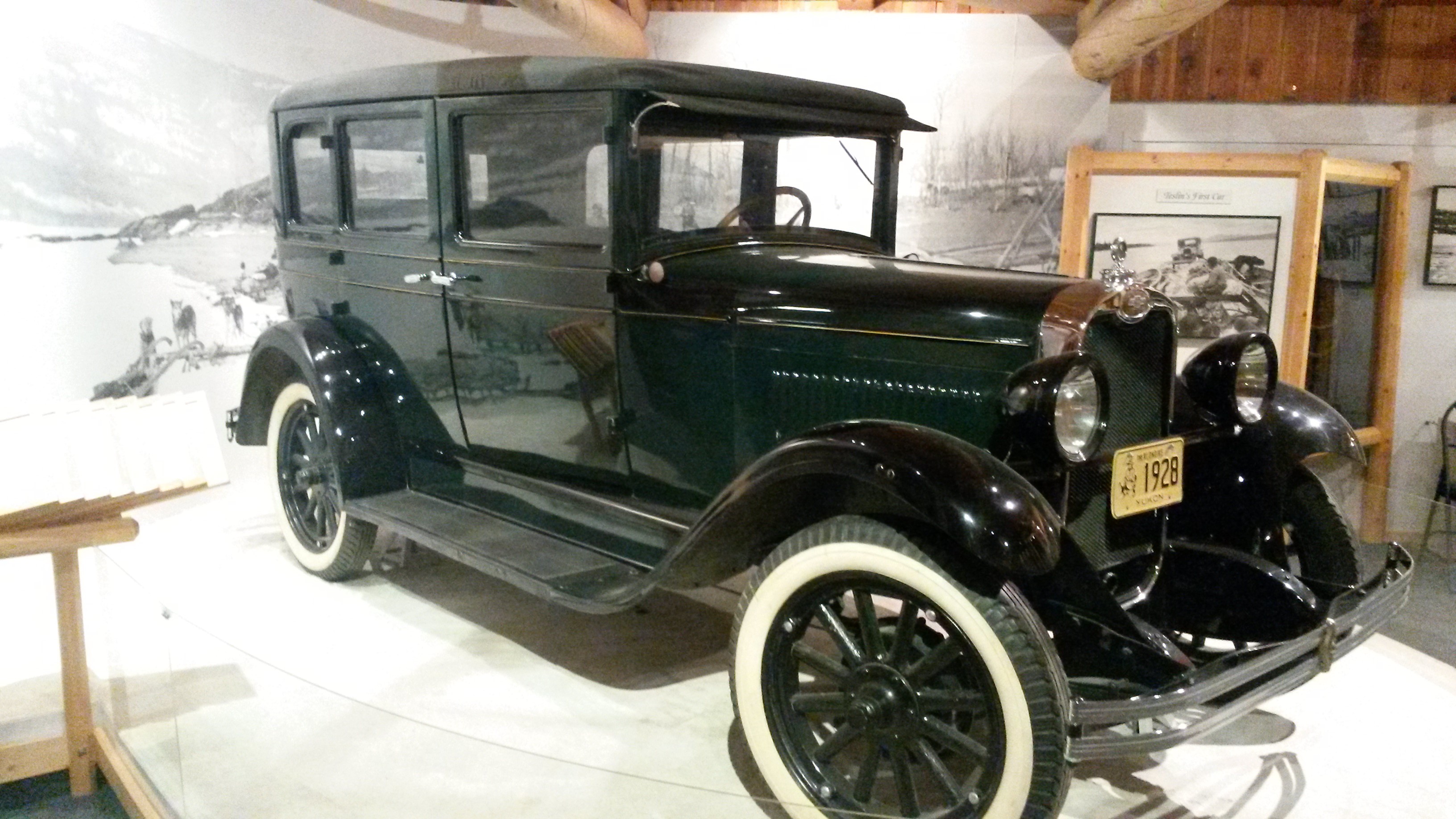
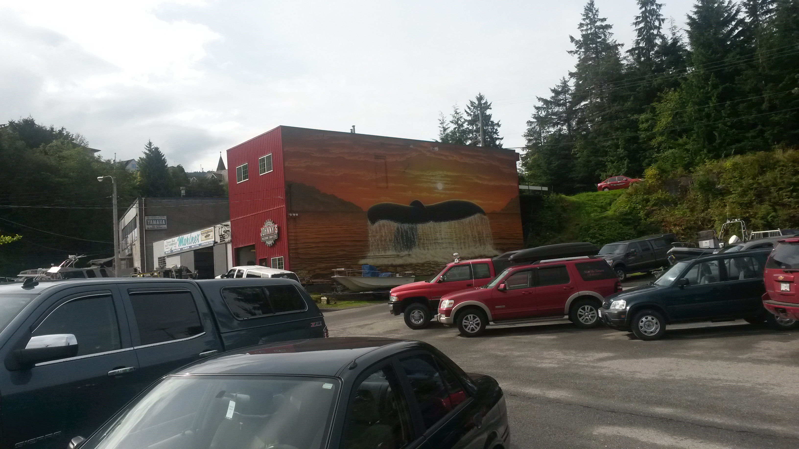
We spent a great week in Missoula that included the Labor Day weekend catching up with family. One day while exploring downtown Missoula we came across a second hand store that boasted that it had everything. After we got inside I would agree. We even found used dental picks in the place. I did pick up a fishing rod and lure for a good price.

20150904_134019

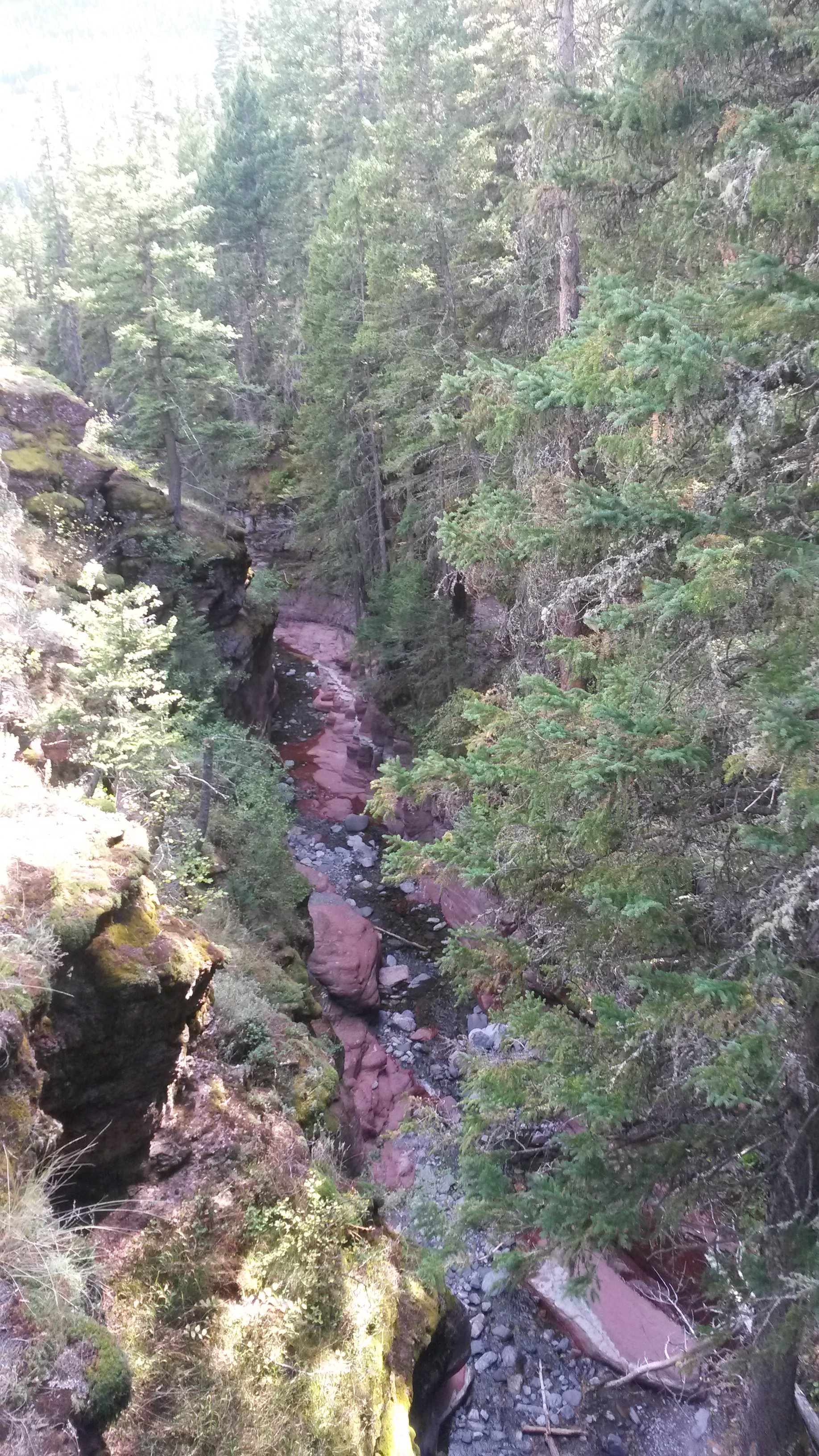
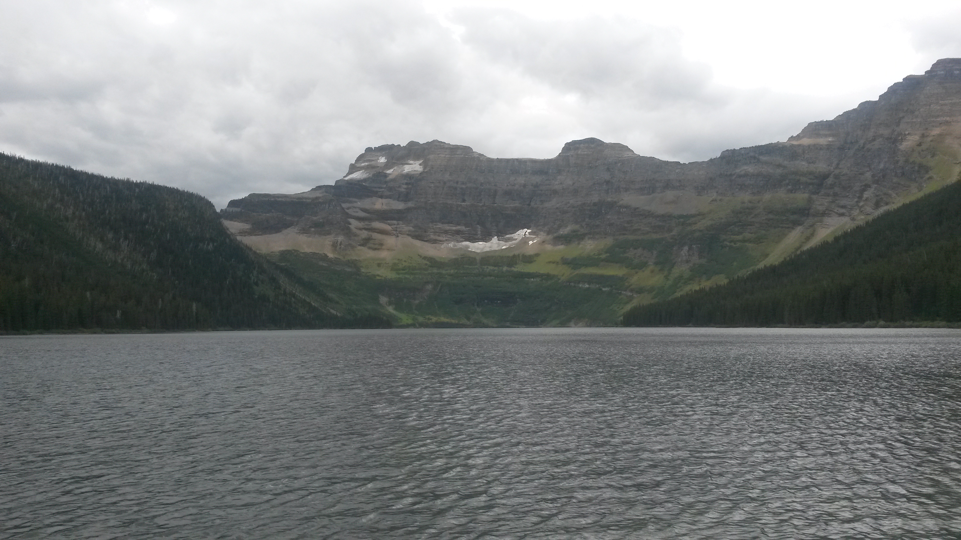
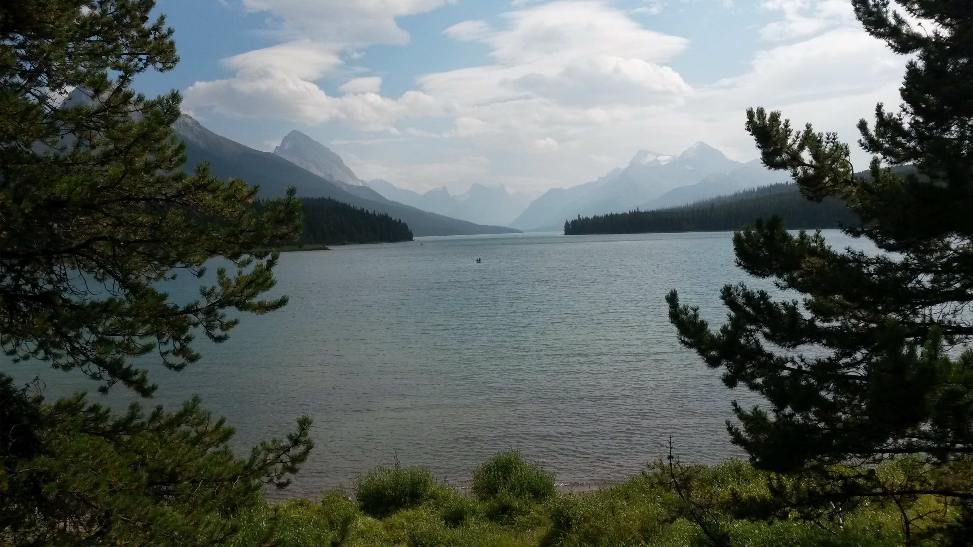
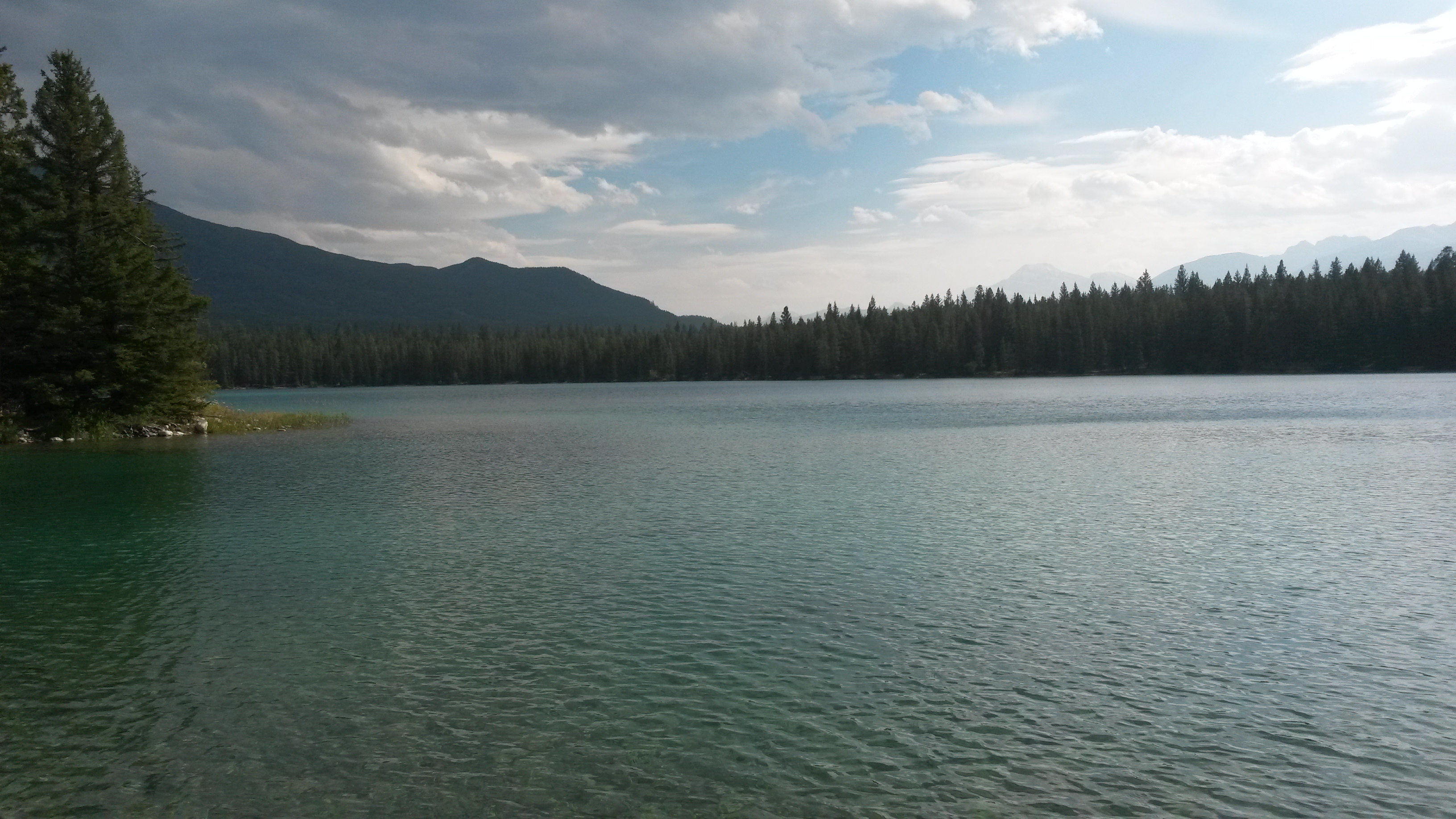
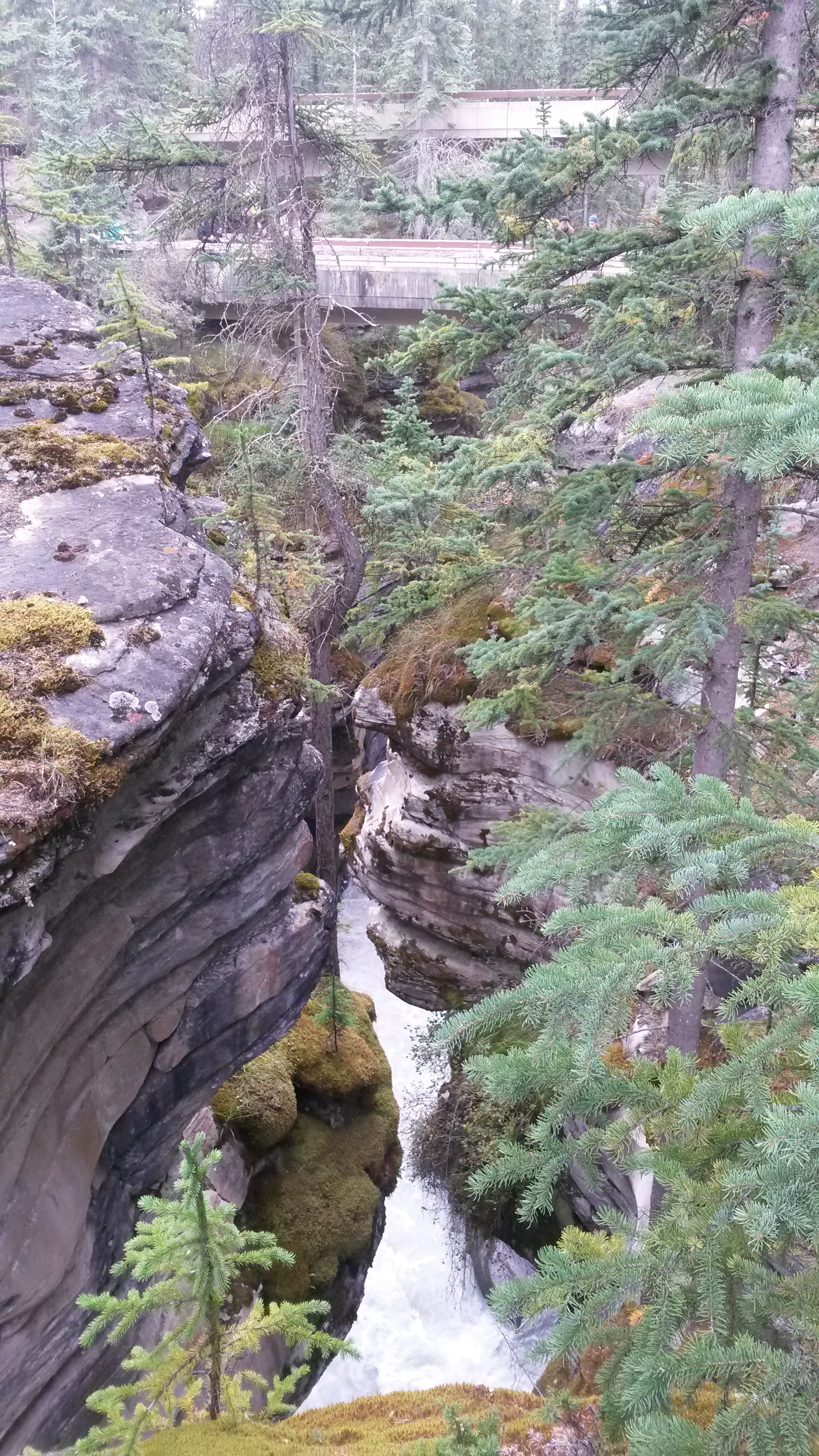
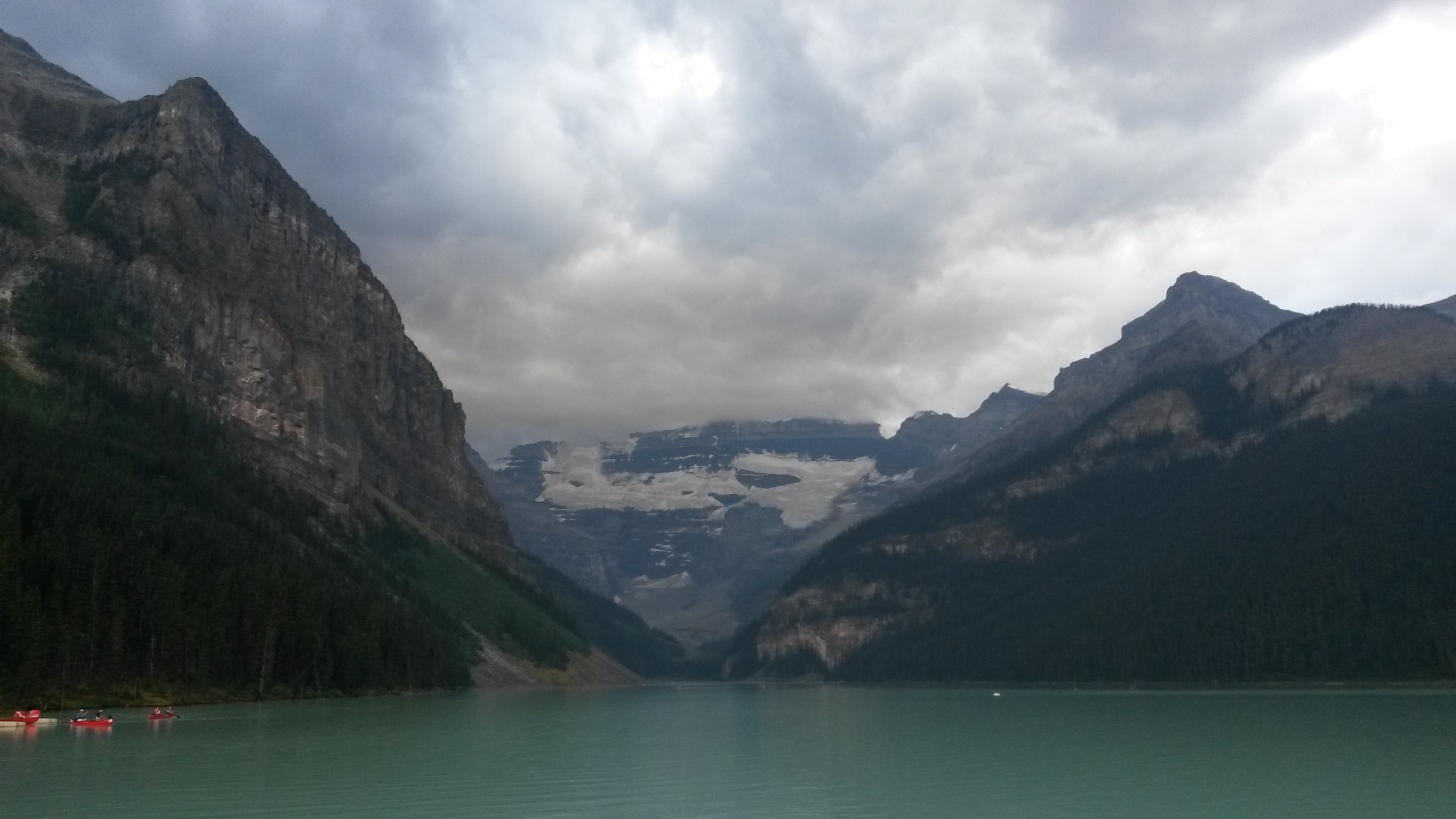
On Labor Day we hiked to a nearby falls. The beauty of the view from the top and the cascading falls almost made up for the near vertical scramble to get up there and back. The only downside of the trip was the place we intended to go afterwards to get some huckleberry shakes had closed by the time we made it down.

However, we did pick up a huckleberry pie in a small store outside Glacier on our way into Missoula. For those not familiar with huckleberries, there are related to the blueberry but much better. The pie didn’t last long, which in part drove the huckleberry craving for the shakes.

20150907_140109

20150907_140059

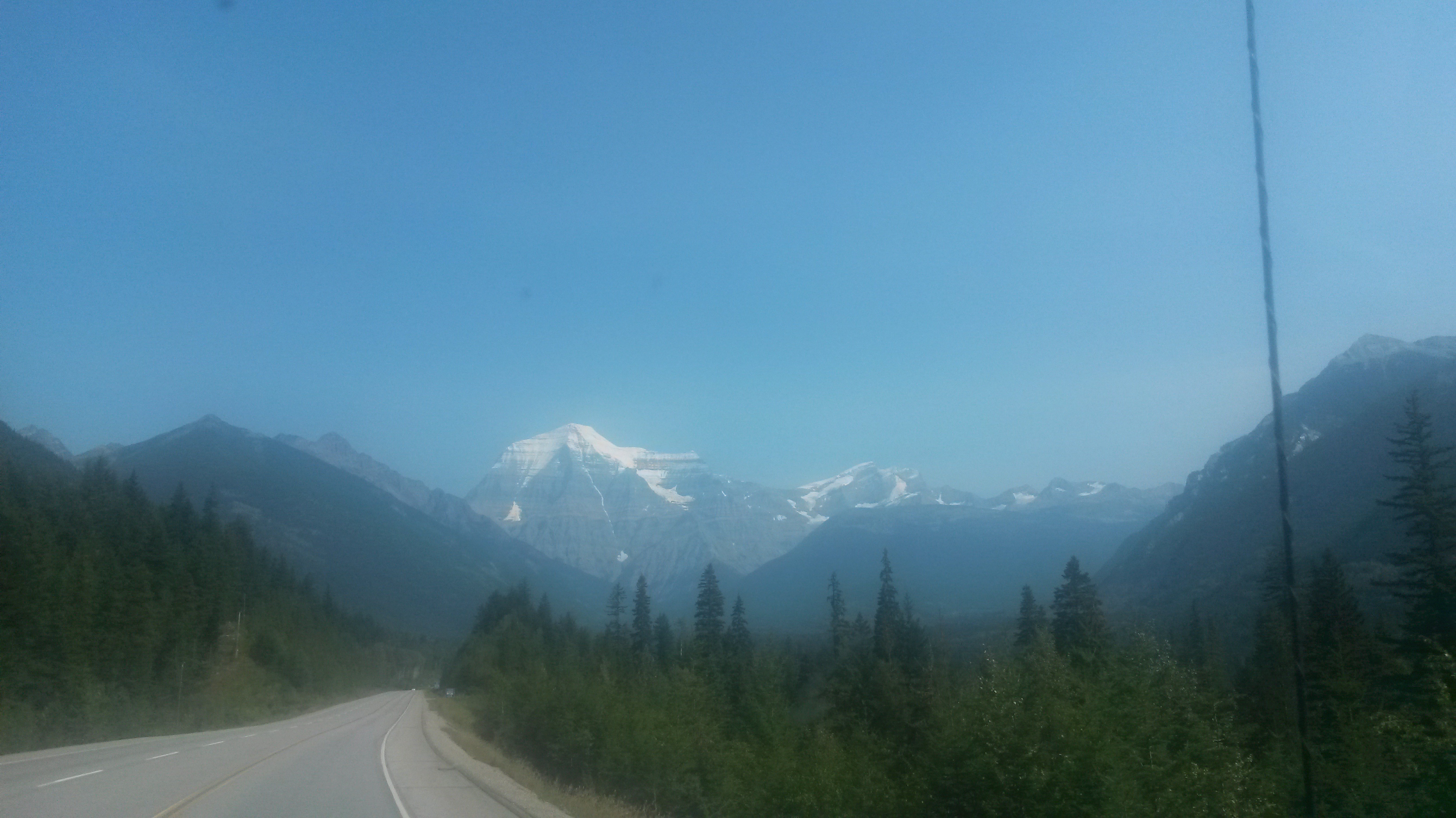
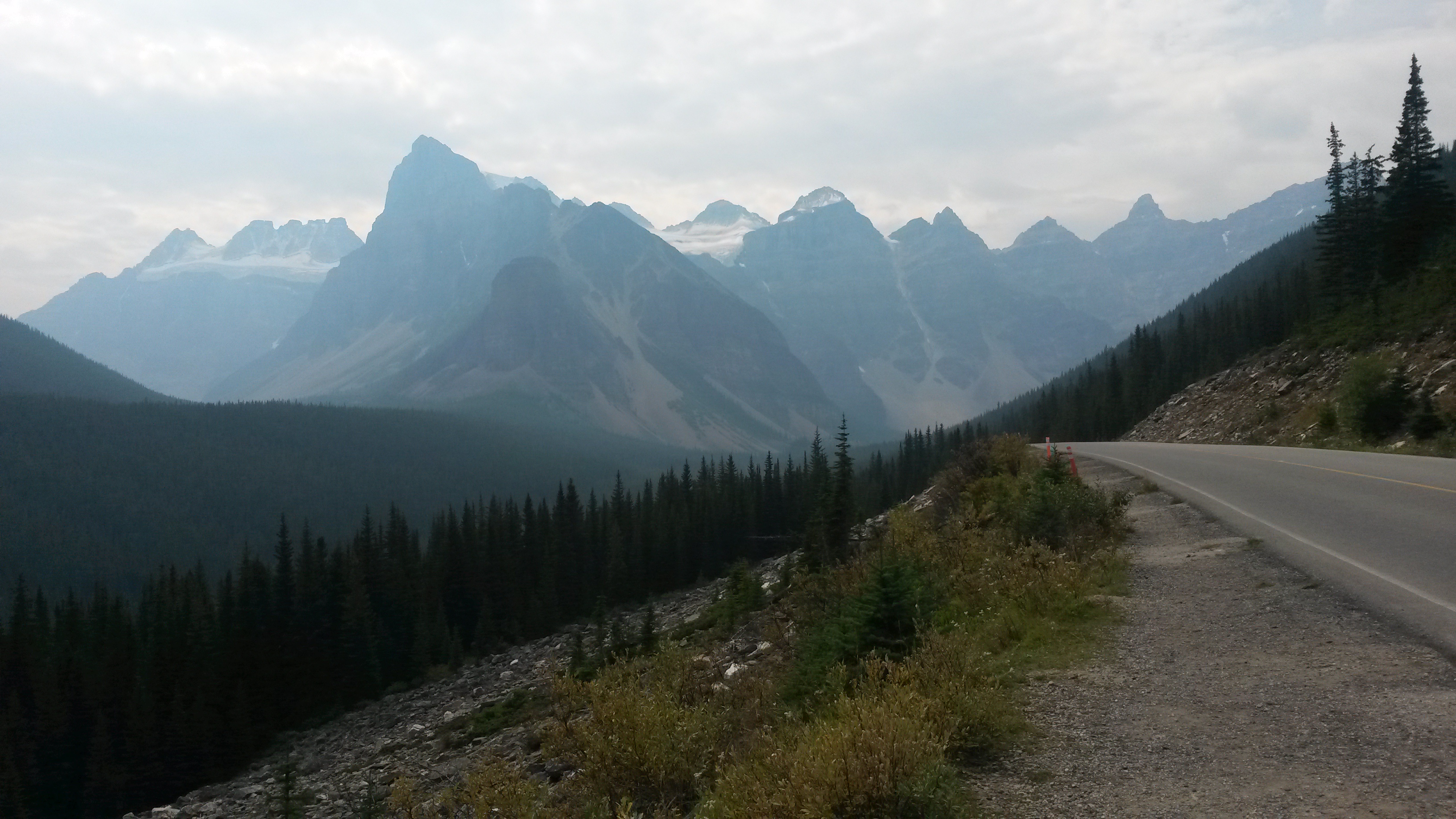
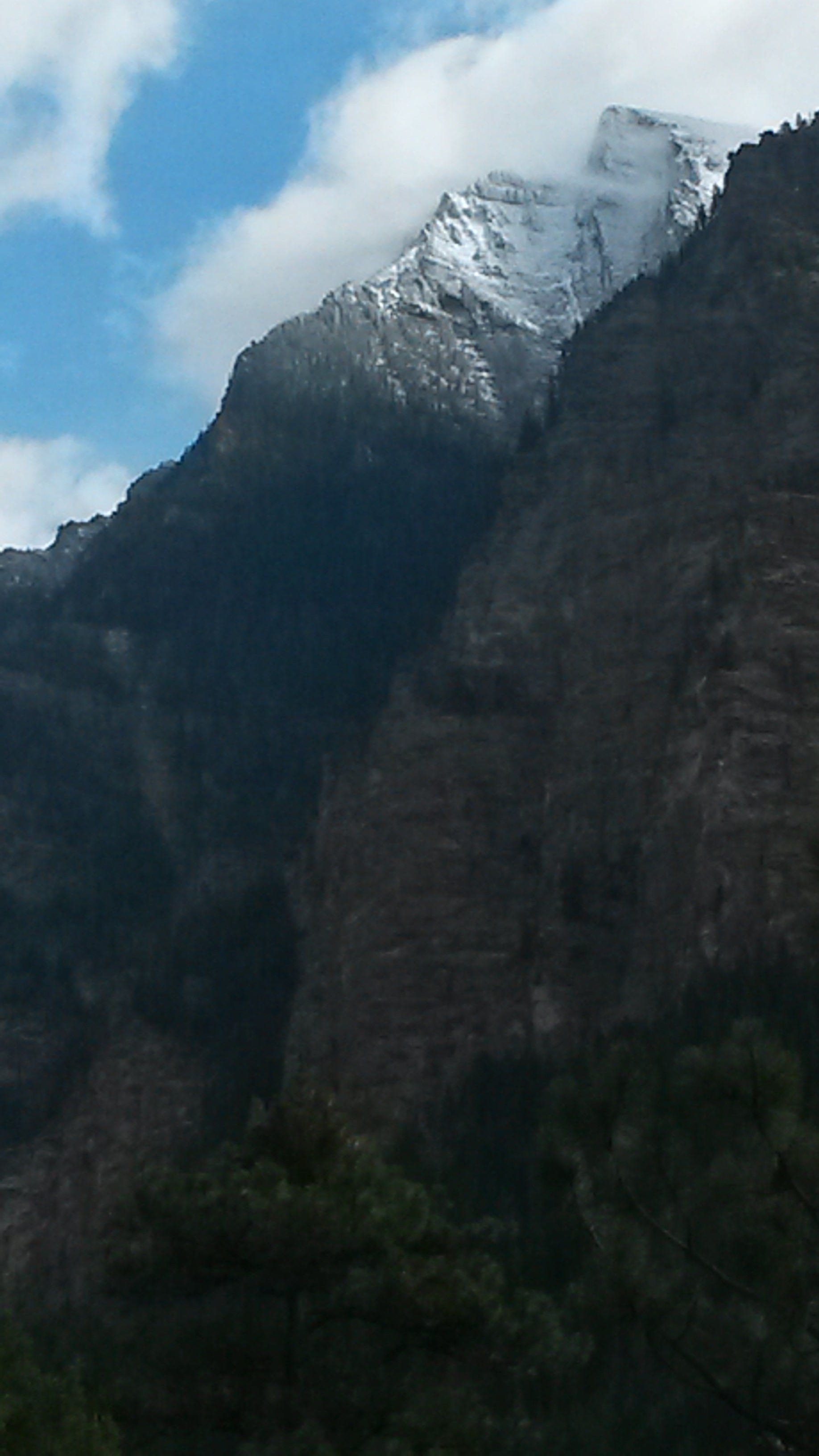
The first snow of the year on the nearby peaks occurred on the Sunday night before Labor Day. We had a good dusting of snow on the peak of the mountain near where we hiked. We didn’t go that far up, but our nephew and his buddy drove out Sunday night and hiked up one of the local peaks that did get a good accumulation to get the first ski runs down for the year.

20150907_123528

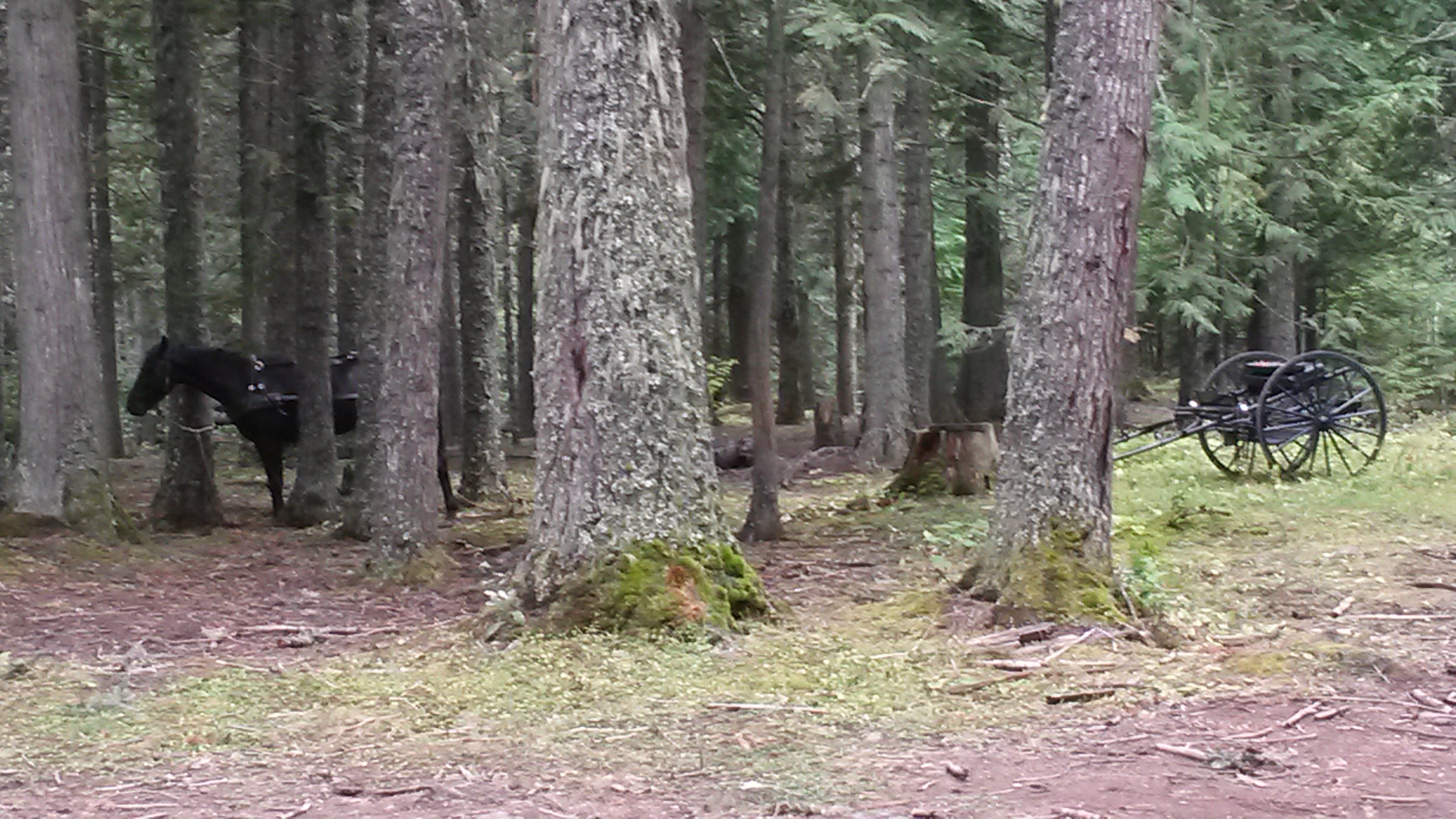
You see a wide range of vehicles at a trailhead parking lot but this was a first – a horse and buggy. The young couple caught up to us on the trail up to the waterfall and were still there enjoying the beautiful vista and afternoon when we headed back down. The dirt road to the trailhead was pretty bumpy. I wonder how smoothly a carriage rides through pot holes?

20150907_153716

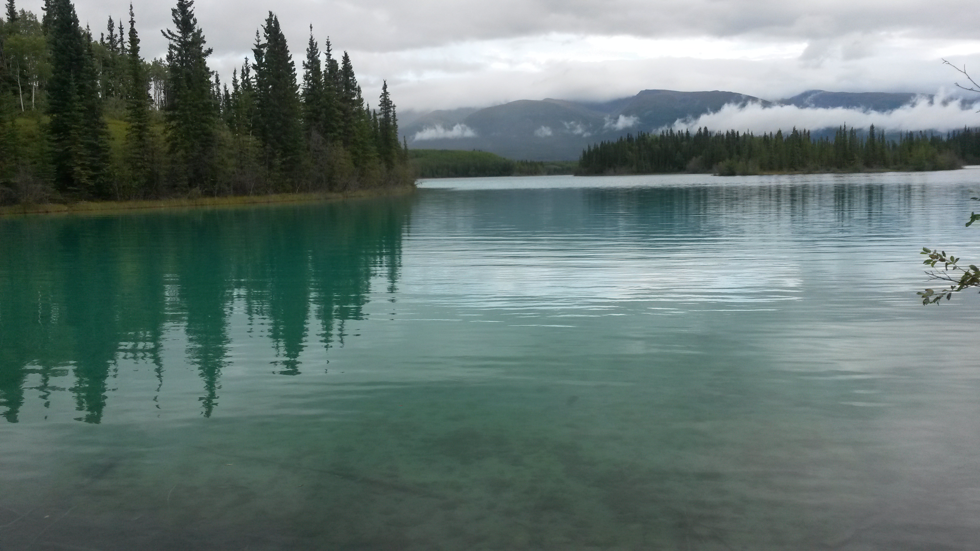
When we left Missoula, we headed south into Idaho, and camped at Craters of the Moon NP. We both like the area very much. It was the first clear skies we had since leaving home, so we reclined in our chairs and watched a million stars appear on a night with a new moon.

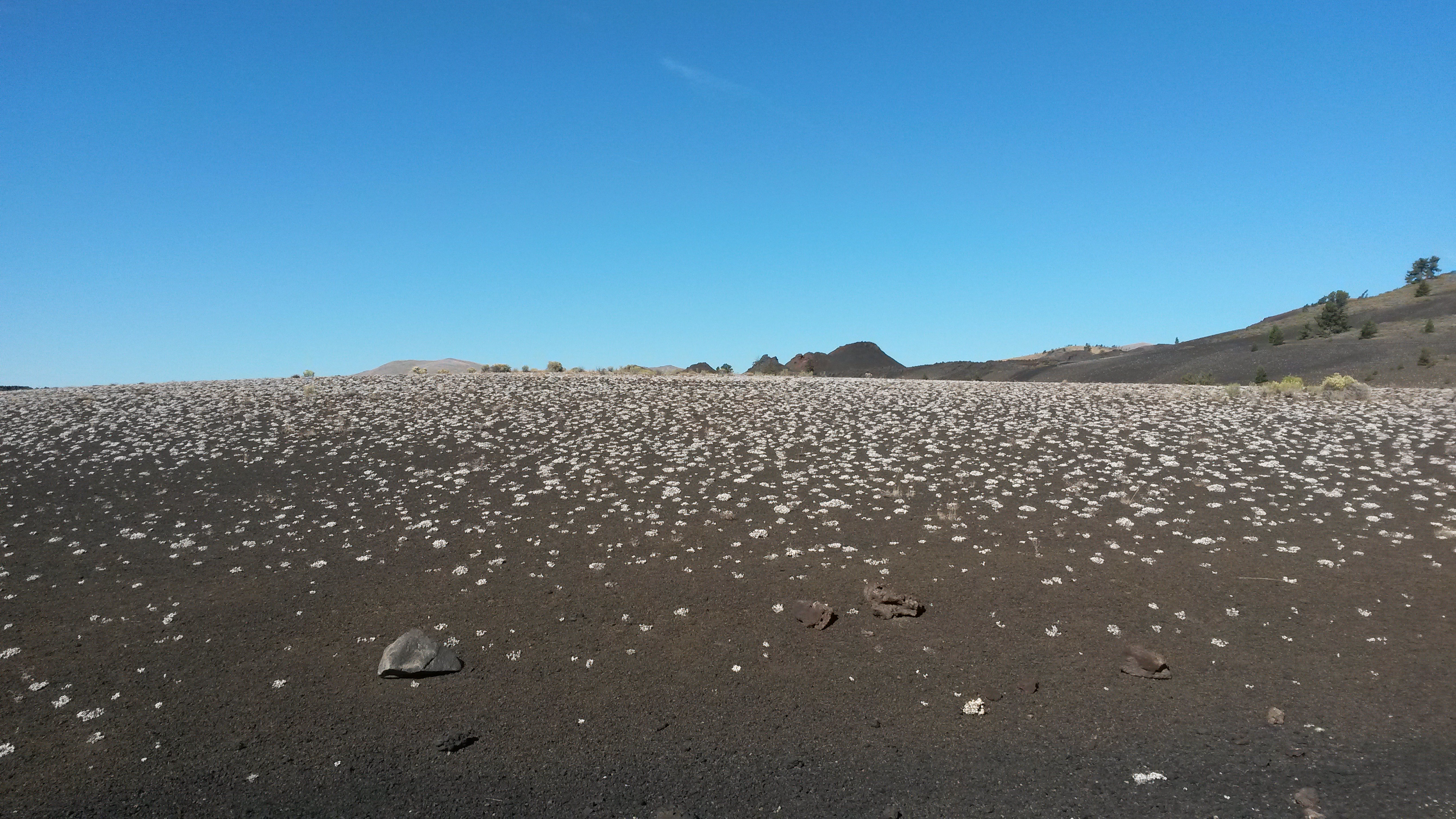
The next day we explored the areas we missed the previous visit there last year. The lava fields are impressive.

20150912_095248

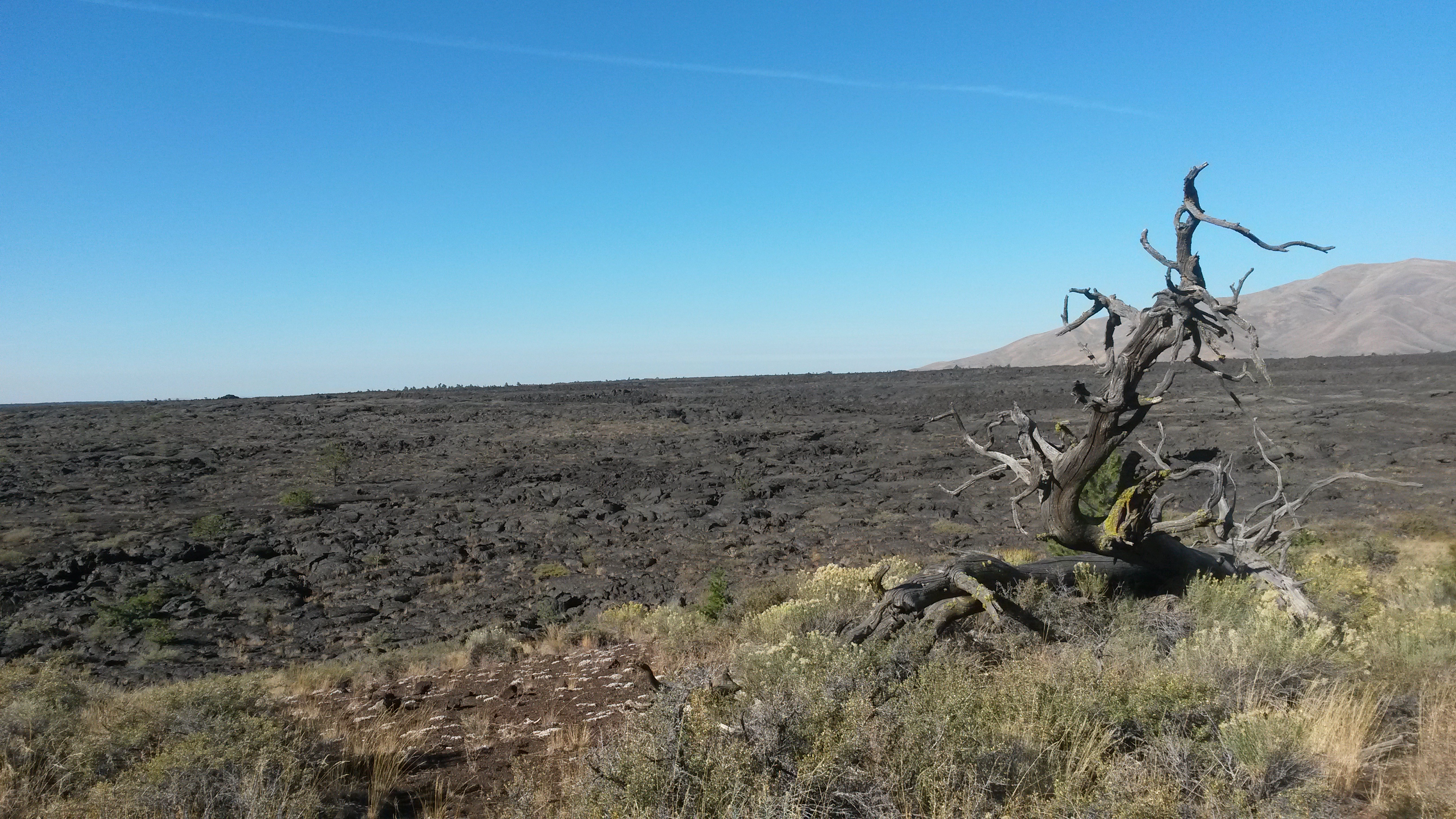
The volcanic activity that created this area was only 2,000 years ago, which is not that long ago for such a massive landscape changing event. Slowly the vegetation is making headway to break down the lava and transform it into future fields. This is some lichen that has dotted the cinder cone field.

20150912_103750

We hiked the tunnels and caves this time. Some of the lava tubes are very large, like this one.

20150912_110033

We then made our way to Salt Lake City to visit Pam’s brother and his family. His sole surviving chicken, Matilda, has the run of the yard and garden. However, I think she misses the pecking order.

20150912_184604

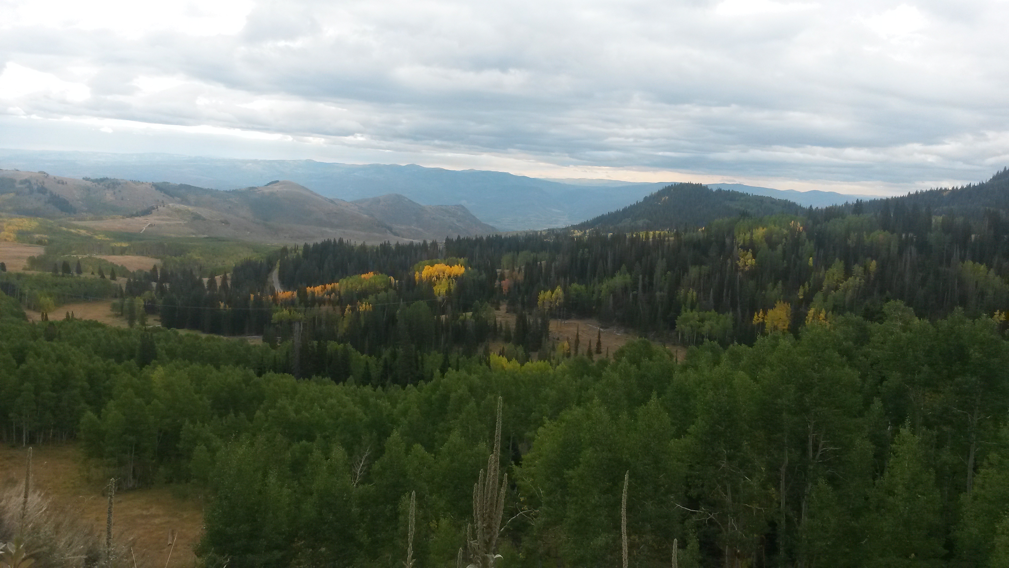
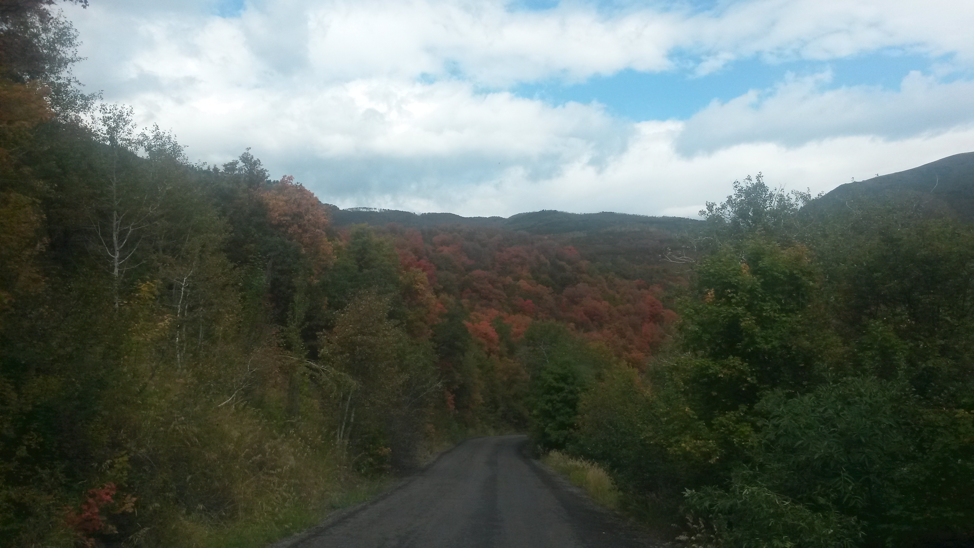
We left Salt Lake City heading east, taking a non-freeway route out of the city up Big Cottonwood Canyon and over the mountain to Heber City. Fall colors are starting to show at 7,000+ feet of altitude.

20150914_111804<20150914_113434/a>

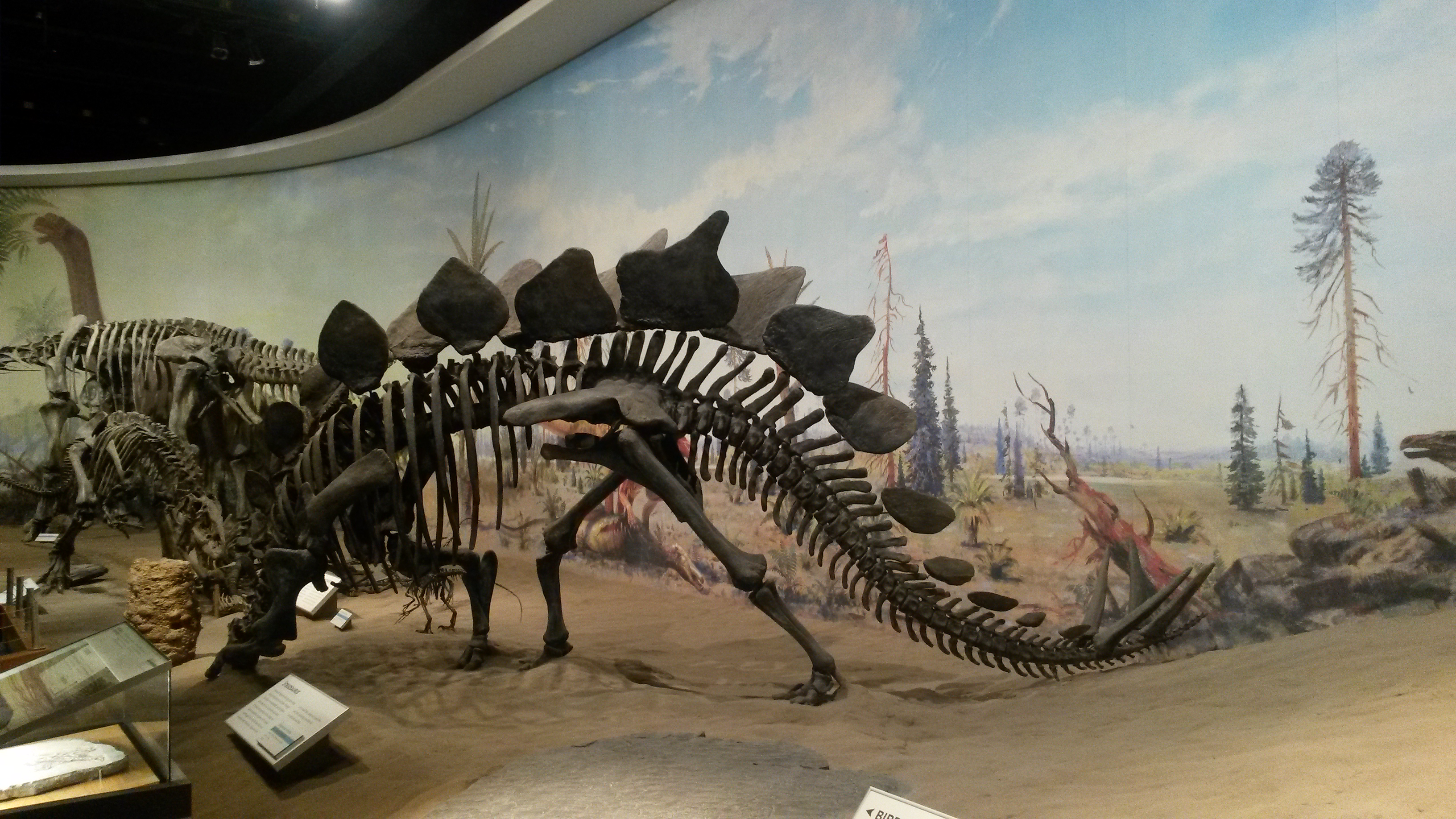
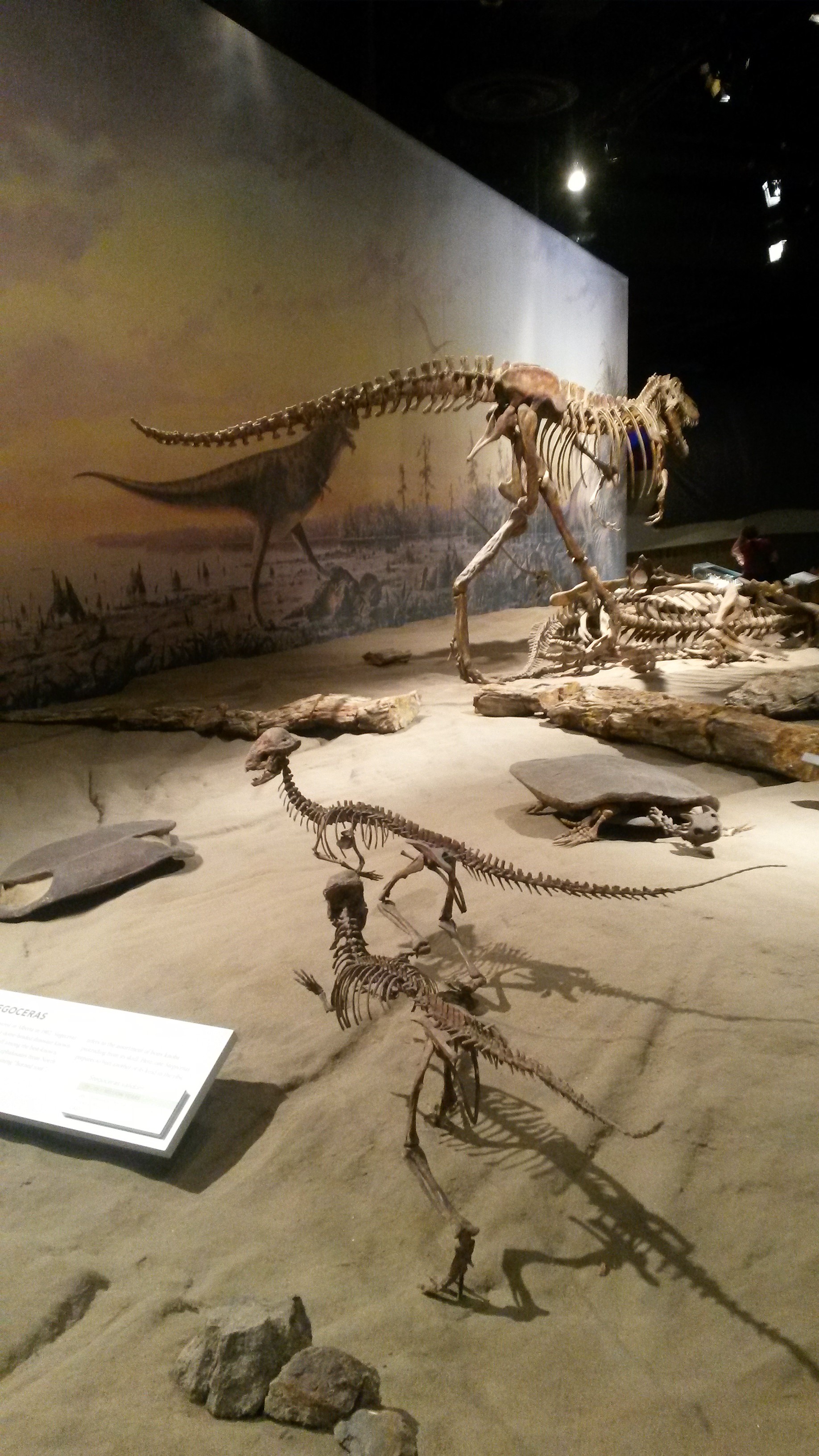
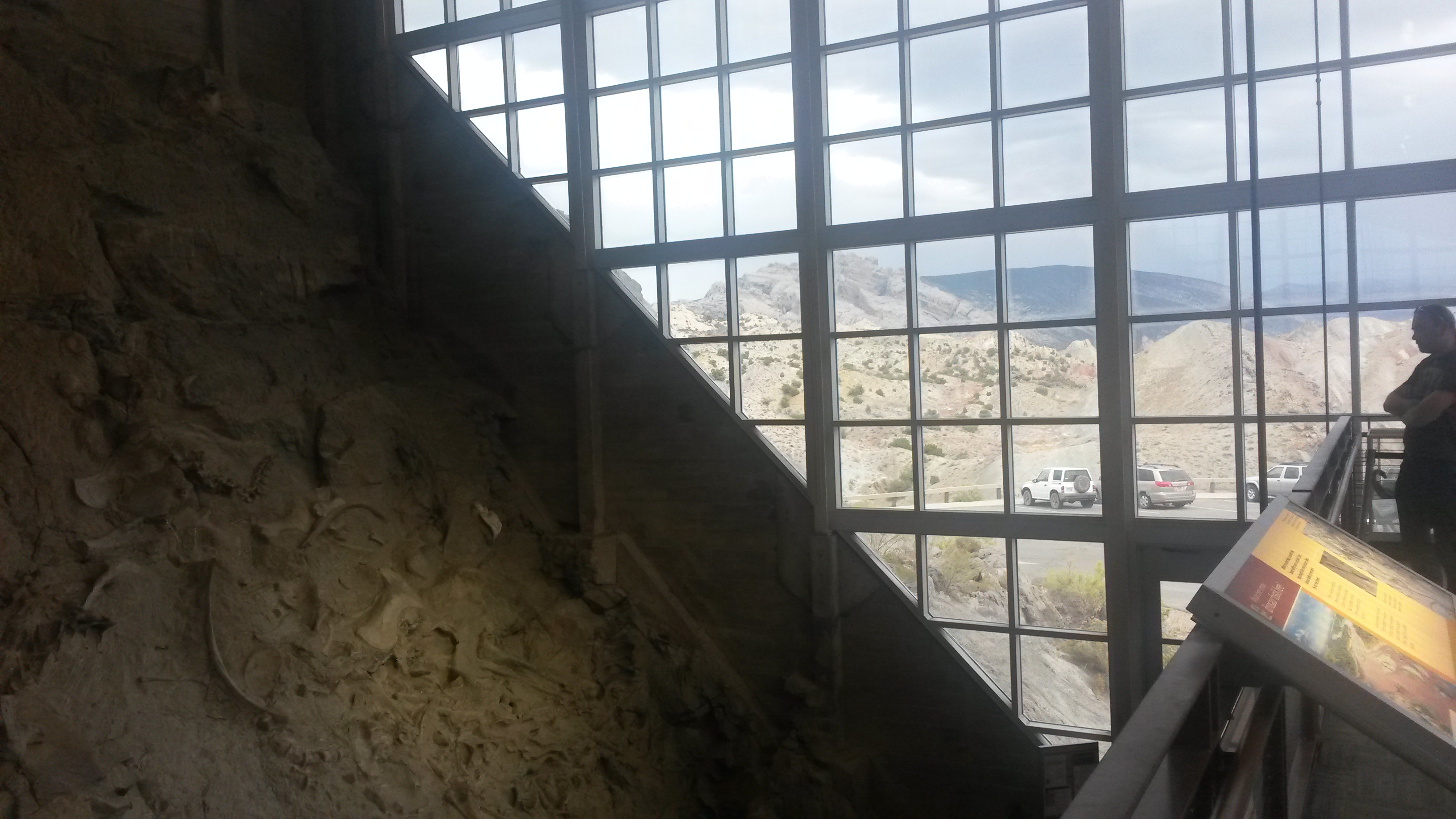
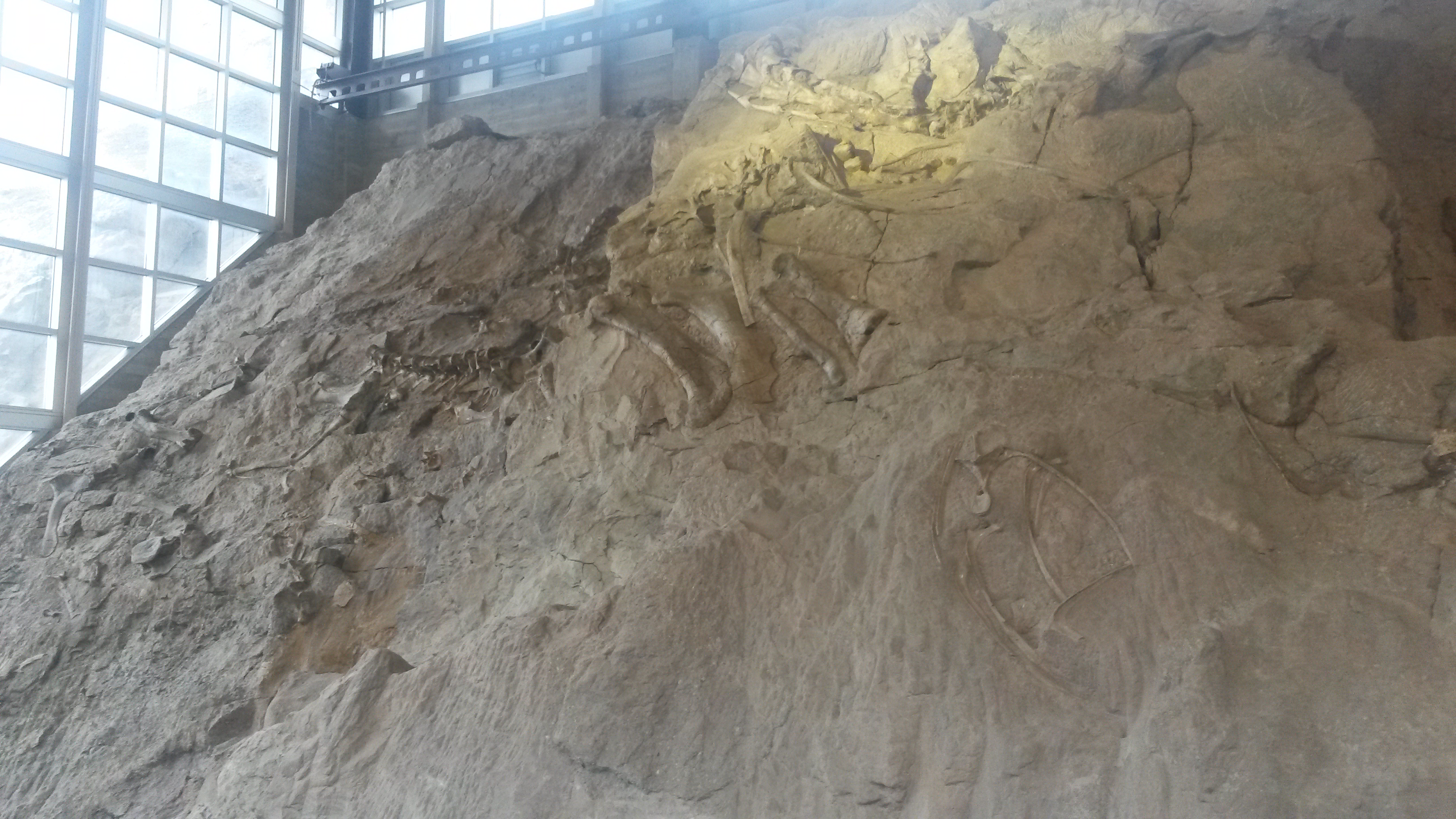
We shot across northern Utah and hit the Dinosaur National Monument. This park spans both Utah and Colorado, but the Utah side has all the bones. They dug up over 100 tons of bones and shipped them all over the world, but mostly to the Carnegie Museum in Pittsburgh. The area where they dug is now preserved with hundreds of bones still in the rock. The ranger told us that the place used to have seven paleontologists on staff when they were digging up bones, but all but one left because they kept digging up the same type of bones. The one left is nearing retirement and as the ranger put it, “there’s nothing worse than an old cranky paleontologist”.

20150914_155837

20150914_155418

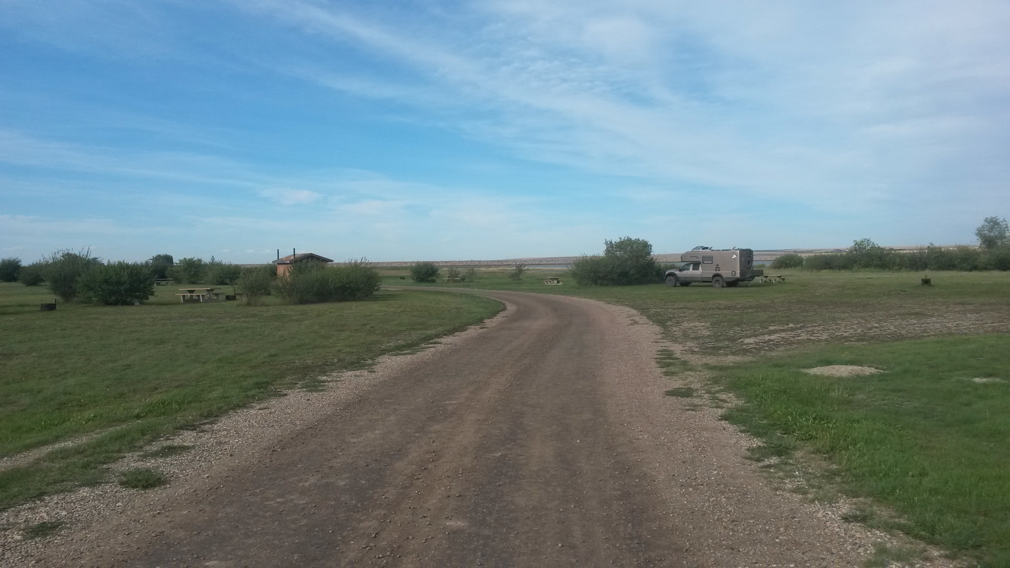
We camped at the Green River campground in the park. The other campground in the park is where the boat trips coming down the Green River end. It was beautiful there.

20150914_162420

20150914_162433

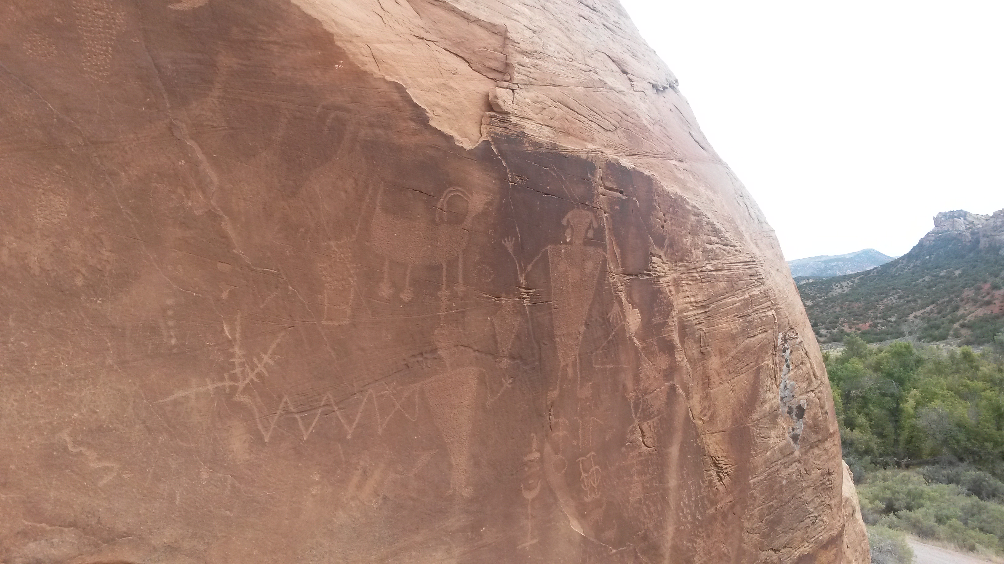
We hiked around a homestead that a single lady had for 40 years into her 90s in a beautiful box canyon, near some incredible petroglyphs.

20150915_104013

20150915_100937

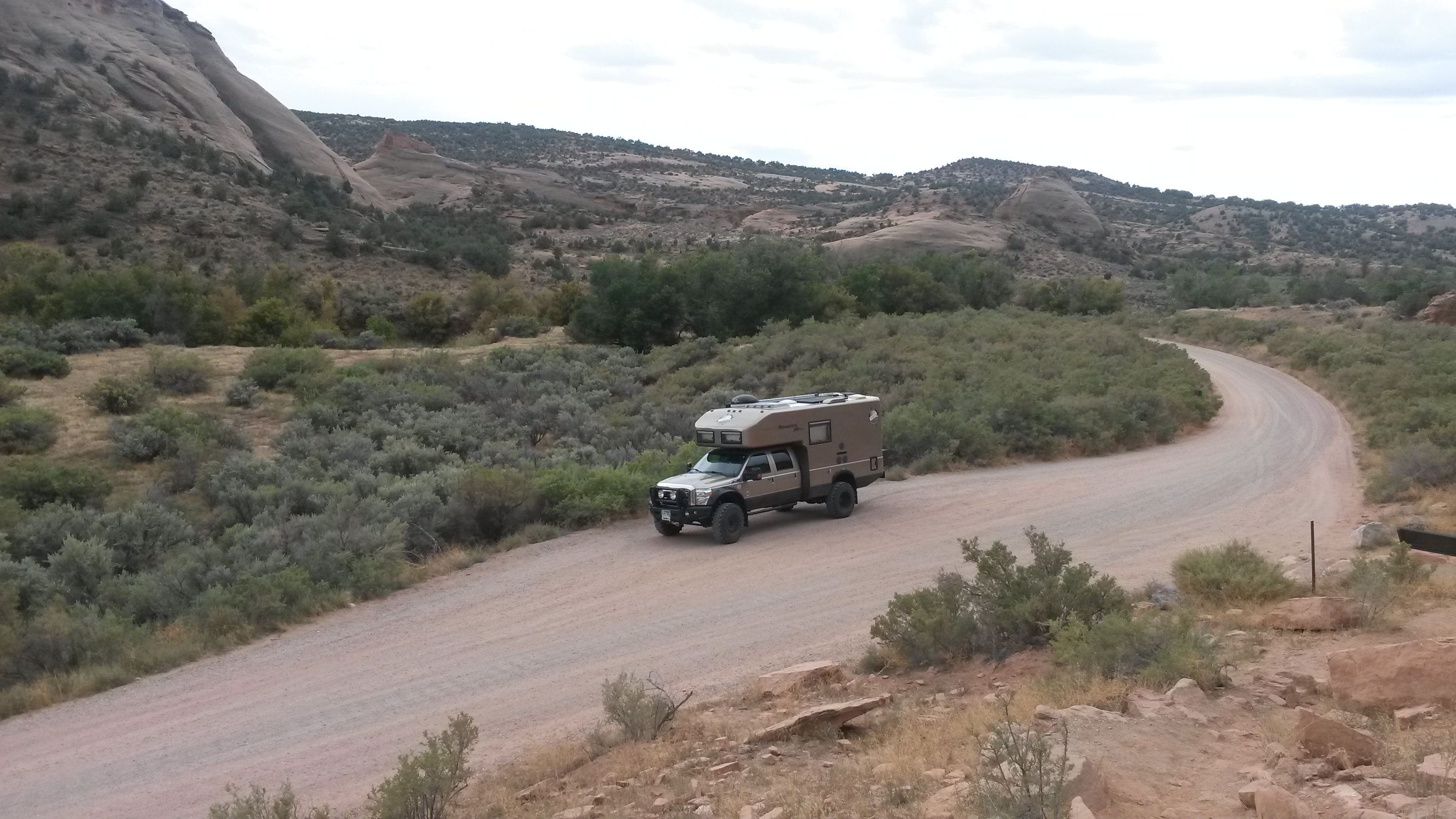
This is the type of landscape this vehicle was made for, open and off road. It was nice to be back in this type of country. It reminded us of a kid in Jasper that jammed his arm up to his elbow into a limestone hole in the rock, as he said to his Mom, “I wonder what’s in here?” Both Pam and I looked at each other and agreed it was obvious that kid has never been to the desert.

20150915_101138

We left the Utah part of the park and made our way to the Colorado side. The visitor center on the Colorado side was made of flagstone, with an interesting pattern of side and edge pieces.

20150915_115554

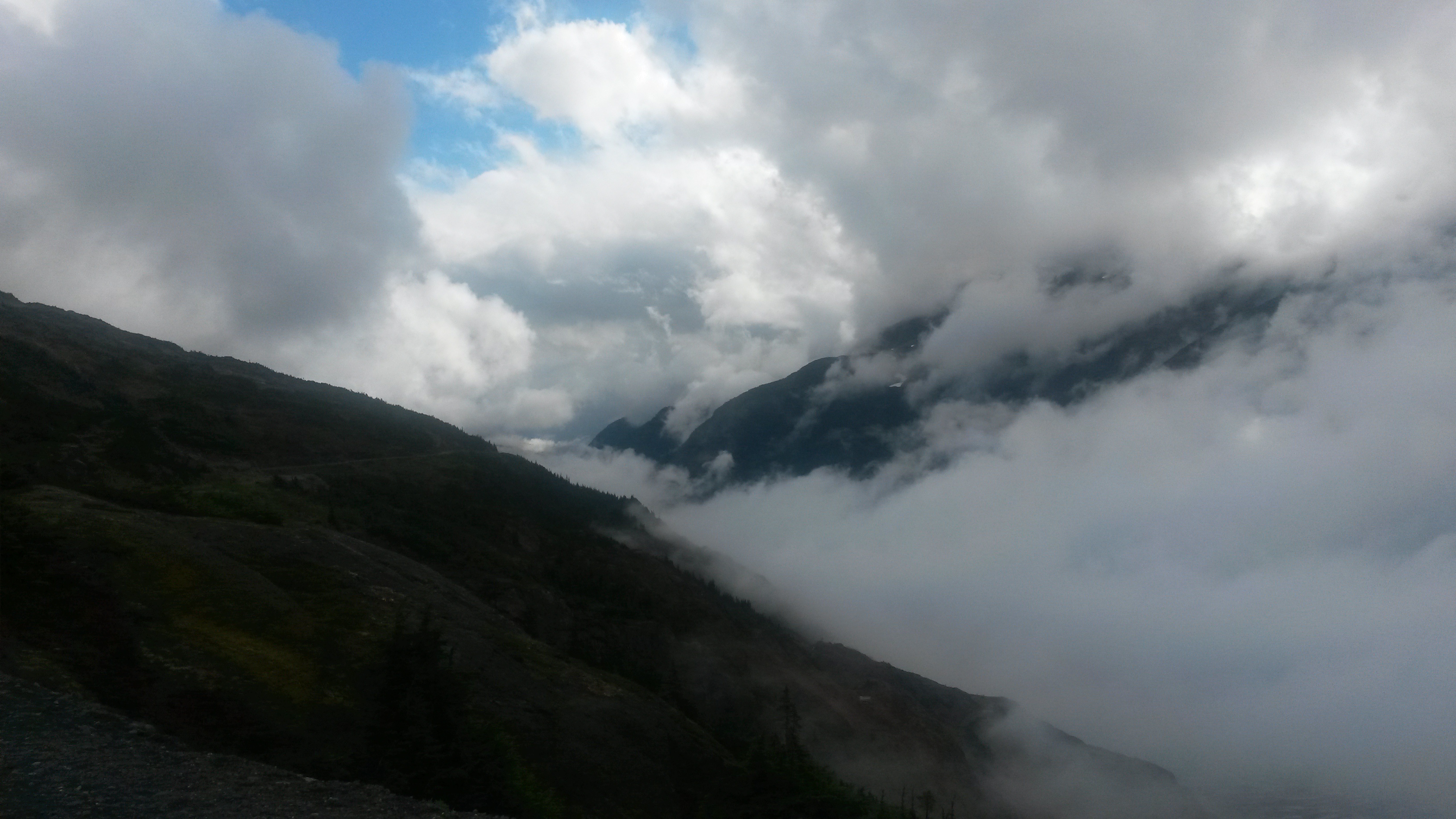
While the Utah side may have the bones, the Colorado side has the Green and Yampa Rivers confluence, and the incredible beauty of this area. A summer storm hung over us during the night and threatened all day with light rain.

20150915_121251

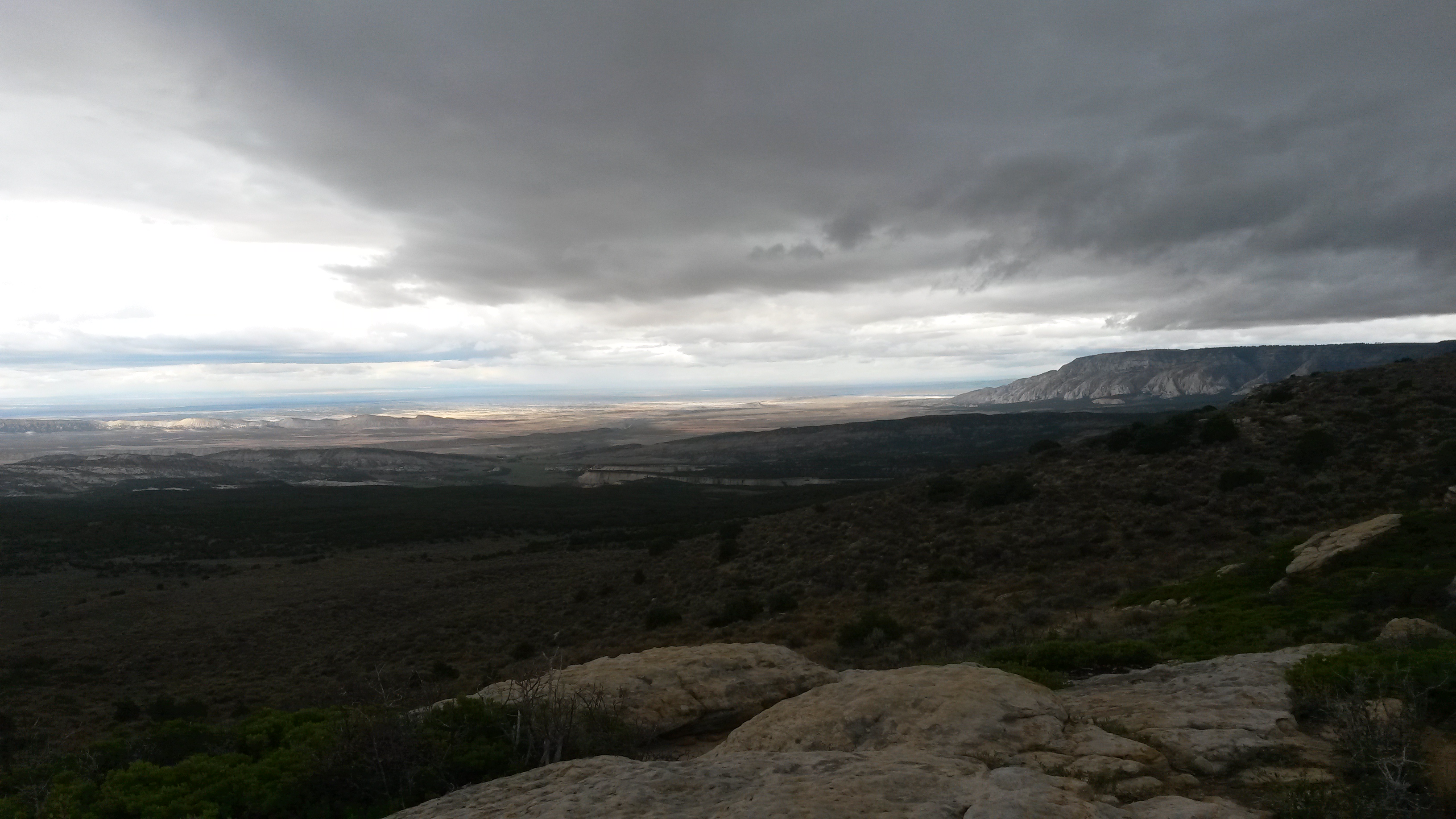
The Yampa and Green Rivers confluence was jaw-dropping beautiful. I’m sure on a sunny day the colors are just incredible in pictures, but for us it was clear to see even with the clouds. This is where the Yampa comes in from the center and the Green comes in from the left.

20150915_142220

This is where the Green goes out to the west. There are some boats of a river trip near the last bend of the river.

20150915_142307

There is a campground at the confluence and a dirt road that run out of the park to the east that we were advised not to take due to the rain. The mud in this area turns the roads into a surface as slick as ice and impassible even with four-wheel drive. A ranger we talked to after we left the park told us of a time he could not even get his dirt bike out after a rain due to the slick road. If we didn’t have an appointment in Dacono on Thursday that we had to keep we would have gone down. There are much worse places in the world to be stuck, like Philly – lol. We’ll definitely be back to travel that stretch of road and camp down at the confluence.

20150915_145632

Southern Alberta

We stopped in Calgary for the night to visit with Pete, Jude and their family. They have a great Australian Shepard, Gypsum that takes keep away to a whole new level. We chatted the hours away and got some great tips on what to see in Alberta as we made our way back to the border.

We headed east out of Calgary to Drumheller to visit the Royal Tyrrell Museum, the best place for dinosaurs in the world. While most places have one or two dinosaur skeletons, this place had hundreds and working on uncovering more in their lab. Most of the finds are from within Alberta, and in the last 30 years.

20150831_120910

20150831_121224

20150831_114100

The area around Drumheller is the Alberta Badlands, and looks very similar to the South Dakota Badlands. Near the museum we visited some hoodoos similar to the ones we have seen in southern Utah.

20150831_122627

20150831_132014

We then drove south through the Alberta farmland area, taking the back roads through the vast countryside.

20150831_133822

20150831_133827

We camped at McGregor Lake Provincial Park. Being a Monday, and the day school started for many of the kids in Alberta, we had the campground on the lake to ourselves.

20150831_152749

20150831_174641

In the heart of the Alberta wheat farms is the town of Vulcan – Live Long and Prosper.

20150901_065523

They do have a yearly trekkie gathering and many of the cast of the generations of Star Trek have been to the town’s visitor centre. We did note that for the town history log one of the most notable items for the town in 1997 was a new Zamboni – this still is Canada.

We then headed south to the Head-Smashed-In Buffalo Jump museum.

20150901_113329

For thousands of years the plains Indians would lead large herds of buffalo over the cliff to feed the tribes for the future. Besides buffalo bones, scientist found tools that date back to 3500BC and even some as far back to 9000BC is the spring nearby.

The name was given to a young brave who decided to stand below the cliff and watch the buffalo come over. I guess the first few landed safely away from him but as they piled up he was crushed against the rocks. However, I bet it was a “you’ll shoot your eye out” type warning to prevent any of the young kids from doing this exact thing.

20150901_104208

We then continued south to Waterton Lake National Park, the Canadian side of Glacier National Park. We hiked Red Rock Canyon and to a waterfall within the park.

20150901_143926

20150901_150431

We camped at Crandell Mountain campground in the park for our last night in Canada.

20150902_071450

The next day we drove to Lake Cameron, where the far side of the lake is in the US.

20150902_085226

As we drove through the town of Waterton, we saw the best vintage car-trailer combo ever.

20150902_082648

We also stopped at the Prince of Wales Hotel on Wateron Lake. Although the park was fairly empty, parking at the hotel was limited because they were shooting a Bollywood movie at the hotel. The view inside the lobby was pretty amazing.

20150902_093940

20150902_094100

We crossed over into the US after taking three weeks to get from the Yukon back down to the lower 48. We drifted into the nearest gas station with just 10% of our fuel left and then made our way to Glacier NP.

Fire restrictions at the park eliminated the planned charcoal steak option for dinner so we decided to have a nice dinner at the Lake McDonald Lodge instead. Visiting one of the well known National Parks is so much nicer once school starts. There is just a fraction of the summertime crowd so parking and showing up without reservations is even possible.

20150902_175846

We camped at Avalanche campground again (we stayed there last year as we passed through this area), which is a first-come-first served campground that fills by noon in the summer. We drove in after dinner around 8pm and more than half of the campsites were still available. I guess the fire smoke and now rain were also factors as to why more folks were not in the park.

The next day we attempted to drive to Bowman Lake along the dirt roads through the park. The road was closed about 6 miles into the 30 mile trip due to local fires and the smoke was drifting down the road towards us so we turned around. We did spot an osprey nest in an older burn section along the road, and are still wondering how it was balanced up there.

20150903_101742

We drove into Missoula to visit Pam’s sister’s family. We’ll stock up, clean up and hang there for the Labor Day weekend before heading off again further south.

Jasper – Banff

We left Prince George and headed towards Jasper. While the sky was slightly hazy from the forest fires over 500 miles away, the majestic beauty of the Canadian Rockies was clear. Mount Robson, on the BC – Alberta border is an impressive chuck of rock that is the gateway to the Parks along the range.

20150826_110519

By the time we got to Jasper, the smoke was thicker and very noticeable, capping the taller mountains from view. Since the smoke was coming from the southwest direction, we headed northeast to the upper corner of Jasper park.

20150826_123141

We camped at the Pocohontas campsite, which was just down the road from the Miette Hotsprings. We started our day relaxing in the hot springs before heading out to explore. We saw a rather plump black bear on the road up to the springs. That bear was definitely going to sleep a long time this winter.

20150827_090355

As we dropped south towards Jasper again, the smoke was not as heavy as the previous day, but still evident. Jasper Lake was along the way and is a very shallow lake. Folks were out there quite a ways and only to their knees in water.

20150827_095953

We were lucky enough to catch these guys right by the side of the road. The last one decided to give Pam and the Roamer a stare-down for her last shot.

20150827_101529

We hiked Maligne Canyon, where the water has cut a very interesting path through the limestone.

20150827_111041

Maligne Lake looked like a postcard with the trees and mountains. It rained off and on during the day, which helped to clear the smoke out of the air.

20150827_121952

This was a picture of Annette Lake, just outside Jasper, which we visited on my Mom’s birthday.

20150827_134701

We camped at Whistler campground, just outside Jasper, and began our falls exploration the next day. The first falls we visited was the Athabasca Falls. It too cut a beautiful path through some limestone down to a lower river segment.

20150828_095025

20150828_095155

The next set of falls were the upper and lower Sunwapta Falls. They were separated by a nice hike through the forest.

20150828_104245

20150828_104551

As we continued south we hit the Columbia Icefield, which is the dividing line between the Jasper and Banff Parks. The weather had moved in about this time and most of the icefield was hidden in the clouds. The big attraction there was to ride a bus up onto the glacier and walk around. While the visitor center was a very nice building, it was packed with way more people than we had seen in some time. We grabbed some information on Banff, snapped a couple pictures and got out of there.

20150828_123209

We camped in the Waterfowl campground in the Banff Park. While we had not needed to use our insect room for the entire Alaska and Yukon segments of the trip, we set it up here as the perfect drizzle canopy to enjoy our evening fire in the light rain.

20150828_151342

The panoramic views during our drive were just amazing. We had some vistas that were during the rain and later on during periods of sun as we made our way through the park.

20150829_083102

20150829_084823

We attempted to go to Moraine Lake during lunchtime on a Saturday. We never made it due to the number of people and the lack of parking near the lake. We were turned around by the traffic control guys and pulled off the side of the road to have lunch just down the road from the lake. There were signs that said it would be difficult to find a place to park between 10am and 4pm at either Moraine Lake or Lake Louise so we instead found a campsite at Castle Mountain campground, had an early dinner and then headed back to the lakes at 6pm.

20150829_103713(0)

Parking was available in the evening and Moraine Lake was beautiful. We heard a Pika (sounds like a squeak toy and is related to the rabbit family) in the rocks but couldn’t see it. As we were hiking out, it popped out of the rocks about a foot away from us with some flowers in its mouth for its den. It scampered through the rocks into its den and then popped out again to follow us down the rocks. I tried to get a picture of it, but he was too quick and all I got was his blur dashing across the rocks.

20150829_170345

20150829_170844

After Moraine Lake, we visited Lake Louise as the sun was setting and the weather rolled back in. It was beautiful but it does attract many people. The hotel there will have to be a future trip sometime (until we see the rate to stay there – lol).

20150829_174435

We attempted to visit the town of Banff, but that was a joke. The small town was packed and attempting to find a legal place to park the Roamer anywhere close to town was impossible. We then pointed south and left the park, stopping instead in Canmore.

20150830_120815

We found out later that Canmore was a sleepy little mining town until the 1988 Calgary Olympics. Many of the skiing and Nordic events were run out of Canmore. The place boomed but was way more accessible compared to Banff. We stopped and visited the Grizzly Paw Brewing Company for an awesome lunch and a flight of their really good beers.

20150830_111933

That wrapped up the Jasper – Banff adventure. There were many more hikes and things to see further off the main route, so we’ll be back.

Northern BC

We were in a connectivity dead zone since leaving Anchorage a few weeks ago. We don’t have a Canadian data plan for our phones, and it really wouldn’t have mattered because there was no signal throughout most of our route through the Yukon, NWT and northern BC. We’ve been stopping into diners (eating poutine) and staying at campgrounds with free WiFi every once in a while to catch up on some emails, but most of those networks were so weak on data rates that uploading a blog was not possible.

Heck, most of the towns we’ve passed through until central BC have their own electrical generators because there is no electricity coming in from a large nearby power plant. A huge powerline system is now being erected up into northern BC to power some mining operations, which will now provide power to many of these smaller towns along the way too – progress.

In one of the diners along the way that had a TV, we saw that the northwest forests are burning, which is a shame since there is so much water up here in the rivers, lakes and even in the recent weather. Clouds bunch up and it rains, and then the clouds break apart for a nice partially blue sky day. This cycle repeats itself every few hours so every day will be both sunny and rainy. The benefit of this pattern is that rainbows will appear during the transition.

20150819_165359

The Yukon Territory, which is larger than California, has a population of less than 40,000 people. Can you imagine California with only 40,000 people? The NWT, which is about one and a half the size of Texas has a population just over 40,000. Therefore, there is a lot of open country up here.
In fact, the maps we have don’t even have a dedicated page for each of the roads in the Yukon, NWT or the top half of Alberta or BC because there are so few roads one page easily covers them all. One guy we were talking to summed up how remote you are here – if you have an accident up here, they will just put yellow tape around your car on the road and it maybe days or even weeks before one of the few tow trucks is available to move it. However, it’s such a beautiful place and full of frontier type opportunities that it makes me wonder how bad can the winters really be?

Southern Yukon has a large Tlingit native population, the same native clans that inhabit Sitka and Juneau. These clans traveled inland to hunt and trap, providing many of the furs for the early Russian and American traders. We visited a couple of their museums in the area.

20150820_085543

One Tlingit native named George Johnston was a really interesting guy, and something of a visionary. He bought the first camera and the first car in the area back in the 1920s with his fur trading profits. He learned to develop his own pictures and they recorded the daily life of the proud clans prior to all of the transitions that the Alaskan Highway construction and missionaries brought to their way of live in the 1940s. There were no roads in his village when he bought the car. He and a few buds cut a path of 3 miles through the forest to create a road, but mostly he used the car in the winter to drive and hunt across the huge frozen lakes in the area. The section of road they did cut became part of the Alaskan Highway when it rolled through this area.

20150820_090806

We left the Yukon, dropped into British Columbia and headed down the Cassiar Highway on the western side of BC. The Yukon provincial campsites we stayed at were very nice. They all cost $12 and even provide free fire wood.

Once in BC we stopped for the night at Boya Lake, a BC Provincial campground. The BC campgrounds cost $18 a night, no fire wood, but they do have a host that will visit and chat. The lake was a glacier run-off created lake where the bottom is the settled white glacier granite powder. The water was extremely clear, possibly because the powder prevents vegetation growth in the lake. The lake appears as about every shade of blue depending upon the depth and the amount of sunlight due to the reflective white bottom. We camped next to a couple from Vancouver that have been coming to the lake for the past 24 years to paddle this lake and portage into the nearby lakes in their two person kayak. Pam and I need kayaks, or a boat. I think I discussed this last year when we hit Minnesota. Mounting it or them to the Roamer will be the trick.

20150820_164329

Heading further south we ran into several stores along the highway that you have to stop and visit because they are the only thing along the road for many, many miles. One had everything from $1 tourist magnets to $20,000 diamond earrings. His rationale was that folks stop in there driving $500,000+ RVs and obviously have some disposable income, so you never know. Another store was in jade country and had some amazing pieces of boulder-size raw and finished jade rock.

20150821_103552

The road through this section of BC is beautiful. The place is thick with forest and bears. We saw several black bears like this just sitting along the side of the road, eating berries and grass.

20150822_092210

We camped at another BC park named Kinaskan Lake, another beautiful lake and another reason to have kayaks. Since we don’t have kayaks, we watched the lake traffic from the shore in our Bass Pro Shop zero-gravity lounge chairs (a must for any long trip or serious lounging). The traffic included a couple of float planes doing take-offs and landings, several kayakers, a few fishermen in their blown-up rowing boats (do fishermen ever snag their inflatable boats with their hooks?), four huge rolls of hay being barged across the lake by a couple and a dog using a 10 hp outboard motor on a very small aluminum boat (not moving very fast), and also a new bird – the surf scooter or skunk head duck, given the name due to its white streak on the back of its black head – lifer.

20150821_155728

We then departed the Cassiar Highway for a coastal side adventure to Stewart, BC and Hyder, AK. Hyder is known as the place to see bears stream-feeding on the spawning salmon, and it is only accessible by a road through Stewart. It’s interesting that the land-locked Hyder does not have a border crossing station coming into the US from Stewart, but the Canadians have a station when you re-enter Canada from Hyder. This is the Canadian station on the bend as you leave Hyder.

20150822_174217

The Canadian border guard caught us off guard when she asked, “what do you have in the back?” I felt like saying the same stuff we had a couple of hours ago when we crossed over, but realized that may not lead to a good afternoon.

While they tell you about the bears and the spawning salmon in Hyder, what they don’t tell you about is the smell of the dead salmon. The stream was filled with nearly a hundred 3-foot long chum salmon spawning in pairs, but there was an equal number of partially eaten or spawned and died salmon along the banks of the river, offering some easy food for the seagulls.

20150822_170058

There is a dirt road out of Hyder that actually runs back into BC (no border guards in either direction for this crossing) up through the mountains to the Salmon Glacier.

20150822_153306

It began to rain as we drove up the mountain. We sat at the glacier viewpoint in the clouds for about an hour having lunch, and we were just about to leave when the clouds parted in the valley below.

20150822_153614

Just the end of the Salmon Glacier was visible. The rest of the glacier and the ice field above were still blanketed with clouds.

20150822_151557

One person at the top suggested we continue on over the hill and into the next valley with our rig. It looked very tempting, but we’ll save that for the next trip.

20150822_153824

We drove back down to Hyder where the bear viewing area was located. There is a boardwalk viewing deck along the river to see the bears, which eat in the morning and evening. We talked to a couple that had been there the last couple of days and found out we would be waiting a few hours for any sighting. Given the screeching seagulls and the dead fish smell that engulfed the area we decided that maybe we’ll see the bears eat salmon next time.

20150822_172430

20150822_172305

We camped in Stewart for the night and headed back to the Cassiar Highway in the morning. We hit the end of the Cassiar Highway at the junction of the Yellowhead Highway, which runs from Prince Rupert on the coast to Edmonton, Alberta. We turned towards Prince Rupert and headed for the coast once again.
The road into Prince Rupert has some spectacular sections like this tight canyon next to the river. As we approached the coast the clouds rolled in and we were reminded once again that it is a coastal rain forest.

20150823_092106

Prince Rupert was a neat little town. Since it has a cruise ship dock it does cater to the tourist crowds. Similar to Seward, many of the buildings had murals. Notice the door on the third floor above the fluke. That’s a whale of a first step – lol.

20150824_095916

The area along the coast was very lush and beautiful.

20150824_121457

We toured a historic North Pacific Salmon canning plant in Port Edward, just outside of Prince Rupert. It was interesting to read about the typical transition from native and immigrant workers to mechanical automation to market crash and the impact each had on the local town. The cannery is in the midst of being renovated and there was a lot of interesting equipment inside, but no anvils.

20150824_124629

We left Prince Rupert and headed towards Prince George, located near the geographical center of BC. Driving along the Yellowhead Highway we both realized that we were no longer in the wilderness. We passed many hay fields, cows and even power poles along the highway on our way to Prince George, things we hadn’t seen since we left Bellingham. It appears this highway is the dividing line for BC, north of the highway is wilderness with a mostly migratory population, south of the highway is year around civilization.

Our next stops are Jasper and Banff. Neither of us has ever been there so it will be exciting to see the beauty so many have told us about. The Northwest forest fire smoke has choked the sky over Missoula and Calgary. We’ll see how much further north the smoke goes as we approach Jasper.