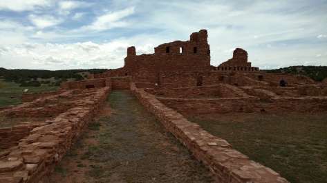
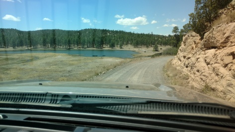
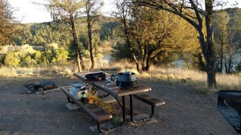
Navajo National Monument and Canyon De Chelly

Pam and I dropped south out of Utah, through Monument Valley to meet up with Lou and Nancy at a place neither of us had been to before, Navajo National Monument. It’s located about 20 miles west of Kayenta, AZ, within the Navajo Nation.

Our view from the campsite was spectacular.

IMG_20160522_134326589_HDR

There were a couple of hikes you could do on the rim of the canyons. One was to a beautiful view up one of the canyons.

IMG_20160523_121508886

The other hike was to a view of the Betatakin ancestral Pueblo ruins tucked into the face of the cliff. The alcove was approximately 400 feet high, 300 feet across and 150 feet deep to give it some perspective.

IMG_20160523_113529602

They have guided hikes down into the canyon with an up-close tour of the ruins, but the first tour of the year started two days after we were there. Therefore, we decided to leave for a couple of days and return and do the hike.

We headed south along the Arizona – New Mexico border to Canyon de Chelly National Monument. This is also a beautiful sandstone canyon. Pam and I have been there many times, but it was the first time for Lou and Nancy. We camped outside the canyon in Cottonwood campground. We had camped there years ago when our boys were much smaller and the cottonwoods were just planted and not providing much shade. Now the cottonwood trees are huge and the campground is a beautifully shaded area. Another couple, Anthony and Astrid, and their dog Digby joined us at the campsite after finishing up the close-out of Overland Expo.

IMG_20160524_160142505_HDR

We took the drive along the south rim and stopped at all of the overlooks.

IMG_20160524_150301837_HDR

The last overlook is at Spider Rock, a beautiful column of rock that has been the subject of thousands of pictures.

IMG_20160524_155317365

Many Navajo families still live in the canyon. The last time Pam and I were there we took both our Moms and hired a Navajo guide to drive us into the canyon. He grew up in the canyon and told us many stories of life in the canyon.

In the 1860s, the US Army, led by Kit Carson, killed or captured many Navajos in the canyon. The captured Navajos were taken to Fort Sumner, NM, over 300 miles away, on what is now known as the Long Walk. Many died on the walk and in captivity before being released and allowed to return to the canyon.

The only hike you can do into the canyon without a guide is to the White House ruins. It was a pretty hike down and back up through the sandstone canyon.

IMG_20160525_120028585

All six of us then returned to Navajo National Monument for the first guided hike of the year down to the Betatakin ruins. The ruins are in one of the many canyons that are visible from the hike. There is a longer hike to the Keet Seel ruins that we’ll have to go back and do sometime in the future. It’s not a guided hike but there is a ranger at the ruins when you make the 8 mile trek up another canyon.

IMG_20160527_101221635

The ruins are one of the most intact ruins in the southwest. Many of the wooden ceilings are still in place. There are a few rock sections of the alcove that have shed over the centuries to wipe out sections of the ruins, but most are still there. The place was occupied from 1250 to 1300 before they left and went south to the Hopi Mesas. Pictographs of several of the Hopi clans are still present today.

IMG_20160527_104441149_HDR

The valley is lush and a different eco system than the rim when looking out from the ruins. The valley was filled with oak and aspen trees and not the juniper trees that dominate the rim.

IMG_20160527_115645923

The hike was beautiful.

IMG_20160527_130057868

However, as with all hikes into a canyon there is always the issue of getting back up and out. A section of the hike reminded us of South Kaibab at the Grand Canyon, but it was just a short section.

IMG_20160527_102703246

We drove home on the holiday weekend and the forest south of Flagstaff looked green and healthy. Small cities of campers were everywhere in the woods for the long weekend.

IMG_20160528_130018108_TOP

Pam and I need to restock and then it’s off for the summer to the Rockies.

Chaco Canyon and Hovenweep

Lou and Nancy left us at Chaco to head to Overland Expo near Flagstaff, AZ. It’s a yearly gathering of worldwide off-road travelers who definitely have chosen the path less travelled. The weather this time of year at the event is always the wild card. Three years ago it was freezing cold, two years ago it was gale force winds and last year the event was nearly washed out with rain. Therefore, Pam and I decided to pass on the expo this year and continue our own exploration.

The weather system that had been over us for that last few days disappeared and our second day at Chaco was beautiful. We did a great hike to the Wijiji ruins that can only be reached by foot.

IMG_20160519_100022018

Since it is off the beaten path, we had the ruins to ourselves. The construction of the buildings still amazes me, lasting now more that century of without any maintenance.

IMG_20160519_103433000_HDR

Even the campground at Chaco has ruins in the cliffs nearby.

IMG_20160519_113828424

The sunset that night in the canyon was beautiful.

IMG_20160519_202035297_HDR

We planned to meet up again with Lou and Nancy on their trip home to Colorado after the Expo so we had a couple of days to kill. Where to go? We decided to head north out of Chaco, thinking that Mesa Verde or the Canyons of the Ancients in southern Colorado would be a good choice. We stopped in Farmington, NM to do some laundry and then headed to Shiprock, NM, the capitol of the Navajo Nation. Once we crossed the border into Colorado there was a sign that said Hovenweep 42 miles to the west in Utah, so that became the next stop.

Hovenweep National Monument is another example of Pueblo masonry that has lasted through the centuries. It’s a collection of sites in a 20-mile radius with ruins in many of the canyons. Most of the ruins are near the visitor center in a nearby canyon.

IMG_20160521_101122761

The buildings are constructed on the rocks in the canyon, many a combination of home and storage for the food that they needed to protect after harvest.

IMG_20160521_102511778

During our hike of the canyon we came upon a Park Ranger who was observing one of the many birds in the area, in this case a mother barn owl with several owlets. The owl had roosted in a cave in the canyon wall. She suggested that I could take a picture of it by holding my camera to the scope she had set up and it worked.

IMG_20160521_104123879

We then took off to the other sites that were located along the many back roads in the area.

IMG_20160521_131738760

The buildings were constructed with defense in mind to protect their families and the food from predators or raiding clans.

IMG_20160521_132453706

The roads were also nice to drive on and luckily there was little traffic to worry about.

IMG_20160521_140013574_HDR

Our campsite there was nice and we set up our alcove for shade and protection from the wind. However, after we returned from our exploration our alcove had lifted out of the ground and luckily wrapped itself around a nearby juniper tree. Thoughts of it taking out a 1000 year old ruin crossed my mind when we pulled up and it was gone.

IMG_20160520_161623850_HDR

It was a full moon when we were there and it rose out of the mountains to the east to light up the night.

IMG_20160521_203827327

Santa Fe National Forest

We left Taos heading west to find new areas that neither of us had been to before and stumbled upon what must be NM’s fishing playground. Just west of Santa Fe and south of Los Alamos is Bandolier National Monument.

IMG_20160516_134731957

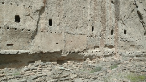
This is a beautiful area that was once a Pueblo settlement until the 1670s, similar to the ones we visited south of Albuquerque. One of the 20 year droughts that the southwest still gets forced these settlements to be abandoned. We camped up on the hill and hiked down into the canyon. The ruins were impressive, both on the canyon floor and up against the walls. You could still see the holes where the wooden ceiling poles were installed that separated the multi-floor dwellings.

IMG_20160516_145921296_HDR

IMG_20160516_152040666

We were allowed to climb into several of the old cliff dwellings.

IMG_20160516_151105383_HDR

One was 140 feet above the floor and required several ladders to get to the dwelling where an old Kiva was probably the site of many ceremonies.

IMG_20160516_160450769

IMG_20160516_160056282_HDR

Heading west from Bandolier was Valles Caldera National Monument, which used to be a national preserve, but was recently upgraded to monument status. Similar to Yellowstone, this area was a huge volcano caldera. The area was noted for the many movies that have been shot there over the years. The back area is day use only, but with many fishing spots that will be on list of places to revisit.

IMG_20160517_113646569

We passed the Soda Dam along the road, where calcium carbonate has been building up for thousands of years to form the rock dam and a pretty interesting rock formation.

IMG_20160517_125133941_HDR

We then headed north to Fenton Lake State Park for the night and relaxed in the high elevation woods near a lake and stream.

IMG_20160517_152441300_HDR

We talked to the Fish and Game guy who was there stocking the area with rainbow trout about the condition of the dirt road that headed north over the mountain. Even with the recent rains he said it was passable so we left the park the next day and headed over the mountains. The drive was beautiful and it was so high that the spring leaves had not come to this area yet.

IMG_20160518_091547457

We dropped down the other side of the mountain into Cuba, NM and then west to Chaco Canyon National Historical Park. This is also a world heritage site due the size and significance of the ruins.

IMG_20160518_151525041_HDR

Between 900 and 1100 Chaco was the trade center for a region that encompassed the entire southwest. They have found evidence of sea shells, macaws, chocolate and even coffee beans in the ruins. The great houses there span many miles and many are not even excavated yet. Those that are visible are creations of masterful stone masons.

IMG_20160518_154408330

Taos Area

We drove into Taos the next day and by way of another beautiful church, San Francisco de Asis Mission Church, one of the most photographed churches in the area.

IMG_20160514_090321888

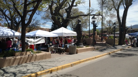
We toured Kit Carson’s Taos home, a few of the many art galleries in the area and strolled through the Saturday farmer’s market in the square.

IMG_20160514_110923239

We then drove the Enchanted Loop through the mountains around Taos that passes by the ski resorts of NM, many with snow still visible on the peaks.

IMG_20160514_140257093_TOP

We camped for the night at Eagle Nest Lake State Park at the base of Wheeler Mountain, the largest mountain in NM at 13,159 feet and still covered with snow. The picture below was not of the peak because it was still covered in clouds and snow while we were there. The park itself was covered in Prairie dogs and we even saw a badger, at a safe distance, hunting them as we sat out in the evening.

IMG_20160514_175925215

The next day we drove back into Taos to join up with Lou and Nancy on their way to the Overland Expo show near Flagstaff, AZ. At one of the galleries we visited, the artist showed us a casita she had redone for guests to stay. It was the epitome of NM décor.

IMG_20160515_150018569

We camped in the Carson forest just outside of town and enjoyed the evening catching up and watching storms all around us until one came right over us, dropping a lot of hail and then providing a good lightning show that lit up the nighttime skies.

IMG_20160515_162956701

Albuquerque, He’s My Turkey ….

We headed north on the east side of the Manzanita Mountains until we hit old Route 66 and headed west into Albuquerque to visit with Sue and Alex. On the way we stopped at Petroglyph National Monument to see some of the ancient graffiti. The petroglyphs are separated into several sites, but I failed horribly at map reading and we wandered around the first site for some time until one of the nearby residents came into the desert and corrected my map orientation. He was a retired postal worker and we got a short history of the region as an added bonus. Once I read the map correctly, the petroglyphs were much easier to find.

IMG_20160512_131412678

IMG_20160512_135150498

The monument was created to protect these rock drawings from the encroachment of the Albuquerque suburbs, which extended from the cliff we were on to the foothills in the distance.

IMG_20160512_135822422

Sue and Alex were awesome hosts and even better tour guides. That night we had a wonderful southwestern dinner at a local restaurant, Cervantes, and watched a thought provoking Robert Redford directed movie, The Milagro Beanfield War, about the changes faced by many of the rural, mostly Mexican-heritage towns in northern NM by new development in these beautiful areas. Christopher Walken was the bad guy so “you know” it had to be good.

The next day they took us north past Santa Fe and to the small village of Chimayo. We visited several beautiful 200 year old churches in the area,

IMG_20160513_112752792

… including El Santuario de Chimayo. Nearly 300,000 people visit the site each year as part of their pilgrimage, similar to the Camino Way in Spain.

IMG_20160513_134848501

We had a fabulous southwestern lunch at the local and very highly rated restaurant, Rancho De Chimayo Restaurante that is located in an old 1880 home.

IMG_20160513_120339830

We then visited the small courtyard village, the Plaza Del Cerro, tucked in the hills…

IMG_20160513_141421266

and visited the local weavers making the beautiful southwestern rugs for export all over the world.

IMG_20160513_142332469

Sue and Alex headed back to Albuquerque, while Pam and I found a nice spot in the Carson National Forest nearby to camp for the night. It was nice to get away from the city again.

IMG_20160513_190342164

Central New Mexico

We dropped south out of the City of Rocks into Deming, NM and shot east across the Tularosa Valley where White Sands is located. This was the same path we traveled back home from Big Bend NP last year so we didn’t stop along this section, but headed north along the foothills of the Sacramento Mountains to Carrizozo and east into Lincoln National Forest.

Capitan, NM is in this area and the home of the Smokey Bear museum. The original concept of Smokey Bear was developed without a real bear in mind, and named after a New York City fire chief. Soon after it caught on a bear cub near Capitan was rescued after a forest fire and named Smokey. He spent his life in the Washington, DC Zoo and was then buried back in Capitan after his death in the 1970s. Another orphaned bear from the Lincoln National Forest took his place.

IMG_20160509_141114878

IMG_20160509_142047486

He became a worldwide recognized symbol for forest fire safety and the museum had quite a few of the memorabilia made over the years for Smokey.

IMG_20160509_142403036_HDR

Just down the road to the east of Capitan sits Lincoln, NM.

IMG_20160509_152716368

This little town was the county seat for Lincoln County, which used to be the entire southeast corner of the New Mexico Territory, about 200 miles by 200 miles with one sheriff. Following the Civil War, this area saw a great influx of folks and was the site for what’s known as the Lincoln County War and its most infamous participant, Billy the Kid. This area is cattle country and two sides went to war to secure the lucrative NM territory government beef contracts, using the cowboys running the herds as hired guns. Because of the lack of any law other than a six gun and crooked politics in the region, both sides were deputies of some faction of the law and many folks died. Billy the Kid, as a participant in the war and a good shot given the folks he killed, was granted a pardon for his testimony to convict one of the ring leaders from the other side, but the conviction was never carried out due to politics and Billy’s pardon was taken away. He was arrested, but then killed his holders with their own guns, who were rivals in the county war and fled. When real law was finally brought to the area they realized that Billy the Kid was a loose end that needed to go, and hunted him down and shot him in Fort Sumner, NM.

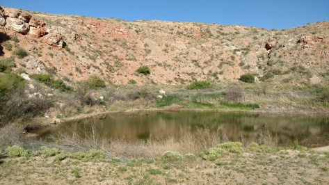
We then headed further east to Roswell, NM. While Roswell is known for its aliens, the town is actually the dairy capital of the southwest. Makes you wonder what’s in the milk. We skipped the alien stuff and headed to Bottomless Lakes State Park just east of Roswell for the night. The campground is built around several sinkholes that filled with water from the Pecos River to form these series of round lakes. We had our own sinkhole lake as a campsite – much cooler than a green alien.

IMG_20160509_172307578

We had a 3-foot diamondback rattlesnake slither across the road just outside our campsight, and then this 4-foot bull snake slithered the other way the next morning. I wonder if he ate the diamonback?

IMG_20160510_095105792

The largest of the lakes has a lot of day sites around it as seen from the cliff above. We hiked the nature trail through the wetlands off in the distance beyond the lake.

IMG_20160510_100442075

When we circled back around the lake where the day-use sites were located we noticed that each site has a built-in spa area to relax in the water. I can imagine in the summer these are prime spots for weekend picnics.

IMG_20160510_085958287

We left the campground and headed to the Bitter Lake National Wildlife Refuge just east of Roswell. This place along the Pecos River is the western border of the North American central flyway for migratory birds. Many of the wintering birds that call this home, including Sandhill Cranes, have already left to begin the migration north for the summer.

IMG_20160510_110534915

We had a nice drive and hike around the place, and saw several interesting birds, but we may have to come back in the wintertime to see the flocks.

We then drove into Fort Sumner to visit the Billy the Kid museum. While the museum had several Billy related memorabilia, like his gun, the museum was packed with all sorts of very cool stuff.

IMG_20160510_144115113

The antique guns they had there were impressive.

IMG_20160510_143607391

I was also crushed to see several good anvils as display items. They would be much happier in my forge.

IMG_20160510_143112697

The area in this part of NM is wide open country. The wind blew constantly for several days across the open land that seemed to be only inhabited by cows, pronghorns and the few vehicles we passed.

IMG_20160510_131653919

We drove up to Santa Rosa, NM to see the Blue Hole. This is a spring that pumps water out of the ground at a rate of 50 gallons a second. Folks come here to scuba dive into the hole or just swim. With the water temperature at 61 degrees, we passed on the brisk swim.

IMG_20160510_155048157

IMG_20160510_154822026

We camped the night at Santa Rosa Lake State Park. The NM state park system has good campsites and beautiful locations. We passed a few pronghorn entering the campground. While a cheetah may be faster in a short sprint, the pronghorn can keep its top speed up for many, many miles. It could be argued that it is the all-around fastest animal on the track, but ironically it would do poorly in the field events.

IMG_20160510_160608292_TOP

I was able to test out the griddle option for the volcano 3 at the campsite, mostly because of the constant 20 knot wind that was blowing through. Turkey burgers, with hatch chilies, bacon and pepper jack cheese grilled up nicely.

IMG_20160510_183728664_HDR

We then headed west again to Mountainair, NM to see the Salinas Pueblo Missions National Monuments. These missions were the northern part of the Spanish trade routes from Mexico City established in the 1580s, built by the local tribes for the Spanish missionaries. The wealth of the area was salt in the local dried lakes. The three mission sites are spread apart by roughly 30 miles. All were abandoned in the 1670s due to drought and famine that hit the area. The missionaries and Pueblo indians crossed over the mountains to the Rio Grande River basin to the west. It was 200 years before the area was resettled again and these missions re-discovered.
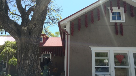
The most southern site is Gran Quivira, where the entire city was constructed from limestone.

IMG_20160511_133959674

Abo was the next more northernly site and the last to be abandoned in the 1670s. Sandstone was used to construct the northern missions.

IMG_20160511_150310801

Quarai was the most northern site in the Salinas area. The walls of the church are just massive. During their occupation, each of the churches were ornately decorated with items brought up the Camino Real trade routes up the Rio Grande River basin from Mexico.

IMG_20160511_161221756_HDR

We headed back up into the hills and camped at Manzano Mountain State Park. I tried fish tacos tonight on the grill, with halibut, mango and pineapple. It was tasty.

IMG_20160511_192437520

Tomorrow we head into Albuquerque to see some friends and spend the night in a city.

On the Road to New Mexico

Pam and I finally finished all the things we needed to do in the valley and headed out for New Mexico, a place we both have wanted to explore. It was about two weeks later than we had originally planned, but just in time as the thermometer hit 100 degrees for the first time this year in Phoenix on the day of our departure.

We got a late start so we stopped at our place on the rim to relax and let the Roamer cool down, being 30 degrees cooler than the valley. The light snow from the week before had melted and the squirrels were back, quickly finding the full peanut feeder.

IMG_20160505_074824656_HDR

We always want to see new routes so we took highway 60 through Springerville into New Mexico this time. We made our way to a place I’ve always wanted to see – the Very Large Array on the plains of San Agustin. The 27 90-foot tall antennae are placed along one of three 13 mile long rail tracks to gather radio waves from far away galaxies.

IMG_20160505_163235499

You get how really big each of these antennae are when you get close to them.

IMG_20160505_163853554

A special train engine moves these guys along the rails, where the spacing along the 13-mile legs depends on the detail desired from the far away galaxies. They have configurations A through D, where configuration A spans the entire 13 miles in each direction and configuration D is for “Darn” close.

We asked the folks there about good places to camp nearby. They recommended the National Forest, but requested that cell phones are kept in airplane mode and no microwave use within 15 miles of the array. It’s pretty sensitive and picks up everything. We took state route 52, a graded dirt road, south from the array and dispersed camped in the Cibola National Forest.

IMG_20160505_170003308

IMG_20160505_192700015_HDR

It was a great spot, but the wind howled through the night and it even poured for a short time before the clouds disappeared and the stars came back out before dawn.

IMG_20160505_172133501

We dropped back out of the national forest and continued south on 52 to 163, and then onto FR150, a forest service road called Railroad Canyon Rd. The scenery was beautiful along the high plains and through the canyons. We spotted a lot of pronghorn in the fields.

IMG_20160506_094403868

IMG_20160506_105955924

The canyons we passed through were beautiful.

IMG_20160506_110554168_TOP

IMG_20160506_111831358

It was clear that this was cattle country. The new calves were romping everywhere.

IMG_20160506_113743765_TOP

We stopped for lunch by a small lake under some cottonwood trees.

IMG_20160506_122443540_TOP

IMG_20160506_125013823

Just after lunch we passed a father and two boys who were there turkey hunting, but the front hub on one of the trucks had failed. They had driven out in their other truck to get a new hub but didn’t have the right wrench to remove the old hub plate. Luckily I had one and was able to help out, given that we were about 100 miles and several hours from the nearest town.

The entire ride we were over 7000 feet, where the area alternated from grassland, to juniper to ponderosa. We camped for the night in the Gila National Forest, at the Black Canyon campground along a nice brook that was the headwaters of the Gila River. We were the only ones there. Many of the trees near the brook were felled by beavers but we didn’t see any around. They must have been moved away from here.

IMG_20160506_143301599

We finished the drive out the southern border of the Gila National Forest and hit pavement again after about 140 miles of dirt. Our cell phones came to life for a brief period as we jumped over the continental divide and then went “searching for service” again for the rest of the day.

IMG_20160507_092331498

IMG_20160507_093145006_TOP

We made our way to the Gila Cliff Dwelling National Monument. We bought our 2016 National Parks Pass (3rd year in a row for a park pass) and hiked to the dwellings.

IMG_20160507_133020467

The six caves that make up the dwellings would have been a nice place to live. The Gila River ran just below these cliffs and the view was spectacular.

IMG_20160507_131910567_HDR

IMG_20160507_132143342_HDR

The wood that made the roofs has long since decayed, but their placement was still very evident.

IMG_20160507_132339670

The area around the dwellings was also beautiful.

IMG_20160507_142004877_HDR

We camped the night by Lake Roberts at the Mesa campground. I used the propane option for the volcano grill for the first time and it worked nicely, although, I’m already coming up with design enhancements to make it more functional.

IMG_20160507_193202340

The last day of the 5-day Tour of the Gila bike race was Sunday. We broke camp early and headed to Silver City before the mountain roads were closed due to the race. The last day is a long leg through 2000 foot climbs and descents. It’s called the Gila Monster, where the racers hit speeds of 60 mph on some of the very steep winding downhills. Top racers from all over the world come for this and it’s a qualifying race for the 2016 Olympics. We saw several of the pelotons leaving Silver City since they do a staggered start for the various racing groups.

IMG_20160508_084833877

We headed south, making our way to the City of Rocks State Park. This is a very interesting place where the rocks must be the remnants of a volcanic core.

IMG_20160508_124630614

We got there early enough to do a great hike and a nice afternoon nap for Mother’s Day. The camp spots are all tucked into the rocks and named after planets and constellations.

IMG_20160508_194953553_HDR

Tomorrow we head towards Roswell, NM.