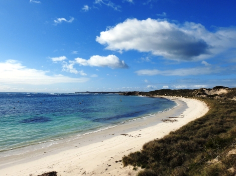
Kununurra

Using the Australian pronunciation rule where nearly every vowel is replaced with the letter A, our next stop, the town of Kununurra, was pronounced (ka-na-NAR-a). This town of 5,000 folks was created in 1961 to support the construction of the Ord River Dam, which was finished in 1972. The Ord River Dam was constructed as part of the Ord River Irrigation Scheme to capture the wet season water runoff down the Ord River and to create a large farming area in this mostly arid region. The dam created Argyle Lake, the 2nd largest man-made lake in Australia, which has a surface area of 271 square miles and holds 18 times the volume of water that is in Sydney harbor. Due to the amount of rain that falls in the wet season it only took 3 years to fill the lake.

Because the dam now provides a flood control system for the Ord River it no longer goes dry in the dry season like all the other rivers in the Kimberley region and has become a huge sanctuary for both plants and animals.

The consistent flow and height of the river have allowed grasses and lily pads to grow in areas that would flash flood prior to the dam. The grasses help to stabilize the shoreline. Here a comb-crested jacana walks across the lily pads in search of food, where they will spend their entire life on the lily pad surface.

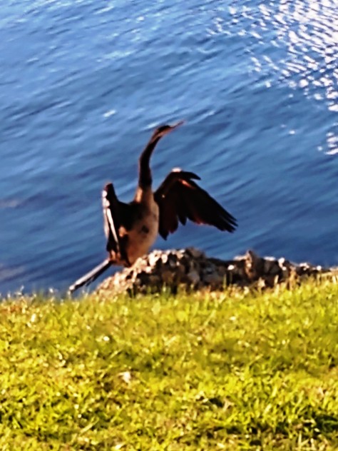
Here was another Australian darter drying its feathers after hunting for fish under water.

Cockatoos roosted in large groups in the trees along the banks.

In the grass along the bank a purple swamphen was building a new nesting area.

We also saw a large colony of flying fox bats that are over a foot tall and have a 5-foot wingspan hanging from the trees. Our guide thought this tree may be their nursery. At dusk the young adults fly out to eat, leaving the newly born bats with the older bats. Just prior to sunrise the young adults return to let the older bats fly out to eat. The younger bats will not eat anything within 2 miles of the nursery so that the older bats do not have to fly as far for their food.

Of course, there were crocodiles in the river.

Our guide gave a talk on the Ord River Irrigation Scheme; its past, present and hopeful future. A lot of the water is used for farming irrigation in the fields that are adjacent to the river. The hope is that one day the area will become the breadbasket for Australia. They are still experimenting with the best crops for the area. Sandalwood is currently the largest crop, but recent successful harvests of wheat and cotton may change that going into the future. Chinese investments are helping with some of the future expansion plans.

This was our tour boat, tucked into the bank while we had lunch along the river.

The distance of our tour, from Kununurra to the dam, was over 45 miles. The three engines on the back of our tour boat allowed us to get between points of interest rather quickly.

Other folks were also on the river. These two were part of a multi-day canoe camping trek along the river. Given the number of crocs we saw along the banks, you would need to choose your camp spots wisely.

The 325-foot tall dam itself was a rock wall dam of locally quarried stone. The sign sums it up, “Faith in a pile of stones”.

This is from the top of the dam looking down onto the Ord River. You can see our tour boat off in the distance heading back to Kununurra.

Looking the other direction over the dam, you see a small section of the 271 square miles that make up Lake Argyle.

The lake submerged the majority of the Durack family station, or ranch. We visited the Argyle Homestead Museum, a look back at the Durack family and the part that they played in the early days of the Kimberley region.
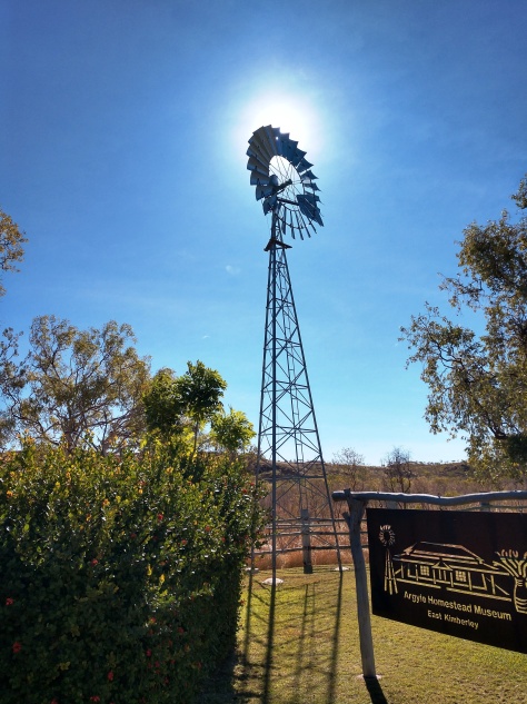
The original Durack homestead was built in 1895. It was constructed of limestone blocks with crushed termite mounds as mortar. The homestead was deconstructed at its original site, now deep under Lake Argyle, and re-assembled at its new location for current and future generations to see.

The grounds around the house were very colorful with local flowers in bloom. There was a lone dingo in the brush around the homestead, possibly waiting for a wandering tourist – lol.

A western bowerbird nest was in the brush along the perimeter of the homestead. The male bowerbirds create these nests to attract a mate, using colorful stones to entice the females.

We then made our way to another wilderness camp named Emma Gorge at El Questro.

Bungle Bungle

The next day of our tour we travelled to Danggu Geikie Gorge National Park for a boat tour of the Geikie Gorge. Our boat guide was Aboriginal and provided a lot of information about the Aboriginal culture during the tour. There were similarities between many Aboriginal customs and the Native Americans. As examples, instead of Native American tribes, Aboriginals were differentiated based on language groups. Instead of rules against marrying into the same clan, Aboriginals were not allowed to marry into the same “skin color”, of which there are four. It’s a very family-based society with a responsibility of care for even distant relatives.

The gorge was very beautiful. The sandstone near the current water level was erosion-etched with a thousand cracks and holes.

In the sunlight is was very clear to see the “wet” season level of the Fitzroy River due to the rock color. It was hard to imagine the water level changing so drastically in a seemingly arid area.

A croc was basking on the rocks as we passed. Like the seals with their fins in the air, Crocs bask in the sun with their mouths open to regulate their body temperature to around 77 degrees. This time of year the water and, for most of the day, the air were both colder than 77 degrees so the crocs were not very active – luckily for us.

The Fitzroy, the Ord and several of the other larger rivers in the area segregate the Kimberley region into isolated islands during the wet season. Travel across the region is only accomplished by small planes hopping between dirt strips. The Kimberley communities become self-contained during the wet season, where outside travel is only used for medical emergencies.

There were flood level markers on the roof structure of the visitor pavilion, which was located way above the riverbank. The apex of the roof had markers indicating at least 3 years in the last few decades when the entire pavilion was submerged by as much as 6 feet of water.

We then made our way to Purnululu National Park, where we stayed the next two nights at the Bungle Bungle Wilderness Lodge in tents like our stay on Rottnest Island. The lodge had a central building that housed the open-air living room, dining hall and bar. Dinner was a three-course set menu dining experience prepared by some amazing chefs. Breakfast was a typical British breakfast buffet: eggs, sausage, ham, tomatoes and mushrooms, as well as cereal, yogurt and fruit. The staff running these places out in the middle of nowhere were great.

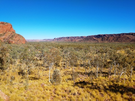
Most trees in the region are some kind of eucalyptus. The ghost gum eucalyptus tree is known for its smooth, white bark that gives it its ghost appearance under a full moon.

The next day we took off to the explore the National Park. The roads in this area of the country were dirt and well maintained. I’m sure they require a lot of work following the wet season to make them passable again.

We passed Elephant Rock on our way to our first hike.

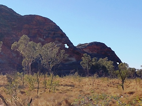
The Bungles are a unique banded rock formation.

We hiked up Piccaninny Creek to an overlook. You can get a better idea of the color and composition of the banded rock that makes up this mountain range.

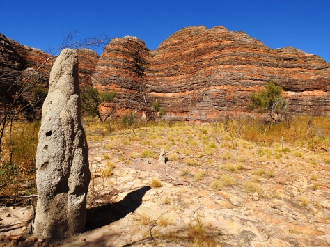
The hike took use by several termite mounds, this one being about 10 feet tall. Ray, our guide, had several books on our tour bus about the flora and fauna in the Kimberley. One was on termites that was surprisingly interesting. These termites were cathedral termites named due to their mound structure. Another species in the Kimberley were the magnetic termites, where their gravestone shaped mounds are aligned within 10 degrees of the north-south compass direction.

This raven provided a striking contrast against the rocks.

We then hiked up into a beautiful box canyon.

At the end of the canyon was the Cathedral. The place was so majestic that a camera could not capture it all. This is a shot from the path looking into the Cathedral.

This is a shot from the far end of the Cathedral, under the overhang, looking back to the path. The place has wonderful acoustics and one visitor broke into an acapella version of Amazing Grace that sounded really nice.

Here’s Riley and Tasman relaxing on one of the ledges in the Cathedral.

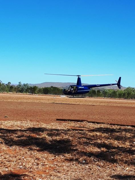
They offered helicopter rides over the Bungles in piston powered R44 helicopters. Riley took a ride and snapped pictures for the rest of us to see. The helicopter outfit had 3 R44s there and all were filled with passengers. Riley’s pilot was 19 but had been flying Robinson’s for several years already on the ranches, or stations as they are known in the region. The stations can cover a million acres and with no or very few roads helicopters are the current technology used keep an eye on the herds. As technology changes, cowboys and horses gave way to helicopters to cover more ground quickly, which will be replaced by drones at some point in the future. Maybe a cattle prod option on a drone would be a good market….

We enjoyed a beautiful sunset as the last light hit the mountain range with the full moon rising. This was followed by another delicious meal at the Wilderness Lodge.

Pam and I both wished we could have the Roamer in the Kimberley, or even all of Australia for an extended stay. I admit I was getting a little tired of packing and unpacking my stuff nearly every day. With the Roamer, everything is packed and at our fingertips.

Also, Pam likes my cooking, and if we ate meals liked those chefs cooked everyday while we travelled I would way 1000 pounds! But for a few days, it was nice.

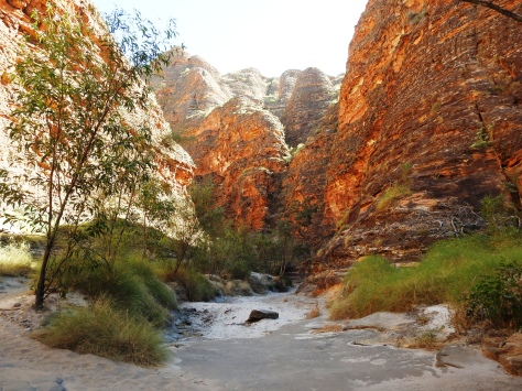
Before leaving Purnululu National Park we visited the Echidna Chasm on the north side of the park. The rock of the chasm oasis was a conglomerate or river rocks, and not the usual sandstone.

We hiked up the river bed into the chasm.

The slot canyon, or chasm, was huge with walls that were over 100 feet tall ending in a box canyon where the stream entered the slot.

The terrain outside the canyon looked very familiar. We could have easily been somewhere in the southwest US for this same view. However, this area is one that is covered in water during the wet season.

We continued north to the town of Kununurra for the night.

Fitzroy Crossing

The Kimberley region is the most northern of the nine regions that make up Western Australia. It is bounded by the Indian Ocean to the west, the Timor Sea to the north, the Northwest Territory to the east and the Great Sandy and Tanami deserts to the south. The region was named after the 1st Earl of Kimberley, the Secretary of State for the Australian colonies in the 1870s and 80s.

Melinda booked us on a 9-day APT Tour of the region. Our 4-wheel drive tour bus was our coach for the next leg of our Australian trip. It had the same size tires as the Roamer but came in at twice the weight. The suspension was nice in that it handled the washboard roads, or corrugated roads as they say in Australia, much better that the Roamer.

Our driver and guide for the trip was Ray, an Irishman that had travelled the world and knew the Kimberley region very well. He was part botanist, herpetologist (reptile expert) and geologist, which combined made for a great tour guide.

We were initially a little skeptical of him as a driver because after picking us up first in a pre-dawn location, Ray proceeded to get lost on his way to the next pick-up location about ½ mile away …. in the hamlet of Broome. I was able to guide him back on course using Google Maps on my phone. While town navigation may have not been his strength, knowledge of the backcountry more than made up for that initial lapse of navigation.

After we picked up the other tour folks, sixteen in all, we knew he was going to be a good guide when he whipped the 40-foot bus around to go back and see this Mulga, or King Brown snake making it way across the road. It’s one of the largest venomous snakes in the world, reaching lengths of 10 feet long. This was a smaller 6-foot version that crossed in front of us.

Our first stop was the Boab Prison Tree. The Boab is called the upside-down tree because without leaves it looks like the roots are above ground. The story is that the tree did something bad and it was turned upside-down by the spirits. It’s related to the boabab trees in Madagascar and it’s thought that the large boabab seed nut floated across the Indian Ocean to create these trees. Leaves do sprout on the tree when there is an abundance of water.

The Prison Tree is 1,500 years old and named for its use as a resting point for the Aboriginal prisoners on their way to the nearby town of Derby in the early settlement days.

Near the tree was this incredibly long watering trough. This was sheep and cattle country and the area was probably used as the round-up location, due to its location near the major road, prior to shipping the stock to market.

Our next stop was Windjana Gorge. We picked up our seventeenth and final tour passenger there. It was a lady flying in from England that experienced some flight delays getting to Broome. The tour company, who had also booked her flights, hired a small plane and flew her from Broome out to the dirt airstrip near the Gorge to catch up with our group.

The entrance to Windjana Gorge was a small tunnel through the rock.

Looking up, the rock walls of the gorge were very colorful.

The Lennard River, which runs through the gorge, was reduced to billabongs, or small pools of water during the dry “winter” season. As we would better understand during this trip, during the wet “summer” season between November and April the Kimberley region can get anywhere from 20 to 50 inches of rainfall. The ground does not absorb it and the quiet little billabong areas like this become 20-foot deep rivers running with incredible force due to the gathering waters upstream.

We didn’t go swimming here. There was a healthy supply of fresh-water crocodiles enjoying the afternoon sun, awaiting a stupid tourist looking for the perfect selfie – lol.

I nearly walked into one croc. Look closely at the photo. I didn’t even see him next to the water until I was a couple of steps away. Fresh-water crocodiles, or “freshies” as they are called, grow to about 6 feet in length and are not aggressive. Their salt-water cousins are the ones you need to respect. Salt-water crocodiles grow to 20 feet in length and possess a bad attitude. Warning signs are posted everywhere “salties” are known to live and hunt.

We spotted a tree full of these Little Corellas in the gorge.

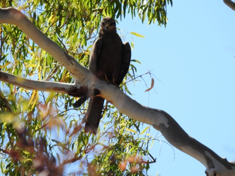
We also saw some Black Kites in the parking area around the gorge.

The landscape along the dirt roads looked flat and barren this time of year. Huge termite mounds began to dominate the area, where the termites clear the brush and smaller vegetation for their food.

Our next stop was Tunnel Creek, a mile-long tunnel through the rock mountain.

There is some Aboriginal art on the walls in the tunnel, but no one has yet determined the age of the drawings.

As we were just about to enter the tunnel, we noticed a “freshie” on the banks near the entrance. As we waded through the water in the tunnel, using only our flashlights, or torches as the Australians say, our guide spotted a few other croc eyes in the water. Luckily, we did not see them so ignorance is truly bliss.

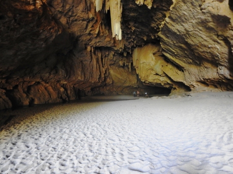
It was a pretty cool cave with an opening at about the midway point to let in a little light prior to the second half of the cave.

Parts of the cave had stalagmites and stalactites. Stalagmites extend up from the ground and “might” reach the ceiling one day, while stalactites extend down from the ceiling and hold “tight” to the ceiling.

The far end was a huge tunnel opening. It was then we also realized we needed to turn around and go back through the crocs in the dark to get back to the bus. Who thinks of these tours? At least we weren’t covered in raw chicken.

We stopped for the night at Fitzroy Crossing Lodge. Wallabies were all over the yard and the entire lodge was up on stilts due to the flood levels during the wet season, where the local Fitzroy River rises about 20 feet before running over its banks and flooding this area.

It was a Friday night and being the only bar within many miles, the place was packed. Once Pam and I got to the bar I couldn’t get the draft beers I wanted because they said they were only serving “mixed drinks” to reduce the rowdiness of the crowd. I said OK, I’ll have a vodka and OJ, to which I was informed that mixed drinks were 3% beer, not hard liquor mixes. Once clarified, I got a Coors-type draft and a wine for Pam.

We had a nice dinner as a tour group, where we both had the Barramundi, or Asian Sea Bass. It’s a tasty fish that we would have frequently on our tour.

The dinner was a nice ending to the first day on the tour.

Broome

We jumped on a plane and flew just over 1,000 miles north from Perth to the town of Broome. There we met up with Pam’s Aunt Melinda, and her two grandchildren, Riley and Tasman, who flew in from Canberra, the capital city of Australia. Canberra is in the southeastern part of Australia. Unfortunately, Pam’s Uncle Barney did not make the trip.

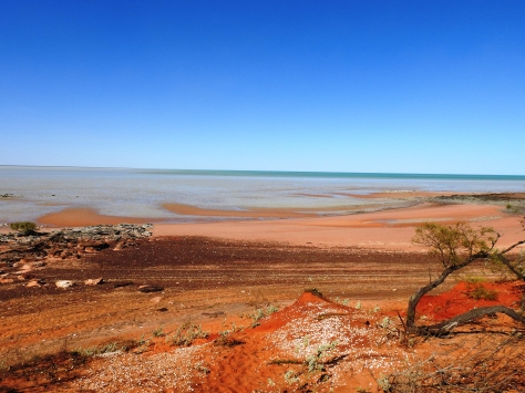
Broome is a small town of just 14,000 folks. It’s a tourist area that swells to about 45,000 folks during their winter months. The town is located at about the same latitude as Puerto Rico, but in the southern hemisphere. It was a little foggy downtown one of the days we were in Broome, but this gives you an idea of what it looks like.

Broome’s major industry used to be pearling, but that has been replaced by tourism. There are still a lot of pearl shops in town, where the pearls today are farmed rather than gathered from the ocean bottom using divers. This has made the weighted diving equipment and pearl boats obsolete additions to the local museums.

Initially, the Broome pearl industry was focused on the pearl shells more than the pearls when it started back in the 1880s. The shells were made into various works of art as well as buttons and combs. The pearls were either the standard white or a unique gold luster.

There was a bird sanctuary outside of town that we drove out to visit. When the dirt road ran alongside the beach the vegetation was mostly mangroves with warning signs for saltwater crocodiles, a place for only serious birders – lol.

We hiked out past the mangroves (and the crocs) to see some shore birds. Unfortunately, the tide was out and therefore no shore birds.

We did catch this whistling kite on the beach, probably looking for shore birds to snack on.

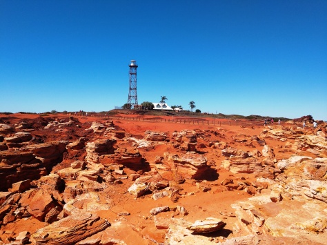
Broome sits on a little peninsula into the Indian Ocean. The town of Cable Beach is on the other side of the peninsula. It got its name from the telegraph cable that was installed in 1889 from there to Java, connecting Australia with England. Gantheaume Point is at the end of the small peninsula. The lighthouse and its keeper’s house sit among the colorful rocks at Gantheaume Point. Osprey built a huge nest on the lighthouse structure.

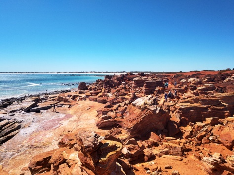
The point was a colorful rocky outcrop. You can see the beautiful white sand of Cable Beach off in the distance.

The place looked like Arizona and Utah with an ocean pasted in the background.

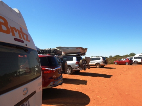
I spotted this new way to mount a boat in the parking lot. We would see several of these boat mounts over the next week while in the Kimberly region. The roof rack had a winch that pulled the boat and mounting track up from the back. The spare tire swing bar had an engine mount for the outboard. I guess in some places, like this parking lot, it’s much easier to navigate without a boat trailer. It’s also a few less tires to worry about, because most folks carried two spares, or four if they also had a trailer with different tires.

We then headed over to Cable Beach for some beach time. I saw this metal sculpture of a sea turtle that I thought was nice.

We lounged on the beach and went for a swim in the afternoon. The water was refreshing and the waves just big enough to do some body surfing.

Here was our travel group: Riley, sporting his new Arizona flag tee-shirt, Tasman, Pam, myself and Melinda. We decided to do one of the beach camel rides.

I guess there are a lot of camels in the outback. Our group was just one of three different camel trains that were present on the beach. Our guide told us that the camel groups are tight herds and can get a little testy if they get too close to the others. One of the camels in our group was the reigning champ of the yearly camel races held at the Broome racetrack.

Tasman and I were on Nasty Ned, a wayward camel that didn’t really like following the herd in a straight line. I could relate.

We enjoyed the Matso’s brewery right across the street from where we were staying. They had a good selection of beers and food that we sampled several times during our stay in Broome. One night our waiter was a lady from San Diego who was in Australia on a temporary working visa. She worked in Perth for a year, but to extend her visa for another year she needed to work in a remote location for 3 months, in her case Broome. Most of the waiters were non-Australians there on work visas, which seems like a good way to see the place and earn a little cash along the way.

One night, Riley and I caught the 3rd and deciding rugby game for the State of Origin cup between New South Wales and Queensland. Riley gave me the color commentary on the players and the cup’s history during the exciting and close game that NSW won in a last second score.

It was now time to load up on our tour and explore the region of Australia known as the Kimberley.

Geraldton

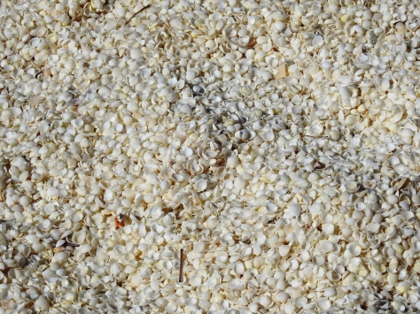
As we turned south and headed back to Perth, we stopped at Shell Beach, and like the name indicates it is an entire beach of shells. It was not sand and shells, but just small white shells for miles.

As Carl Sagan said -“billions and billions”. In the Denham museum there were examples of shell blocks that formed over the years through compaction and were used to construct buildings. There was no shortage of shells and it was impressive to see.

We then continued south to the town of Geraldton, a relative metropolis of 40,000 folks compared to the towns we had stayed in on our way north. Our Airbnb was near downtown and had a nice clothesline in the backyard to hang our laundry. Australia, like many places in Europe and the UK we’ve visited, doesn’t really embrace the use of a clothes dryer.

We walked downtown that evening and found a surprisingly good little Italian restaurant. We both tried a different pasta and sauce combination, and a nice bottle of Australian wine. It was a very good dinner.

The next day dawned with bright blue skies. Just at the end of our street was the St. Francis Xavier Cathedral, designed and built by the Catholic priest and architect Monsignor John Hawes. Completed in 1938, it is considered one of the finest Cathedrals built in the 20th century. He also designed and built several other churches along the coast of Western Australia.

The HMAS Sydney II memorial is also in Geraldton. The ship was one of the few Australian cruisers at the start of WWII, but gained fame during early engagements in the Mediterranean Sea, sinking two Italian warships and providing shore firepower for the ANZAC (Australian and New Zealand Army Crops) troops without sustaining a single casualty.

It was the pride of the Australian Navy and thought to be unsinkable. It disappeared, with all hands lost, off the coast of Geraldton in November of 1941. The true events of the battle that sunk her took some time to piece together. It was eventually discovered that the ship was lured into a surprise attack by the German cruiser Kormoran, disguised as a merchant vessel. The initial volley destroyed its big guns and the bridge, but the crew somehow managed to sink the Kormoran and turn towards home for repairs. Both ships were found in 2008 about 10 miles from each other off the western coast. Some of the Kormoran’s crew were rescued, but none from the Sydney survived.

The seagull tip marks the spot on the ocean where the ship was eventually found.

We then visited the museum in town. It covered a lot of interesting topics; the Aboriginal folks that lived there, the expansion and settlement of the area by Europeans and the marine life off the coast. This was a display of the Aboriginal boomerangs that rotated in the case for a nice visual effect.

They had a cross-section of a typical early explorer ship. The ballast of brick and stone provided the stabilizing base for the ship, while all the cargo and supplies were layered until the internal hold of the ship was filled. I’m sure the early explorers took ship packing to a whole different level.

A new exhibit had art done by some of the local Aboriginal kids. Aboriginal art is typically very colorful and is usually done in colored dot patterns rather than brush strokes.

Geraldton had a nice public park and walkways along the entire waterfront. In one of the kid’s parks we saw these Emu egg “benches” colorfully painted in Aboriginal-style art patterns.

There was a nice tavern in downtown Geraldton that we stopped in for a bite and a beer. Traffic lights are very uncommon throughout Western Australia. Most intersections, like this one, are traffic circles. Entering them in a clockwise pattern takes some getting used to, but we did it. The Australian GPS tells you to take the first (left turn), second (continue straight) or third exit (right turn) from the traffic circle. Traffic circles work well to keep everyone moving in light traffic but seem to have issues in heavy traffic and especially when one direction has most of the incoming flow. Nothing is perfect all the time.

After our stay in Geraldton we continued south to Perth. We had peanut butter and jelly sandwiches under a treeful of black-cockatoos at our lunchtime stop along the road.

We stayed at a hotel near the airport, along the Swan River that runs through downtown Perth. It had a nice walking path for an evening stroll after our drive.

We caught this Australian Darter sunning itself along the riverbank. Similar to cormorants, these birds dive for fish. Their feathers have less oil on them compared to most birds to reduce their buoyancy, making it easier to dive deeper and longer to catch fish. It comes with the price of needing to dry out their feathers after a hunting period so that they can fly again.

As a bird tidbit of info, owls too have very little oil on their feathers, providing them extremely quiet flight capability in the night. Because of this attribute owls cannot fly in the rain for very long.

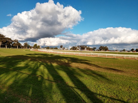
The hotel path led us past the Ascot horse racing track. Unfortunately, there were no races that night.

We had dinner at the hotel and tried another Australian wine, The Squid’s Fist, from the Some Young Punks vineyard. How could you not choose that wine? It’s good to see some folks having fun in the wine business. The wine was pretty good too.

This ended the first of three legs of our Western Australia trip. The next day we would fly to Broome, meet up with relatives and start the second leg of our adventure through the Kimberly region.
Francois Peron National Park

The Francois Peron National Park is part of the Shark Bay World Heritage Site as shown on the map below. We figured the best way to see it all would be to take one of the tour flights over the entire area, so we did. The black line represents the approximate flight path for our 90-minute flight. We started at the airport just east of Denham and did a clockwise path around the area.

This was our plane for the tour. Our pilot was a young lady who had only been flying there a few months. We found out during the flight that she flew not only tours, but flew workers, parts and guests to the remote dirt strips along our flight path on nearby peninsulas and islands.

Pam, Eve and I jammed into the aircraft with our pilot and we were off. Pam caught this shot of our shadow as we took off on our flight.

We passed over the town of Denham as we headed out over the bay.

The bays are filled with sea grass and dugongs, the Australian version of the manatee. We spotted a couple dugongs from the air but did not get a picture of one.

As we approached the Carrarang Peninsula and the town of Useless Loop, the salt flats came into view. Huge piles of salt were being loaded onto tankers from the dock. If you ever buy Australian salt, there is a good chance it came from here. A dirt strip on the other side of this site is one that our pilot flew workers and part into on a regular basis.

The water in the bay is shallow, but there are deeper channels that allow larger ships safe passage. The depth difference always provides great colors.

The western coastline of the Carrarang Peninsula was a steep rock face that the Indian Ocean waves crash into. You can see the few dirt roads that cross the land here.

The northern point of the peninsula is a good camping area, but it takes quite a while to get to it on the roads. A ferry leaves from this point to Dirk Hartog Island to the north where the one-way cost was more than our flight. The ferry supplies the Island with food, fuel, materials and the occasional tourist.

A huge sand dune covers the southeastern side of Dirk Hartog Island. Our pilot said that the dune shifts quite a bit due to the local winds.

Dirk Hartog Island’s western coast was also a cliff attempting to hold back the Indian Ocean. The historic island is owned by one family who used to use it for sheep ranching. However, it’s now used for tourism and environmental research. The family still lives there and coordinates all the activities on their island.

A recently completed project was to kill all non-native animals (feral cats, foxes and rabbits) and re-introduce the native ones. It took about 20 years to do this. We could see the fence-line roads that ran across the island as they slowly isolated the non-native species into a smaller and smaller area on the island during the eradication process.

A lighthouse is at the northern tip of the island, the most western location of Australia. We spotted a couple of manta rays in the water near the point. Fishing is a big industry in this area, but as a world heritage site it is heavy regulated.

We then crossed the bay again and flew over the tip of the Peron Peninsula, the most northern part of the Francois Peron National Park. The orange dirt with white sand beaches provided a nice contrast.

The park had several campgrounds on the peninsula. We flew over one of the campgrounds near the beach. To get from Denham to the point or to this campground takes an entire day due to the road conditions – definitely not a good option for a day trip. However, given its beauty, I’m not sure I would only want to stay just one day here.

As we found out in our travels later through the Kimberly region, Australians take packing and camping in remote locations to extremes. Keep in mind that ARB, the huge off-road equipment company, is Australian and came about from trips through the outback in the mid-70s.

The colors of both the ground and water were just amazing. As you can see, there are not many roads to explore much of the park. I’m glad we chose the aerial option.

The park is best known for the Big Lagoon area, a colorful tidal area with many pools and lots of marine life.

The lagoon was very shallow water, but colorful. The road through the park winds around this area and would be a fun drive. The park has a tire deflation – inflation station at its entry point. You must have 4-wheel drive and reduce your tire pressure to at least 20 PSI to enter the park. There is even a list of approved 4-wheel drive vehicles that are allowed to enter.

Several little pools feed into the lagoon. This would be a great place for a kayak. You could have your own private pools to explore.

The outlet of the lagoon flows into the bay and again is just a spectrum of colors.

Continuing south, you could see Denham again on the coast in the distance as we completed the loop, as well as the sea grass field in the bay that is home to the resident dugong.

I’m glad we waited for a better day to do the flight. It was the best way to see this large area in just one day. After the flight we turned south and began our trip back to Perth.

When we first began planning this trip, we wanted to rent a car and drive from Perth to Broome to meet up with the relatives for the commercial tour, rather than an out-and-back trip from Perth and then a flight to Broome. However, it gets even more remote north of Shark Bay and the AVIS restrictions stated that you could not drive their 4-wheel drive rental car north of Carnarvon, a town on the coast just north of the Shark Bay area. I called AVIS and asked for clarification on this and was told by one of the North American representatives that the limitation was true because it would be taking the car out of Australia….

Rather than point out the obvious geography error to this person, we switched our plans. In hindsight, it was a good thing since it eliminated the huge one-way rental charge, more than covering the flight from Perth to Broome, and gave us a chance to see some things we drove by on the way north to Denham.

Denham & Monkey Mia

The entire population of Australia, a land mass similar in size to the US lower 48 states, is only 25 million people. For comparison, the population of the US is around 330 million people. You would have to go back to the1850s, pre-Civil War era, to find a time when the US had Australia’s current population density.

The population of Western Australia, an area the size of the US from Colorado to the west coast, is only 3 million people. This fact starts to sink in as you drive on the major roads that are only 2 lanes for most of the distance and see only a few cars per hour of travel.

In the remote areas you come across Roadhouses that are the only gas, food and hotel for many miles. We stopped at one on our way north to grab some lunch and some gas. The Billabong Roadhouse was a hub of activity in this remote area. Billabong means the pools of water that remain when most of the river or stream dries up during the dry season. Billabongs are where the crocodiles hang out waiting for something to come in for a drink. Not sure how that name came to be associated with surfing apparel – lol.

Road trains are common on these roads, where truckers attach extra trailer segments to their rigs. We were still in the slightly remote area of Australia, so the road trains were limited to 120 feet. I talked with the driver of this rig and he said north of where we were, the remote area of Australia, rigs can add another trailer and get up to 163 feet long. They have “Road Train” signs on their bumpers so you know if you go to pass one it may take some time. They have road train assembly areas off the road on the outskirts of the larger cities so that the trucks can be reduced in size to get into town, or likewise increased in size as they leave. This one was unique in that all the trailers were gas. Most road trains are pulling dissimilar trailers so that it looks like a circus train on the roll, with everything imaginable attached.

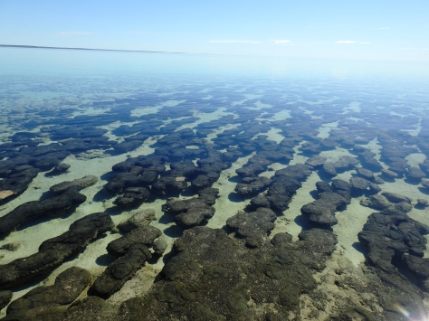
At the southern tip of Shark Bay is the Hamelin Pool Stromatolites. These stromatolites are formed by the layered growth of a single-celled photosynthesizing microbe. Some of the first forms of life on earth are found in stromatolites that date back 3.5 million years. This shallow area of Shark Bay has very high salinity that the stromatolites and some fish like. It’s one of the few places on earth that stromatolites still live.

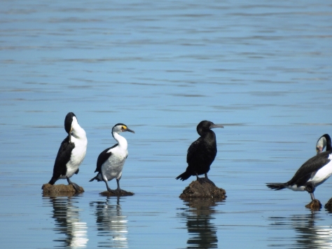
Some Australian Pied Cormorants and some Little Black Cormorants were perched on top of the stromatolites.

This Welcome Swallow was also there, enjoying to afternoon sun.

We continued up the Peron Peninsula and arrived at Denham, a town of around 800 folks, named after the English Navy captain that charted Shark Bay in 1858.

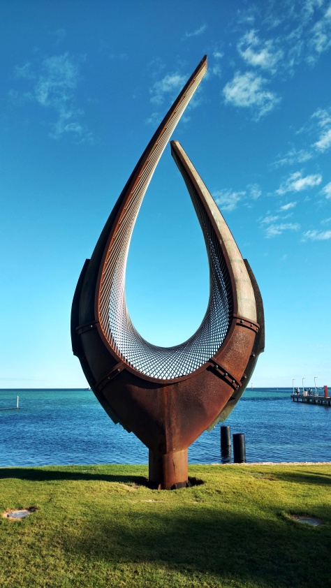
We saw this metal sculpture in town, and I was intrigued with the look the straight rods created along the curved surface. I may have to play with something like this for a future project.

The next day was another weather day with light rain so we explored the aquarium and museum in town. The museum was very interesting, discussing the many Dutch, French and English explorers that charted western Australia. The area was also the site of many shipwrecks throughout the years. The Dutch East Indies company travelled around Sumatra to get to Singapore and the Far East. It wasn’t until 1616 that Dirk Hartog, a Dutch explorer, sailed south far enough to hit Australia and Shark Bay. The large island in the bay was named after Dirk.

With the entire day on our hands we sat and watched several videos that explained a lot of the marine studies and ship explorations that have gone on in and around Shark Bay.

The aquarium was small but interesting. It only reaffirmed that everything in Australia, and in the water nearby, is either poisonous or venomous – lol. The guide picked up the sea snake, which is extremely venomous, but do not bite people due to our size. They are extremely curious and attempted swim out to say hello to all of us around the tank. Its amazing how quick you can move when a venomous snake is coming towards you.

Another unique group of guests in the aquarium were the rockfish, that surprisingly look exactly like rocks, but react lighting fast when food is near their mouths. The also have poisonous spikes along their back if you are unfortunate enough to step on one.

On the way back to our place we saw two Emus in the bush.

The skies cleared the next day and we made our way to Monkey Mia. This place is known for its dolphins. Pods of dolphins have become accustomed to humans over many years and swim next to the beach all day long. The guides feed them daily now, but only the females and only in the morning as a tourist item. The males can get too aggressive and they want the dolphins to get most of their food from the sea.

We did some hikes through the dunes and came out along a secluded beach.

Shortly after we got to the water’s edge a mother dolphin and her calf swam up to us and effectively escorted us back the mile or so down the beach back to the main tourist area. We have never “walked” with a dolphin before and it was a truly unique experience. The mother would look up from time to time to see that we were still there with her while the little calf just frolicked over and around the mom the entire time.

We had a nice lunch on the beach there.

One of the most picturesque places in Shark Bay is the François Peron National Park. It’s only accessible by 4-wheel drive due to the sandy roads, but we decided to see it from the air. We had scheduled a flight for the morning, but the commercial flight schedule was thrown off due to the weather the previous day. We rebooked to the afternoon.

Upon arriving at the airport, a runway with a check-in shack, there was just a little old lady sitting there. Eve has wintered in Denham for many years but had never seen the national park. Since we were only two, she was able to book on our flight to fill the Cessna. The plane arrived a short time later with a tour group and the pilot said the clouds over the park were getting bad and we could reschedule for the next morning if we wanted, so we did.

We ended up going to Eve’s house for some tea and spent the afternoon with her. She was 85 years old, an English citizen born in Rhodesia, now known as Zimbabwe. She lived there for 30 years before emigrating to New Zealand with her husband after the regime change. She lived in New Zealand for 30 years and moved to Australia with her husband and kids and has been there for the last 25 years. She wasn’t sure what country she was a citizen of anymore but said it really didn’t matter since she wouldn’t be traveling anytime soon – lol.

We made plans to meet again in the morning for our flight over François Peron National Park.

Kalbarri

Over the 35 days of our Western Australia travels we covered over 3,600 miles, or just over 100 miles a day. We would typically travel one day and spend the next day or two exploring the new area. Therefore, our travel days were about 3 to 4 hours on the road as we made our way to a new location.

As we travelled north from Cervantes, we passed through Greenough at about lunchtime and stopped for a bite at a now deserted settlement in the middle of sheep country. As we were to find out more about the weather in the Kimberly area, when it rains in the summertime, it rains. After a few floods of 2 to 4 feet of water through this area the town was eventually abandoned.

The area is also known for the strong winds that come in off the coast. This tree in the sheep pasture was typical of many of trees in this area.

We arrived at our next stop, a little town of 1,500 folks called Kalbarri, located on the rocky cliffs where the Murchinson River meets the ocean.

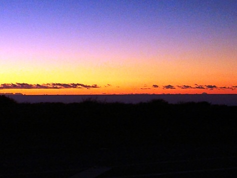
Our Airbnb was right across the road from the cliff and gave us a beautiful sunset that evening.

The next day we explored Kalbarri National Park that encompasses the Murchison River gorge. The color of the sandstone and sparse vegetation reminded both of us of areas in Arizona and Utah.

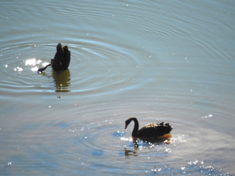
There were black swans swimming in the river below.

One of the main attractions in the park is Nature’s Window, a mini arch that overlooks the gorge.

We hiked around the area and down to the river.

Unlike Arizona and Utah, where the different colored sandstone layers are many feet thick, these layers of eroded rock were just a few inches thick and very colorful.

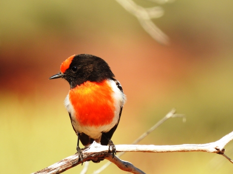
This red-capped robin sat on a branch for us so that we could get his picture.

We drove to Hawk’s Head Lookout, another picturesque gorge within the park.

I caught this great egret just taking off from a log in the river below.

Across the river we saw kangaroos feeding on the grass.

There was also a Rock-Wallaby in the rock outcroppings along the gorge wall. They are monitoring their movements there and this one had a radio collar on for that purpose.

We made our way back into town and stopped at the lookouts along the cliffs. We caught this Willie Wagtail resting on the sign.

The coastline looked like one side of the Grand Canyon next to the Indian Ocean.

An Eastern Osprey was enjoying the setting sun along the coast, probably looking for dinner.

It was another beautiful sunset with the 10-foot waves rolling in far below.

The weather was getting noticeably warmer now that we had gone so far north, but we had a little further to go before we turned back to Perth.

Cervantes

This was the first leg of our Western Australia trip. To get an idea of the size of WA, let Perth, our travel hub in Western Australia, be Phoenix, Arizona. Our trip was the equivalent in distance to driving from Phoenix, Arizona to Salt Lake City, Utah and back for the first leg, flying from Phoenix over Utah and Wyoming to Missoula, Montana and then driving to the Black Hills of South Dakota and back for the second leg, and finally flying back to Phoenix, Arizona and driving across New Mexico to Big Bend National Park in Texas and back, while the entire time remaining within Western Australia. The place is huge.

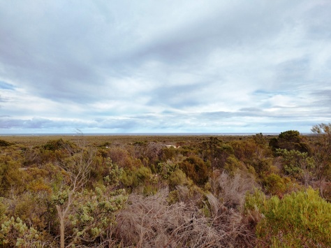
We picked a route up the coast next to the Indian Ocean. However, we soon realized that while on the map it shows the road running up the coast, the “coastal roads” are still far inland. This is what the view to the coast looks like for most of the drive. We found out later that this area explodes with wildflowers in September, their springtime. That would be something to see.

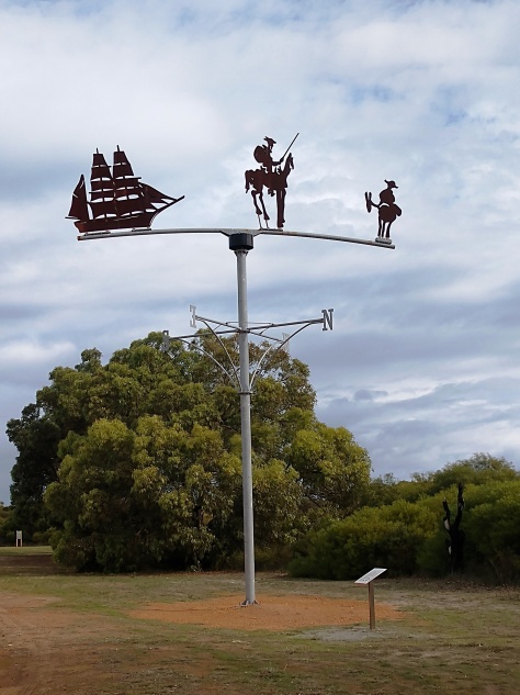
Our first stop was the town of Cervantes, a small fishing village of less than 500 folks. The town was named for a ship that wrecked nearby, but the town also knows their literature, as can be seen by the wind vane as you enter the village. I thought the metal cutouts of Picasso’s Don Quixote and Sancho Panza might be a good future project.

We stopped here to explore Nambung National Park. After picking up a 30-day Western Australia parks pass we went to check out The Pinnacles.

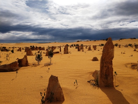
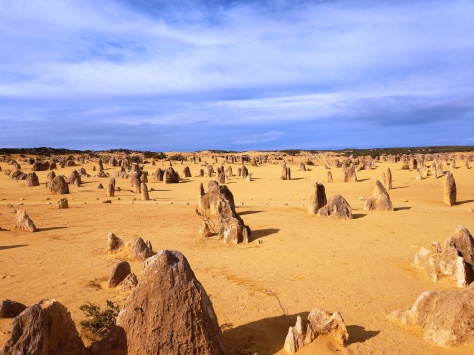
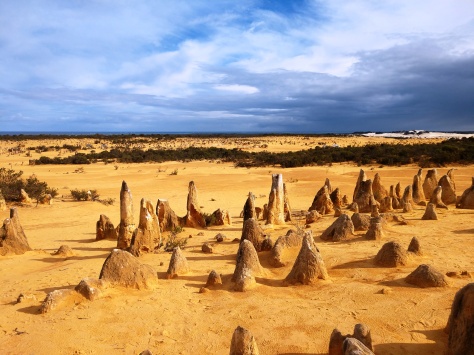
The colors there were striking. The ground is the color and consistency of corn meal, and the pinnacles vary in size from 1 foot to about 10 feet tall. They are the fossilized remains of palm tree root bundles from the forest that once existed here millions of years ago above this eroded ground.

There was both a walking and driving path through this large forest from the past. We did both.

We had a 4-wheel drive for this leg of the trip, a new diesel Ford Ranger. It had an integrated dash GPS that spoke to us in a nice Australian accent and kept us from getting too lost. Pam also reminded me to stay left as we entered and exited the highways.

It’s always fun to hike in sandy areas and see the tracks that the local wildlife leaves, from small lizards to dingoes, the wild dog that inhabits Australia. We came across a track with large feet and a center groove. At first, we were thinking a goanna or other larger lizard, but then realized it was a just a slow moving, grazing kangaroo track. Very cool.

The sky and ground colors made this entire place just amazing.

We didn’t expect to see any new birds here, but Pam spotted these two Galahs in the bush.

Even in bright light the fossilized rock color made the area truly unique.

Looking from the Pinnacles towards the sea you could see the white sand of the beach on the horizon to the upper right.

We drove to the beach next. The sign at the boundary of the National Park was along the road. “National Parks” in Western Australia are more like our national monuments; unique lands set aside to enjoy, but with little to no development or staff overseeing the place. Most of the locals have high gain CB antennas mounted to their vehicles due to the lack of phone signal and the remoteness of the area. Since Pam and I travel in areas outside of phone coverage alot this didn’t bother us, but you knew if you broke down it may be a long, long wait for another person to appear.

There were many roads that ran to the coast and each were equally beautiful.

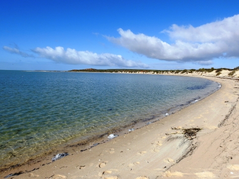
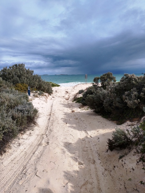
The Indian Ocean was still showing signs of the weather that was off the coast, but the beaches were all pristine.

We had dinner at the local tavern one night and tried the local catch, rock lobsters. These lobsters are like the spiny lobsters found off the Pacific coast of the US. The taste was wonderfully sweet.

We waved goodbye to Don Quixote and Sancho Panza and continued north.

Rottnest Island

This is the first of 18 blogs that will cover our recent trip to Western Australia. While we did not have our Roamer for this trip, it was still a great adventure. Our 35-day exploration of Western Australia was two separate treks with just Pam and me using Airbnbs that bookended a standard commercial tour with relatives. As a little background, the trip was initiated by Pam’s aunt, who lives in Canberra and always wanted to visit the Kimberly region of Western Australia. We flew to Perth a couple of weeks before the commercial tour was to begin, rented a car and headed up the west coast to start the first trek.

Perth is near the southwest corner of Australia, and the capital of Western Australia. It is a beautiful city of about 2 million folks, where the total population of Western Australia is roughly 3 million and the land area about 9 times the state of Arizona. To give some perspective on Perth’s location, if you drilled through the center of the earth from Perth you would come out near Bermuda. It was the middle of the winter there, but due to its location the weather was very nice.

We made the trip to Perth in one day, flying from Phoenix to LA, then to Brisbane and finally arriving in Perth after crossing nine time zones and the international date line. After checking into our hotel, we found out that our ferry to take us to Rottnest Island the next afternoon was cancelled due to an incoming winter storm. Luckily, we were able to re-book on the early morning ferry, which wasn’t a problem since we were wide awake at 3am due to the time shift. The storm was not as bad as predicted, but we did have about 10-foot seas on the way over. Pam, who does not do well with motion sickness, took some ginger pills and made it over ok. A couple of other folks on the ferry did not.

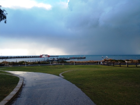
Looking towards the dock on Rottnest Island, the storm moved over with just light, intermittent rain all day. The nice thing about being from the desert is that a cloudy, rainy day is actually a nice change.

Rottnest Island is about 7 square miles in area, located just 10 miles off the mainland and is now a popular tourist stop due to its beautiful beaches and the Quokka, the friendly little marsupial that is now famous due to selfies. The Dutch fist discovered the island nearly 400 years ago and the explorers mistook the quokka for rats, hence Rottnest Island, or Rat Nest Island in Dutch.

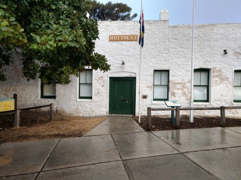
The deserted island was used as a prison for Aboriginals in the early days of Australia and even had a reform school for wayward boys. It was also the staging area for tall ships at the turn of the previous century awaiting approval to enter Fremantle, the port city of Perth. Now most of the government buildings have been converted to restaurants, galleries and hotels.

Much of the island is unpopulated, but around the small town near the docks the quokkas are everywhere. As we were to figure out quickly, to speak Australian you substitute the letter A for nearly every vowel and replace any word ending in R with an A. Therefore, quokka is pronounced as (kwa-ka) and water is (watta). Even though it was English, it took me awhile to get used to the inflection and cadence. At one point on the island we ran into an Australian couple talking to a Scottish couple. While both were speaking English, one with all vowels and the other with all consonants, I had no idea what was said – lol.

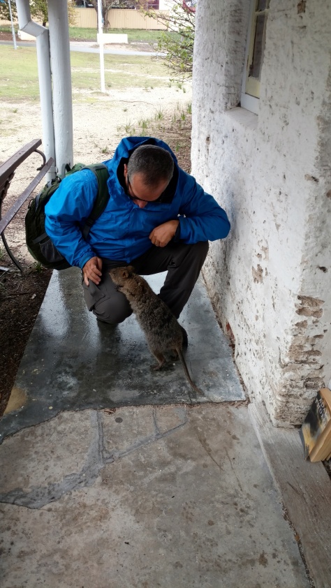
As we walked around town, we came across many quokkas. They are not afraid of people and are very cute and curious. Here one came right up to see what I possibly had for it to eat.

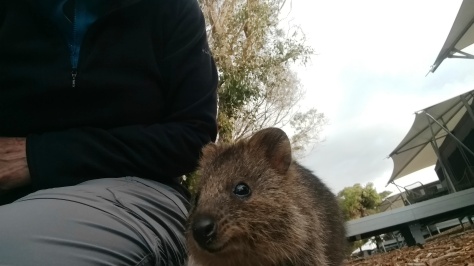
Pam tried to get a selfie with another quokka. If you just sit stationary, they will come to you. However, they may not do exactly what you want for a good picture.

The camera angle was a little off for a selfie, but they are cute little buggers. You are not supposed to feed them or pick them up since they are wild. It was mating season and one tourist got nipped on his head trying too hard to get the perfect selfie.

One of the first purchases we made in Australia was a book on the Birds of Western Australia to keep track of the different birds we saw. We caught this peacock catching some sun between rain showers on our walk around town, which was ironic since it was the only bird we saw not in the bird book (introduced). It was still a nice-looking bird.

Rather than stay in a condo or hotel on the island we booked a place at an “Eco-Sustainable Resort”, otherwise known as a high-end tent near the beach.

It was our introduction to “glamping” as its known, where our tent had electricity and a full bath. You had a door you could lock, but then you could just unzip the walls and walk through too – lol. Being winter and a little stormy the tent canvas rippled with the wind and it was chilly at night but nice for sleeping.

Since most of the places we booked on this trip were off the beaten path we had many evening meals of light snacks and a good bottle of Western Australian wine. Food and gas were more expensive, but the exchange rate was favorable, 70 cents US to a dollar Australian. Most restaurant food was reminiscent of British fare, but we did find the fish excellent.

The storm passed by sunset and the next day dawned with beautiful blue skies. We bought a daily bus pass that allowed us to jump on and off the bus that circled the island all day. We took it out to the furthest point and got off to explore.

The hike back took us from rocky cliffs to beautiful beaches where most of the time we were the only ones on the trail. We spotted this white-faced heron along the cliffs, our first true Australian bird.

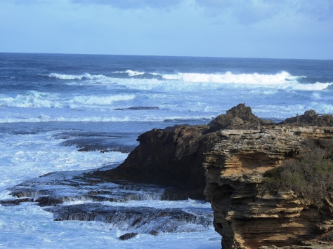
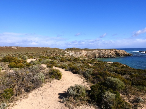
The hiking path was a nice dirt track that ran along the crest of the rocky shore.

In one cove we spotted a group of New Zealand fur seals relaxing and regulating their body temperature by raising one of their fins into the air.

Other parts of the hike dropped you onto secluded beaches. The number of mooring balls in the bay indicate that it must be packed with boats while the folks enjoy the beach on summer weekends.

We spotted this colorful Australian Shelduck in the seaweed along the beach.

Then we spotted the Australian Pelican, which is a very impressive bird at 5 to 6 feet in height. Even at a distance the bird looked huge.

The island was very colorful and must be a great getaway destination for those folks living around Perth.

You can see the skyline of downtown Perth on the horizon from the eastern tip of the island.

We stopped in the historic boat shop and spoke with the curator. In the days of the tall ships these row boats made the 10-mile crossing from Perth to the island to let the ships know who was cleared to enter the harbor and to bring the local captain aboard. Then the rowboat was either towed by the ship or they had to row back to Perth, sometimes several times a day.

When we told the curator that we were from the US he told us that he was originally from Newcastle in eastern Australia. He worked in construction and several of the older buildings in Newcastle were built using the bricks salvaged from the 1906 San Francisco earthquake that made it to Australia as ship’s ballast.

The ride back to the mainland was much smoother than the trip out and then we started north up the coast.