Sitka – Juneau

Getting to Sitka turned into a story all its own. Sitka was the capital of the 1800 Russian-American territory and the place where the transfer of power took place when Alaska was sold to the US. Therefore, it was rich with history and a place we wanted to see.

Our original ferry from Ketchikan to Sitka was cancelled so we were rerouted all the way to the end of the Bellingham route at Skagway and then back to Sitka on the return trip of the ship to Bellingham, adding two more interesting days to our ferry ride at no cost. However, on the return leg the ship developed an engine maintenance issue and was held in Juneau for repair, one stop short of Sitka. The ship was fixed, but we missed the tides so we were going to be held in Juneau for a few more hours, we thought.

By now we had gotten to know the crew pretty well so when I went to check on our departure one of the crew pulled me aside and gave me a, “now I’m not telling you what to do but….” talks. Turns out making it back to Bellingham on schedule is top priority and Sitka is way out of the way. The ship was going to be held in Juneau until the USCG could inspect the engine fix the next morning so all the stops between Juneau and Bellingham were going to be cancelled. All people and cars getting off at any of those stops were about to be booted off in Juneau.

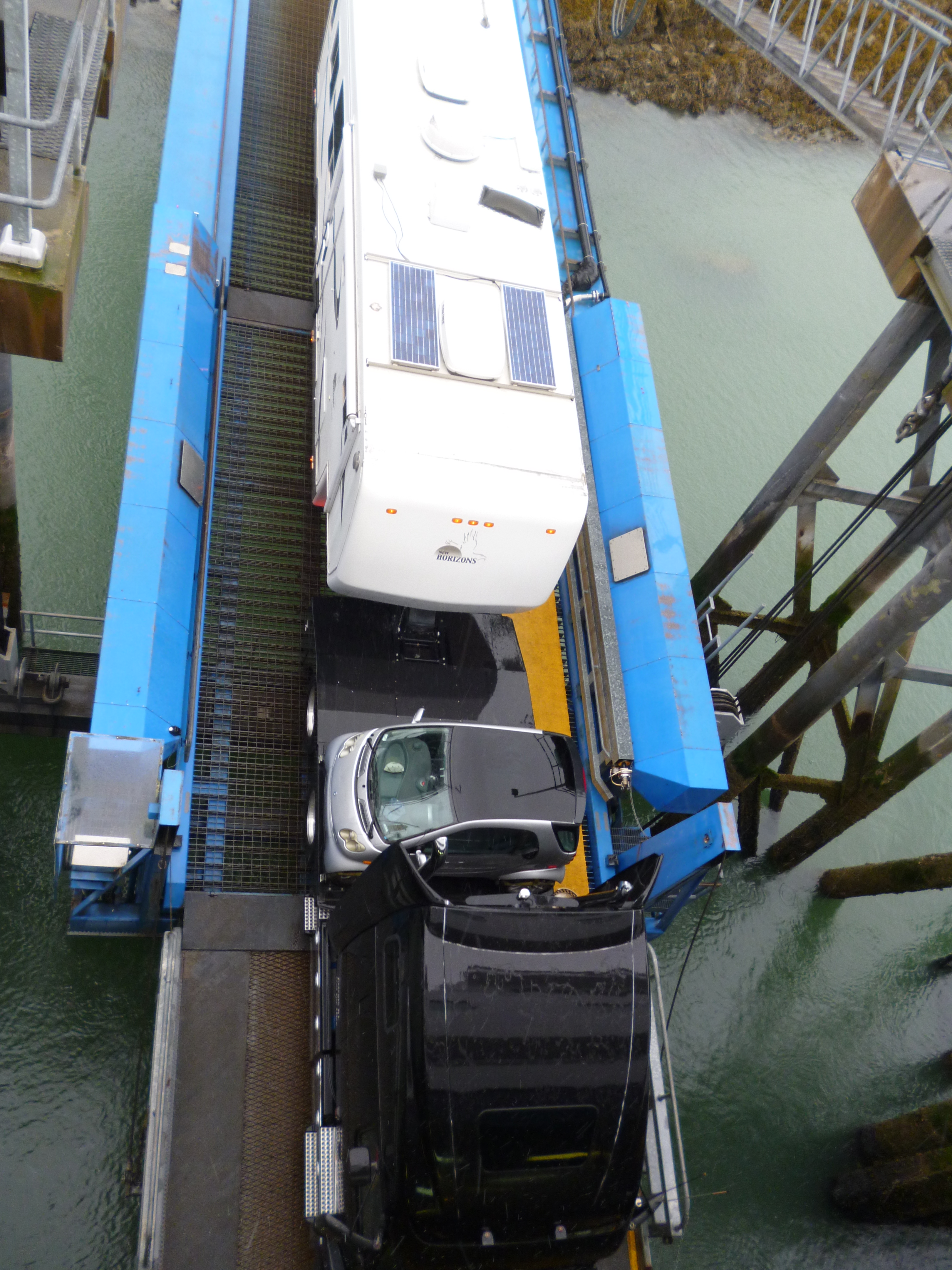
The nice heads-up talk allowed Pam and I to go ashore to the terminal and work our re-rerouted plan with the great folks at the counter way before others even knew what was coming. Rebooking walk-on passengers is easy and even folks with cars not too bad, but getting a 26 foot camper rescheduled is not something that can be done easily, but it worked. Because we have no defined timeline for our trip we slid our three remaining ferry routes by a day and left the next morning on an express ferry to Sitka, with a free meal on the ship that night and reimbursed for the room from the Juneau to Sitka leg.

P1040942

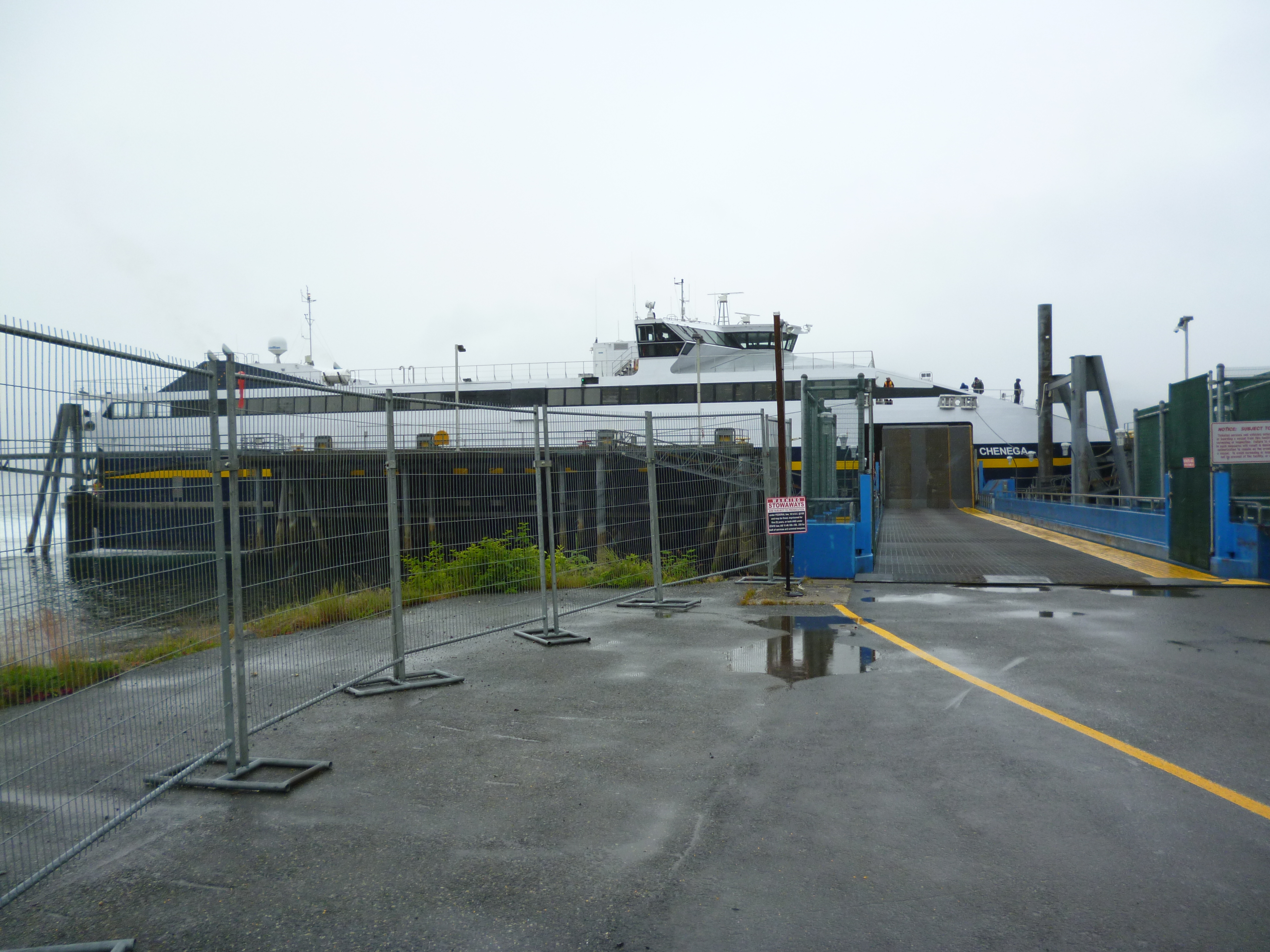
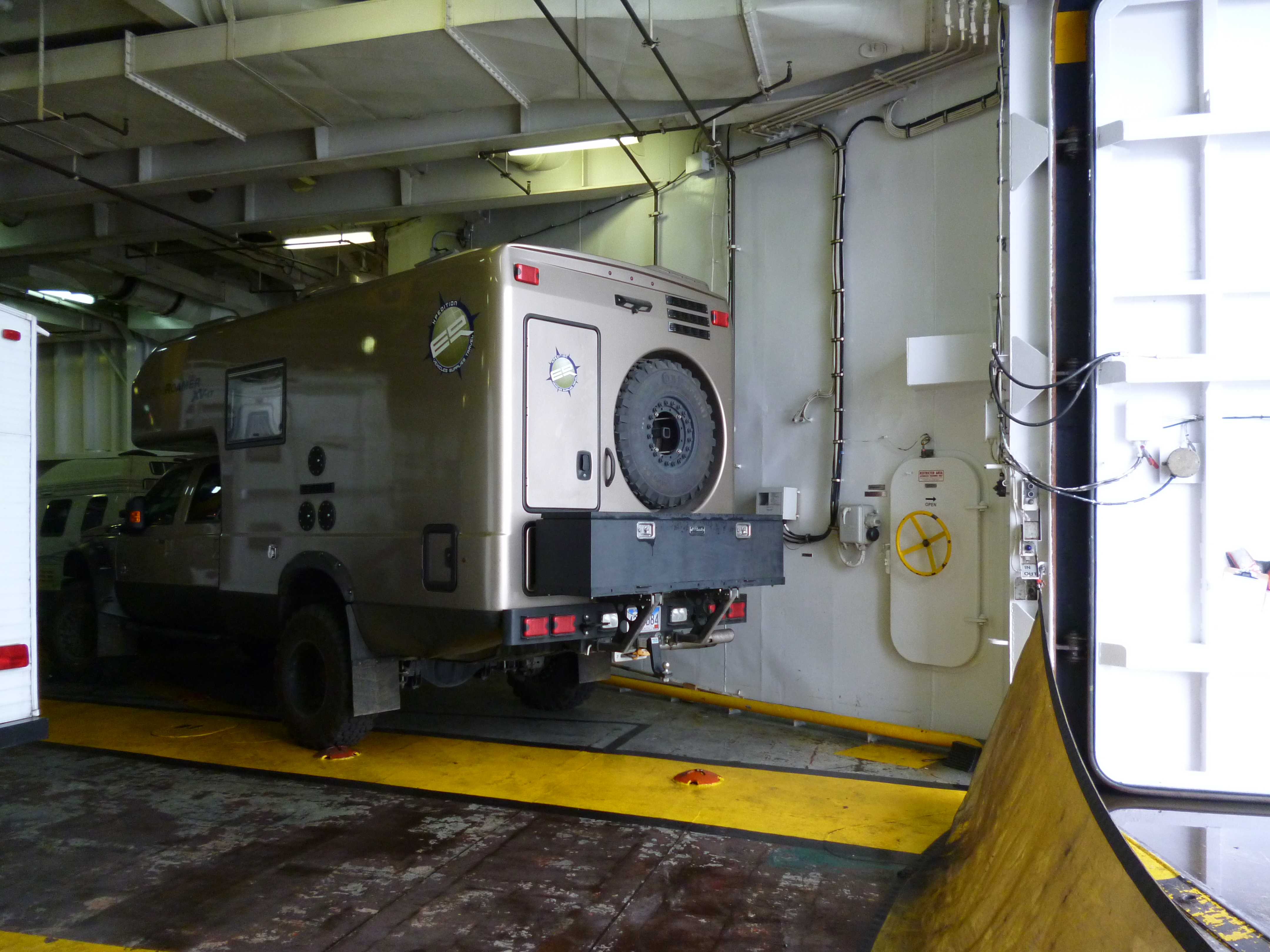
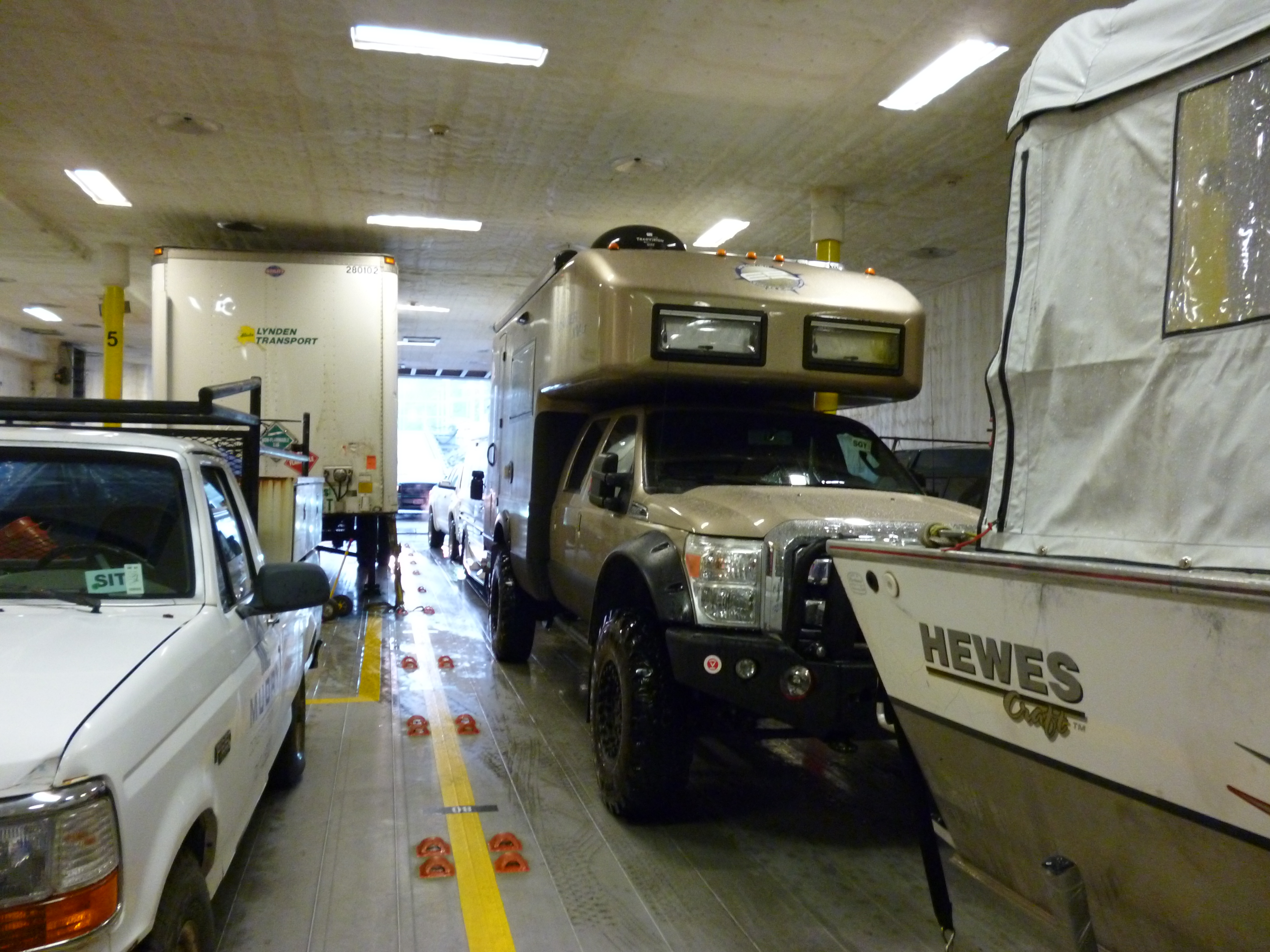
The real bonus of the change is that the M/V Chenega makes the trip from Juneau to Sitka in 5 hours instead of the M/V Columbia time of 10 hours. We loaded the Roamer the next morning onto the ship and left the M/V Columbia and Juneau behind at very high speed.

P1040835

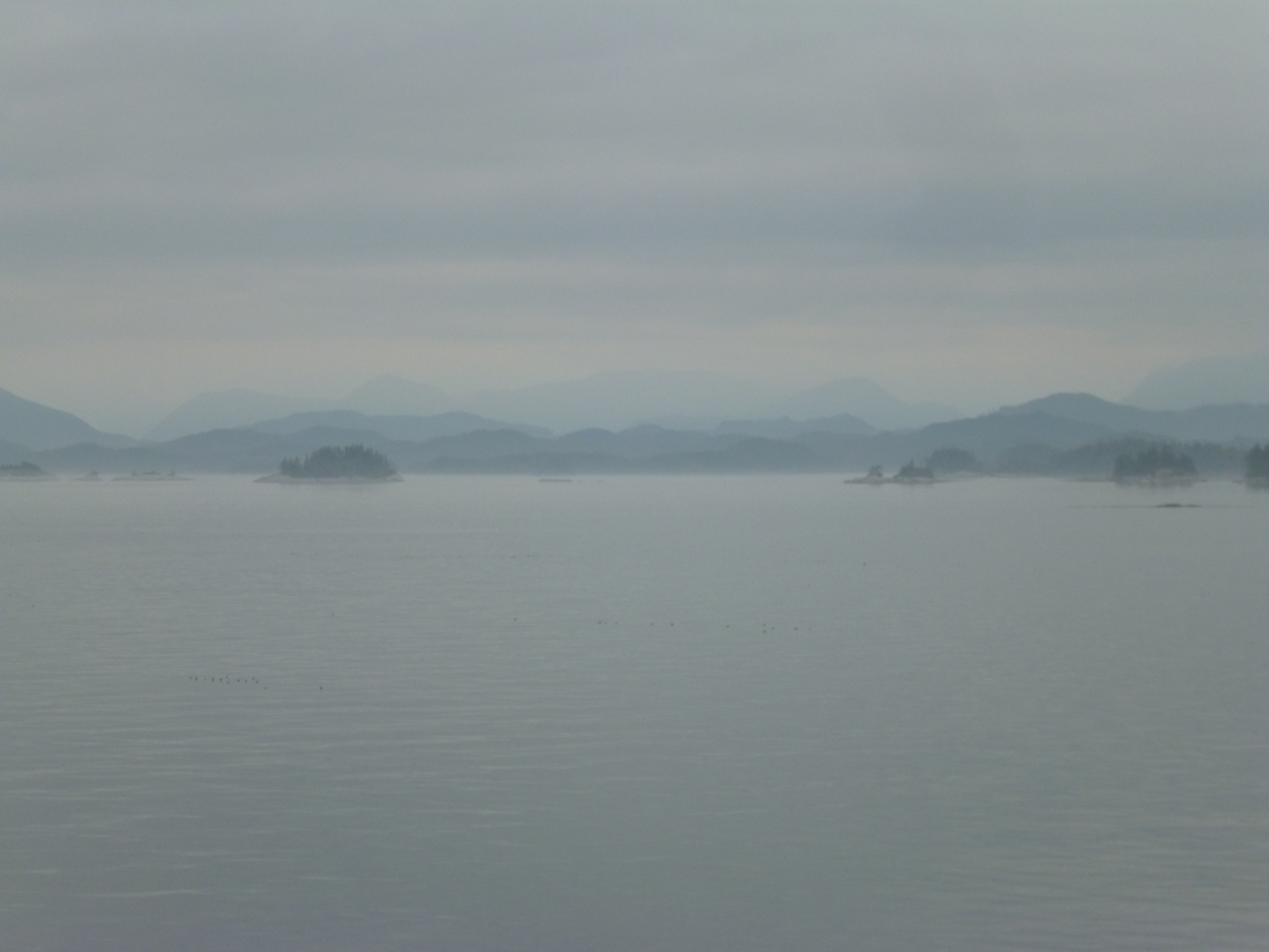
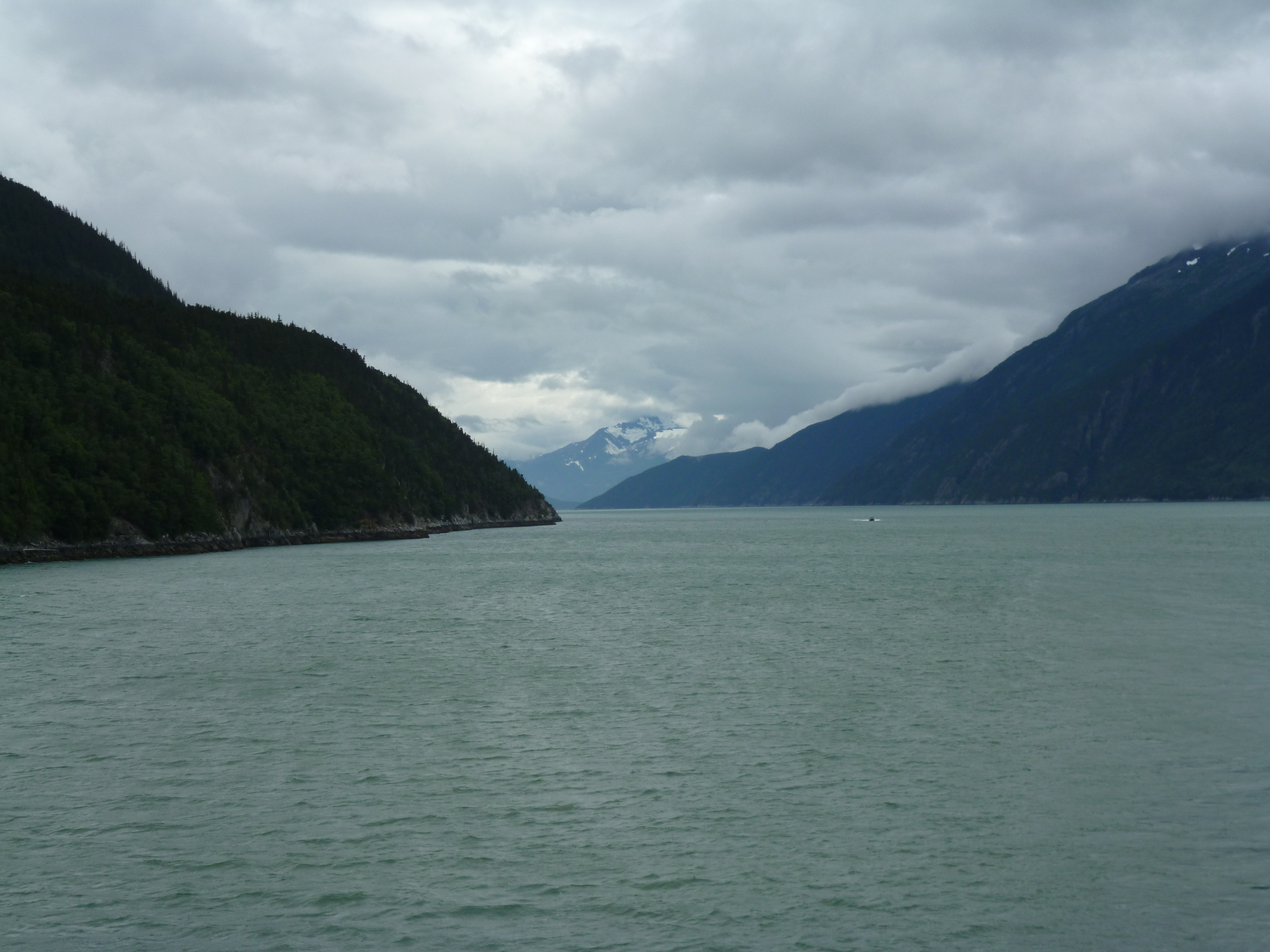
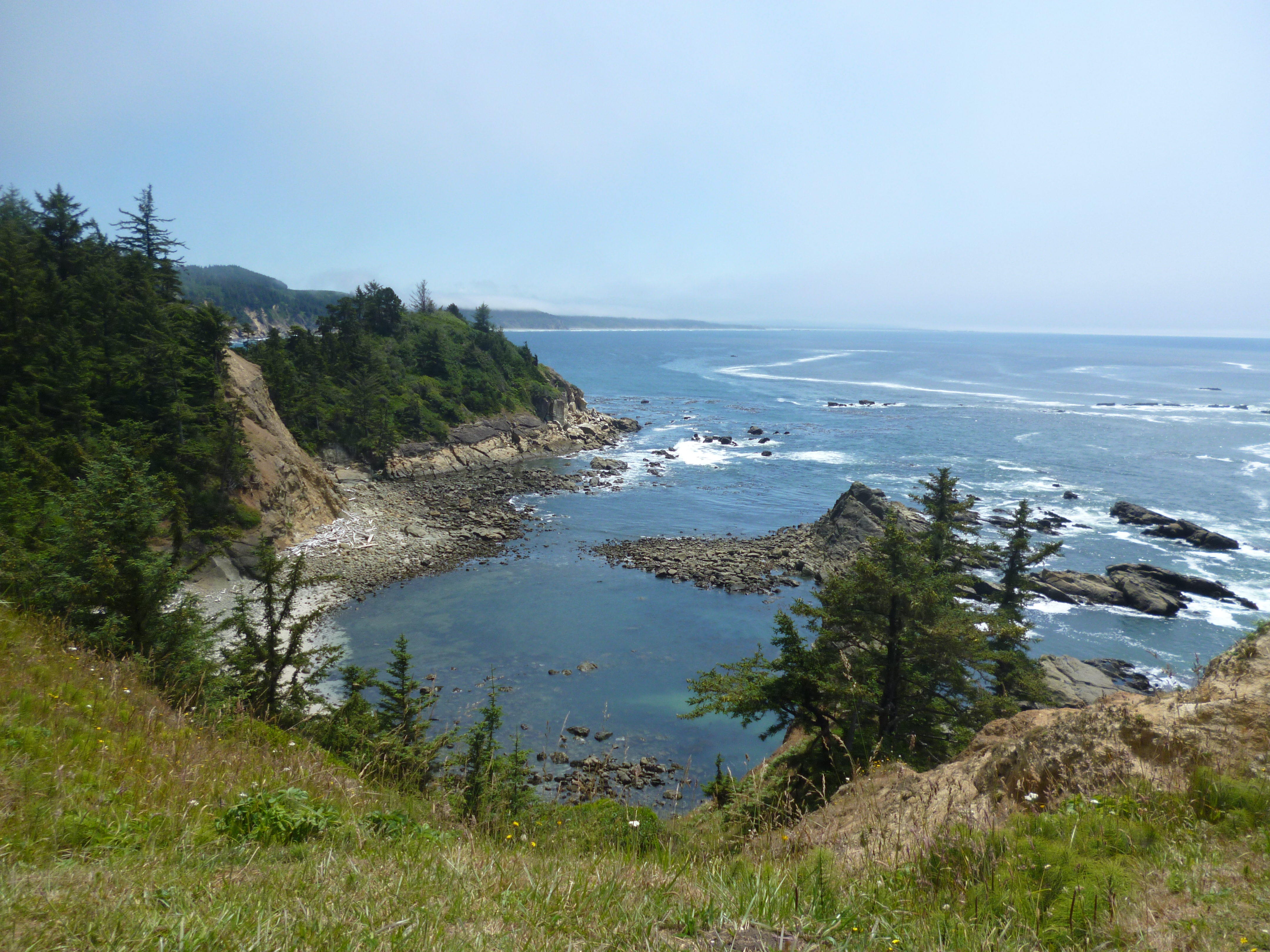
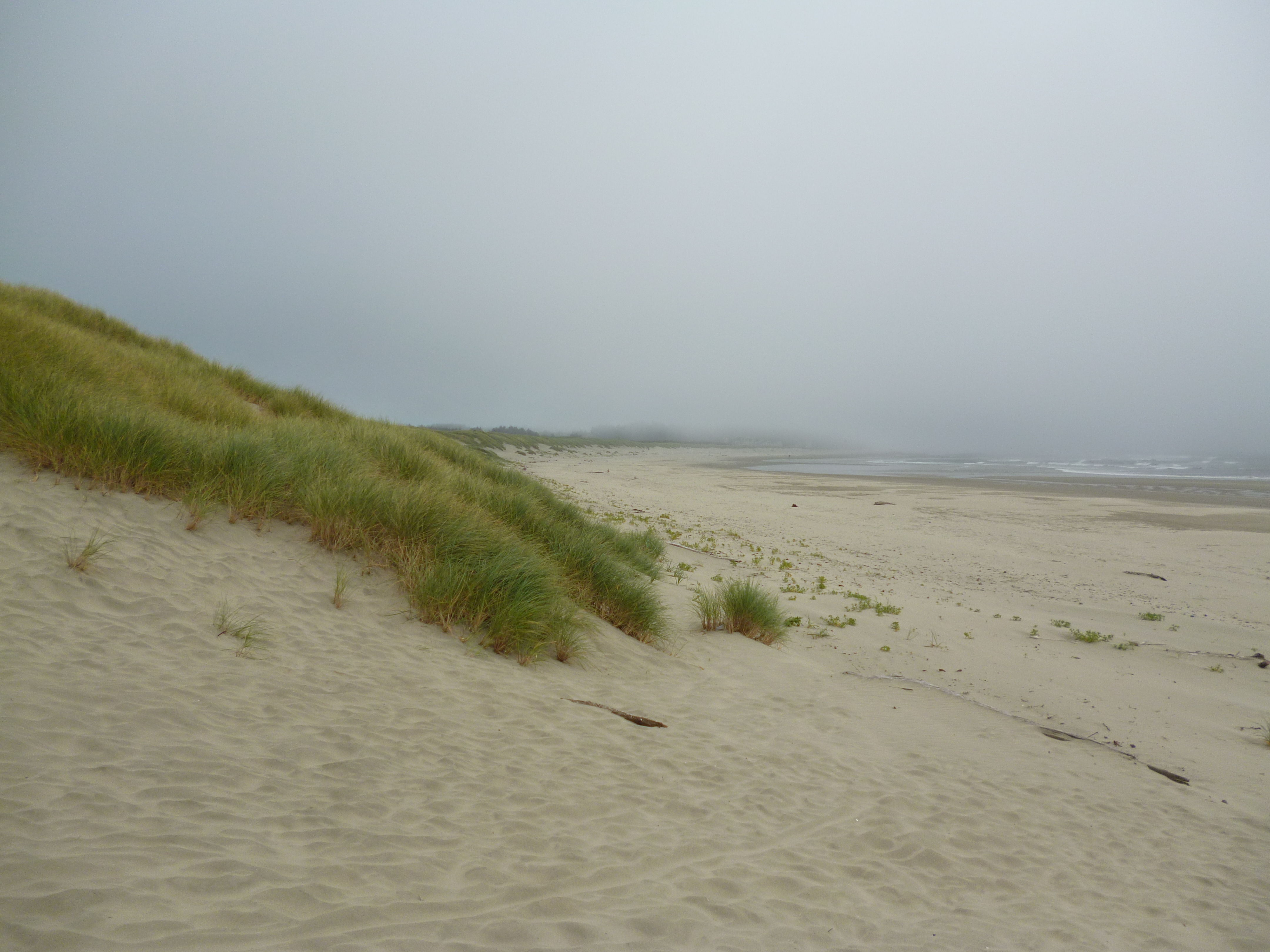
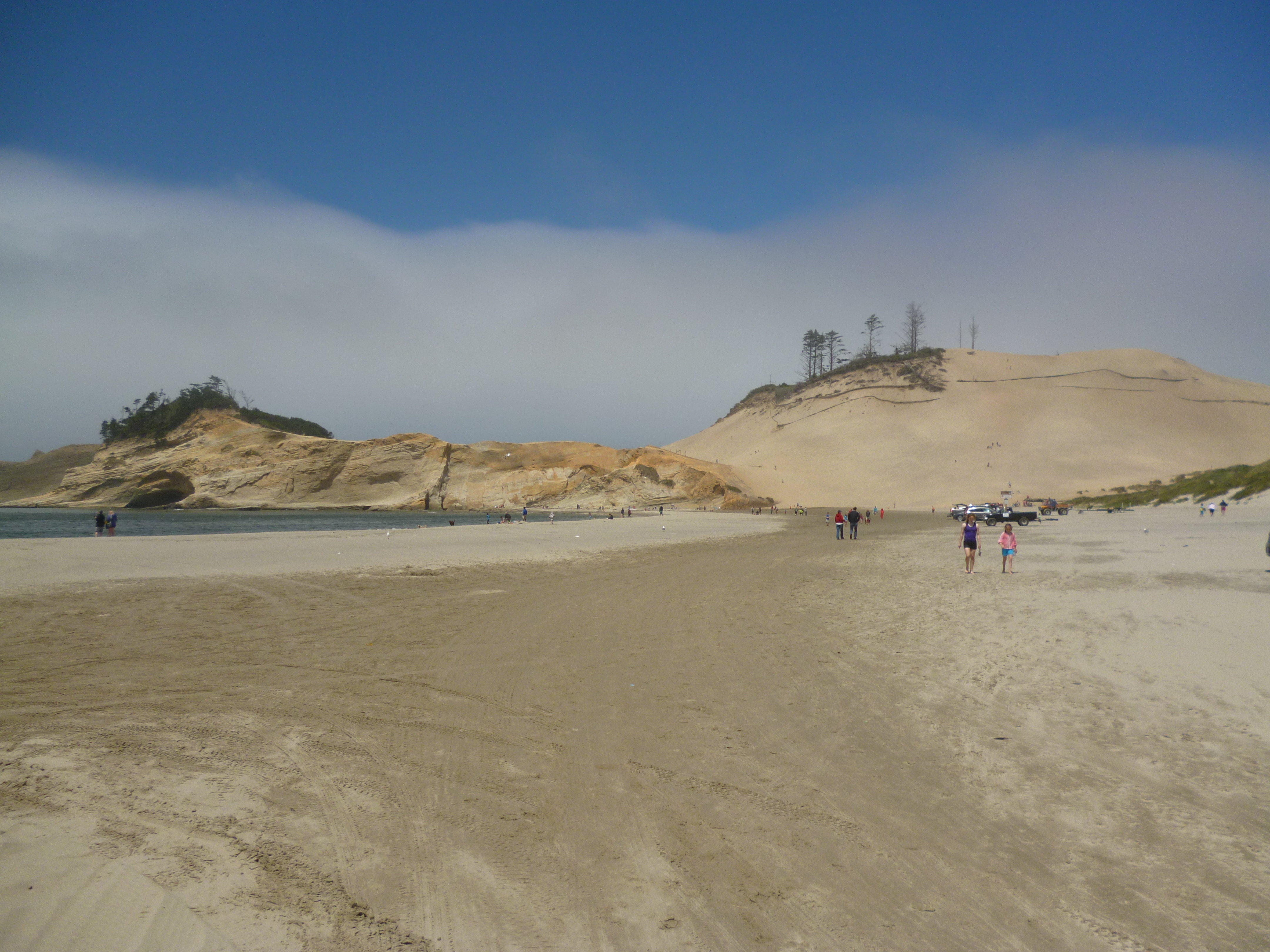
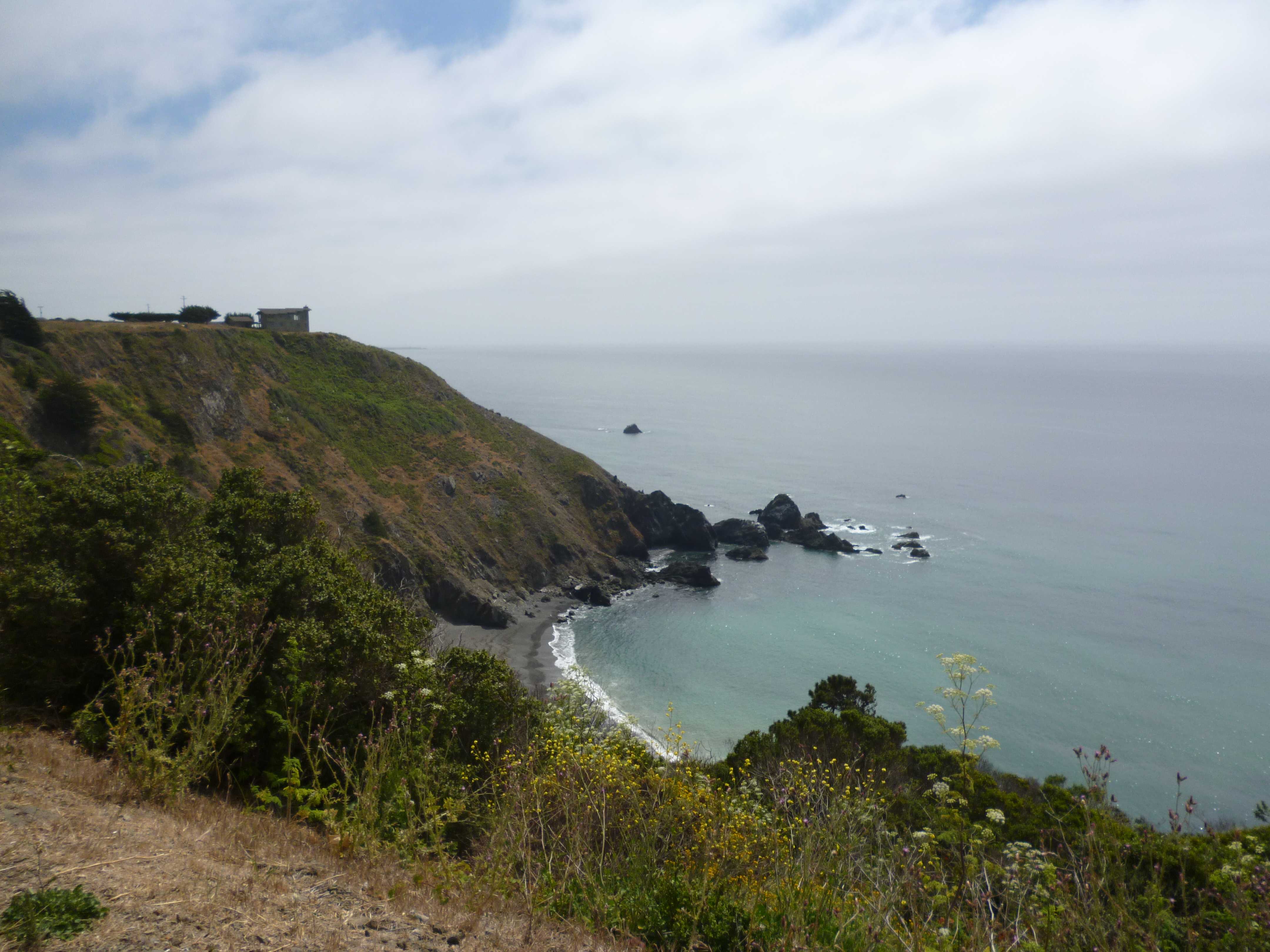
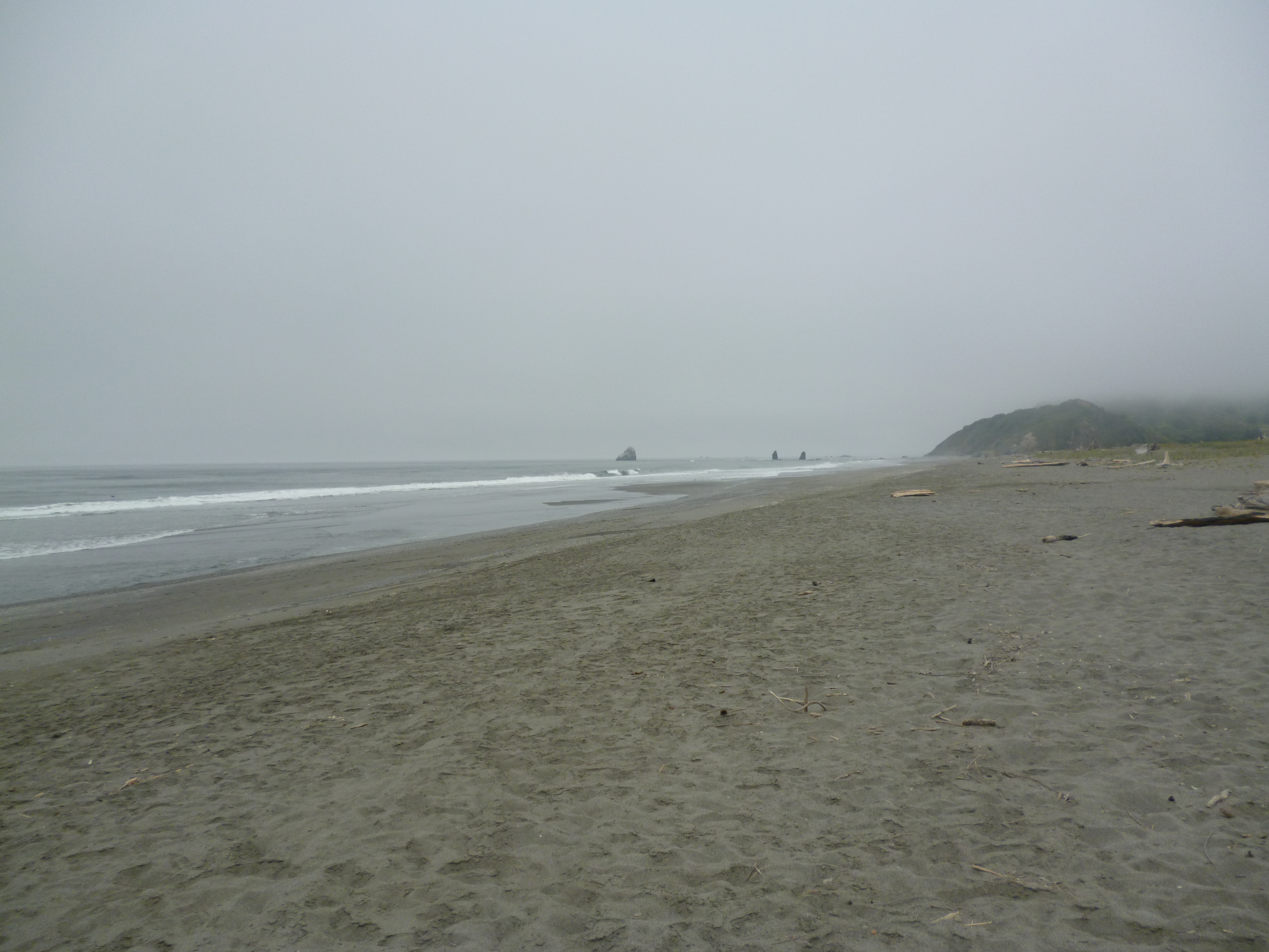
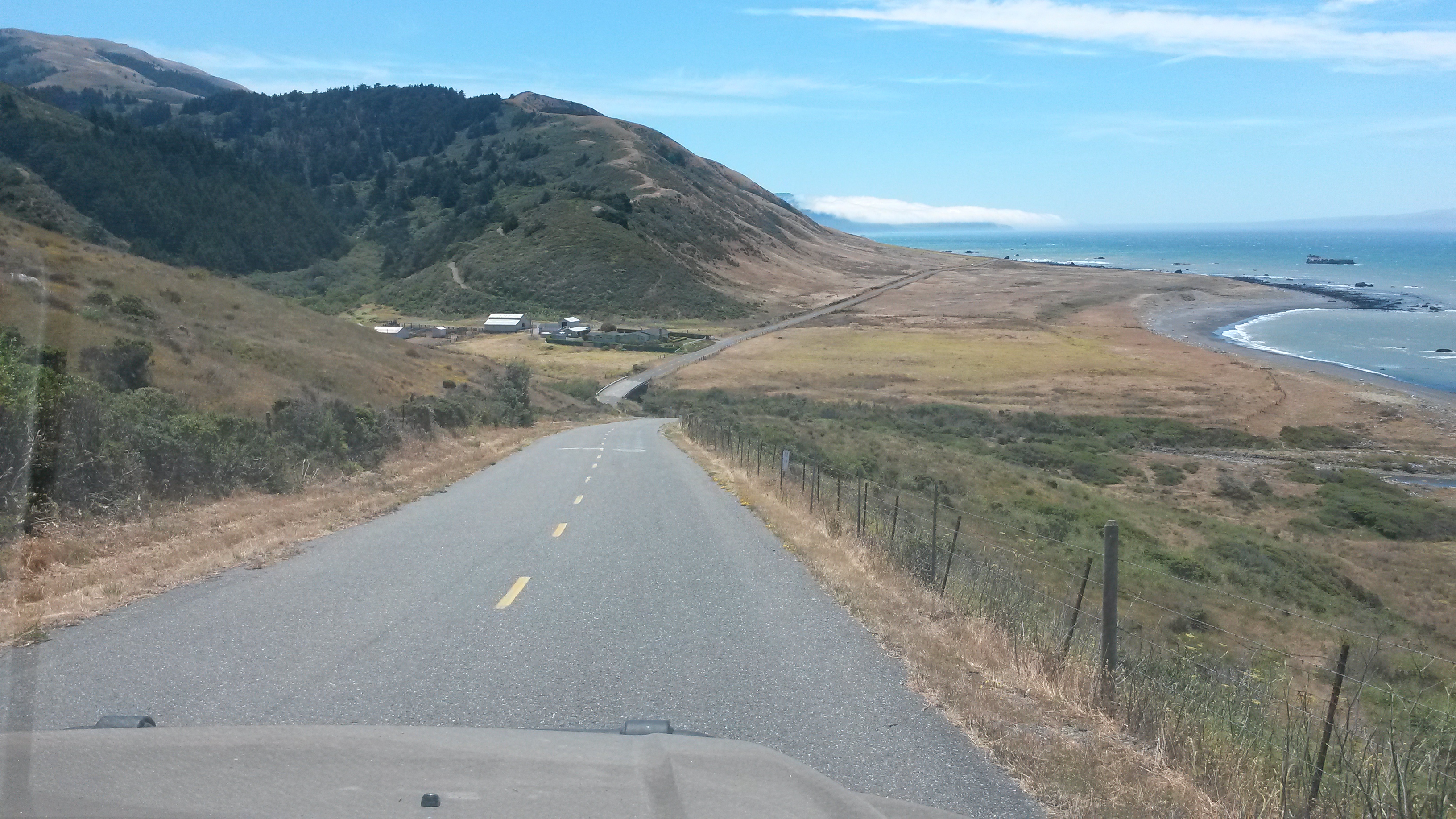
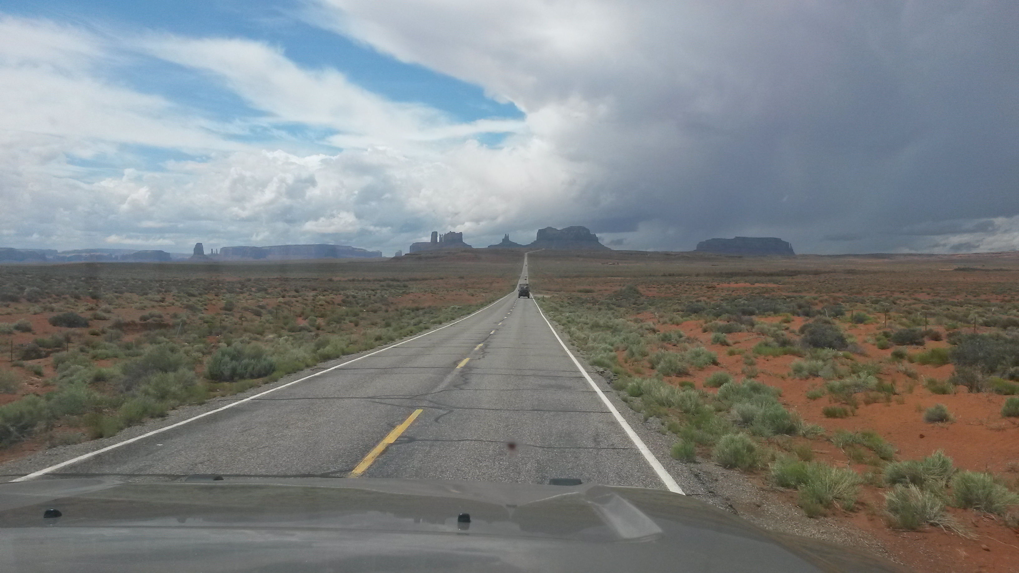
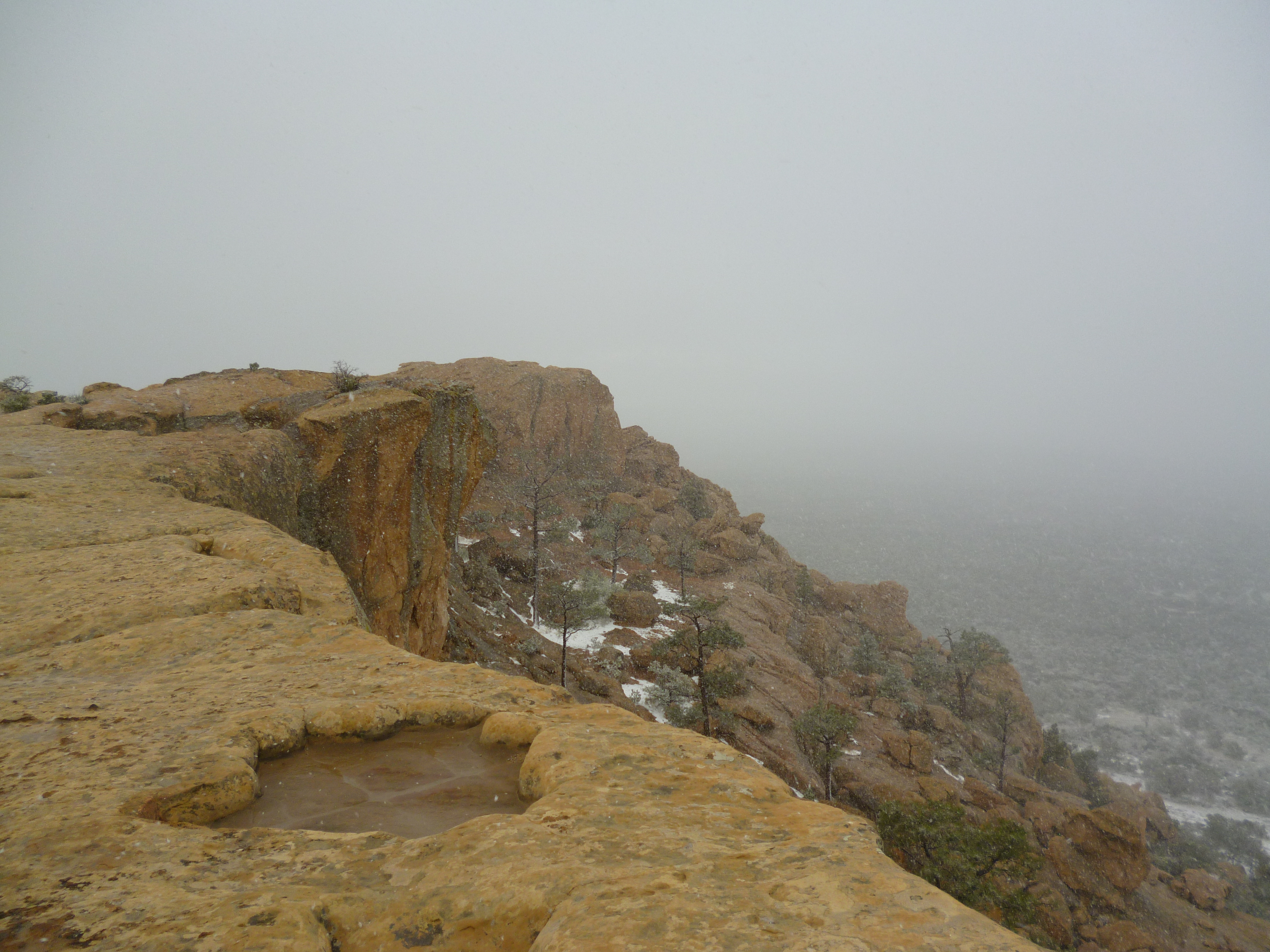
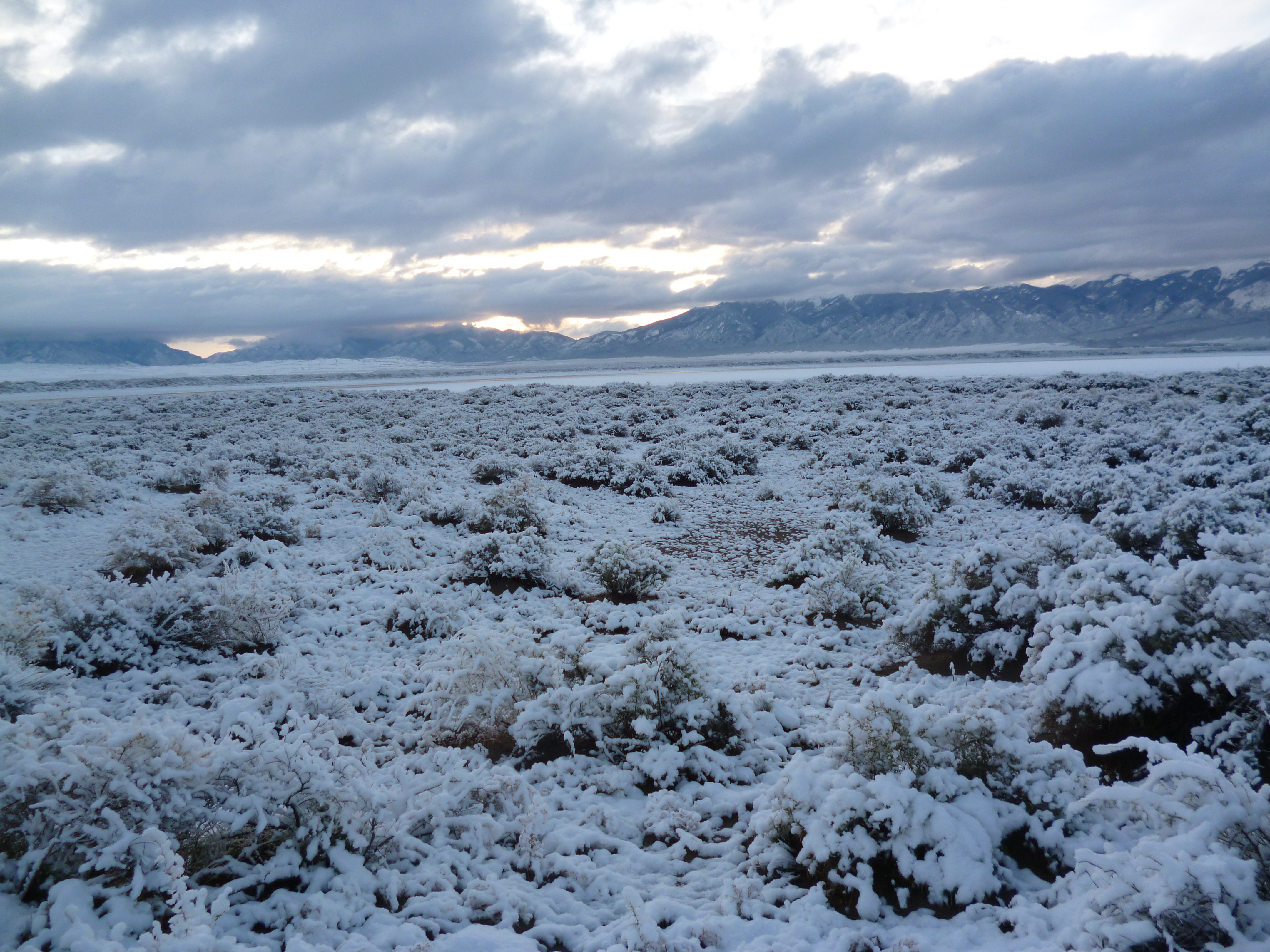
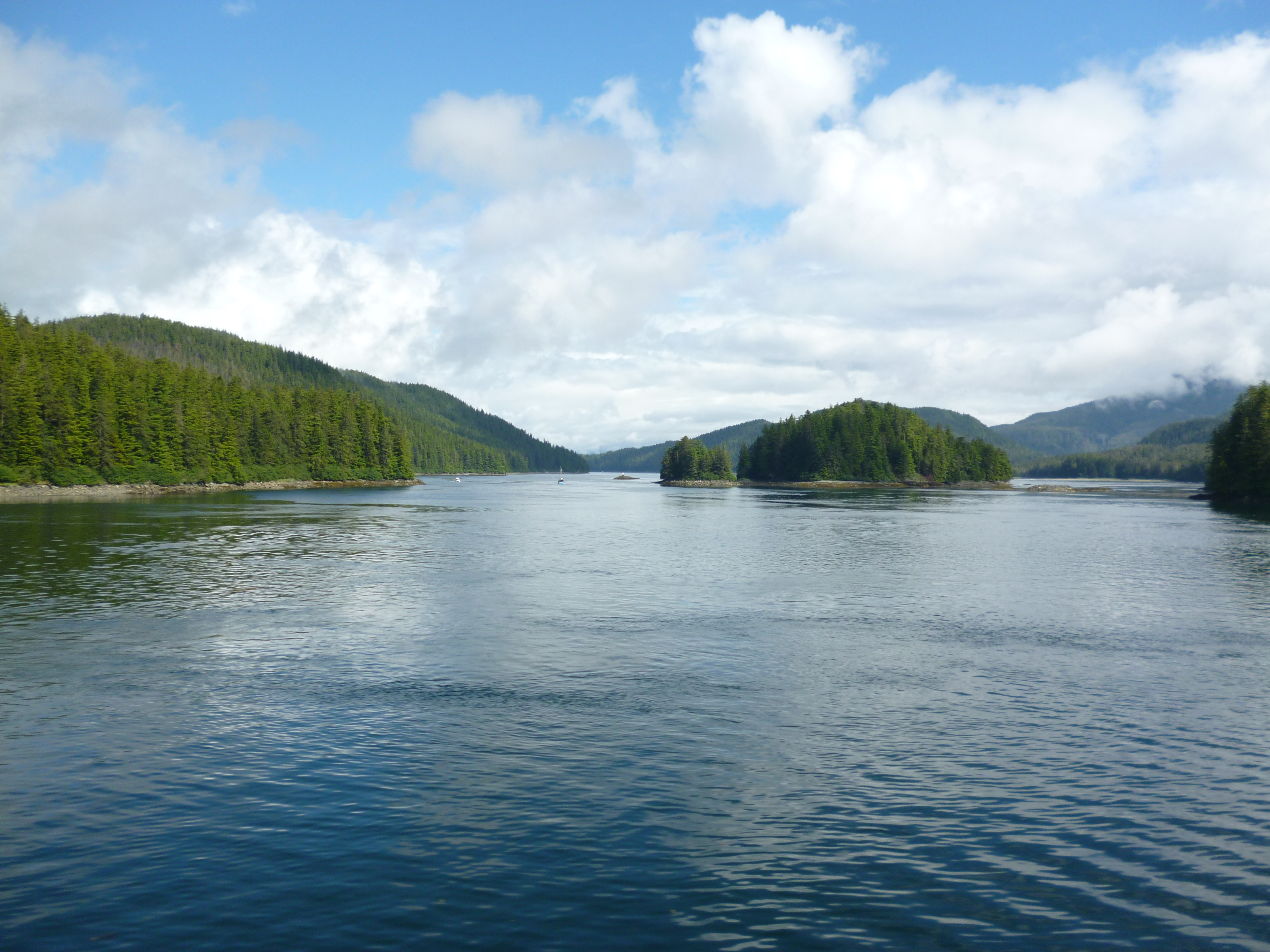
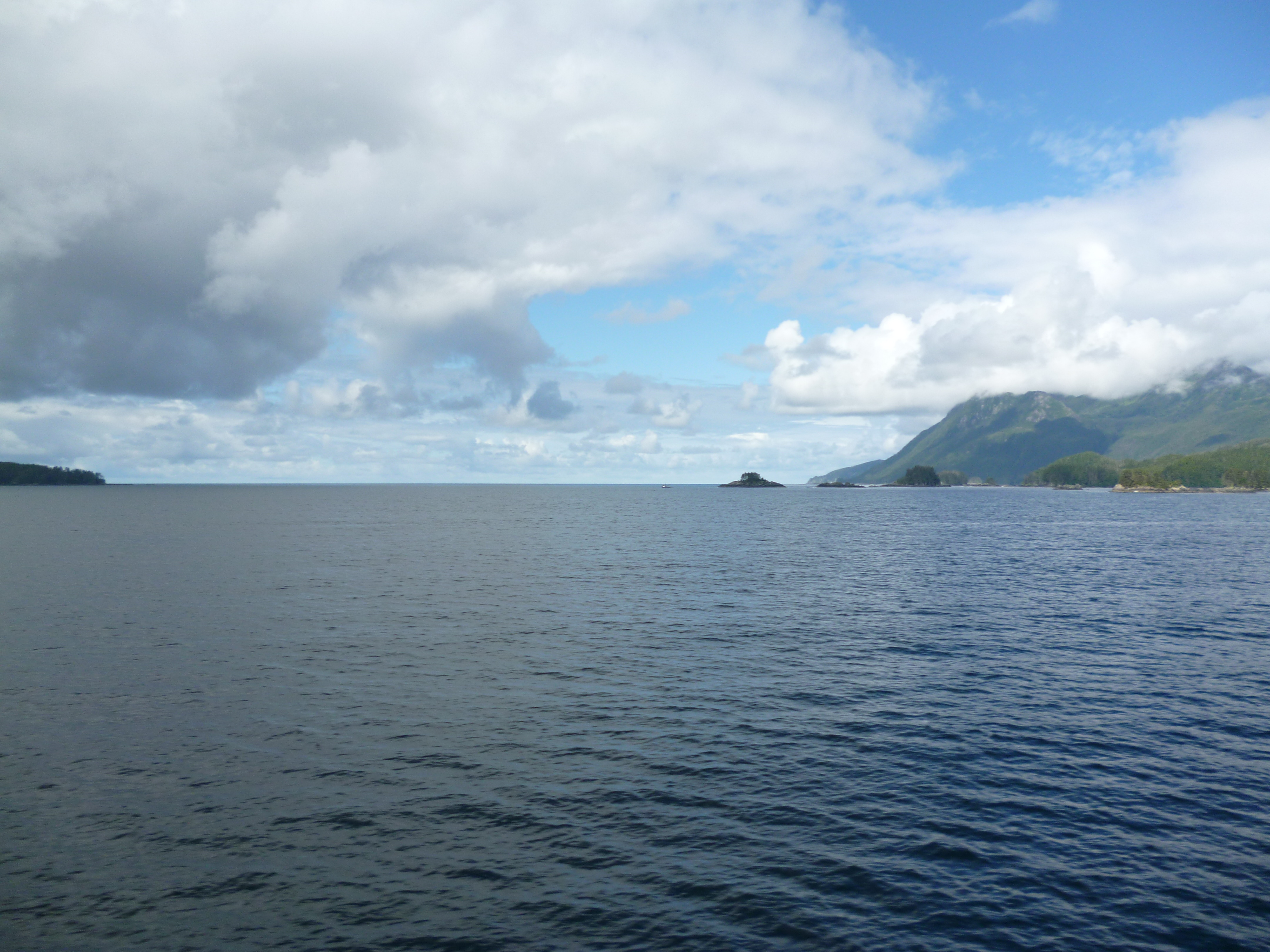
The trip to Sitka was beautiful. The sun finally broke through the clouds and the route cuts through some relatively small passages between the forest-covered islands to arrive at Sitka without having to travel any open ocean segments. Sitka is located on the Pacific Ocean side of the Baranof Island.

P1040841

P1040847

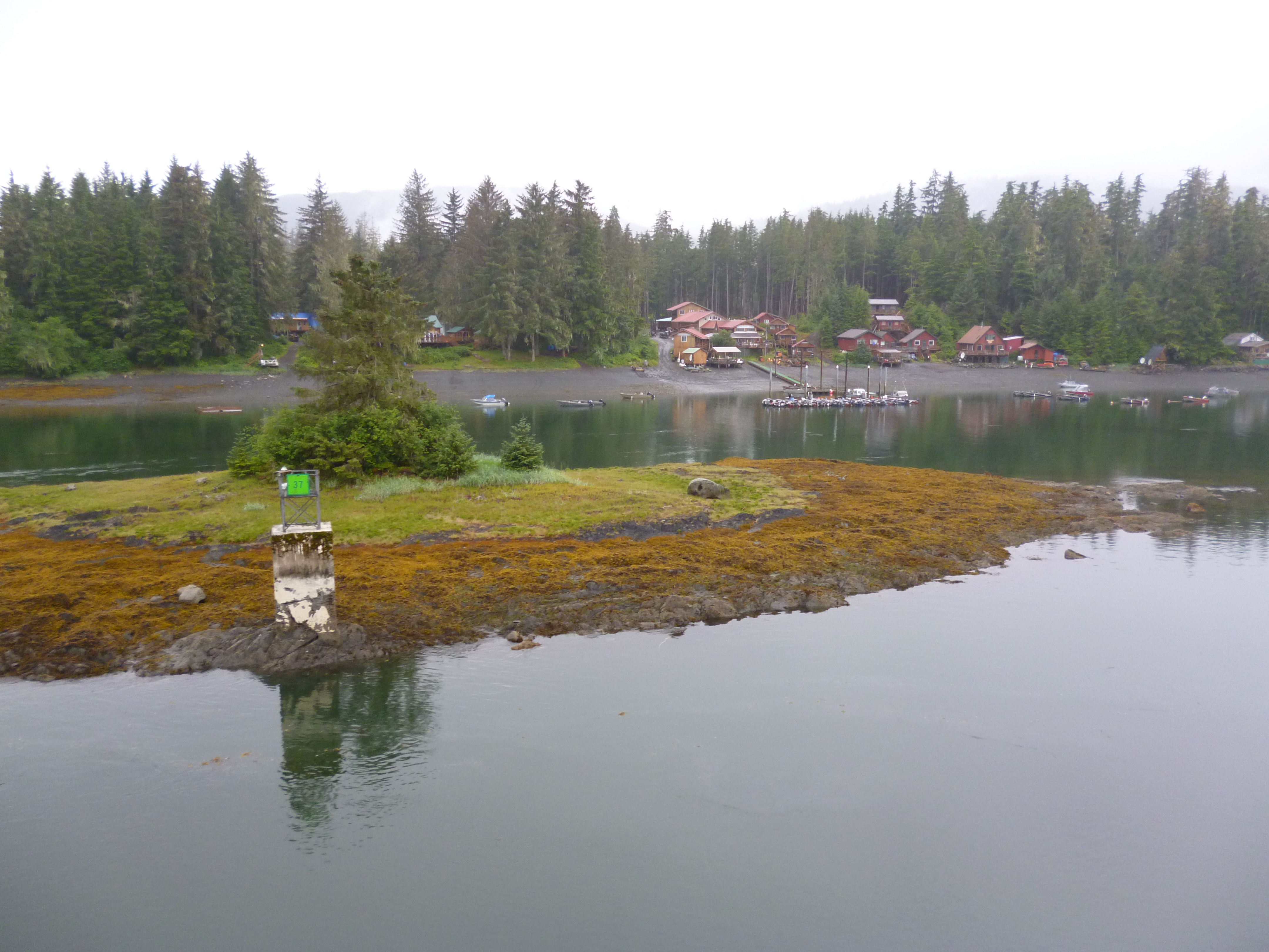
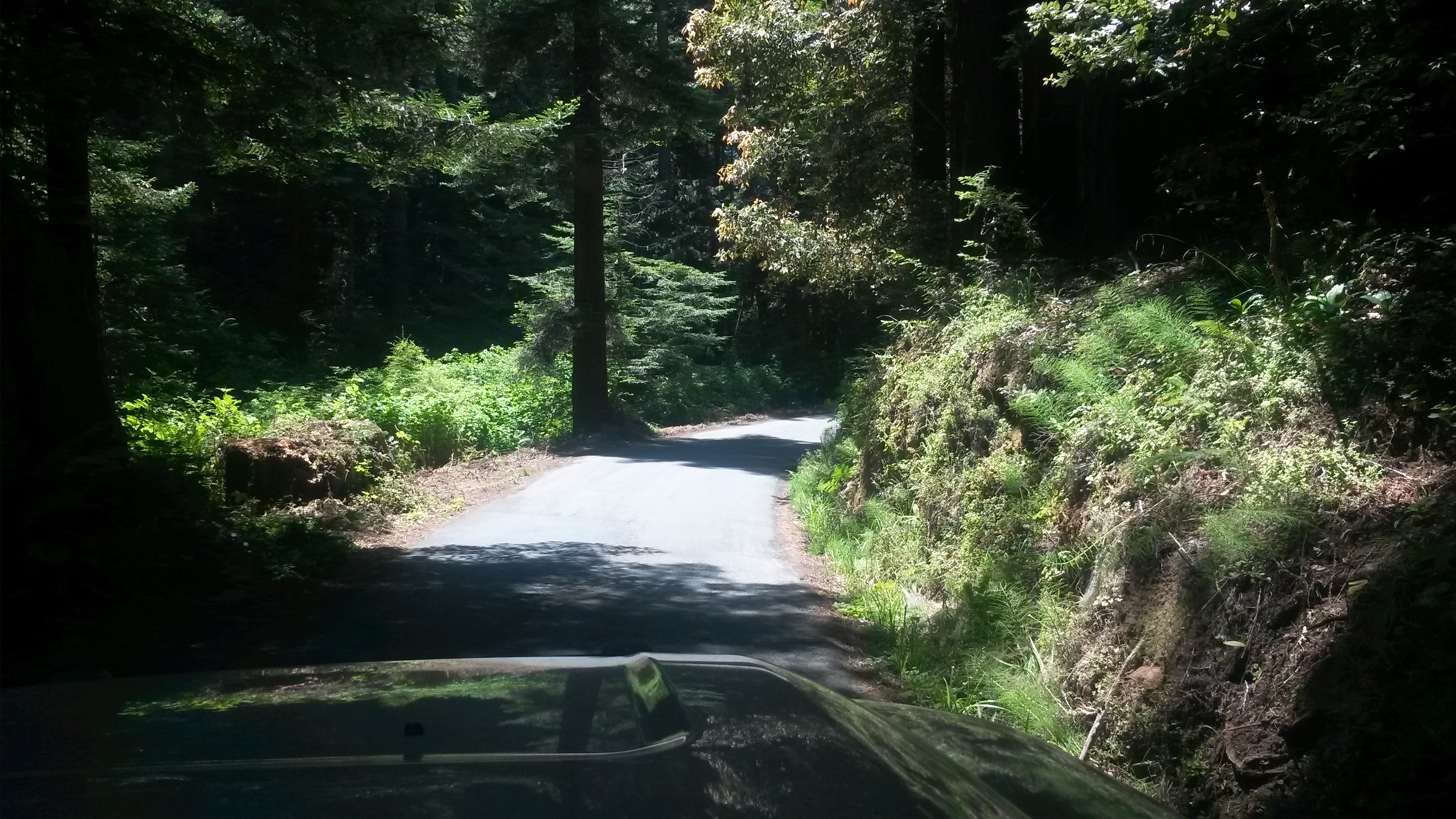
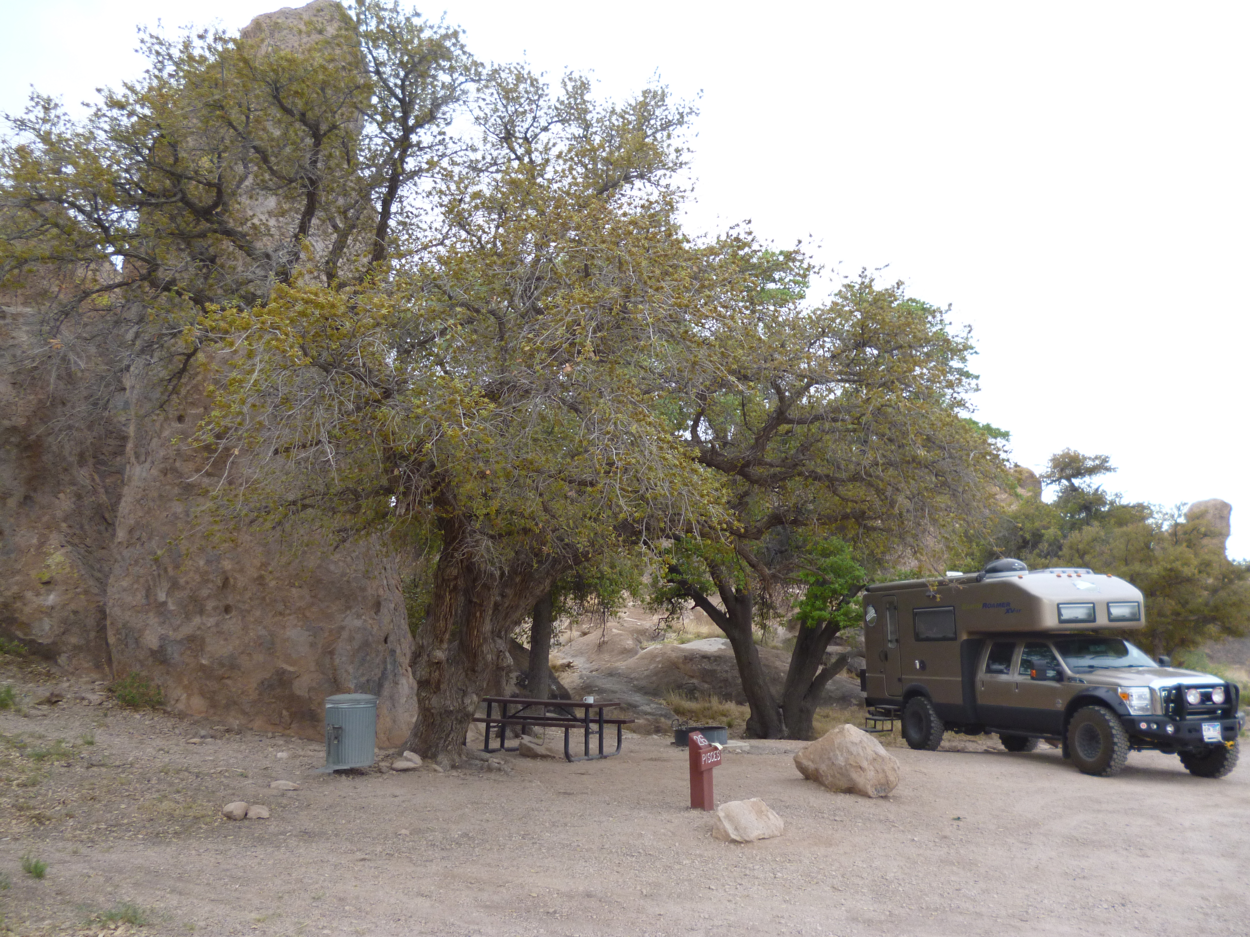
There are not many miles of paved roads in Sitka and our campground was literally at the end of the road.

P1040887

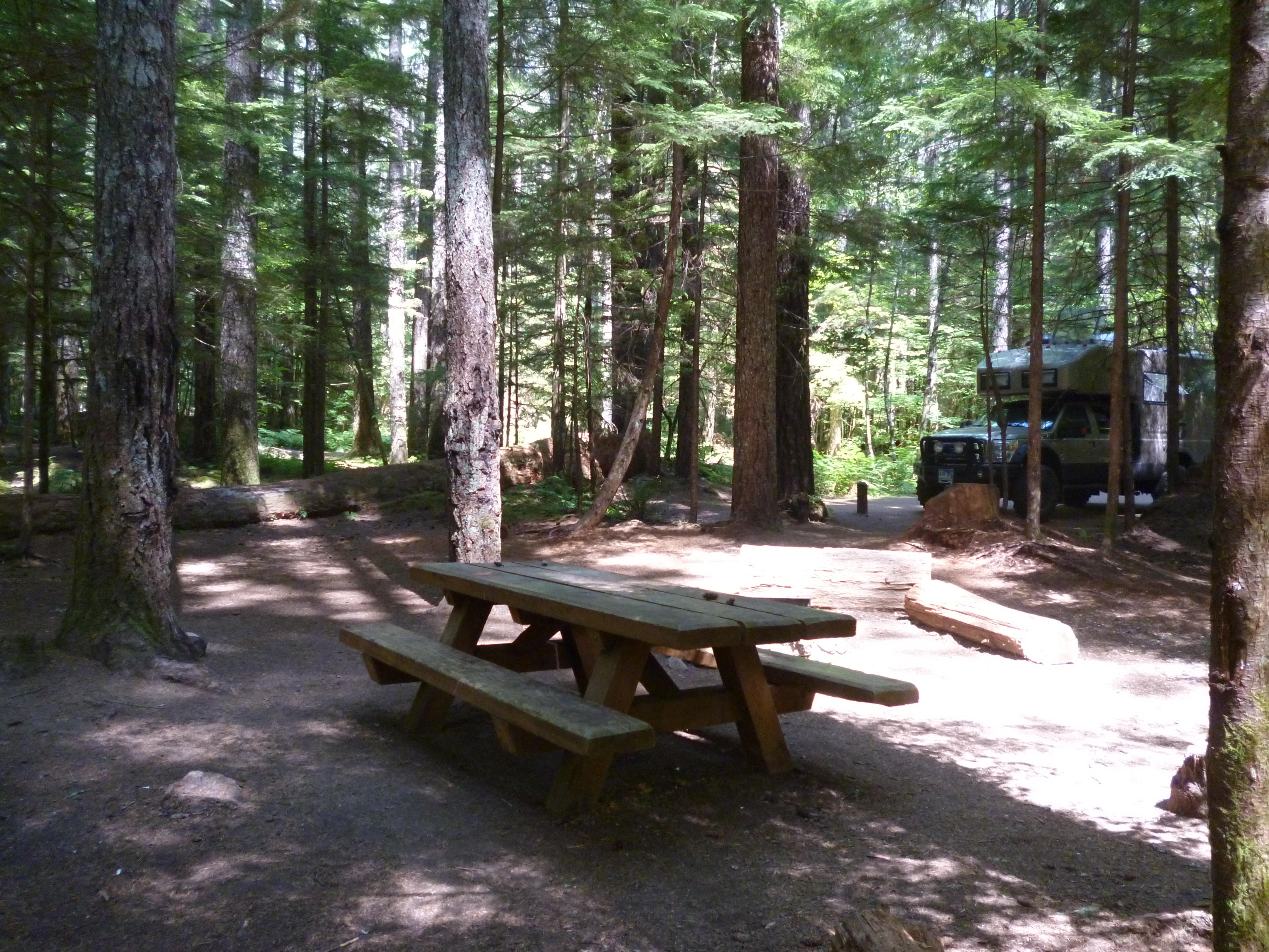
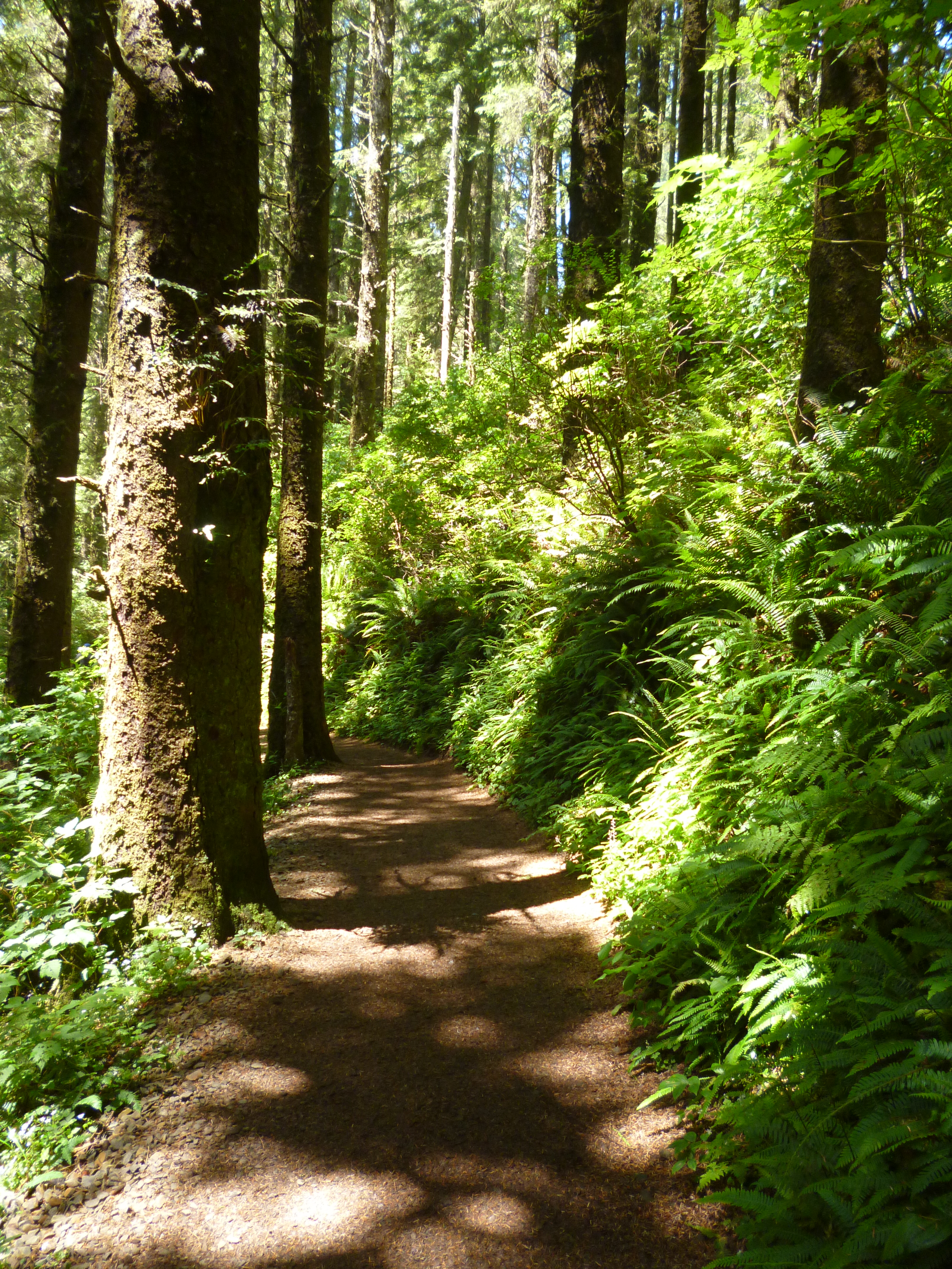
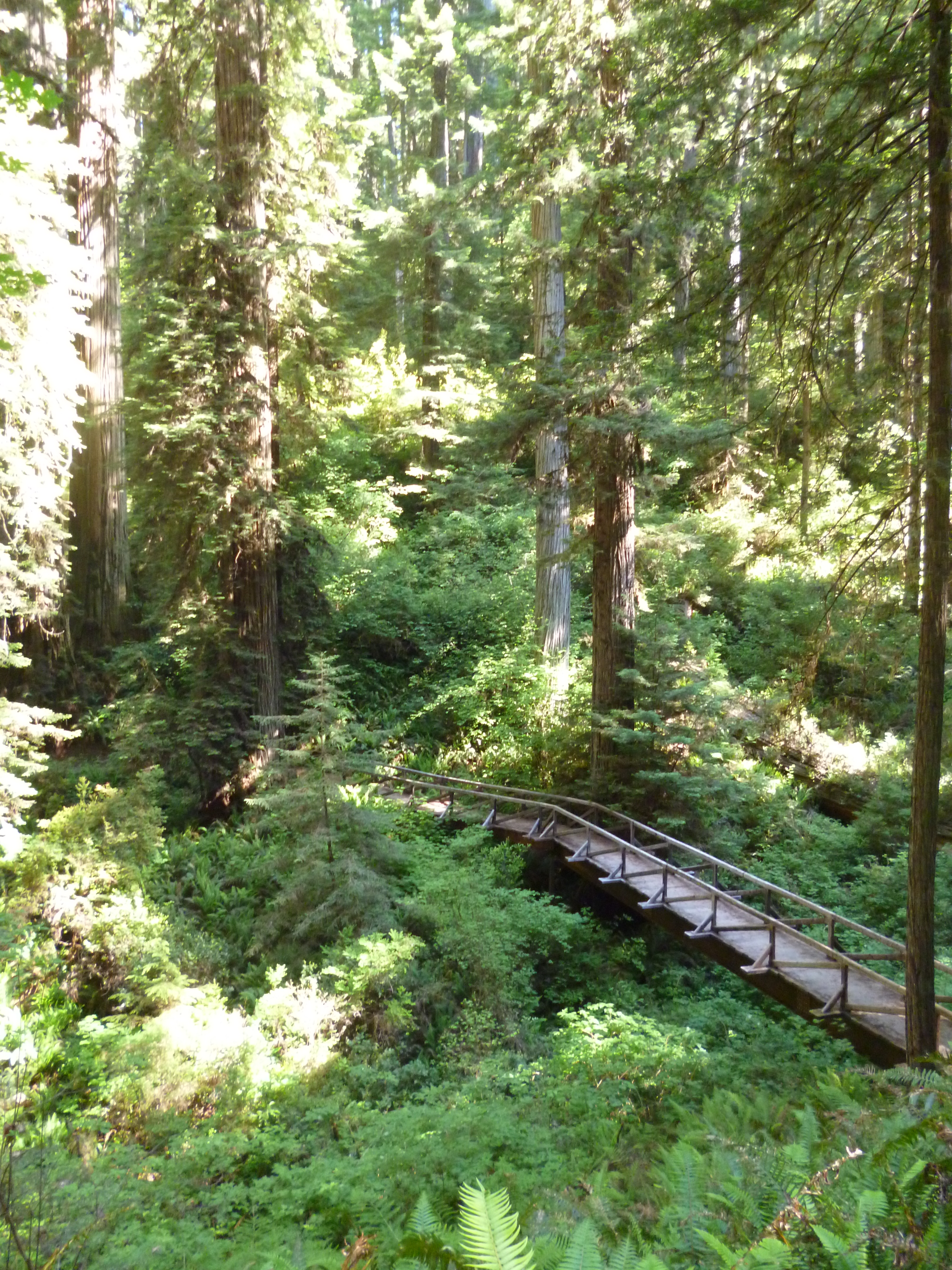
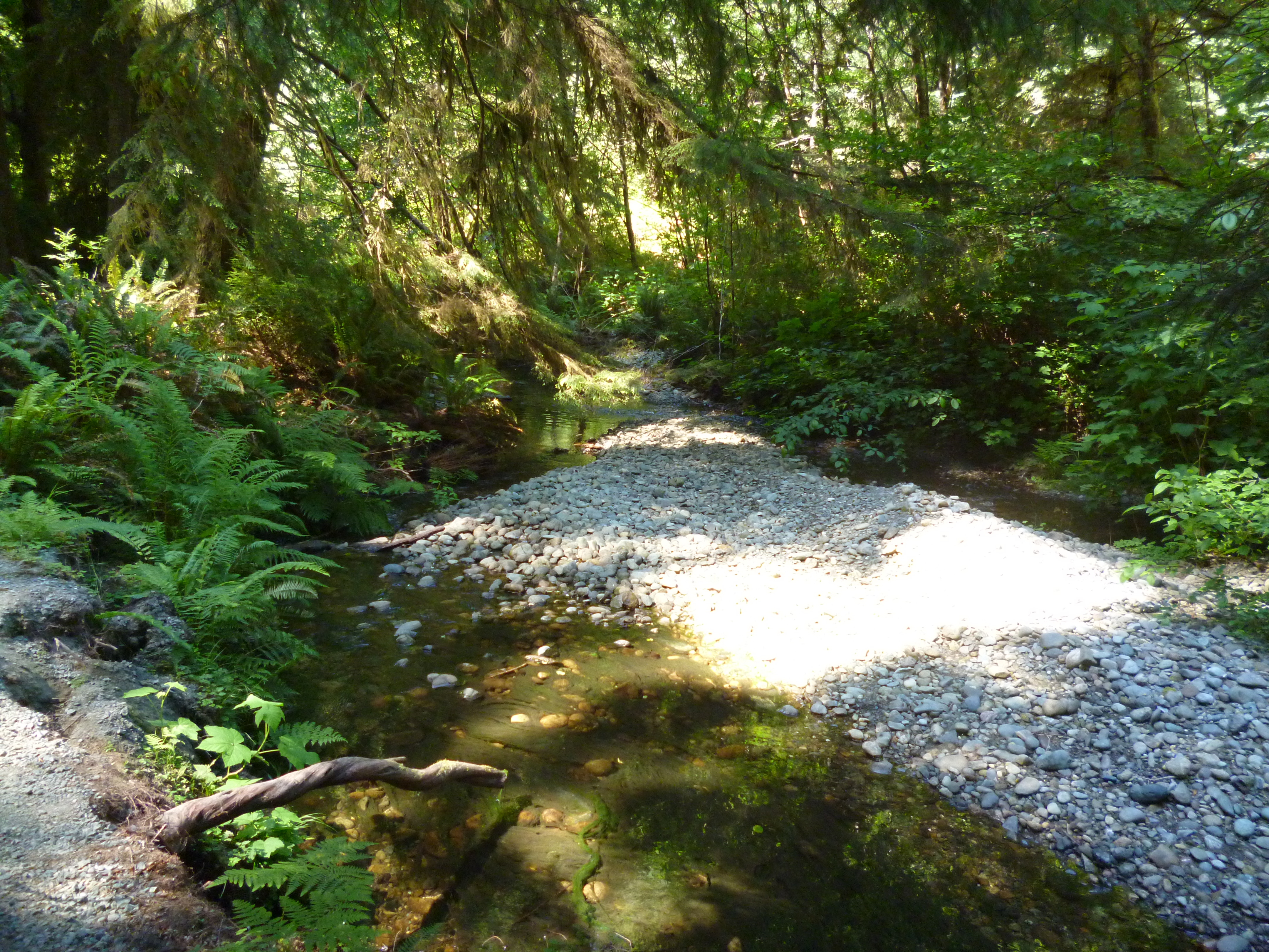
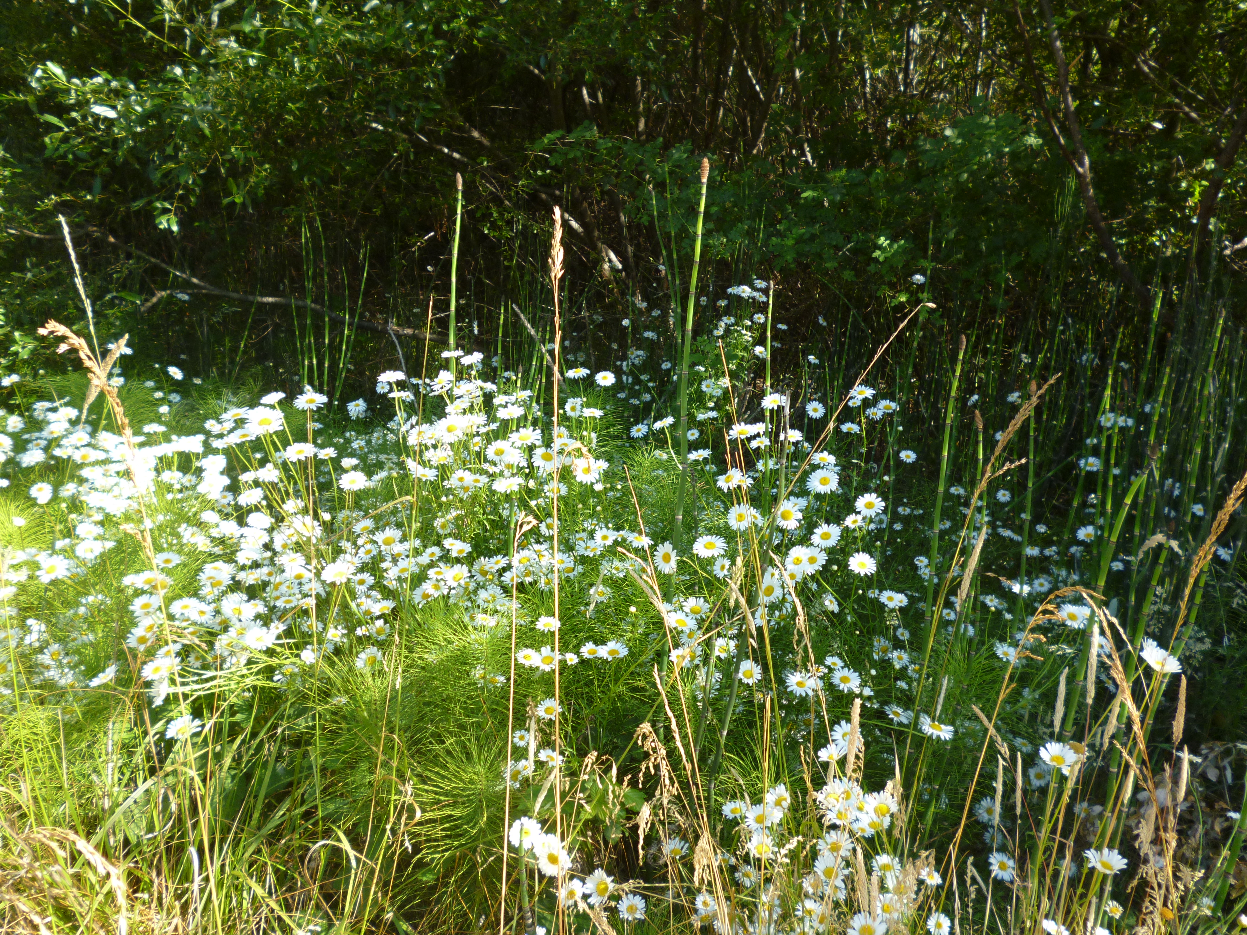
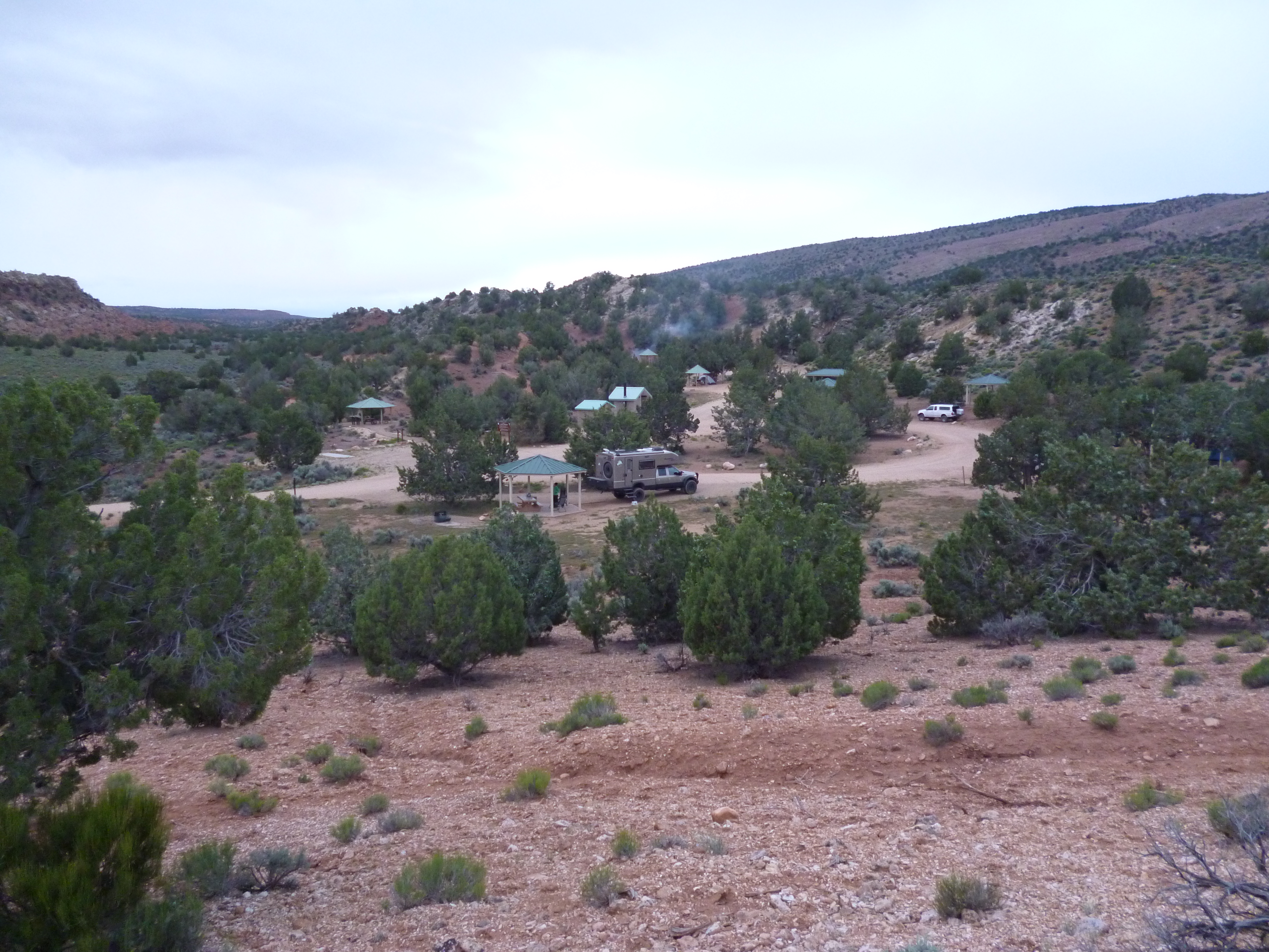
The Starrigaven campground, located less than 10 miles from downtown Sitka, is in a rain forest and was a nice spot while in Sitka. However, it did live up to its name the second night with a constant drizzle the entire night.

P1040852

P1040885

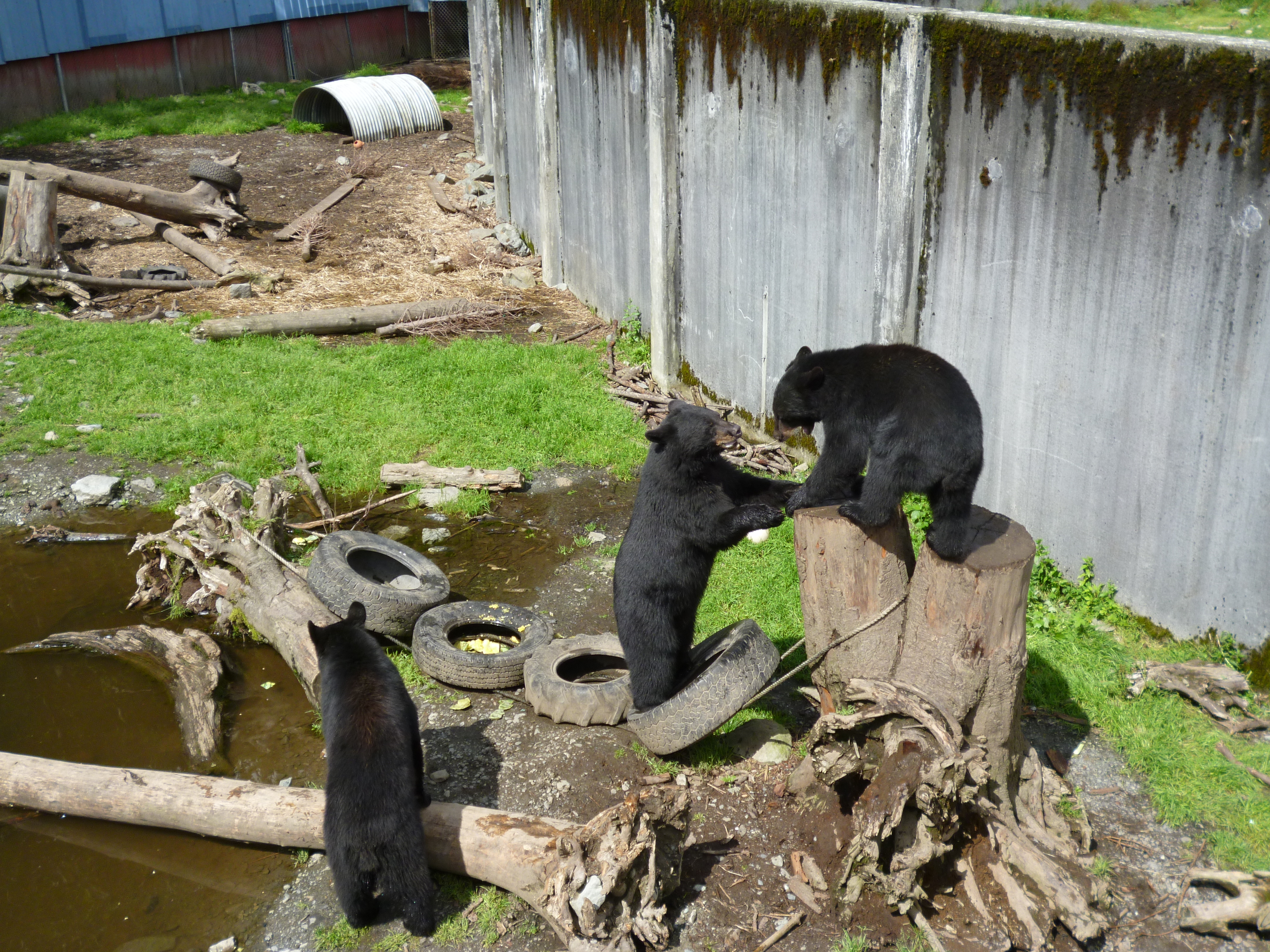
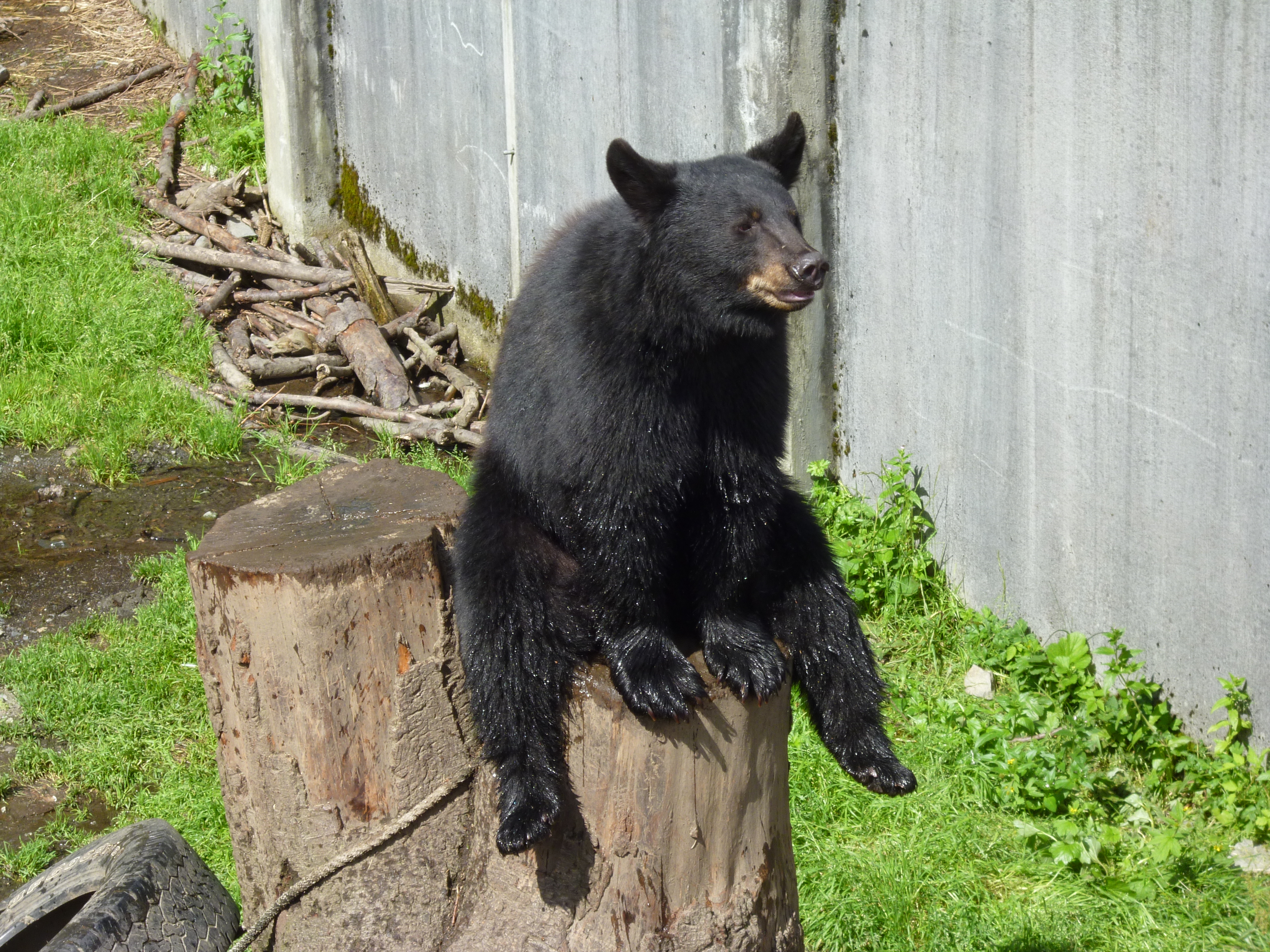
We drove to the other end of the road on the other side of Sitka, where the “Fortress of the Bear” is located, a bear rescue habitat that takes in displaced black and brown bear cubs. They have three black bear and five brown bear permanent guests that were great to see. They were mostly brothers and sisters from killed mother bears.

The black bears were similar in size to the ones we saw in California, 150 to 250 pounds, and were playing “king of the hill” for most of the time we were there.

P1040855

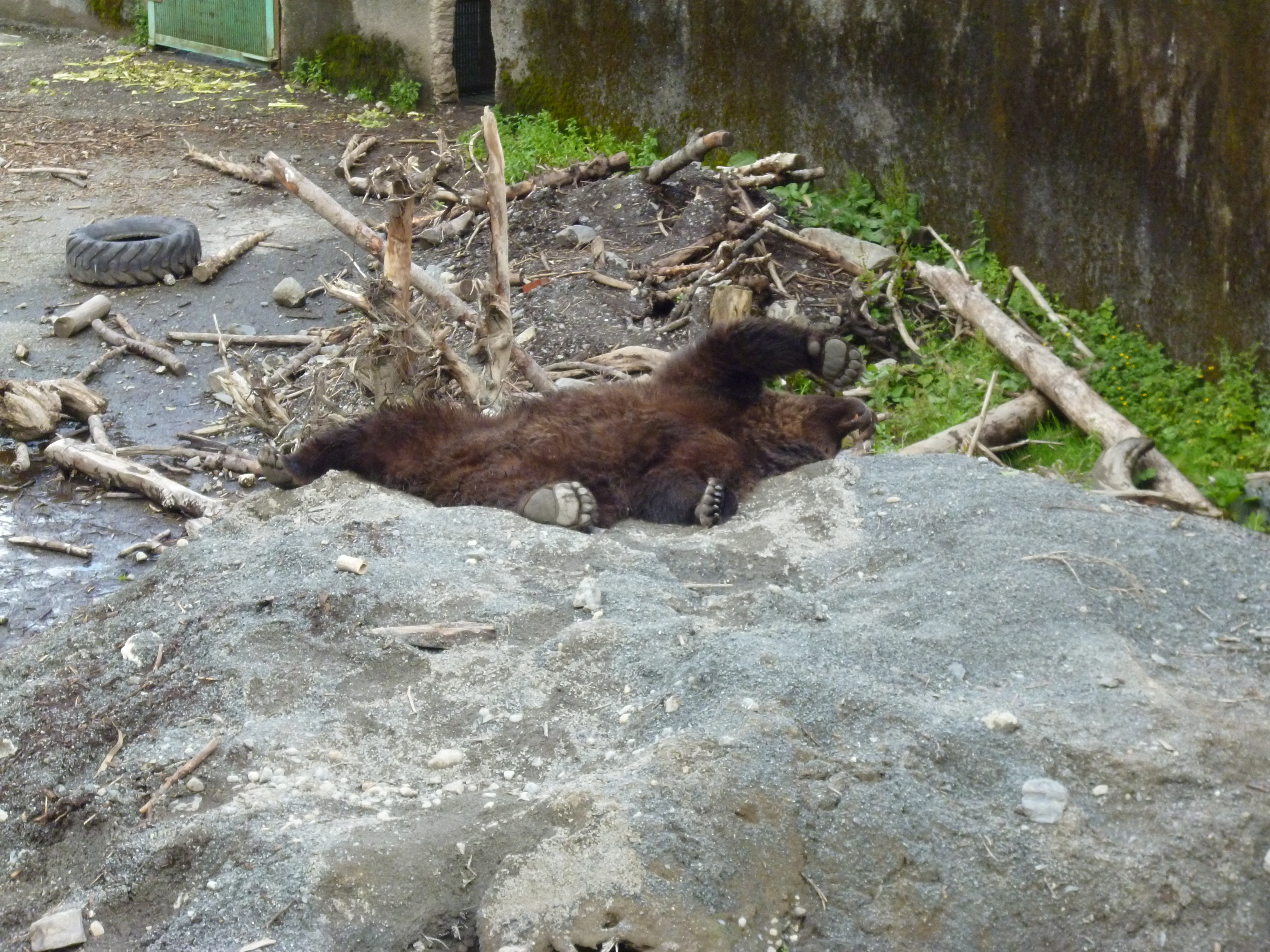
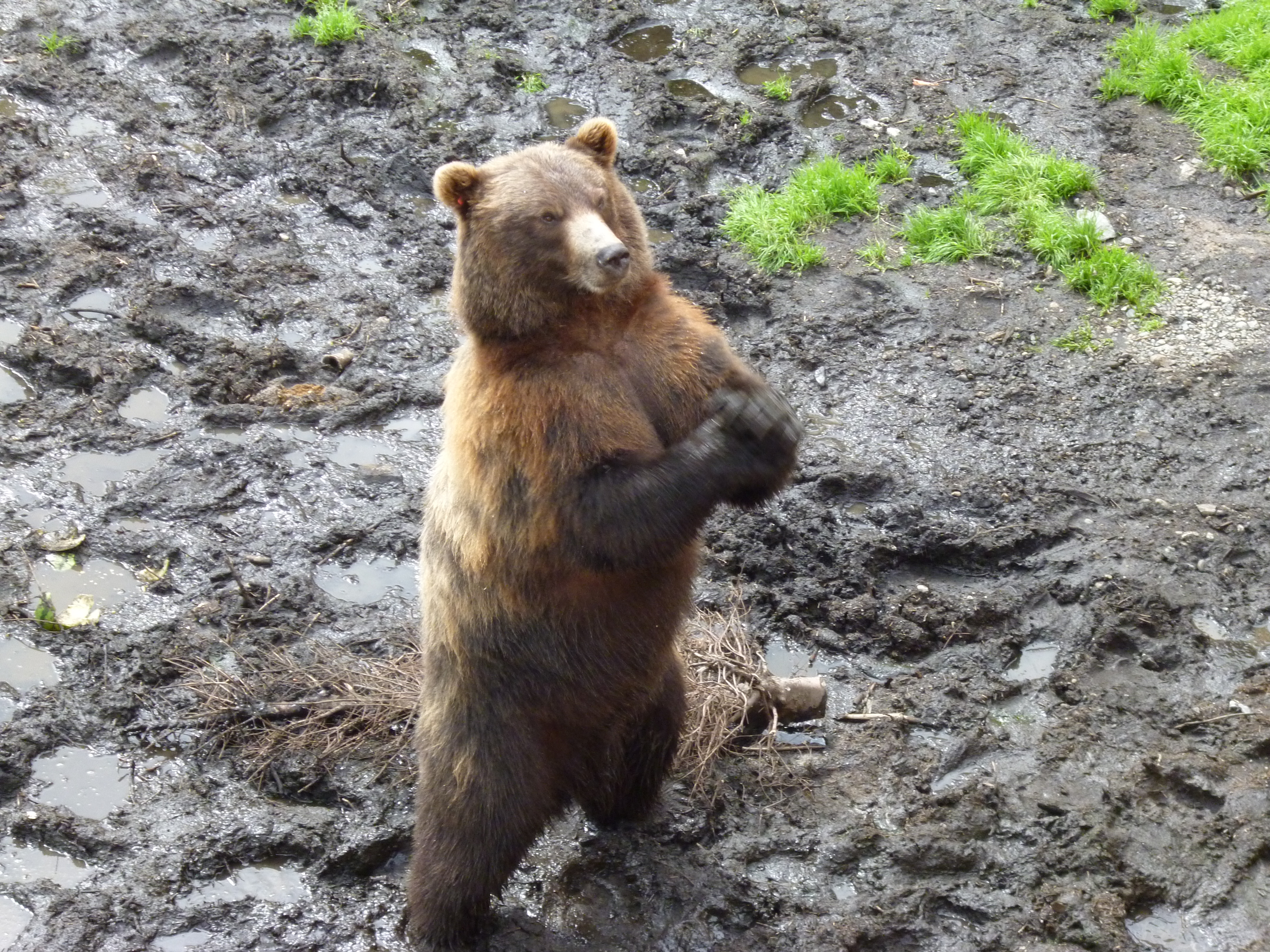
The grizzlies were just huge, where the big males were close to 1000 pounds and four feet tall at the shoulder.

P1040854

We were most impressed by how agile they were while climbing up, on and around the various things in their enclosures.

P1040859

The grizzlies had a volleyball tetherball filled with dog food for their snacking game in one of their enclosures.

P1040867

We got there just after lunch, and once the sun hit it was nap time.

P1040871

P1040868

The smaller female bear had learned to use sign language to ask the folks for more food since her brothers had eaten most of it.

P1040874

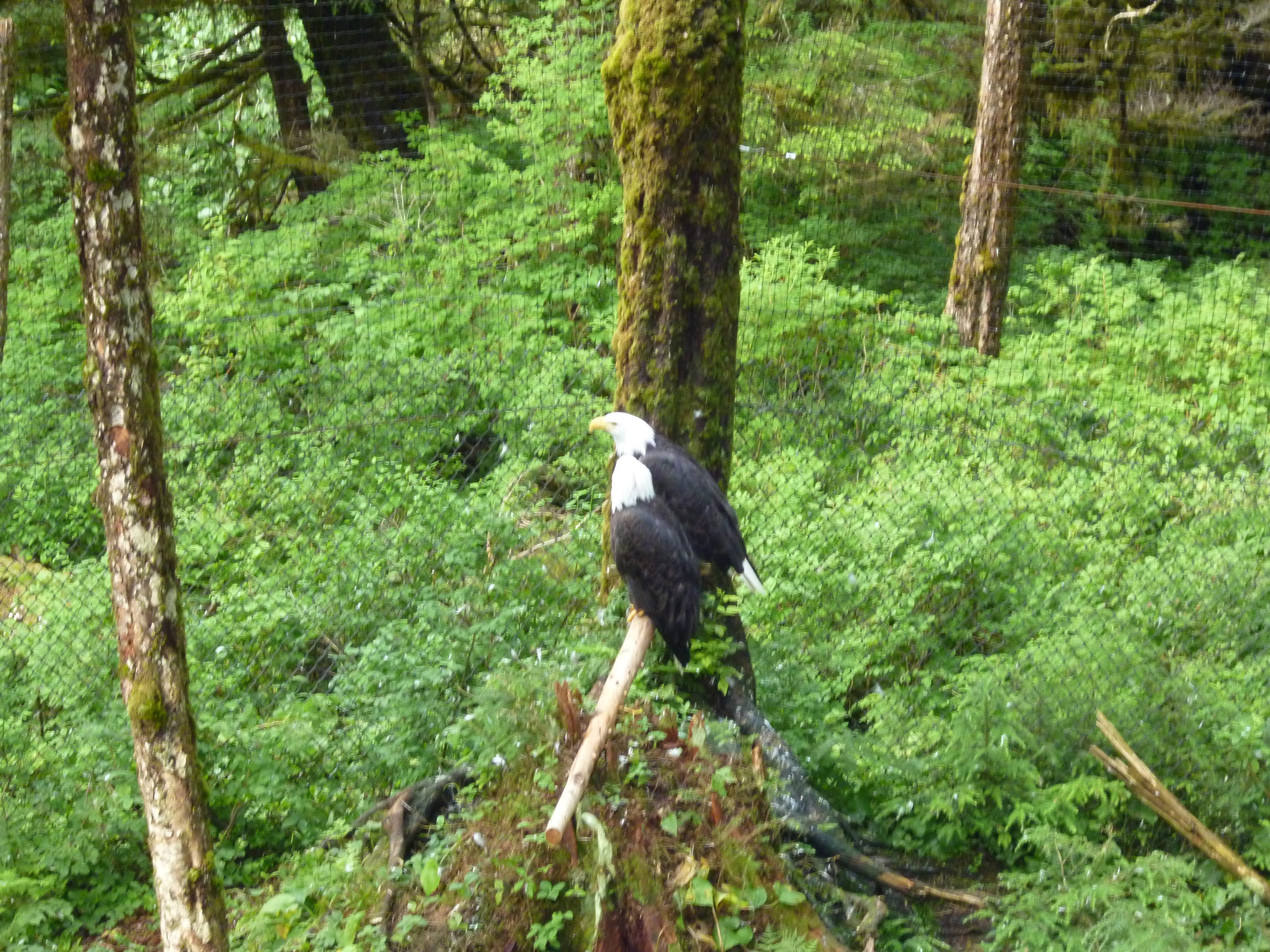
We visited the Alaska Raptor Center next. They rescue mostly eagles given the large number in the area, and other raptors as well. Many were permanent guests due to the injuries that landed them at the rescue center. The eagle enclosure had a fence around it to keep land predators out, but did not have a roof. The recovering birds could not fly away so the open enclosure allowed other local eagles to stop in and visit, which they did.

P1040878

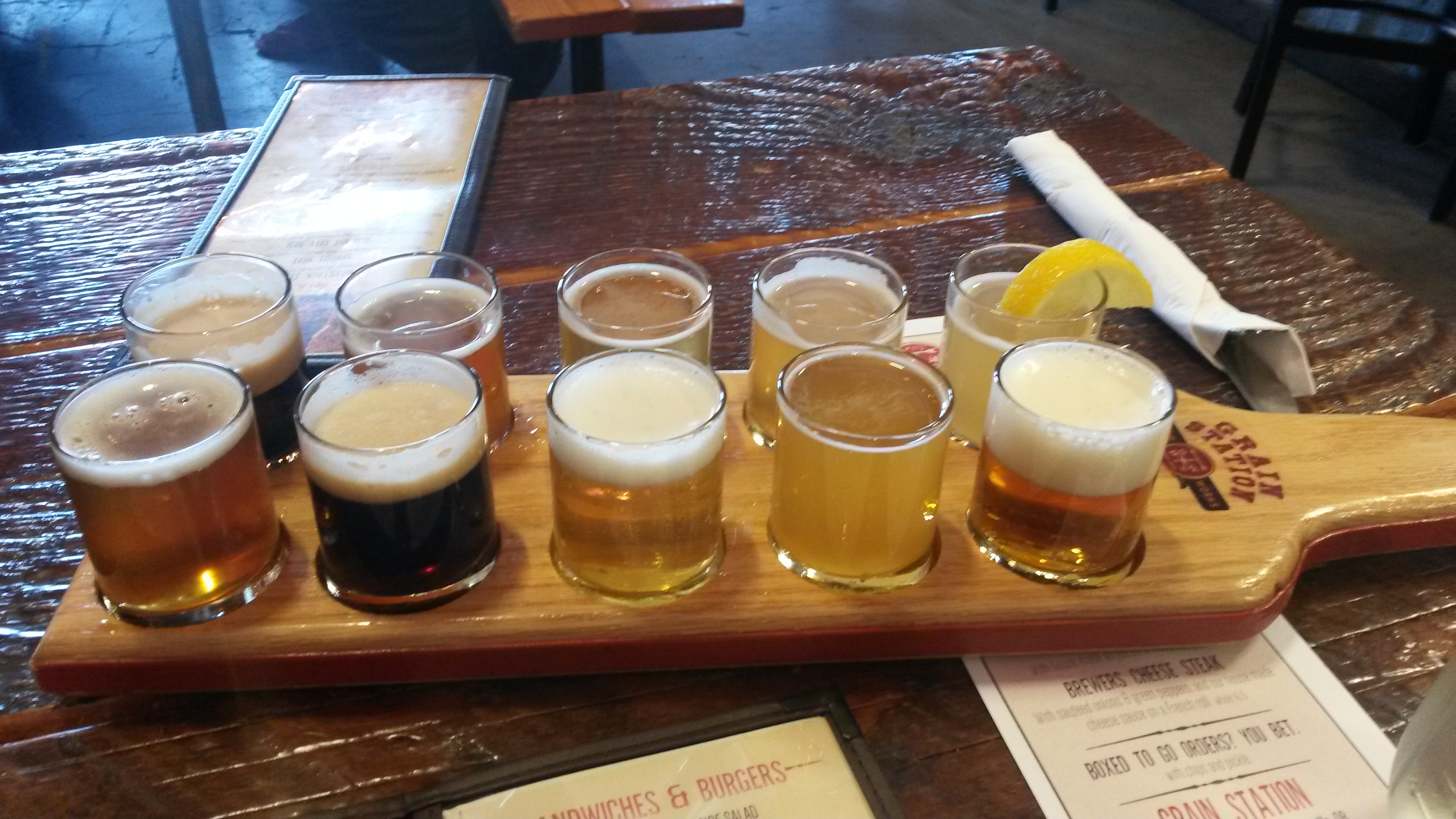
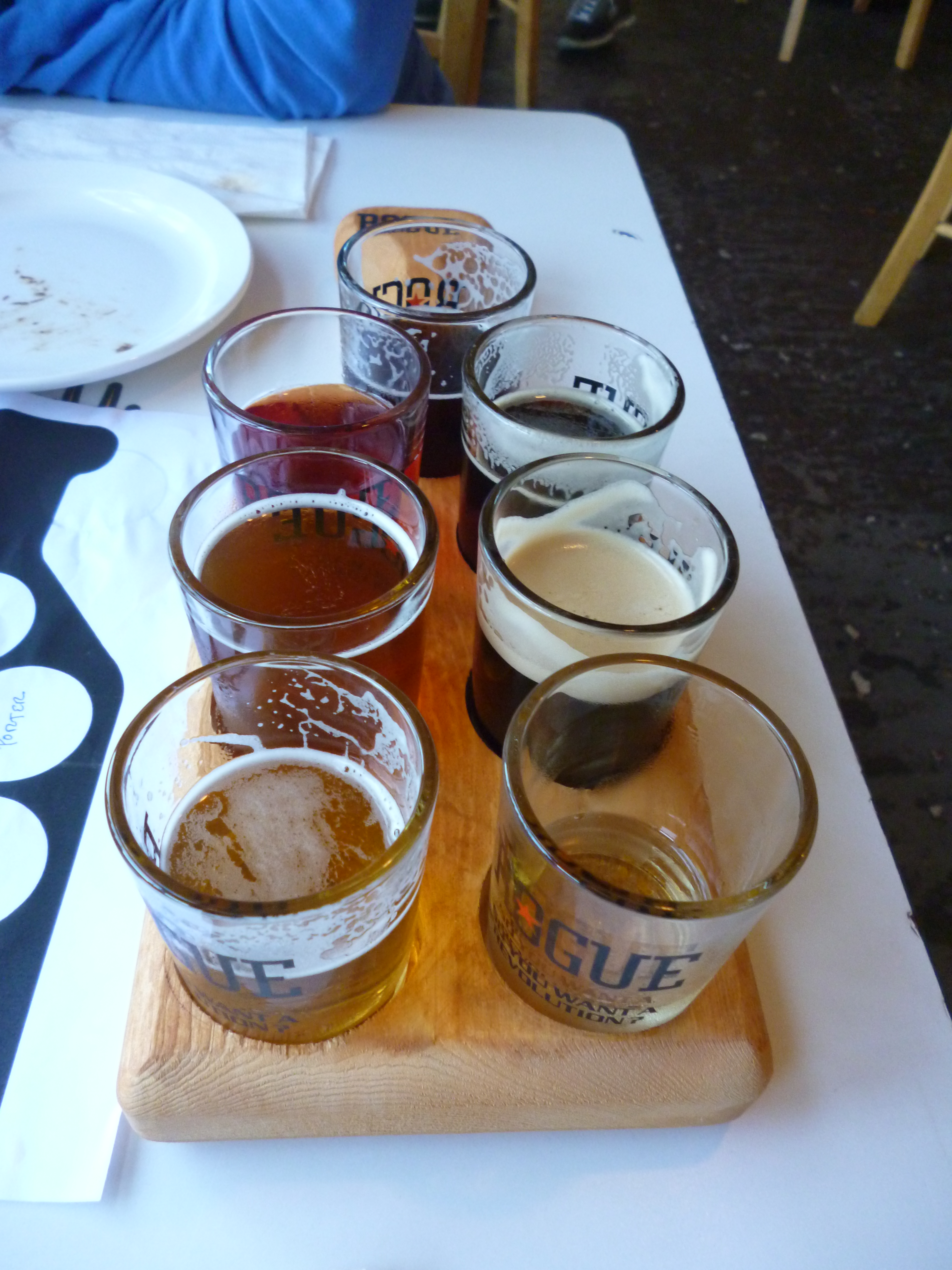
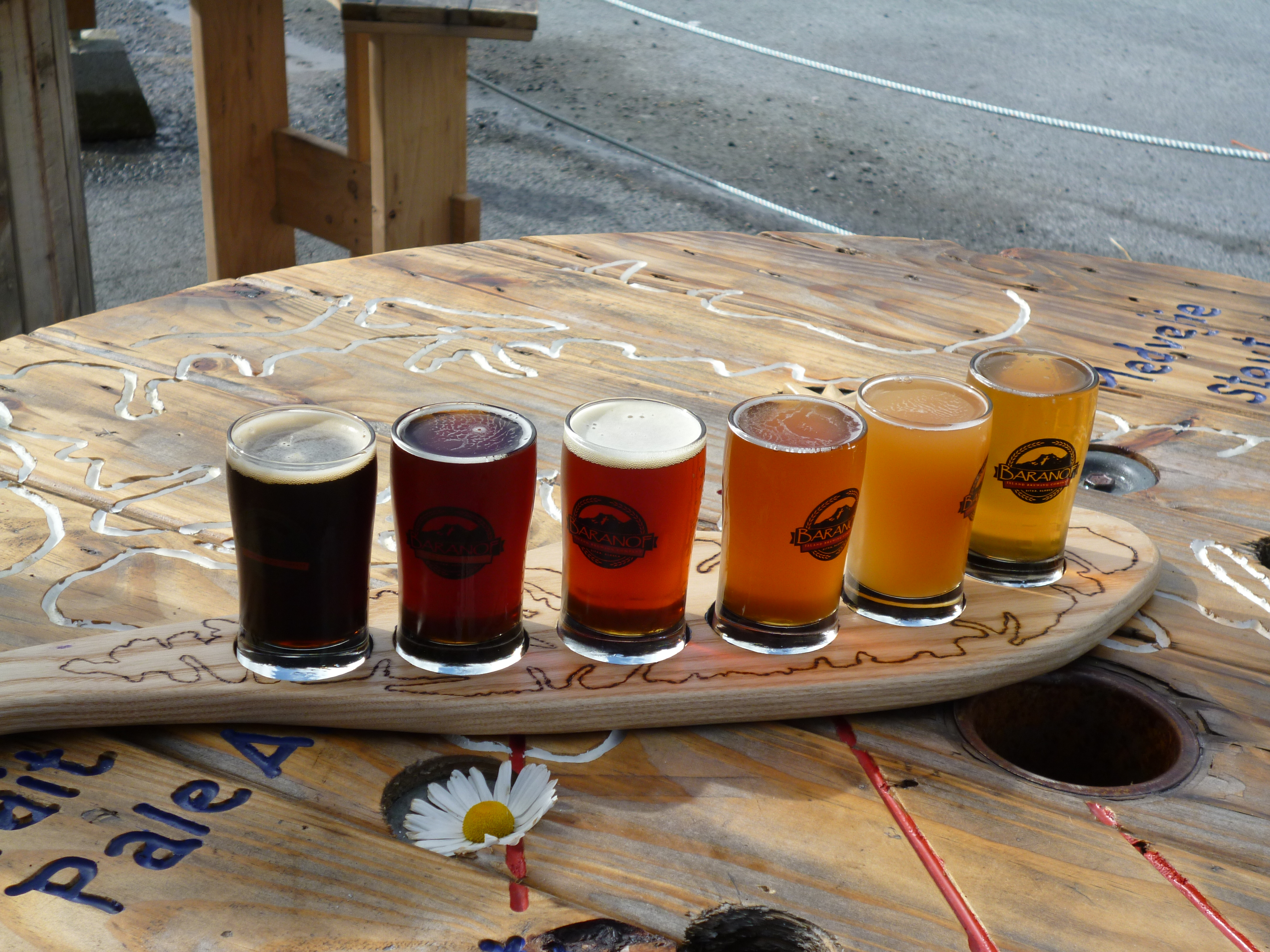
We met a nice local couple at the Baranof brewery following our first day’s travels and traded them two nice filet cuts of meat we had for two huge salmon fillets and a couple of cooked crabs. We ate the crab that night at the campsite’s picnic table next to a nice campfire.

P1040883

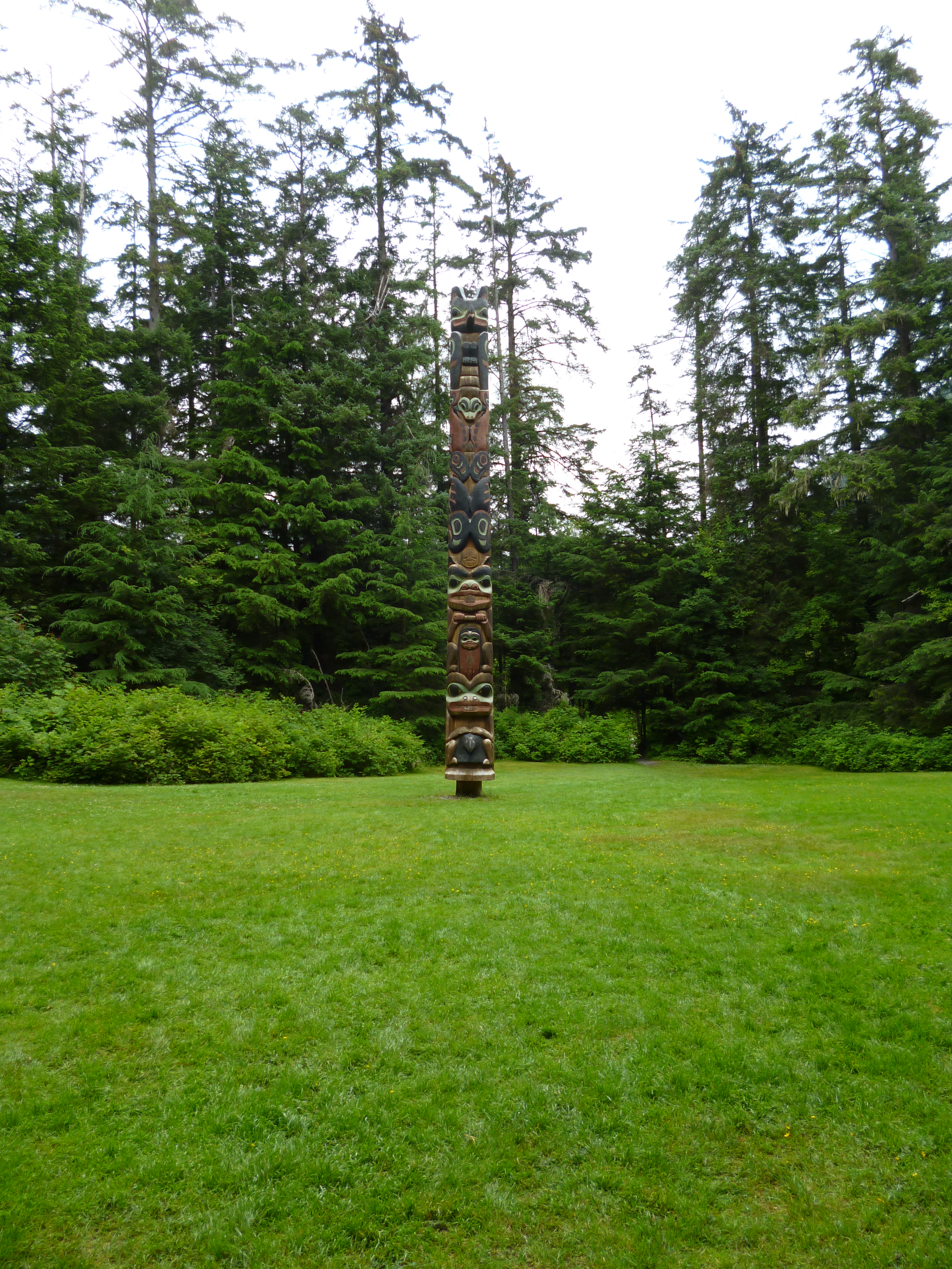
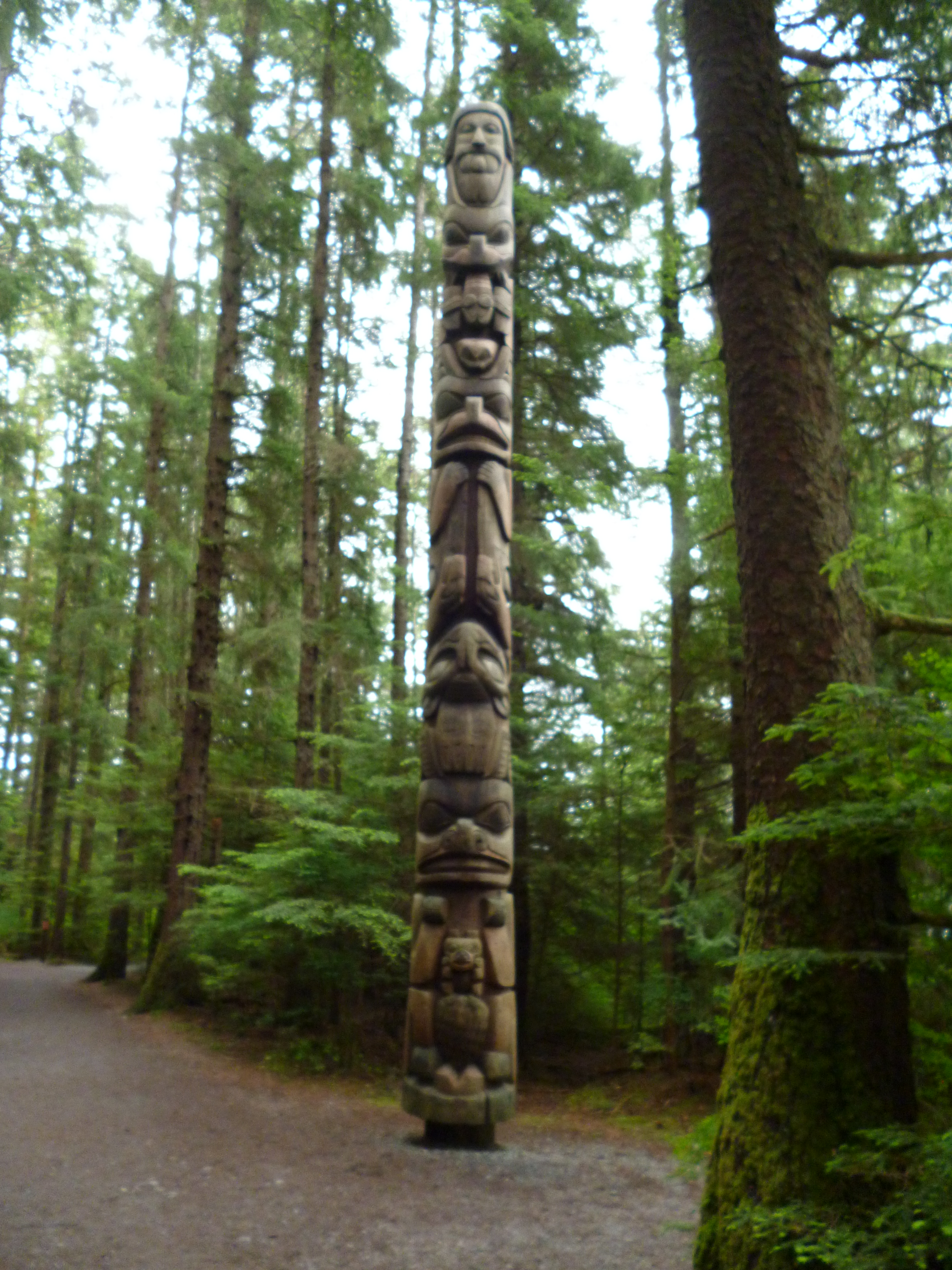
We spent the next day in town, checking out the history of the area. At the end of town is the Sitka National Historic Park where the 1804 battle between the Russians and native Tlingit occurred. The park is also the home for many totem poles.

P1040904

P1040901

The Russians first settled Kodiak Island as their main base for fur trading, but moved to Sitka which was rich in sea otters. The sea otter has the densest fur on the planet, over 1 million hairs per square inch. They had a couple in the various museums and wow I could definitely see having a blanket of sea otter fur. One of the park rangers was a native and her mom made her a sea otter cuddle animal out of a sea otter pelt when she was a child. Wow, it was tough to put down.

P1040936

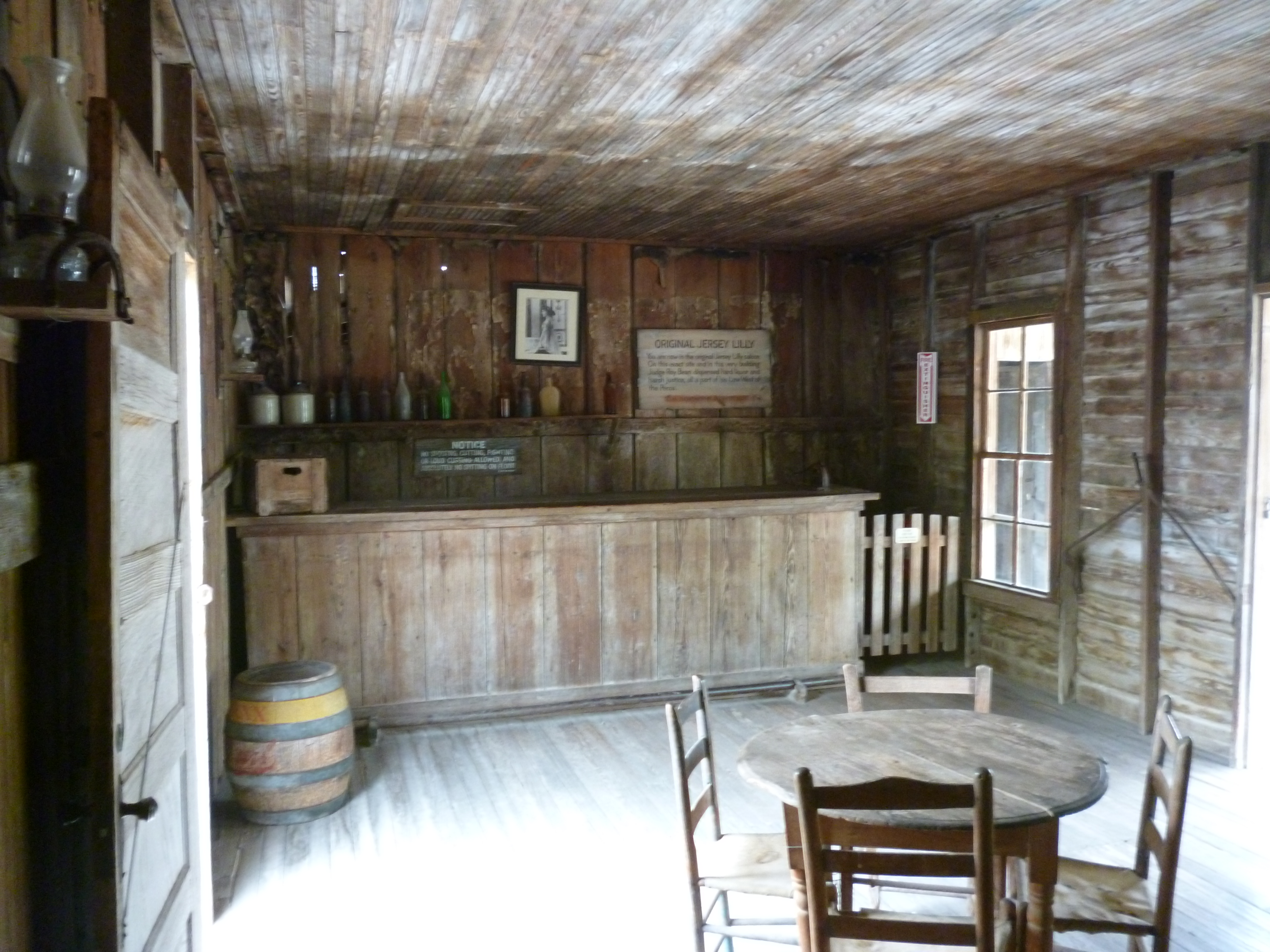
The Russians were not attempting to colonize Alaska and when the fur supply began to go away, coupled with financial issues at home, the Tsar decided to sell Alaska to the US in 1867. Sitka still has a very strong Russian community in the town as part of its heritage. The Russian Orthodox church in town was very beautiful, where many of the Tlingit converted to Russian Orthodox during the Russian rule of the area.

P1040931

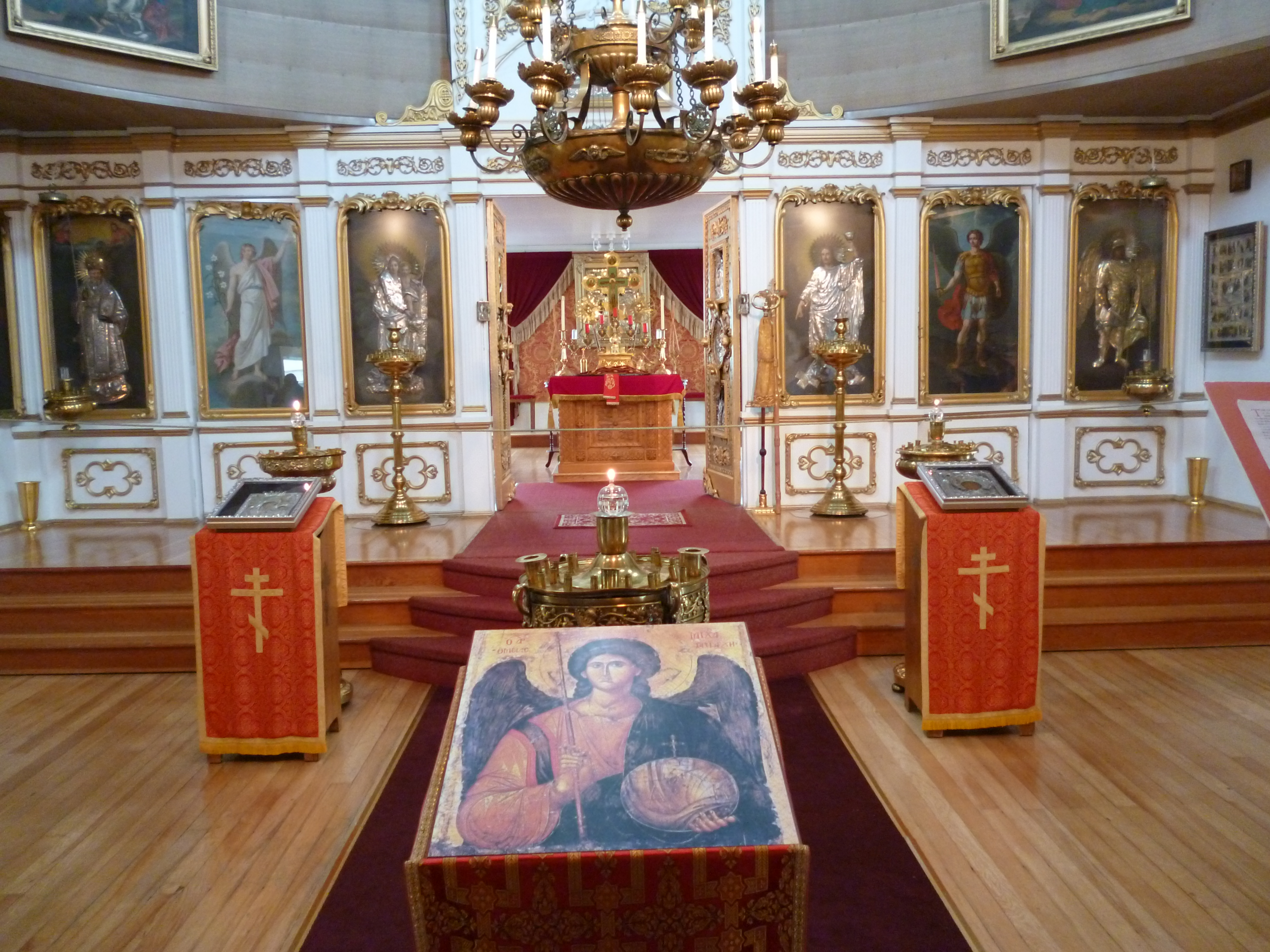
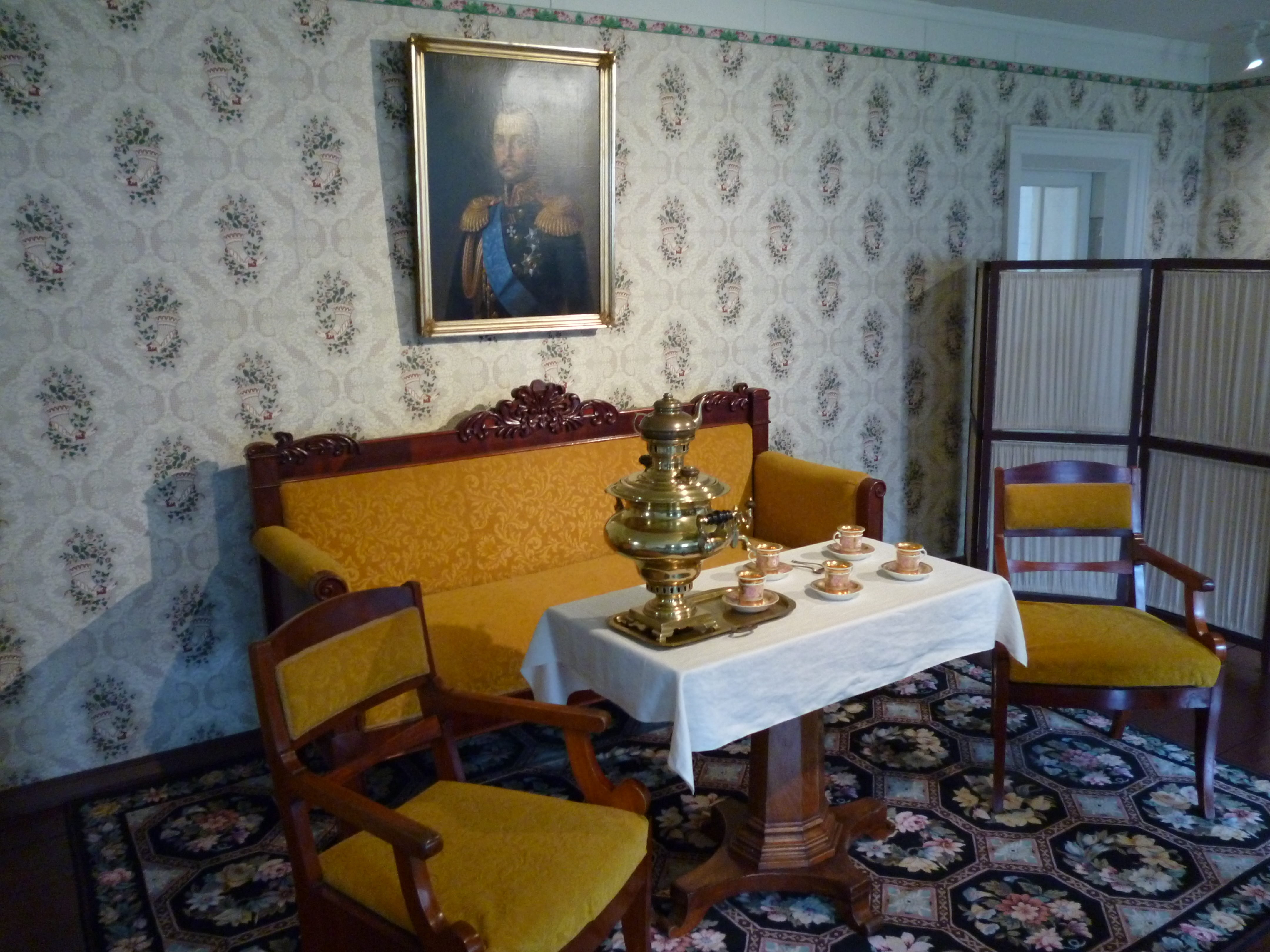
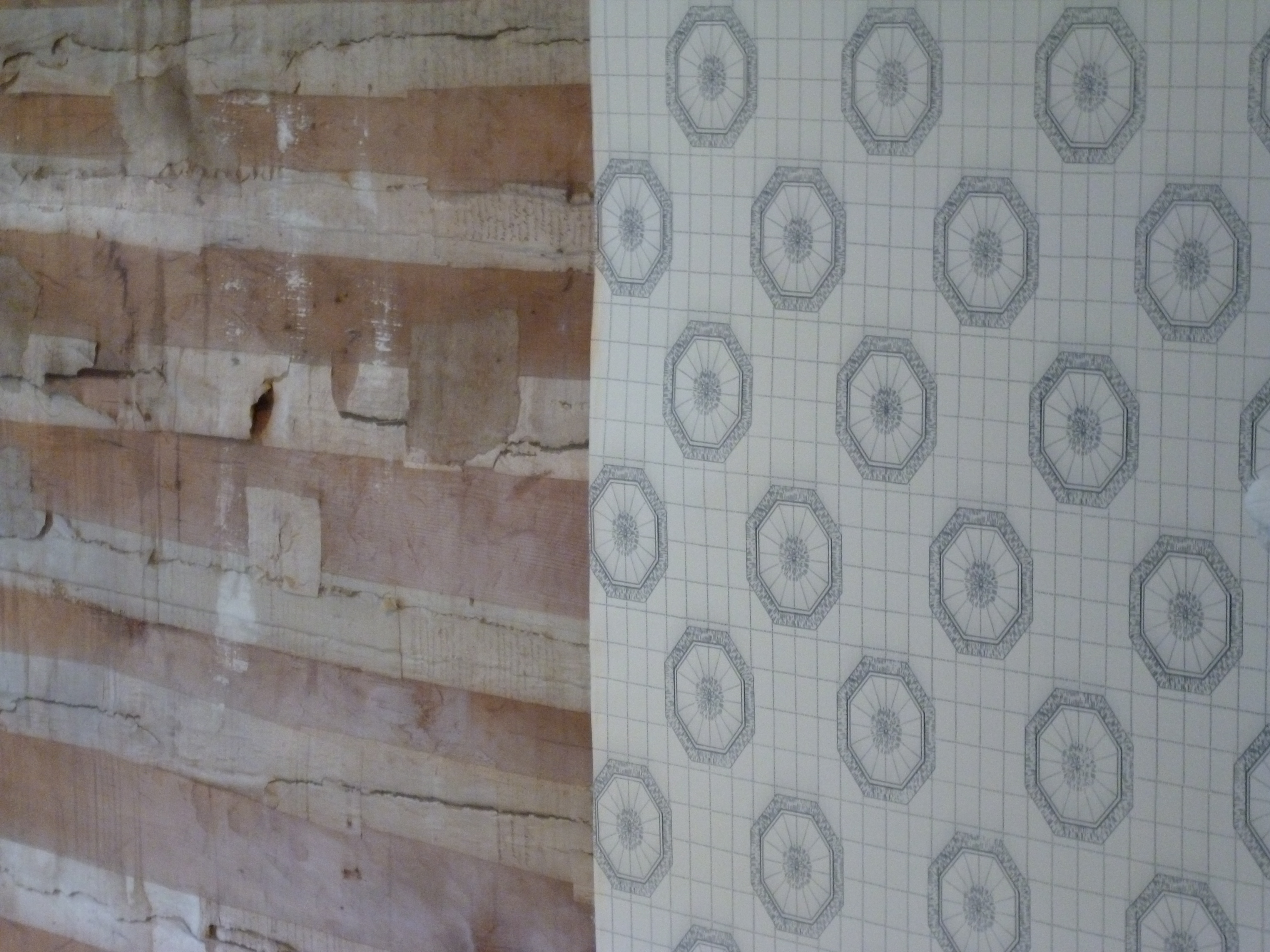
As the political seat of the colony, Sitka also had a Bishop with the power of Russian royalty because there was no separation of religion and state. The Bishop’s house is today a part of the national parks to preserve the Russian heritage. The building is one of the very few remaining from the Russian rule and was build like a ship with interlocking wood planks and joints.

P1040924

P1040918

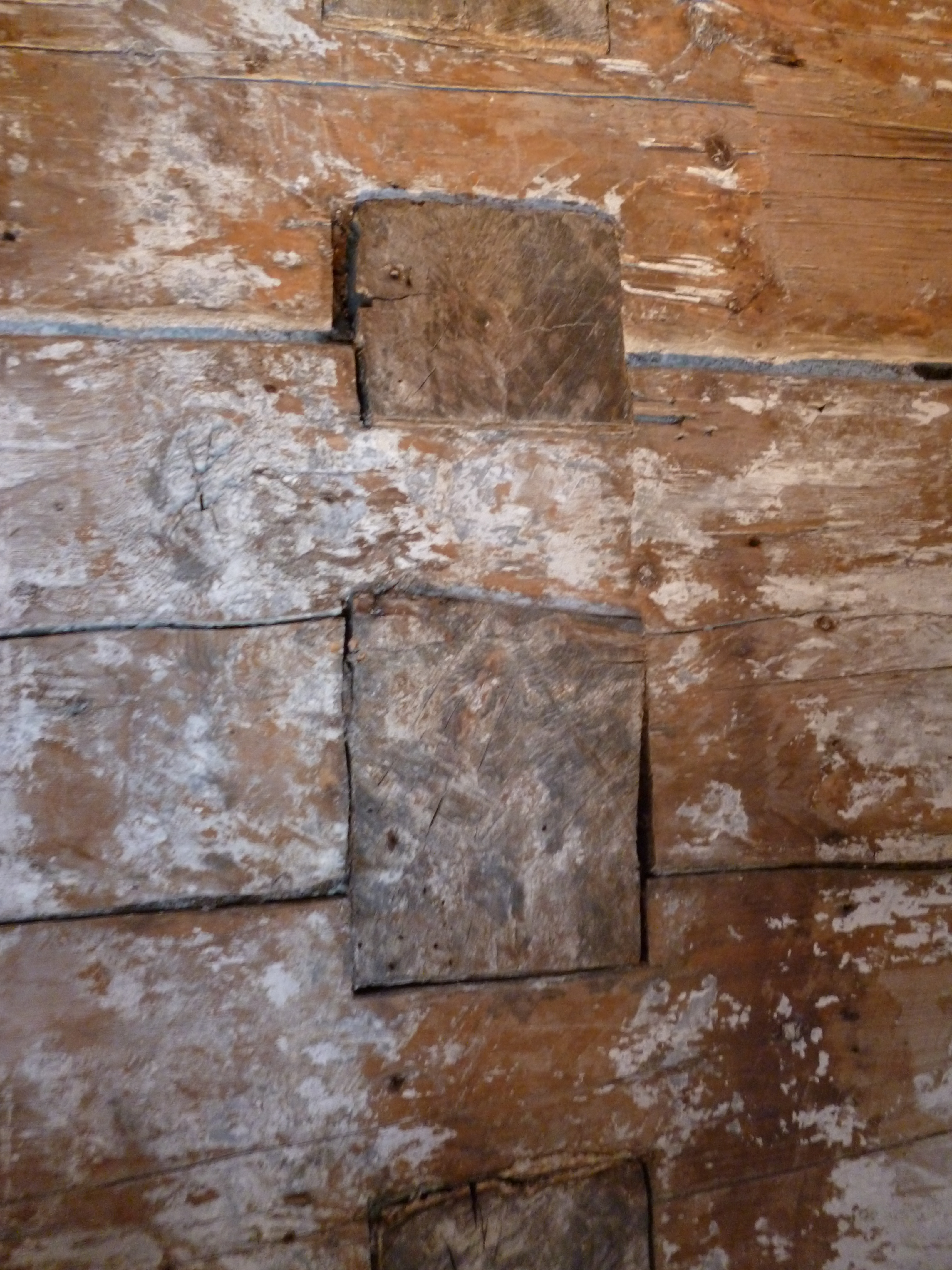
Wallpaper was used to cover the wall planks and seal the air gaps in the joints.

P1040926

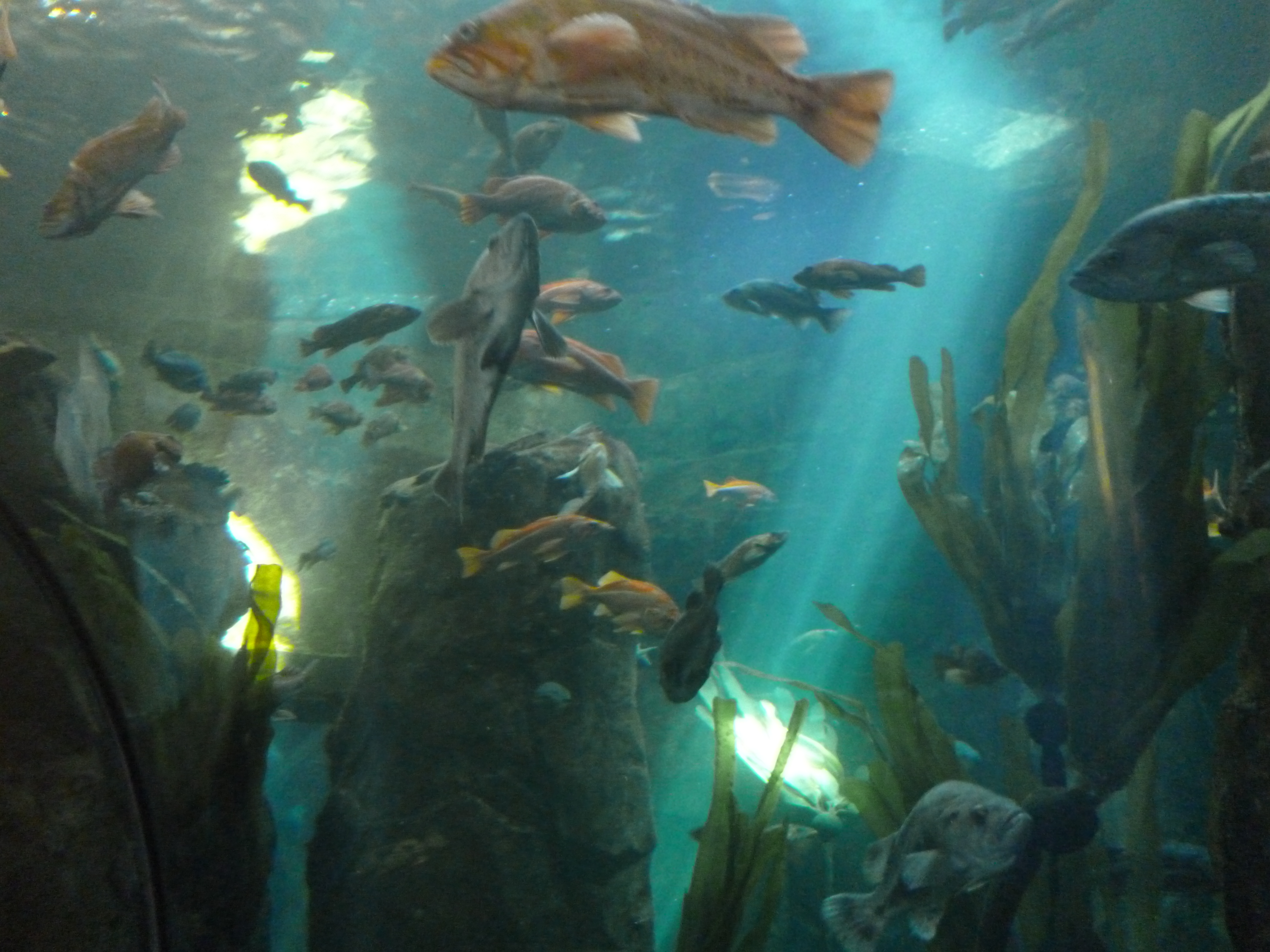
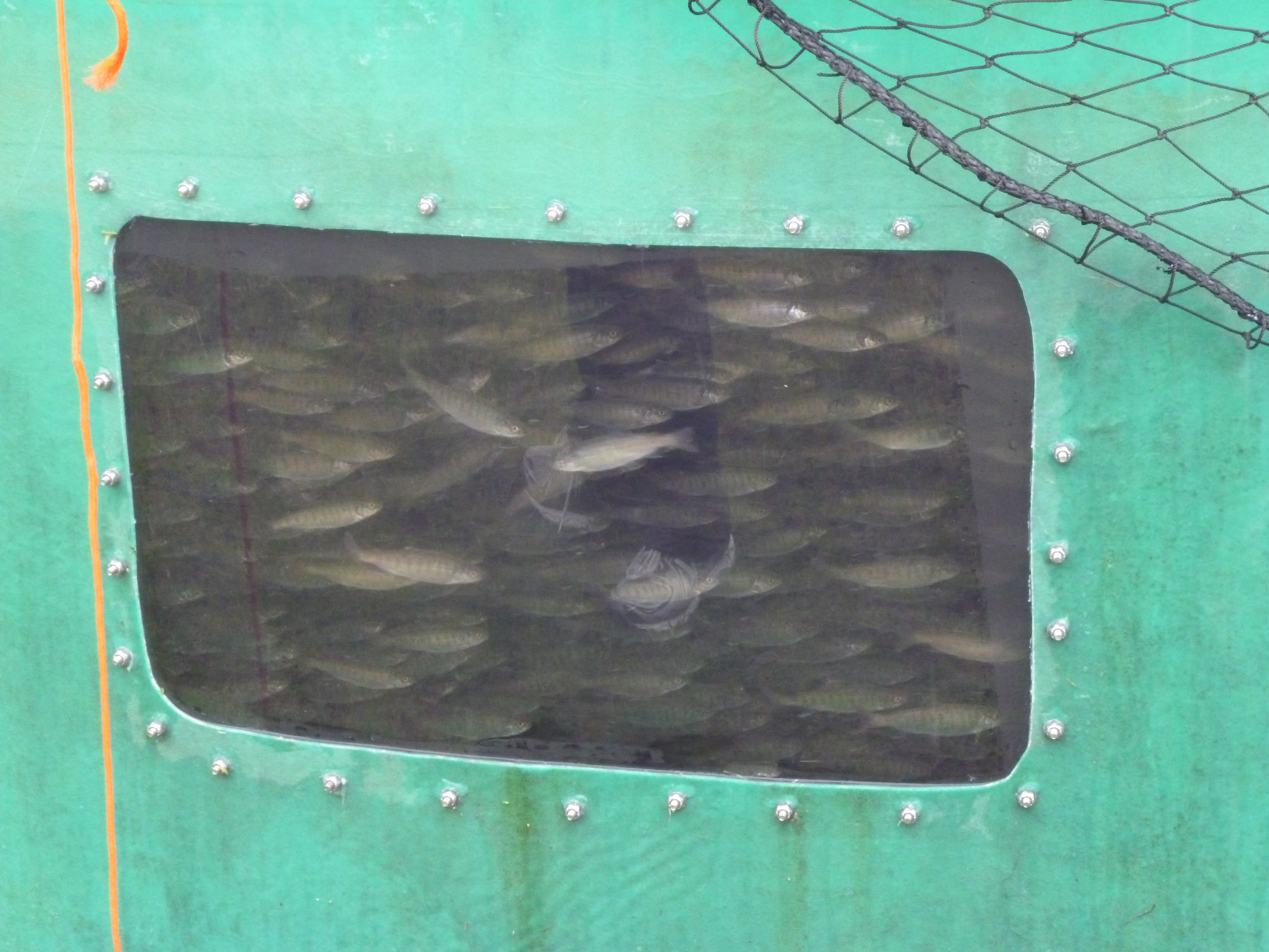
The aquarium there was interesting that they had one of the few killer whale skeletons on display. They knew of the other one we had seen in Eden, Australia of “Old Tom”, the Alpha male killer whale for the pod that worked with the local folks to capture and kill local whales for the people and the killer whales to both use. The aquarium had a fish hatchery that trains others how to properly raise salmon for release to keep the billion or so salmon that are critical to the entire food chain.

P1040910

These Coho salmon were in tanks ready to be released next spring. The pink salmon were in the bay jumping and ready to start their spawning run up the local rivers in the coming weeks.

P1040912

The aquarium also had a chowder booth where the chowder was from a local bistro. It was clam and chorizo chowder with a chunk of rosemary potato bread on the side. I wasn’t sure on this combo, but boy was it good.

Our last stop was at the Sheldon Jackson Museum in town. Jackson collected many Alaskan native people artifacts between 1880 and 1900. The collection was impressive and included many daily life items such as baskets, boxes, tools, clothes and jewelry of the native peoples.

P1040933

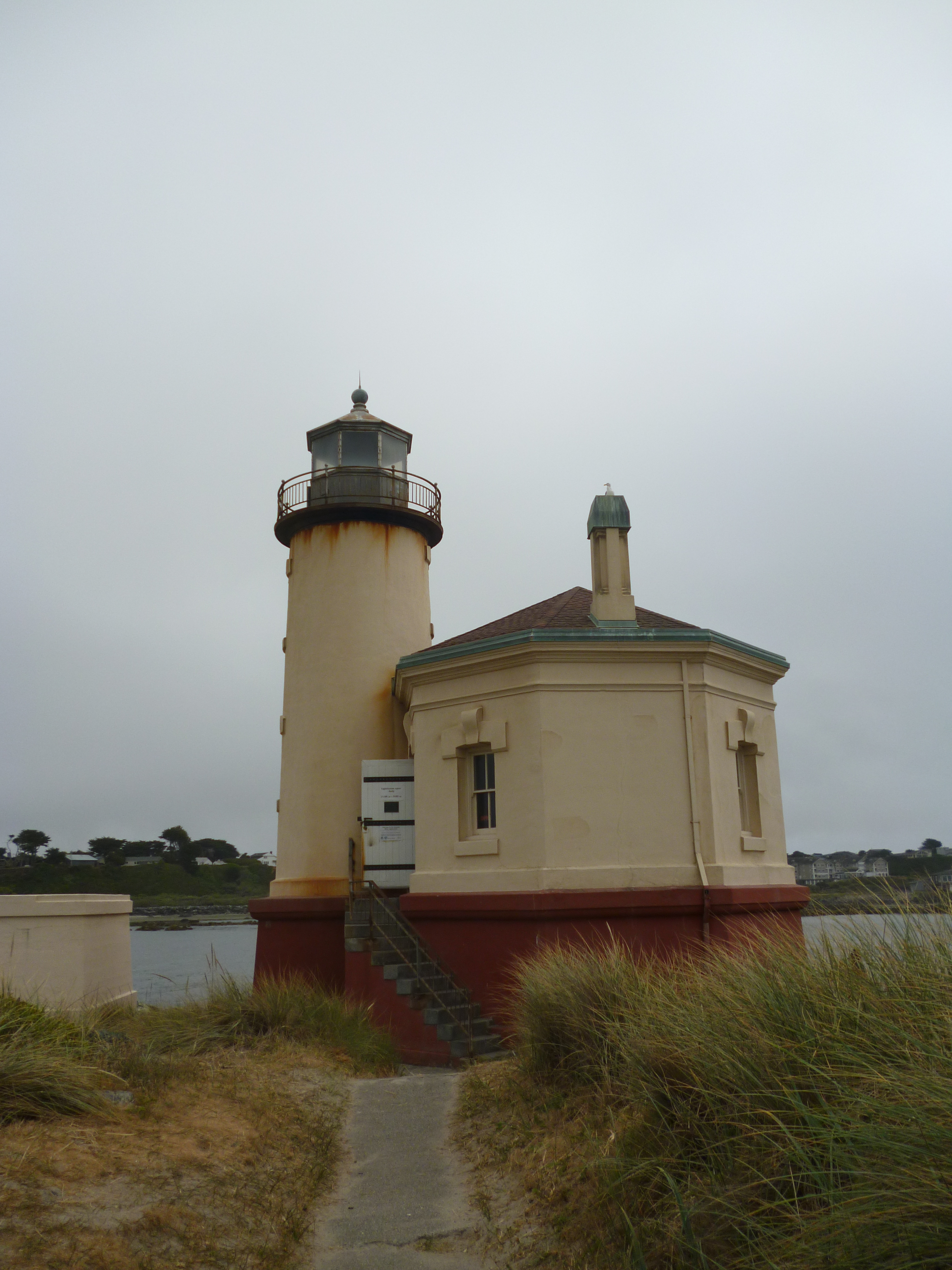
Sitka was worth the adventure of getting there. A very interesting place that I found out has a lighthouse for sale as a residence for only $600k – lol. Maybe Alexander Baranof and I will just kick back in town and see what happens.

P1040930

We left Sitka on the M/V Chenega again and arrived back in Juneau for a couple of days to explore there before heading to the interior of Alaska.
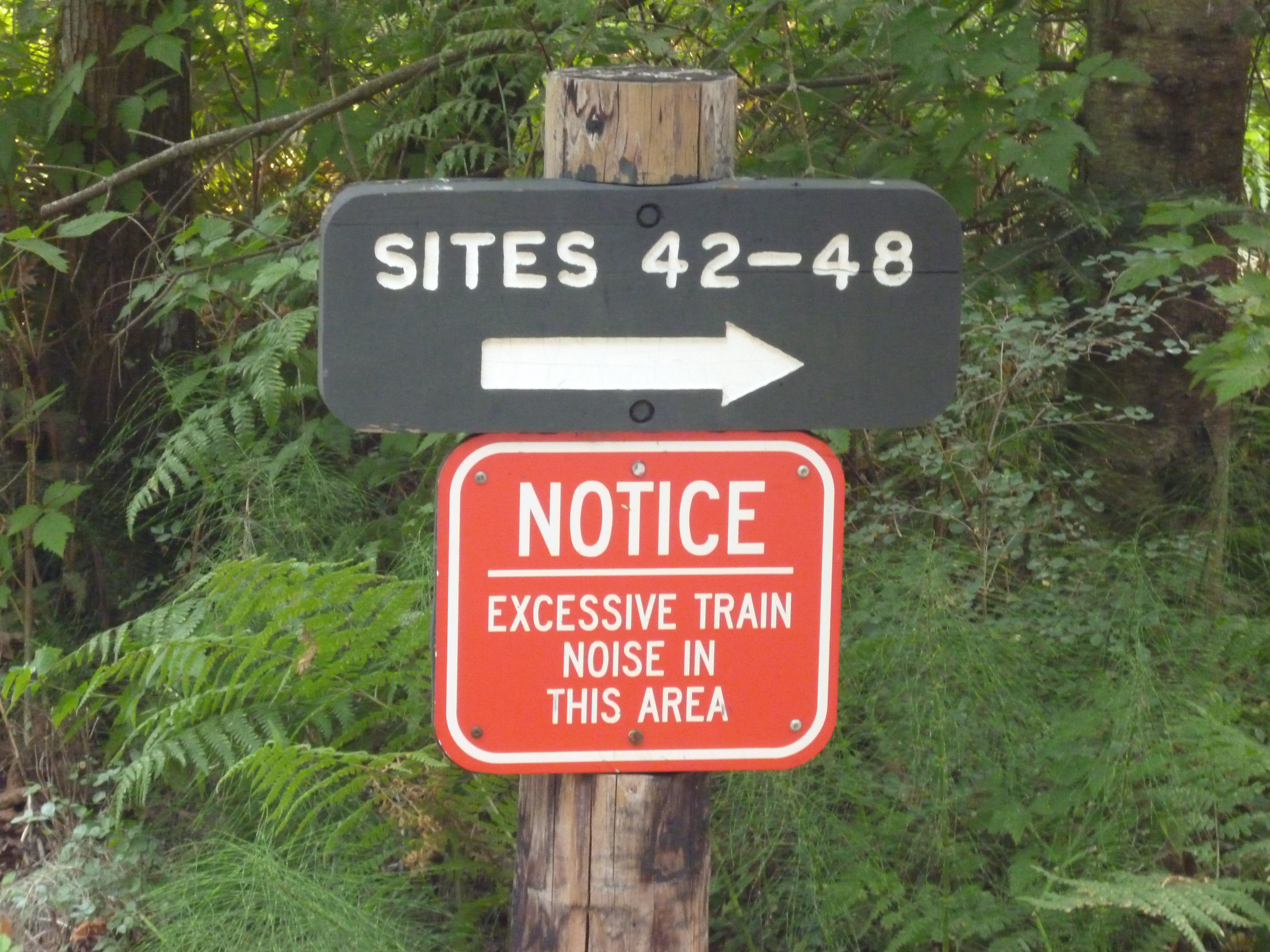
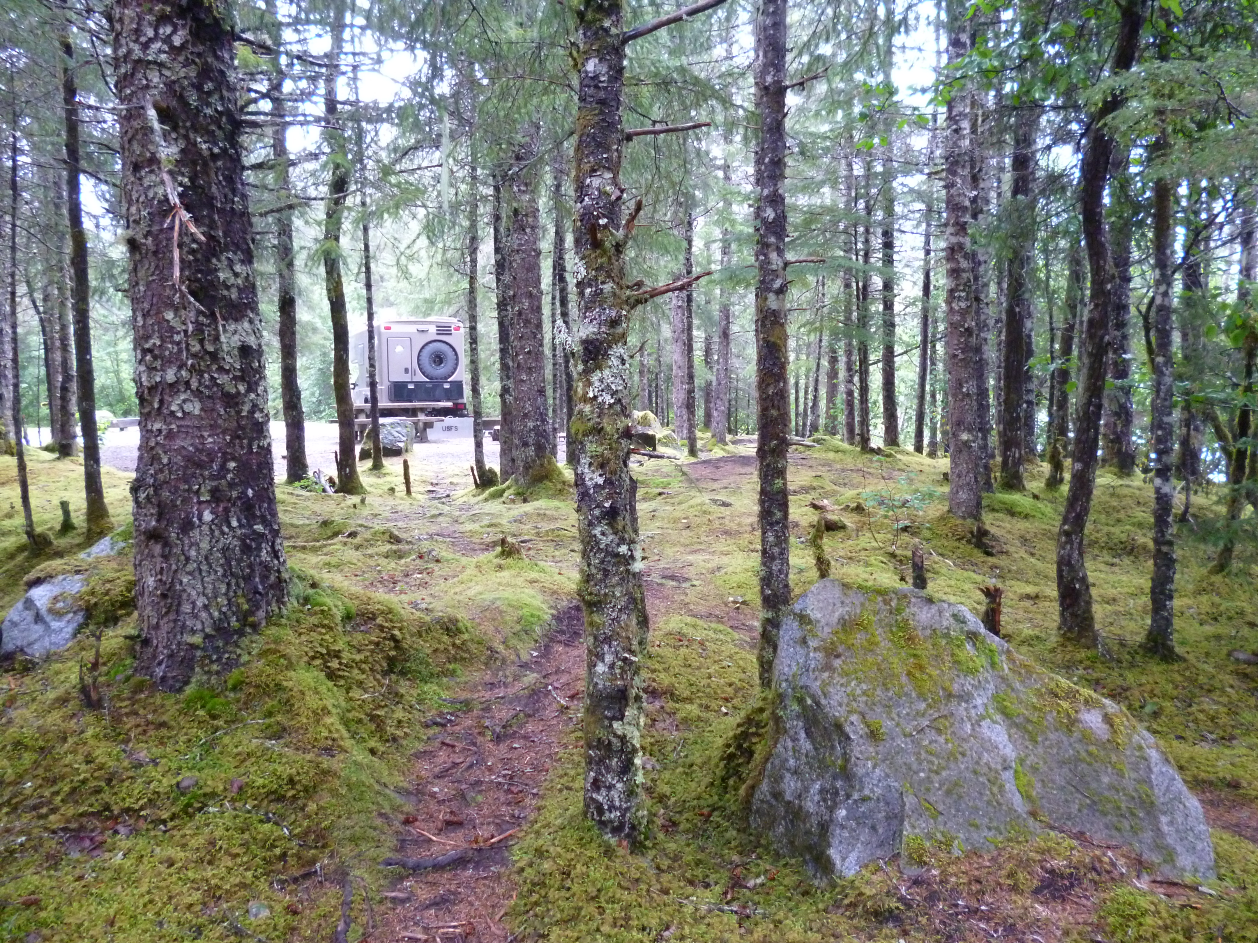
We camped at the Mendenhall Lake Campground and the camp host gave us a great site.

P1040948

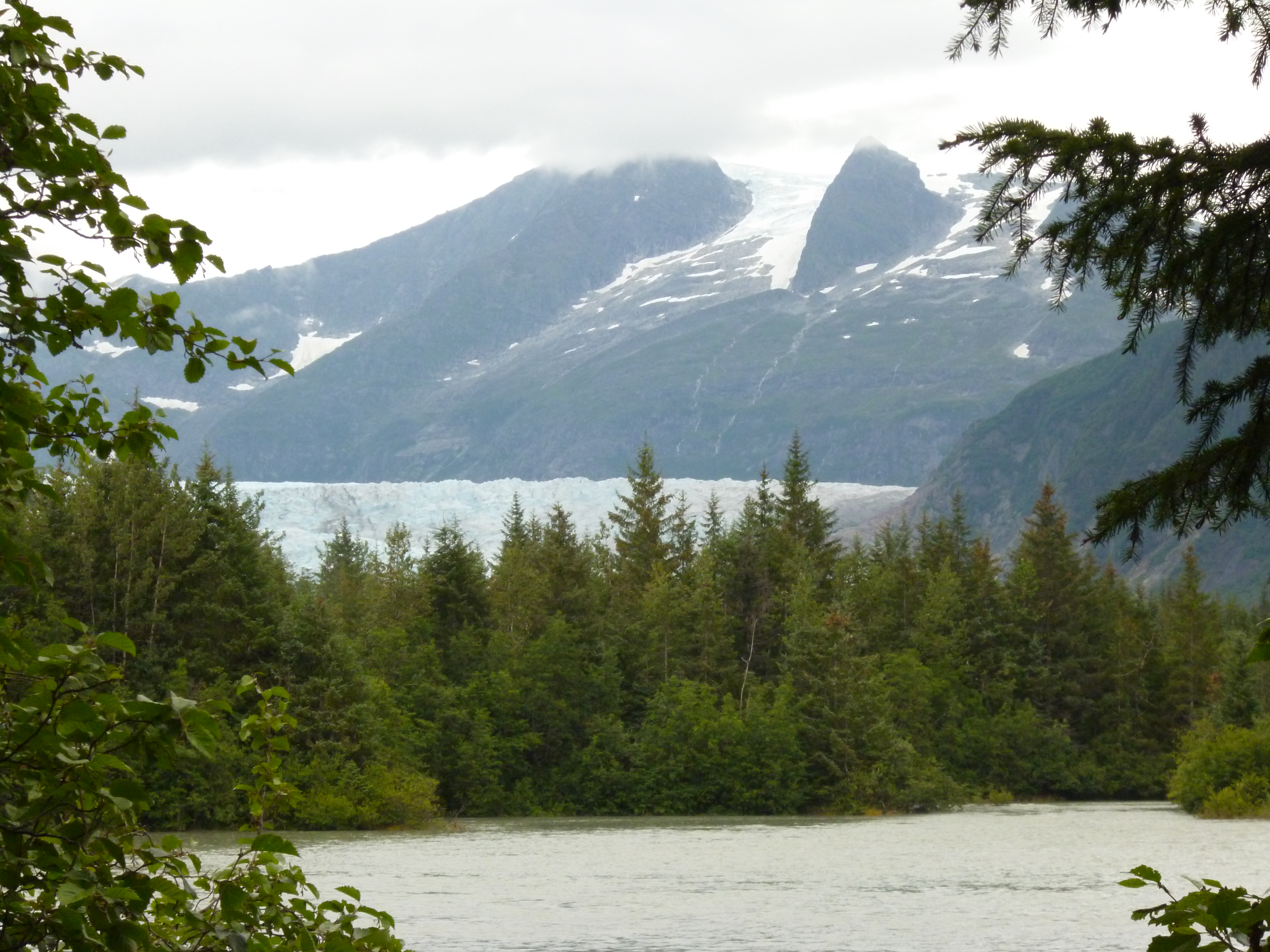
Here is the view from the campsite looking toward the Mendenhall Glacier.

P1040991

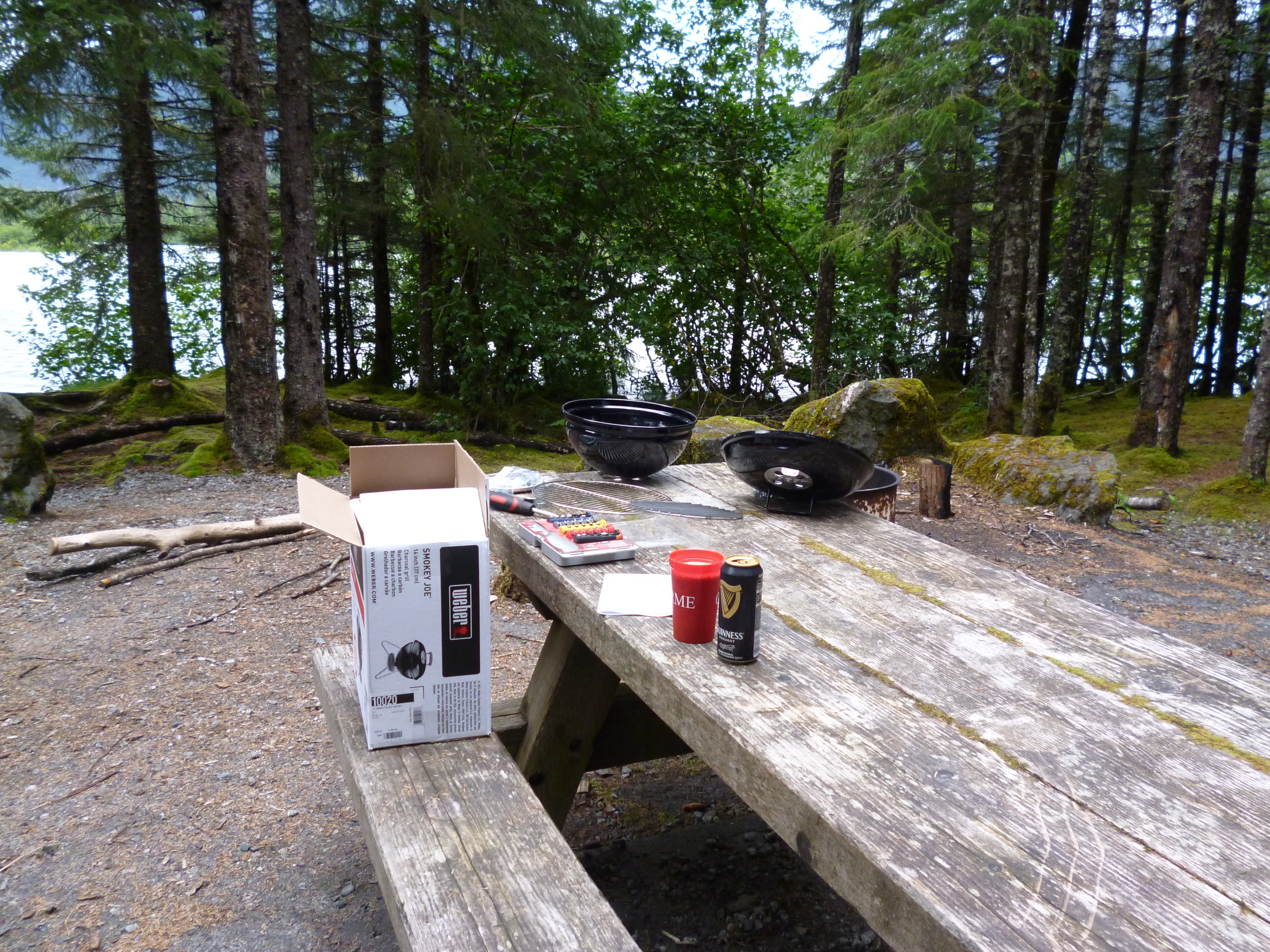
It would have been a top ten spot if someone had not taken my baby weber from our campsite while we were out sightseeing. We bought a new baby weber to replace the stolen one, but it’s not the same. I hope Karma kicks in real soon for whoever took it.

P1040992

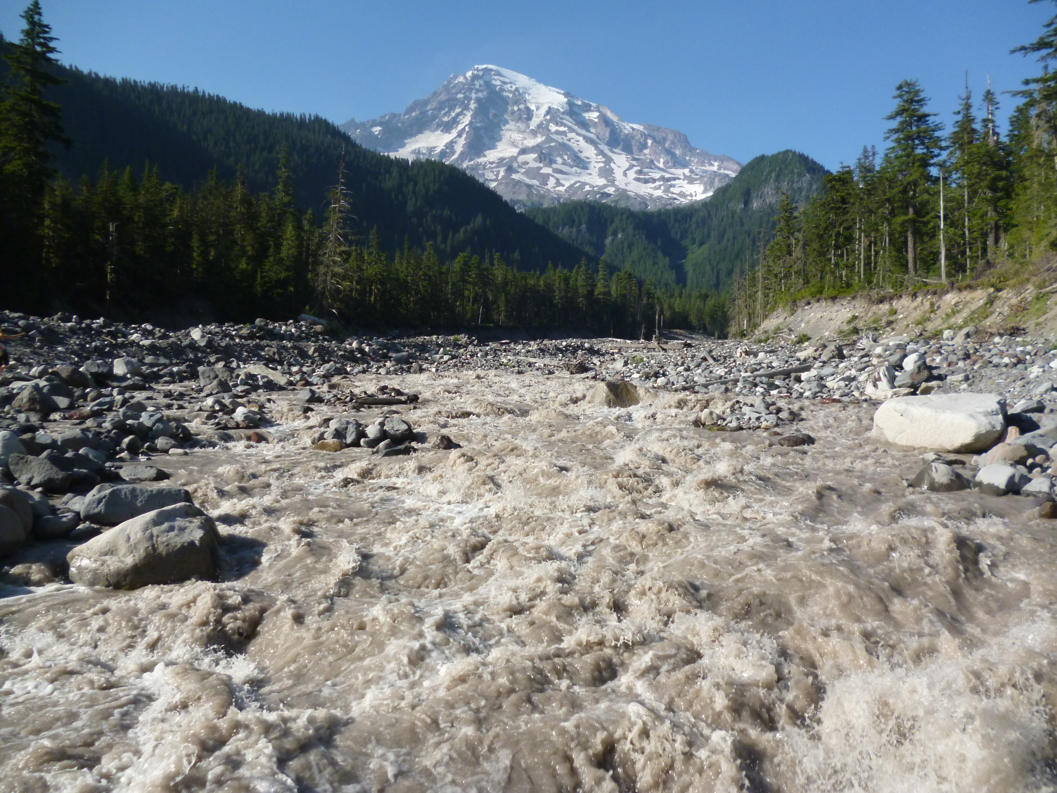
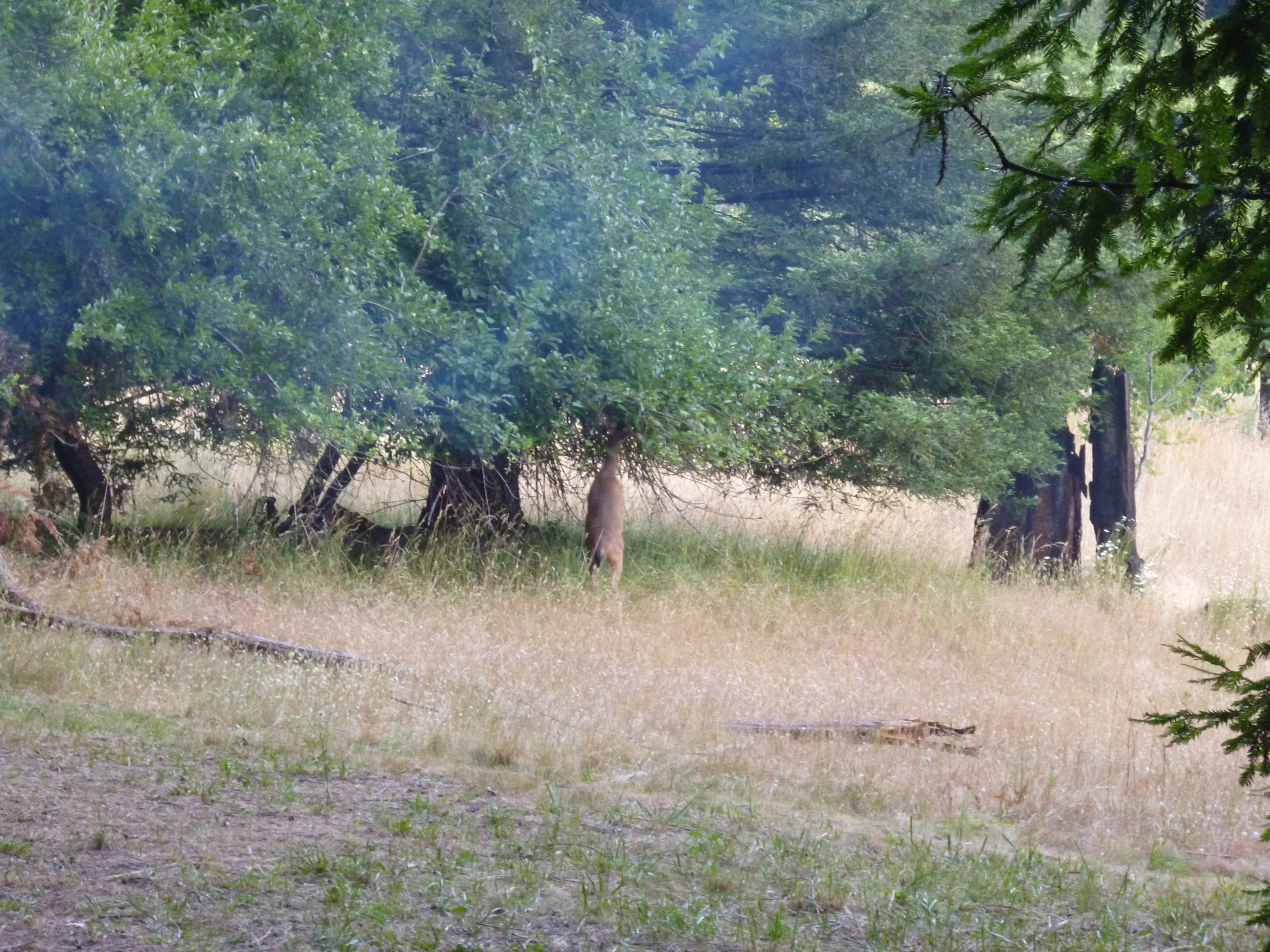
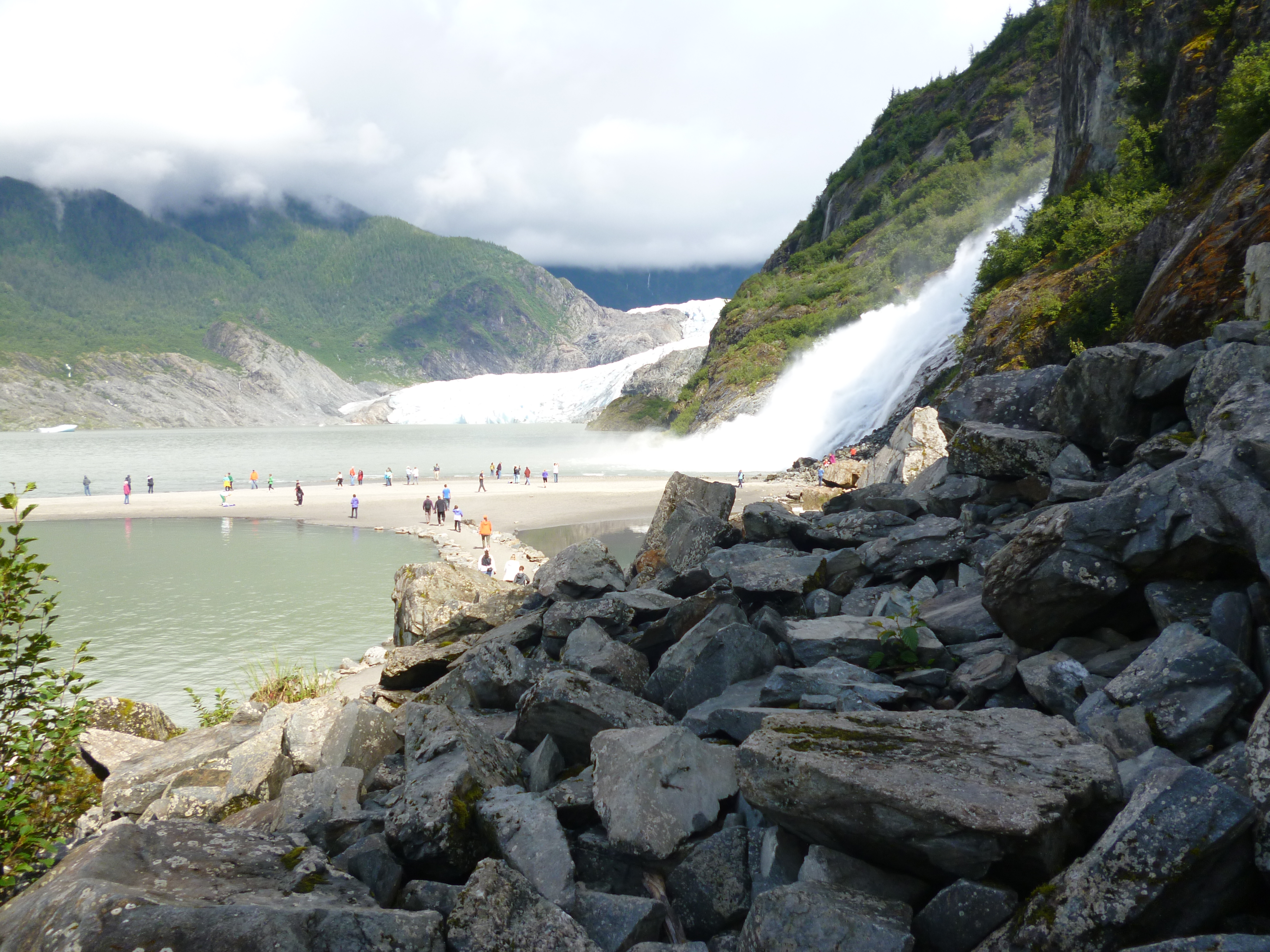
We went to the Mendenhall Glacier and did a couple hikes around the area. The sun broke out from the rain clouds to really show the amazing color of the glacier.

P1040958

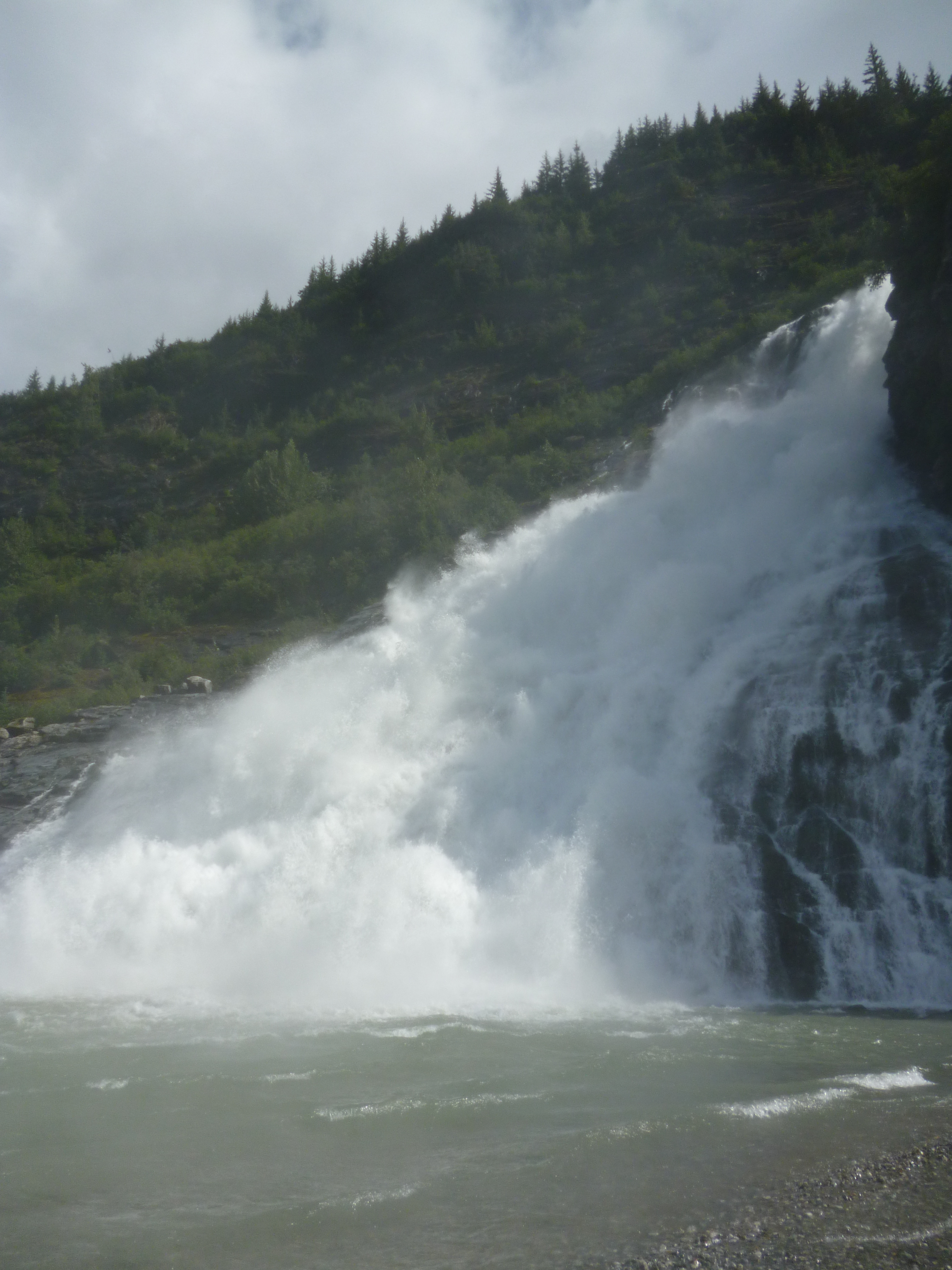
The waterfall of the mountain runoff was pretty spectacular too.

P1040971

P1040966

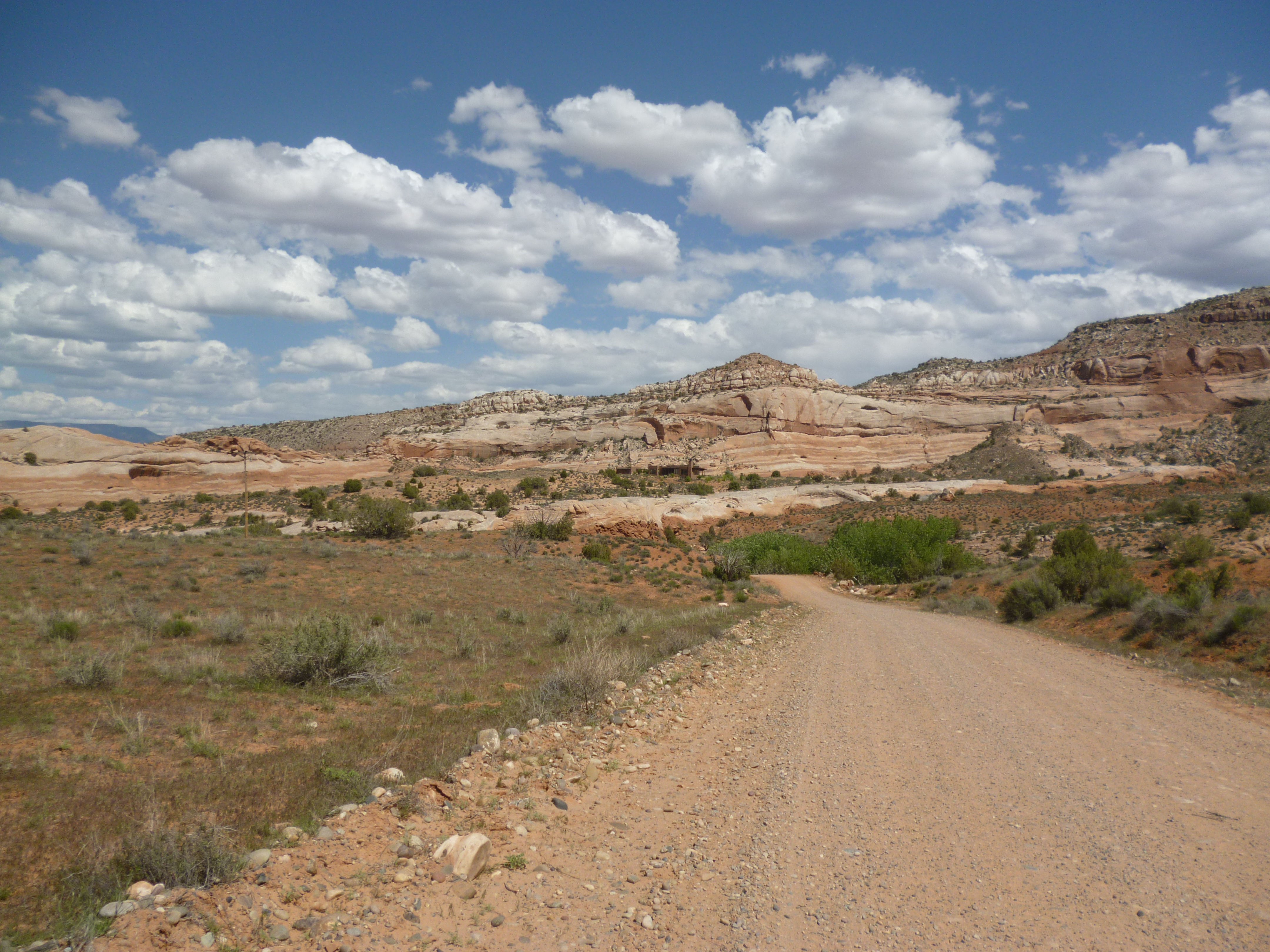
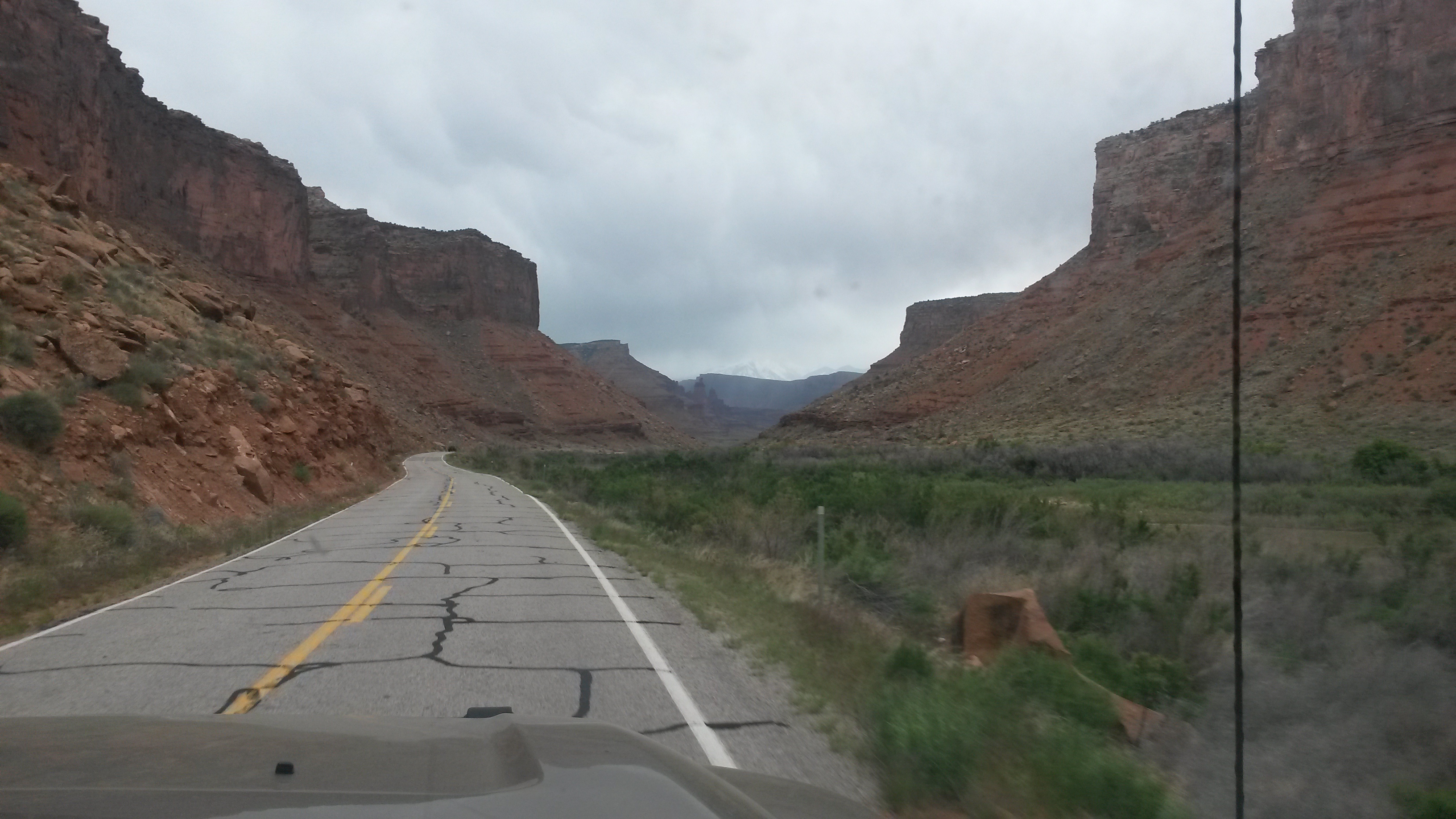
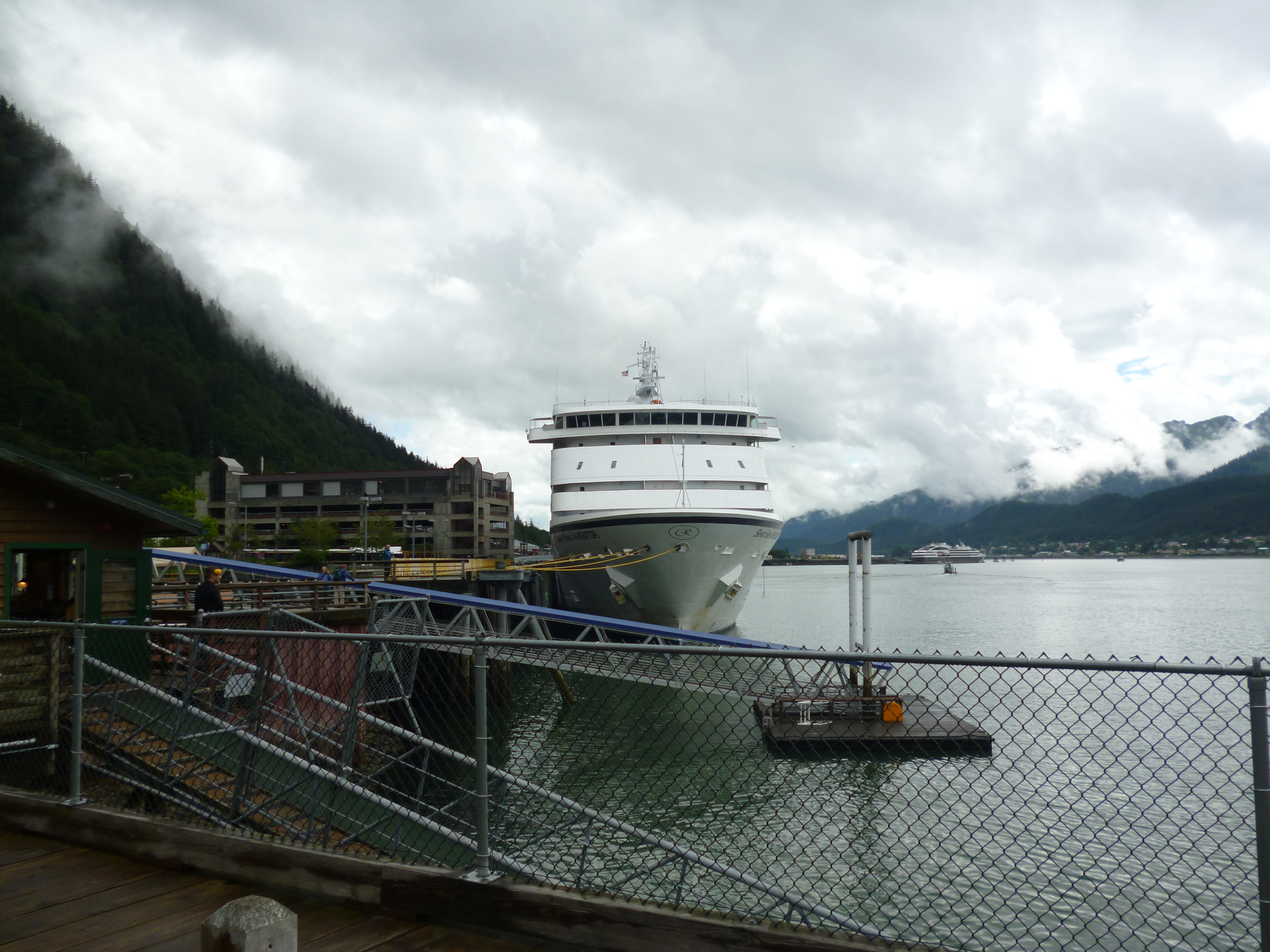
The downtown section of Juneau is small enough to cover the entire area on foot, so we did. We were warned that the downtown streets would be tight for a rig the size of the Roamer, but it was not an issue. They obviously have never driven through Moab before where mirror removal is highly likely. The buildings in town have a gorgeous backdrop of the mountains.

P1040979

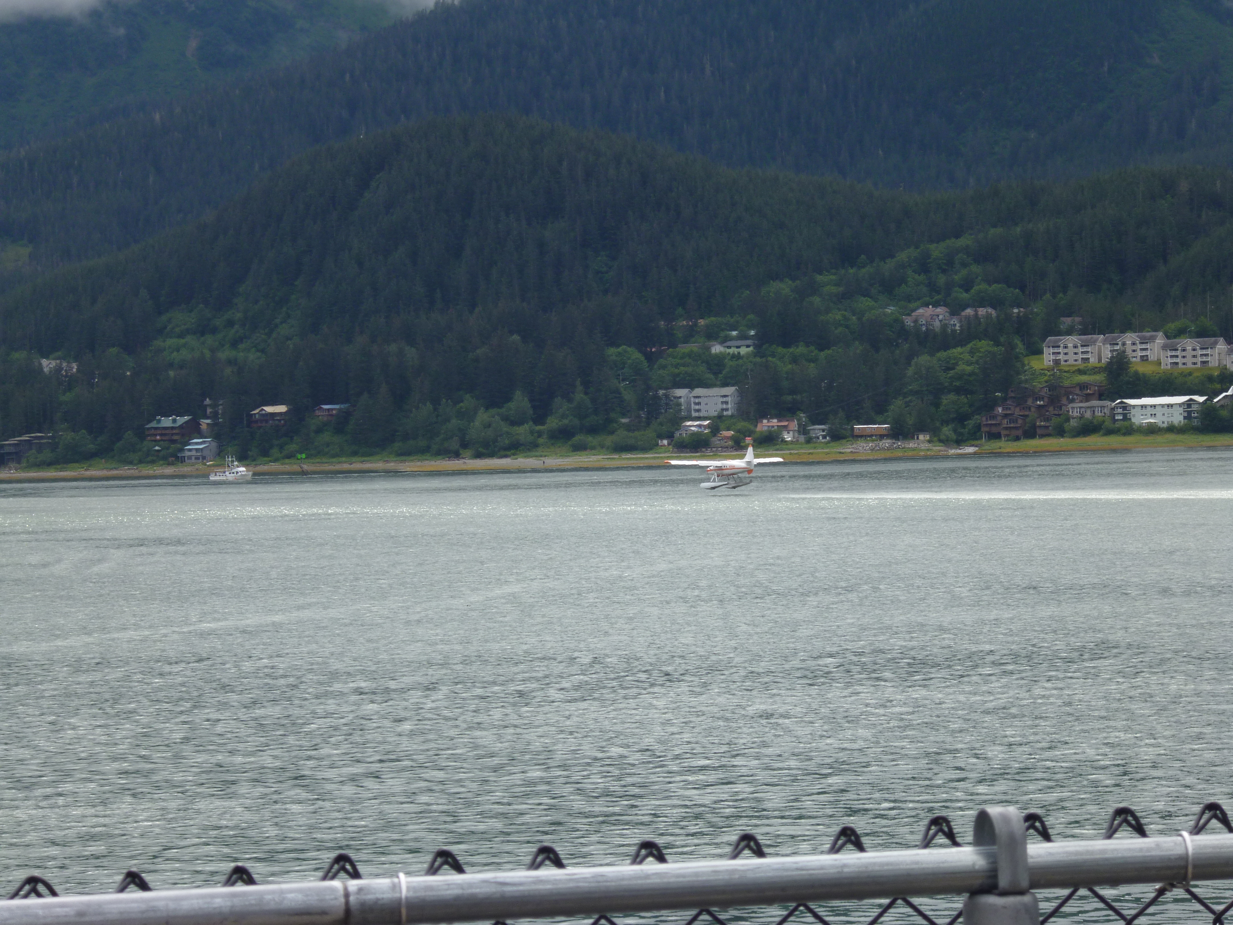
There were five cruise ships in town, which made for a lot of folks walking around town. The folks were also taking advantage of the good weather to book flights on the boat planes that fly out of the downtown harbor.

P1040975

P1040978

We head for Haines tomorrow and the inland of Alaska. This will end the ferry section of the trip and begin the next leg of our summer journey.

Northbound Alaskan Ferry

The next leg of our trip is the ferry ride on a few of the Alaska Marine Highway ships with stops along the way to our final departure port into the heart of Alaska at Haines, Alaska. The most southern port on the highway, and our point of departure from the lower 48 was Bellingham, Washington aboard the M/V Columbia.

P1040728

These ships carry vehicles of every size from motorcycles to 18 wheelers. The upper deck is only cars, but the lower deck held every type of RV and truck. Here was one self-contained convoy that loaded during our trip. I wonder how easy it is to get the Smartcar loaded behind the cab?

P1040792

Our original plan was to get off at the first stop in Ketchikan, but the boat that was scheduled to take us from there was taken out of service. Therefore, we changed our route a few weeks before we left to go all the way to Skagway and then return on the M/V Columbia to Sitka, Alaska, our intended second stop. Because of this, our vehicle would be on the ship for 4 days (us too) so it was the second to the last vehicle loaded at Bellingham. A little further back and the roamer would have been swimming.

P1040785

Our M/V Columbia route took us from Bellingham to Ketchikan, to Wrangell, to Petersburg, to Juneau, to Haines and to Skagway over three days. At each port, vehicles got off and got on using just one door into the ship. The crew was amazing that they were able to off-load and load all the vehicles without moving ones already aboard around. We had to reposition the roamer at Skagway to make it easier to get off at Sitka. The roamer was the one of the few vehicles left onboard to make the return trip.

P1040824

We were worried that the freezer full of great food would not last for the three days without solar or external power. The camper batteries had gone down to 58% charge by Sitka and then re-charged to 92% during the brief time that I ran the roamer to reposition it on the ship to Sitka. You got to love this vehicle.

P1040827

The Alaska Marine Highway ships are not cruise ships, and the crew are state worker (no tipping allowed). While the commercial cruise ships docked in the downtown berths, our docks were typically a few miles away from town. This actually worked out better since it allowed us a nice hike at our stops to stretch our legs after just sitting, reading and chatting with the passengers and crew during the hours on the ship.

Many folks did not get rooms for the multi-day trip, instead they just threw up a tent on the aft decks to camp. The covered part of the outside aft deck even had heat lamps to keep the folks crashing in just sleeping bags on lounge chairs warm through the night.

P1040731

Luckily a room became available when we changed our itinerary so we had beds and a shower for the trip to Sitka. Given that the weather was a little damp most of the time aboard, a room was a very good thing.

P1040734

The first day aboard was a pure steaming day, no stops. We saw a few whales and many eagles on our way to Ketchikan. The waterway runs through the hundred of islands along the British Columbia and Alaska coast, some as big as Connecticut and others as small as a pile of rocks. We saw a whale breeching in one of the channels ahead, but then the ship turned and motored up the other side of the island. We never got a picture of the whales or their spout mist, but the landscape scenery was beautiful even during the foggy, drizzly days. I guess that’s an advantage of living in the desert. A nice rainy day is a wonderful thing.

P1040811

We got off the ship at Ketchikan while it was at port instead of a couple of days as originally planned.

P1040770

We visited the museums and visitor centers there that were quite interesting. The town is only about 4 streets wide and a salmon creek cuts through the back side of town, where the bars and brothels used to be located in years past.

P1040778

Now the buildings along Creek Street are historic (although I’m sure they were then too), and contain shops for the tourists. It was said that the men only talked about fishing while on Creek Street and only Creek Street while out fishing.

P1040776

The waterway varied in width from open ocean sections and far away islands to tight channels.

P1040742

P1040808

The Wrangell strait was a narrow section, where only one large ship can go through at a time.

P1040795

At Skagway we made the turn back to Sitka. We didn’t get a chance to get off at Skagway since I was in the car deck waiting to reposition the roamer during most of our dock time. Skagway was the place all those folks climbed the hill heading into the wild Alaskan wilderness and gold country back in the early days.

P1040819

Looking back down the channel towards Haines was very beautiful.

P1040816

We left Skagway expecting to wake up the next day nearly to Sitka. However, we woke to find ourselves back at the Juneau docks with a ship engine in repair. At one point we had to reposition the ship to allow another of the ships to come in and port. The ship was finally fixed, but we missed the tides for a critical section between Juneau and Sitka so we’ll arrive in Sitka about 12 hours late. Instead of two days there to explore we’ll only have a day and ½ before we will be back in Juneau for a couple of days of exploration.

P1040830

While the ship travel has been interesting and the dining room food yummy, we’re both ready to hit the road again and explore the land on our own schedule in the roamer.

P1040736

P1040764

Washington

We left the Oregon coast on Friday morning, 3 July. As we headed inland it was very clear that most of Oregon was descending upon the chilly coast for the holiday. The road heading towards the coast and the 101 highway along the coast were packed. We got out of there just in time.

We headed inland to McMinnville to spend the holiday with Chuck and Lori. They were great hosts for the holiday weekend. Since we got there early after deciding not to sight-see along the coast due to traffic, they met us at the Grain Station brewery for lunch.

20150703_120841

We toured the beautiful valley and visited one of the many outstanding Pinot Noir vineyards in the area, Durant Vineyards. The view they had was amazing, looking over the vine covered hills with Mt. Hood off in the distance. The pinot noir was good and our server very gracious with a few extra pours. He grew up in the neighborhood Pam and I lived in Long Beach and now owns a place in Pacific City, Oregon to surf, the home of the Pelican Brewery and our possible next home site – lol.

20150704_114808

We then went to the Evergreen air museum, where most of the vintage planes from Falcon Field’s museum were sent, along with the Spruce Goose. The last time Pam and I saw the Spruce Goose was the day after our wedding on the Queen Mary in Long Beach 30 years ago. It was where the Spruce Goose used to reside, next to the Queen Mary.

20150704_191926

I saw the DC-3 that I helped a little to restore back in the early 80s when I worked at the Long Beach plant.

20150704_193159

Their aircraft collection included both air and space and was pretty extensive. They had a video of the President Kennedy speech that launched NASA and the quest for the moon. Why don’t we hear speeches like that anymore?

20150704_203146

I am always amazed when I see the lunar lander and wondered how that discussion between the engineers and astronauts went – okay, so we need the largest streamline rocket in the world filled to the top with fuel to get us out of earth’s pull and into to space, but this tiny aluminum foil covered, easy bake oven shaped box with fuel about the size of a keg of beer is going to get us off the moon and home – I’m in.

20150704_202338

We saw a 40 minute fireworks display that seemed to never end for the 4th at the museum. We took the roamer there and the 4 of us sat inside and had some drinks while the parking lot of thousands emptied – man I love this vehicle.

We then headed north to Mt Saint Helens area and camped at Lower Falls campground. This is a great campground for those passing through the area. The sites are huge, well forested and right next to the beautiful falls – definitely a top campsite list site.

P1040653

P1040654

We did some nice hikes along the river and then just relaxed in our zero gravity seats (a must for long trips) in full recline mode to enjoy the canopy overhead.

P1040661

P1040659

We visited the blast area of Mt Saint Helens. It was in May 1980, over 35 years ago that the mountain blew. The lateral blast out of the mountain obliterated everything within 5 miles, knocked trees over up to 15 miles and scorched the forest up to 17 miles away from the blast. This shot was just beyond mile 5. South facing slopes and even some of the local lakes survived the blast due to the ice and snow that still covered the ground in May of that year.

P1040673

We climbed the thousands of stairs to a nearby lookout point. Felt like a small piece of south Kiabab all over again. This was from about half way up to the peak. The entire area is part of a study to see how the terrain regeneration will happen.

P1040670

Mt Adams could be seen from the area. All of these peaks: Adams, Hood and Rainier, are volcanoes similar to Mt St Helens in their ability to erupt.

P1040674

The white along the lake shore are thousands of logs that washed back into the lake from the far side when the blast related landslide displaced the lake up the far side of the mountain in a wave. The landslide raised the lake bed and the local terrain by 200 feet. The mountain peeking over the rise is Mt Rainier.

P1040671

Mt Rainier NP was our next stop. The mountain is covered with glaciers and the surrounding area is rugged terrain and woods.

P1040709

We hiked what we thought was a nice level hike around the lake and it seemed to go up and up until we came out on top, overlooking the lake below. The roamer is parked down there somewhere along the road.

P1040705

After the hike we kicked back at the campsite and had a few Raaaai-nieeeeeeer-Beeeeers to relax at the end of the day. It seemed appropriate.

P1040711

We camped at the Cougar Rock campground in the park for a couple of days. It was right next to one of the many glacier generated rivers coming from the peak. The water has the “glacier flour” mixed in to give it the milky color. The majority of the drinking water for Seattle and the surrounding Puget Sound is from the glacier run-off.

P1040712

We then drove to Bellingham to close out this segment of our trip, the west coast adventure. Taking the back roads to by-pass Seattle took us by Snoqualmie Falls.

P1040715

We are restocking, refueling, doing laundry and in general getting ready for the next segment of our trip – the ferry ride up to Alaska.
We camped at Larabee State Park outside Bellingham. It was a nice place with the possible exception that it’s about 100 yards from the Burlington-Northern Railway line that runs down the coast with trains running about every hour. I can sleep through anything, but Pam was a little restless. I’m glad she picked the site – lol.

P1040717

P1040721

Oregon Coast

Before we left Eureka, we had to get some business done on the road using a traveling notary. Nearly everything can be completed on the road with marginal connectivity in remote areas, even things that require the older way of doing things, like physically signing papers.

The notary was a petite lady who met us at one of Eureka’s mall parking lots with her husband. Being RV owners themselves, they also liked the roamer. As we took care of the paperwork, they told us about a recent trip they had to the Midwest where a tornado touched down next to their RV park, 30 minutes after the severe storm warning was lifted for the area. Their RV was picked up off the ground, with them in it, and several of the others RVs around them were damaged. Luckily no one was hurt. Wow, not the kind of off-road adventure we want to ever do.

Our first stop in Oregon was at Crater Lake NP. It’s hard to grasp the beauty and size of the now-submerged volcano caldera. The lake is six miles across and it’s the deepest lake in the US at just under 2,000 feet deep. That’s a lot of fresh water.

P1040571

We got there as a huge thunderhead cloud formed over the area, which shed only a few drops of rain, but the lightning it produced sparked 6 small fires in the local area. We saw fire crews the following day around the park fighting the smoldering spots in the forest. We watched a huey with its bambi-bucket fly over our campsite carrying water to the remote fires.

P1040580

The lake has many great places around its perimeter to enjoy the view and do hikes. We did a couple of hikes to the local waterfalls. These are spring fed streams from water pushed through the rock from the lake that appear miles away from the lake itself.

P1040554

The meadows there were pretty and full in bloom. The mosquitoes seem to be getting bigger as we move north. Maybe they will be bird-sized when we get to Alaska.

P1040537

We also did a hike to “the pinnacles”, which are the remains of heat vents that hardened in the pumice ash and have now eroded in the river valley.

P1040550

As with all of the larger national parks, the Crater Lake lodge was very interesting. Maybe after we no longer have the roamer we’ll do a national park lodge tour in the winter months when they are blanketed in snow and the parks mostly empty.

P1040572

We then headed north out of the park and west towards the coast down the beautiful Clearwater and North Umpqua River gorges.

P1040583

Before we reached the coast we passed a logging truck procession in Myrtle Point. Logging is big business in the area and these trucks roll by constantly on the area roads, or at least the ones we were traveling.

20150628_115806

We stayed at Bullards Beach State Park once we hit the coast. It was a ¾ mile hike to the beach through the grass that grows along the sandy coast.

P1040586

The beach was foggy, cool and mixed with a little rain. Coming from the Arizona heat, the weather felt chilly and perfect. In fact, talking with the Oregon folks at the campsite the heat was nearly triple digits 1/2 an hour inland, so they too flock to the coast to cool down.

P1040588

The Oregon coast is beautiful. It varies from rocky slopes to huge sand beaches with hundreds of state parks running nearly the entire length of the coast. This picture was at Cape Arago State Park.

P1040597

We spent a morning in Coos Bay doing laundry. We now are the proud owners of a Green Lantern laundry card.

20150629_121709 Oh Yeah!

While we have a great stockpile of food in the roamer and have been eating great on the trip, it dawned on both of us that we were now on the coast where good seafood was to be had. During our adventures we stopped at Fisherman’s Grotto in Coos Bay, a small restaurant near the docks surrounded by beat up cars – must be good. I had some great fish and chips and Pam had the seafood sampler with some incredible chowder on the side – yum. She even found an Oregon beer that rivals Four Peaks’ Kiltlifter. It’s brewed further up the coast so we added it to our list of places to see.

We found a botanical garden at Shore Acres State Park that was very interesting. The nice thing about the Oregon parks is that if you are staying at one you get into all of them free. Also, like the botanical garden, many of the parks are lands that were given to the state by early Oregon families to maintain the beauty of the coast.

P1040600

P1040606

The garden also has a rose garden with many different varieties that are the winners of a yearly competition. This one was about the size of my fist and had as many petals as a head of cabbage.

P1040604

We then made our way up the coast to our next campground at South Beach State Park, just south of Newport, Oregon. Along the way we stopped to visit the lighthouses that dot the coast. There is a Lighthouse Stamp book similar to the National Park book I have, but in a very weak moment I decided not to get it and therefore pass by some future lighthouses unstamped.

P1040610

We passed the great sand dunes of Oregon and stopped to take a picture. The last time I passed through there I was with my two sons and a friend of my eldest son. We rented a couple of sand rails for the afternoon and ripped through the dunes. We passed on the rails this time.

P1040618

We also passed through Yachats (YA-hots), Oregon and stopped in the Drift Inn for another great seafood lunch of salmon chowder and seafood lasagna. The seafood lunch stop can be very addictive.

South Beach was a shorter walk from our campsite, but foggy when we arrived.

P1040622

The weather on the drive up the coast alternates from beautiful sunshine to fog. One person I talked with said the exception is Brookings, Oregon near the California border. Unfortunately our route took us around Brookings, but the place apparently has unexplainable great weather all the time, even when the neighboring areas do not. May be a place to visit and find out.

We did a hike at Cape Lookout, which was lush forest until it broke out into an amazing view high above the local surf. The fog wrapped around the cape and we could see areas of the coast that were sunny and others socked in with fog. I wonder if the fog pattern is nearly the same so you can pick your pleasure along the coast, fog or sun? Maybe it is the same and could explain Brookings’ weather.

P1040629

P1040630

We then traveled north along the coast’s back roads to Pacific City and the Pelican Brewery. Apparently more folks than just Pam like their Scottish ale because it was the only one they did not have on draft – noooooo. They had great food and we sampled the many beers they did have, all award winners and very good.

20150701_114411

The place is right on the beach and in this area of Oregon driving on the beach seemed to be the norm.

P1040626

Pacific City has a real shot at being our retirement residence.

We then headed to the Tillamook cheese factory in Tillamook, Oregon. They make 167,000 pounds of cheese a day there. That’s a lot of curds.

P1040634

They had awesome homemade ice cream and we tried the Oregon black cherry – very good. We stocked up with cheese products and even found some maple walnut fudge. Pam and I jumped in the Tillamook VW minibus and attempted to make a getaway, but decided to keep the roamer instead.

20150701_145809

We did a walking adventure day to Newport, Oregon, which was only 2 miles from our campsite. We visited the aquarium first. Otters, sea lions and even birds were at the aquarium.

P1040645

We then walked home past the Rogue brewery – had to stop. We tasted a few of their beers, ciders and mead. Pam could not find a four peaks Kiltlifter equivalent there, but I did stumble upon a good “aged” beer that was similar to Stone’s Oaked Arrogant Bastard Ale, called Aged Dead Guy. They had a cooper onsite and made their own barrels for the aging process.

P1040650

Heading north tomorrow to spend the holiday weekend with friends.

California Coast

We left Yosemite and headed west to Sonoma, California. Everything seems to grow in the Napa and Sonoma valleys, but mostly grapevines dominate the landscape.

P1040472

We parked the roamer at one of Pam’s high school alums that we met recently at the Orme Sustainability Workshop and the yearly reunion a week later. Dani and her dog Smokey were great hosts. We checked out downtown Sonoma and a few good restaurants in the Sonoma area.

P1040469

We then headed for the California coast over the rolling hills between the hwy 101 and hwy 1 along a road that was marked as “other road (paved)” on our Rand McNally map book. It was a great drive through the hills as the road varied in width from two lanes wide to sometimes barely one lane. Luckily the traffic was very light so it was an enjoyable drive.

20150621_130155

20150621_140647

We hit the coast and drove north on hwy 1 to Van Damme State Park for the night. There seems to be a lot of land along the coast for sale. We found out for many of the older places their wells have dried up and need to have water trucked in now. Million dollars views and nothing to drink but beer and wine – could be worse.

P1040475

We then headed further north to the Redwood National Park, just north of Eureka. We stopped along the way to check out the beaches.

P1040482

And even found a few sea lions basking in the sun at one of the stops.

P1040480

The redwoods may not be as wide as sequoias, but they are taller. We parked by one of the redwoods along the park road.

P1040484

We did several hikes through the park. The forest represents only the 5% of the old growth redwoods they could save before they were all logged and the place is jungle-lush with growth.

P1040503

Even the fallen trees provide a growth area on top for ferns and smaller trees.

P1040499

Small streams ran through the woods with crystal clear water.

P1040504

The ocean was less than a mile or two away so we had lunch on the beach between hikes, watching the fog roll in.

P1040508

We camped at the Elk Prairie campground in the park. It was aptly named given the elk that were all around. Check out the rack of the bull elk on the right resting in the tall grass.

20150622_153213

We then headed south to Humboldt Redwood State Park using another of the “other paved” roads noted on the map and recommended by Lou. The road starts in a little town of Ferndale, which has a great blacksmith studio and gallery along with a good pie shop.

P1040511

The road was a winding road through the coastal hills that drops you down to the seaside, hidden from most of the travelers through this area of the country. The end of the drive enters the Humboldt Redwoods park from the less-traveled west-side entrance. What a great drive. The road was a little rough given the hundred of pothole patches along the way, but at least it was 2 lanes wide for nearly all of the route.

20150624_122102

20150624_122210

We camped at Albee campground in Humboldt which used to be the location of the old Albee homestead before the park was created. Pam and I went for a walk around the place after we arrived and through the old orchard of the homestead. We found what we learned later was inch grass, a bamboo looking plant that appears like 3 foot tall strands of asparagus that lined the perimeter of the field.

P1040524

We surprised a deer buck that bounded out of the tall grass and as we watch him we turned and noticed a bear under one of the orchard trees about 20 feet away. Both of us must have noticed each other at about the same time because the bear had that “duh” look on his face as he looked at us. I guess so did we. He then ran the other way into the orchard. That makes 8 bears so far this trip.

The deer were eating the apples too as we noticed this buck on his hind legs reaching for some of the low hanging fruit.

P1040529

Goodbye to the redwoods for now.

P1040489

We’re now heading north to Oregon.

On the Road Again

Pam and I are on the road again for another epic summer trip in the roamer around North America. The trip is really made up of of seven different trips that just happen to end when the next begins to melded into one long trek. The first leg of our trek is a western and Pacific coast adventure that will take us up through California, Oregon and Washington.

Our first stop was Joshua Tree NP. It has been at least a couple decades since Pam and I were there. It was nice to be back. Joshua Tree looks like the place Doctor Seuss got most of his inspiration for his unique landscape drawings in his books. Joshua trees are really interesting and the rock formations in the park are just beautiful.

P1040394

P1040373

We camped in White Tank campground and got the spot at the end of the road, site 15. What a great spot.

P1040362

It was a little warm when we arrived but it was late enough in the day that the roamer cast a nice shadow that we could hide from the sun. You know your vehicle has enough ground clearance when there is no shade from the setting sun.

P1040367

We got out early for some beautiful hikes in the park. Barker Dam and Hidden Valley are two of the ones we did.

P1040379

P1040387

We also did the 18 mile geology road into the park’s back country. What would a trip to Joshua Tree be without a drive on “a street with no name”.

P1040390

P1040391

Our next stop was at Sequoia NP. Last time we were there was when Tom was 6 weeks old and we took off on a NP tour with him. We did a lot of camping, hiking and realized that a little dirt and tree sap on a baby’s bottle did nothing bad. It was nice to be back and you do forget how massive the sequoia’s are though.

P1040413

Our campsite was at Potwisha, which is within the park but lower in elevation that the sequoia groves. The lower elevations of California were dry and warm. Luckily there was by a nice cold stream that we hiked to and dabbled our feet in to keep cool after we arrived.

P1040404

The campground was pretty eventful. First, as we were heading to bed for the night a college student biking across America asked if he could pitch a tent in our site since we have the RV. I said sure and found out he was a Virginia Tech Hokie with a plan to bike from San Diego to Virginia Beach. Lief was on day 5 of his trip and spent the day sightseeing in the park.

The next morning a black bear rolled a camper awake who was just in a sleeping bag without a tent under the stars. Apparently the bear had been visiting the campground to find food and Shaun was just in the wrong place. Pam made him a cup of coffee and we talked as he calmed himself down from the encounter. He woke up looking into the face of what looked like a 200-lb bear as I saw it disappear over the bank with his sleeping bag. He had three good raised claw marks across his side and back but the bear didn’t break his skin. When we got back from sightseeing for the day the “bear tech” team was in the camp with two bear traps to catch and relocate the bear.

We spent the day hiking the trails through the park. While we only saw a single bear all last summer in New Hampshire we saw seven bears during that day in Sequoia, 5 black and 2 brown bears. There was a bear in every beautiful meadow during our hikes.

P1040424

The General Sherman tree is the largest living thing. You can see the small folks near the 40 foot across base of the tree.

P1040430

The trees are just beautiful and it’s hard to grasp their size until you realize the trees nearby that look like saplings are really 60 foot tall full grown pines.

The next stop was in Yosemite NP. We camped at Bridalveil Creek campground, a campground near Glacier Point that is a first-come, first-serve campsite for those of us who didn’t book reservations many months in advance. We had never been to Glacier Point but it has a spectacular view of the entire Yosemite valley.

P1040454

A wedding party was there for photos at the overlook.

P1040445

You could see both Nevada and Vernal falls from the Point.

P1040449

A pet peeve of mine is that cars use RV parking as the overflow parking spots leaving no spots for RVs to park. Yosemite had these signs posted on the RV spots to eliminate that from occurring. Oh yeah!

P1040455

At our campsite, a Korean family stopped to have a snack at the campsite next to ours. We began to talk and after some time he offered me some Korean gifts: Soju and kimchi flavored noodles – who could even make this stuff up! He was surprised that I had been to his country and enjoyed Korean food as well as Soju. In return we gave him some micro-brew beers to try that we had picked up in Fresno.

We traveled down into Yosemite Valley the second day there but a forest fire outside the park made the air very hazy and our shot of the entrance a little less spectacular, but still very awe inspiring to see the thousands of feet of solid granite rising up into the sky on both sides.

P1040456

We hiked to the Bridalveil falls before leaving the park.

P1040465

We are in Sonoma now with an alumni of Pam’s high school and heading to the Pacific coast tomorrow.

Loop Completed

The Earthroamer folks were awesome. Even though they were busy getting ready for the Overland Expo show they got us in, tuned up the rig and on our way in a day. We picked up some spares for the upcoming summer trek to Alaska and started home with Lou and Nancy, another Earthroamer couple who live near the Earthroamer plant. While we aren’t big fans of freeway traveling, I-70 through the Colorado rockies is a beautiful drive. It follows the Colorado River and in places passes through some beautiful gorges where the freeway is stacked on top of itself to fit through. 20150513_112554 We stopped in Fruita, Colorado at a Mexican butcher shop to pick up something good for dinner. It was chicken in an orange sauce that grilled up nicely. The butcher threw in some ribs to try and made a great appetizer. We made our way to Dewey Bridge, Utah and diverted to a dirt road that is in the Utah Backroads and 4 Wheel Drive Trails. P1040286 Roamers are really made for this type of exploring. I was able to jump out and snap a shot of them coming up behind us on the road. P1040288 We camped at a BLM campsite (Cowskin Campground) along the road that is mostly used by mountain bike groups that ride these areas. 20150513_153513 We hiked around the area and found this colorful fellow trying to hide, but having a hard time due to his colors. P1040305 Ate a great meal of chicken, ribs, re-fried beans and tortillas next to a nice campfire. This spot is now in the top 10 places to camp. The next morning we headed towards Moab, again a beautiful drive along the river. A spring weather front dropped some rain and snow on us off and on during the entire trip. 20150514_090858 The plan was to camp in the Valley of the Gods, but it was pouring when we arrived there so we continued south to Flagstaff, AZ area through Monument Valley. 20150514_112529 We stopped at Monument Valley for lunch and to take in the view. P1040318 We stopped for the day at Sunset Crater, a volcanic field north of Flagstaff. We got a hike in to the lava fields before the rain and snow hit later in the evening. P1040322 We then split ways the next morning. Lou and Nancy headed south to Mormon Lake and the Overland Expo, while Pam and I headed north west to the Vermillion Cliffs area on the Utah / Arizona border to meet up with some folks that were backpacking in the Paria Canyon. We camped the night at Stateline Campground that is located off of House Rock Valley Road, another dirt road that runs through some pretty country. P1040328 These are our preferred state line crossing roads. P1040333 The campground is so remote that its first-come first-served and free, with great facilities for the middle of nowhere. P1040336 Pam and I enjoyed a great dinner (grilled of course) and a campfire, but our friends never did show. It turned out that the weather and resulting run-off water made hiking out of the canyon impossible until it passed, so they did not make it out safely until the next day. On our way home the next day we stopped to do a hike to some toadstools, rocks supported by eroding softer rock. P1040342 The whole area was pretty spectacular in color. P1040341 We stopped at the Overland Expo on the way. The lake bed is usually dry, but the recent rains turned it into about 6 inches of slick mud where the expo was located. It was kind of fitting that you really needed 4 wheel drive to get into the parking lot and the expo. It was a blast driving in it, but now the Roamer needs a serious bath. P1040349 They have every kind of vehicle you can think of at the expo, but we’ll stick with the roamer. P1040356 Home now for a few weeks before we begin our summer trek. While last summer was an east / west route, this one will be more of a north/south route to Alaska and back. Just need to start packing and get about 50 lbs of mud off the roamer – lol.

Counterclockwise Around Four Corners 7:30 to 1:30

We’re on the road again, swinging a counterclockwise loop around the four corners states: Arizona, New Mexico, Colorado and Utah. We started in Mesa and headed up to our place on the rim. Everything is nice and green, and plenty of water all around. Filled the peanut feeder for the Stellar’s jays and the Abert’s squirrels before heading out.

P1040221

We’ve been trying new paths in and out of Arizona. This time we drove on hwy 61 into New Mexico and the Zuni reservation. We stopped for the day at El Morro National Monument. The sandstone rock there has been the crossroads for travels for 100s of years.

P1040245

Probably because it has a year-around water source in a pond at the base of the rock.

P1040244

The trail on the rock was one of the more interesting trials we’ve hiked in all of the parks. There were ancient Zuni tribe ruins…

P1040227

Ancient art…..

P1040242 P1040240

Etching from the Spanish when they controlled the area. This one from 1709…

P1040241

One of the more recent ones from early Americans when they took control of the area. This one from 1866…

P1040239

The path was carved in the sandstone in some places and two lines marked the path along the crest.

P1040230 P1040235

Woke up the next morning to snow on the ground.

P1040247

We drove a little way east to El Malpais National Conservation Area. It is a volcanic area with large volcanic beds and craters over a large area. There were many volcanic lava tubes that were now caves and tunnels throughout the area.

P1040248

At the visitor center we ran into a couple that was hiking the Continental Divide Trail from Mexico to Canada. This park is along that trail. It was their third year of hiking, having finished the Appalachia Trail and Pacific Crest Trail in the two previous years. Pam and I agreed that we would stick with the roamer – lol.

As we were exploring the area a blizzard blew through with alternating heavy snow and blue skies. Here is a picture from one of the look off points over the volcanic flow fields below…

P1040252

Pam enjoyed the view from inside the roamer…

P1040255

Then the skies cleared when we got to the arch located in the park ….

P1040256

We then continued up through Santa Fe, New Mexico and the snow to southern Colorado. We camped just outside the Great Sand Dunes National Park there and awoke to some beautiful landscapes.

P1040275

We headed over to the Dunes for a unique shot of the snow covered 700 foot dunes with the 10,000 foot mountains in the background.

P1040280

From there we continued up the valley through Salida (a very neat town with a great restaurant named Laughing Ladies), over the front range mountains and into Longmont, Colorado. The roamer is getting its yearly tune-up for all of the camping systems at the Earthroamer factory in Dacono. We’ll be heading west with friends back to Arizona soon to complete the loop through western Colorado and Utah. Stay tuned…

Westbound from Austin

Before we get into the return part of the trip, I did find a couple of pictures off of Pam’s phone from Big Bend that were great. Typically we don’t take pictures of the more “interesting” places during a drive due to our attention on the road. However, Pam snapped this one on the road to the hot springs, where it was a one-lane road, and given the wider wheel base of the Roamer, it didn’t leave much room for error. The one-lane the other way is tucked against the rock wall on the other side. What a blast to drive.

20150405_115132

The second picture was of a very unique rock wall where the softer rock had eroded away around the veins of harder rock to form the marbling seen in the wall.

20150405_125100

Now back to Austin and our trip home.

We headed into Austin from our campsite to see the wildflower center and grab some good Texas BBQ. It should be said that the flowers along all the roads and in the Texas fields during our trip there and back were gorgeous, best in years folks told us.

P1040119

The Lady Bird center was nice, but a little bit of a letdown. Based on what we saw on the roads, I expected huge lawns of the Texas flowers in all their colors for us to see. It was more of a botanical garden with large open fields and a visitor center to help us identify all the flowers we had been seeing on our trip.

P1040121

The facility buildings were beautiful stone, metal and wood structures and still a very nice place to visit. They were getting set up for the yearly sale of plants and the place was buzzing.

P1040138.

We looked up a Diners, Drive-in and Dive BBQ place in Austin called The Green Mesquite. The place looked like a classic throw-back with an outside patio area that also hosted local bands there most nights. Their T-shirt “horrifying vegetarians since 1988” said it all.

20150409_130336

We sampled every meat option they served between the both of us. It was good, but a recent find in Phoenix called Little Miss BBQ left us wishing for Arizona BBQ.

We hiked the falls at Pedernales Falls State Park. The water was pretty low, where at times it can be a wall of water cascading over the rocks following a hard rain.

P1040148

It rained the day of our departure, but we did stop a few places along the way. First, was one of the frontier Spanish forts near Menard, TX, the Presidio San Saba along the San Saba river. The Spanish outpost was constructed and abandoned in the mid 1700s.

P1040155

Another stop was for lunch as we entered the oil fields of west Texas.

P1040159

The lonesome roads out there are all pick-ups and oil trucks running from one far flung site to another. Most of the little towns in the area were made up of RV lots for the oil rig worker’s 5th wheels.

Our next campsite was at Monahans Sandhills State Park. The rich, dark soil of the Austin hill country transitioned into sandier soil as we moved west until the vegetation was nearly gone at the sandhills. They were beautiful.

P1040161

What was most interesting was hiking the dunes in the morning and seeing all of the tracks in the sand from the many creatures that traverse the dunes at night.

P1040178

The sunsets there were also spectacular.

P1040168

We met some new fellow travelers at the park that also have a travel blog at http://www.metamorphosisroad.blogspot.com. They have been on the road for a couple of years now. Pam and I are still new-comers to this adventure lifestyle. They travel with their cat, which is something we have been considering. Pam felt a little homesick for Peanut after our nice visit with Hans and Lisa, and their travel cat Rosie. Given our new mobile life, what we haven’t figured out yet is the optimum travel mode for the road: expedition vehicle, truck and 5th wheel or class A motor home with a car in tow. We’ll keep the Roamer for now.

We left the dunes with the objective to make it to the City of Rocks State Park in New Mexico the back way through Cloudcroft, NM at 9,260 feet before dropping down into the desert basin near Alamogordo. We stopped at White Sands National Monument since we passed right by it along this route. It was raining again, but the white gypsum dunes were very beautiful even in the rare, overcast and rainy weather for the area.

P1040191

We drove the loop into the dunes, but no hikes this time. We’ll have to go back. It’s too bad they don’t have car campsites there, just back country tent sites. It almost makes me want to break out the tent again – almost.

P1040188

We then stopped in Las Cruces for dinner at a good Mexican place, Andele’s Dog House, before arriving at the City of Rocks State Park in pure darkness just prior to them shutting the gate for the night. If you have never been to the park, finding your campsite can be tough in the daylight, but finding one of the few remaining open sites in the moonless night was an experience. Pam broke out the flashlight and we slowly made our way around the park looking for the elusive spot. After nearly circling the place, we stumbled upon a site that was marked as taken with no one there. It turned out it was a day use ticket so they had just left the park prior to our arrival – we got lucky.

When we woke up the next morning we realized how lucky we were. The sight was very nice, and now we understand why folks talk so highly of this place.

P1040196

We hiked around the rocks a little and then drove around the park again in the daylight to see what we thought we saw the previous night, and to mark campsites for future trips.

P1040197

The visitor center there was a neat building. I’m thinking I need another building project.

P1040207

We’re always looking for new roads in and out of Arizona to make our trips more enjoyable. We left the state on a dirt road near Portal, AZ into New Mexico and re-entered Arizona from New Mexico along route 180 to Eager. This was a pretty drive marked with the Rand McNally map green dots, given to picturesque roads. We’ve now traveled on many of the green dot roads. Take these roads, they are not the fastest way to a destination, but possibly the most beautiful.

P1040208

We arrived at our place on the Rim to check up on things (nothing broken or in need of repair – oh yeah) before dropping back down into the valley. The pond was full and forest looked lush, even with the lower than average snowfall this year. I guess the additional winter rain may have made up for the snow. An early Monsoon season would be good too.

P1040213

Our next trip will be into Utah in May….

Eastbound to Austin

Pam and I are on another adventure, this time to Texas. Our most eastern stop of this trip is Pedernales Falls State Park, just outside of Austin, Texas. The two main objectives of this trip were to explore Big Bend National Park and to visit the Lady Bird Johnson Wildflower Gardens outside Austin. However, the trip also needed to be filled with other stops along the way in Arizona, New Mexico and Texas. The trip started with a return visit to the Chiricahua National Monument. We visited there recently with friends, but decided to add this stop to the trip east and do some longer hikes around the rocks. We picked a nine mile loop that took us through some spectacular parts of the park. P1030912 P1030906 The eroded rock formations there are unique and some huge rocks balance perfectly on the rocks below… P1030902 …and others look like things that can easily be identified. P1030903 A male coati (about the size of a raccoon) crossed our path during the hike. One of the park rangers provided us with some good info on the furry things once we shared the picture. P1030911 We then took off over the mountains to the south on a dirt forest road (FS 42) that dropped us into Portal, AZ and then onto New Mexico Route 9, a little two-lane road that just skirts the border between the US and Mexico. The drive was though pristine desert. 20150402_113140 After passing through several border patrol check points along the route the overall verdict of the Border Patrol folks is that the Roamer is one bad machine. We agree. We stopped in Columbus, NM at Pancho Villa State Park for lunch. It was an interesting stop to learn about the Pancho Villa raids into the US and the US Army’s pursuit of his gang down through Mexico. I’m not sure I would want to be in the tank they used in the summer time. It is definitely not a Roamer. The RV park there had very pretty desert sites to camp, but it was just a lunch stop for us. Maybe a future stop of a future trip… P1030915 We ended up at Guadalupe Mountains National Park in Texas for the night, the location of the highest peak in Texas at 8,749 ft. The RV campsites are located in the trailhead parking lot and the wind howled at about 50 mph that night. Pretty place, but the winds rattled the Roamer vents all night and made for a restless sleep. P1030917 We made our way to Carlsbad Caverns National Park and hiked the caves there. We knew the cave where the millions of bats come out at night was near there, but did not realize that it is that cave opening itself. In fact that is how the cave was discovered. A 16-year old back in the 1890s wanted to know where the “smoke” was coming from, where the smoke was the dusk trail of the millions of bats leaving the cave. Most of the bats had not migrated or have awakened from their winter hibernation yet so we did not stick around until dusk. The Ranger said at this time of year it could be anywhere from 2 to 10,000 bats that leave the cave at dusk (a laser counting system is now used to track the bats), but in the summer the number is between 700,000 and 1.5 million bats. We descended down into the cave… P1030920 The cave is definitely something to see. P1030948 Unlike any other of the caves we have visited, this cave was mostly self-guided so you could take as long as you liked at a given spot. The inside of the cave rooms are huge, bigger in size and more interesting things to see than Mammoth Cave in KY. I think Mammoth may have the lead in overall length of cave distance, but Carlsbad is hands down the most awe inspiring. P1030970 Seeing that we needed to head back south to get to Big Bend National Park we retraced our path back to Guadalupe NP for the night. We prepared ourselves for the wind that had blown all day and was again predicted to build in the night, but it turned out to be a beautiful night with a light breeze and a good stop. We made our way to Big Bend National Park along route 90 through Marfa and Alpine, Texas. Along a lonely stretch of road that ran next to the Southern Pacific railroad, a train tooted at the Roamer and we back to the train, two awesome machines making their way through the empty desert. Too cool. The region had a year’s worth a rain the previous month and the spring flowers covered the desert. P1030977 In Marathon, Texas we stopped at the Gage Hotel to snap a shot of some interesting long horn art. P1030979 The road into Big Bend NP was lined with Bluebonnets. 20150404_142857 Similar to Death Valley, Big Bend has a lot of area that is only accessible with high clearance, 4 wheel drive vehicles. I’m beginning to like these places because they are more interesting to see and the number of folks in the back-country greatly reduced. We book 4 nights at Rio Grande campsite, but after arriving and talking with the Ranger decided to get a $10 back country permit and camp throughout the park. We filled our water and dumped our trash at the campsite and headed out. P1030988 The Rio Grande river enters and exits the park through two beautiful canyons. It enters at Santa Elena Canyon… P1040061 … and exits at Boquillos canyon. P1030995 The 50 some miles of 4-wheel drive road over hills and through washes between the two was a sight to see. P1040048 We camped one night at the Frenso back country campsite… P1040038 …next to the closed Mariscal Mine, a Mercury mine in operation back in the 1920s and 40s. Along with the warning if you touched anything – it would kill you, if you called it Frances – it would kill you… P1040020 The road runs along the river and at one stop we saw beavers in the river, where they build their homes in the river banks instead of the typical beaver dam and huts. P1040058 Another night we spent in the back-country campsite Rattlesnake Mountain. I was not thrilled with the name and what it implied, but there was no mountain or rattlesnakes, just hundreds of beautiful blooming ocotillos. This was a great spot that is now on our top camping spot list. We did see a beautiful 6 foot red racer snake, which eats rattlesnakes, in the back country but he was too fast for us to get a picture of him. P1040076 For our last night in the park we drove up to Chisos Basin, a campground at 5,400 feet that was not recommended for RVs over 24 feet. Since the Roamer is not an RV it had no problem with the climb or the few switchbacks. P1040099 We did a nice hike to the window rock…. P1040098 … that is a 10 foot wide gap in the rock where the wash cascades over in a beautiful waterfall in the rainy season. P1040097 Big Bend is in the Chihuahuan desert so its rainy season is the summer monsoons from June to September. However, we did see lighting in the western sky while camped at Fresno and after reaching the western border of the park the next day we saw a group of folks stuck on the wrong side of the Terlinqua creek wash that was dry when they crossed but now filled and running fast at the Santa Elena canyon. Given the number of washes we crossed in the 50 miles of back roads, traversing the park during the monsoon season would be interesting. We drove for 3 hours one day before we passed anyone in the back-country so you better be prepared for a long wait if something breaks, which we always are with the Roamer. We then drove to Austin in one day, which looks easy since it’s just a little ways across Texas, until you realize that distance is about the same as from New York City to Cleveland, OH! We also took the back roads, which added to the time but also the enjoyment. We stopped in Langtry, Texas along the border where judge Roy Bean, “the hanging judge”, dished out justice west of the Pecos. P1040108 As we entered the hill country approaching Austin, we drove by a ranch that has been hanging their boots on the fence for a few decades, according to the guy who came out to check out the Roamer while I snapped a picture. P1040114 We didn’t make it to our campsite at Pedernalas Falls State Park outside Austin until after dark and nearly clipped a deer in the rump after dusk. There are a lot of exotic game ranches hidden on the back roads in the area with high fences to keep the big horn sheep, gazelles, springbuck and even moose in so the deer had nowhere to go but in front of the Roamer (of course). Not sure it would have done any damage to our front grill, but glad we didn’t find out. More on our adventures back out west soon…