
We left Alaska and entered Canada along the Top of the World Highway.
This area is very remote so it has been a nice quiet few days to enjoy the area.
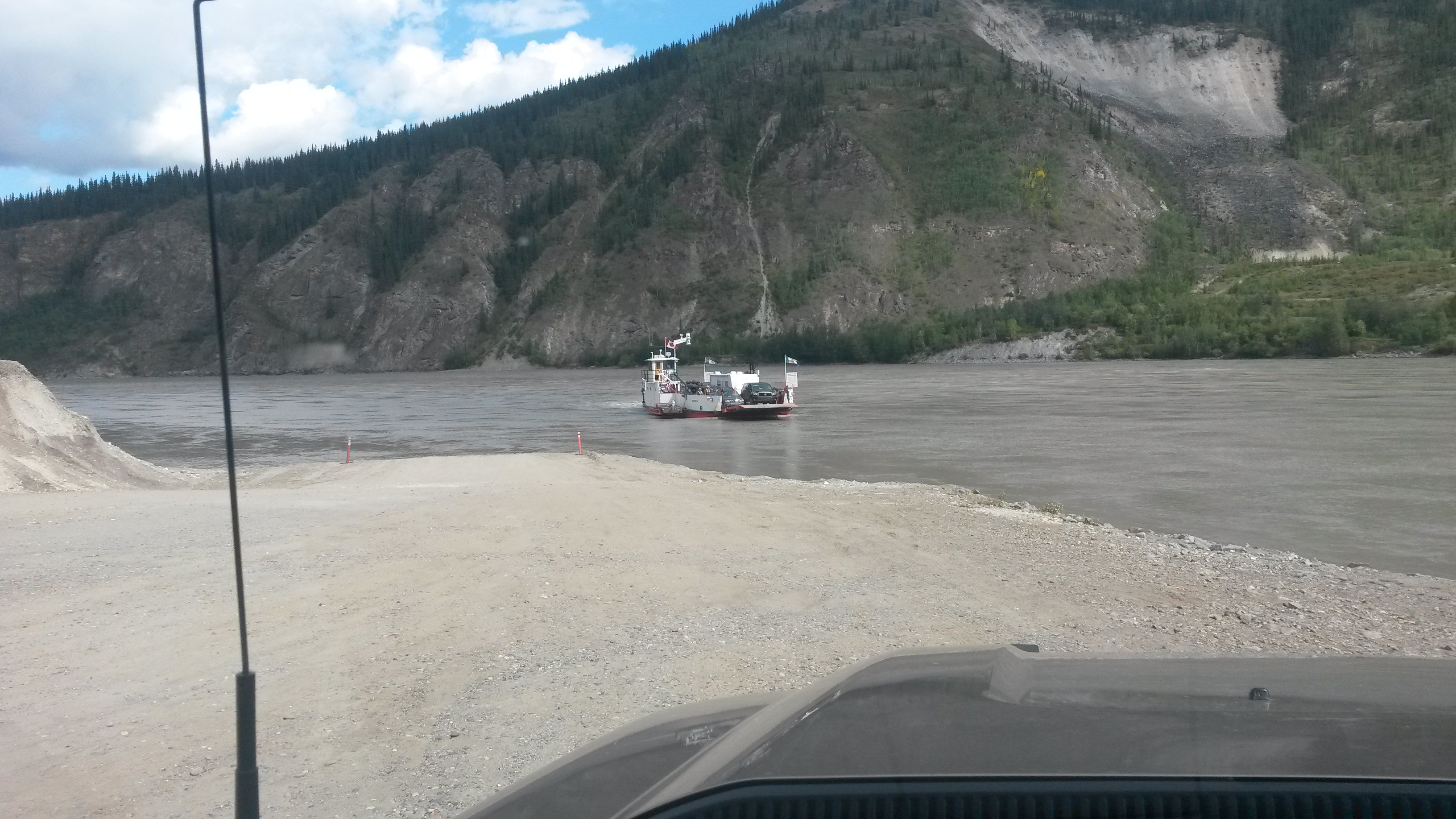
We got to Dawson City, where you have to take a ferry to cross the Yukon River, a very fast moving river. The little ferry seems to struggle to make the crossing but it does it six times an hour, 24 hours a day carrying everything from over-sized construction trucks to ten cars every trip.
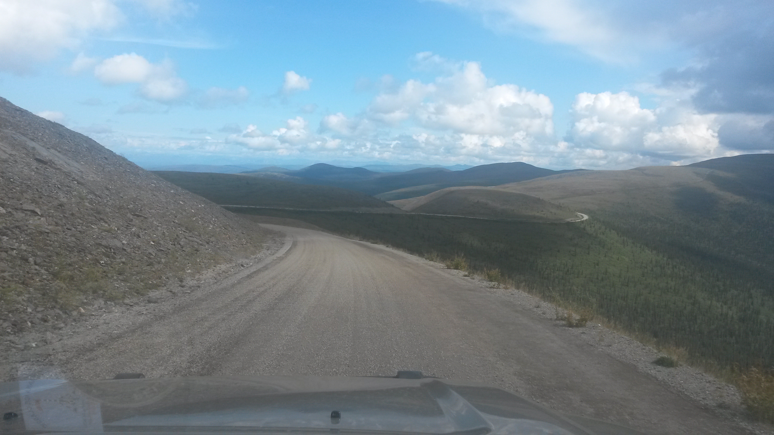
As we left Dawson City heading towards Whitehorse, we noticed another road north to the Arctic Circle in the Yukon. The big three Ds of remote roads are the Denali, the Dalton and the Dempster Highways. This was the Dempster Highway, the Canadian version of the Dalton Highway – we had to take it.
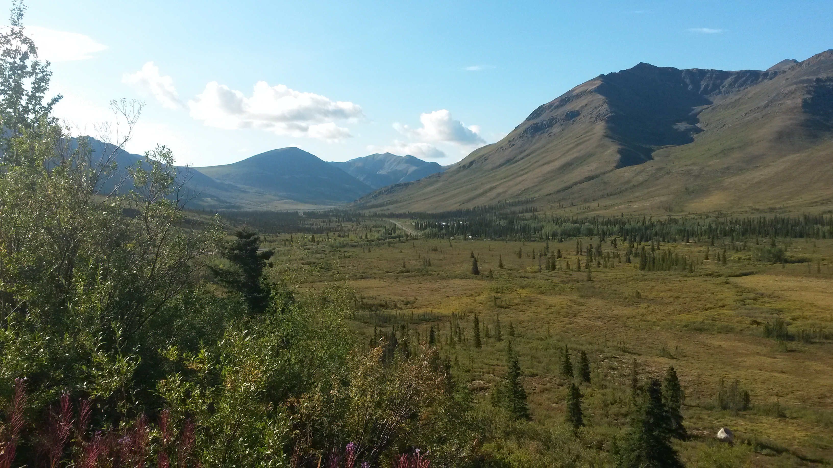
Tombstone Provincial Park is near the southern end of this road. We stopped for the night at the park’s Interpretive Centre in a beautiful valley.
The campground was full so the overflow was actually the visitor centre’s parking lot. This worked out well for us because it was free and right next to the beaver pond trail. We hiked to the pond and watched four beavers working away on their incredible multi-level dam. I’m still convinced that California’s long term water solution is tied to beavers.

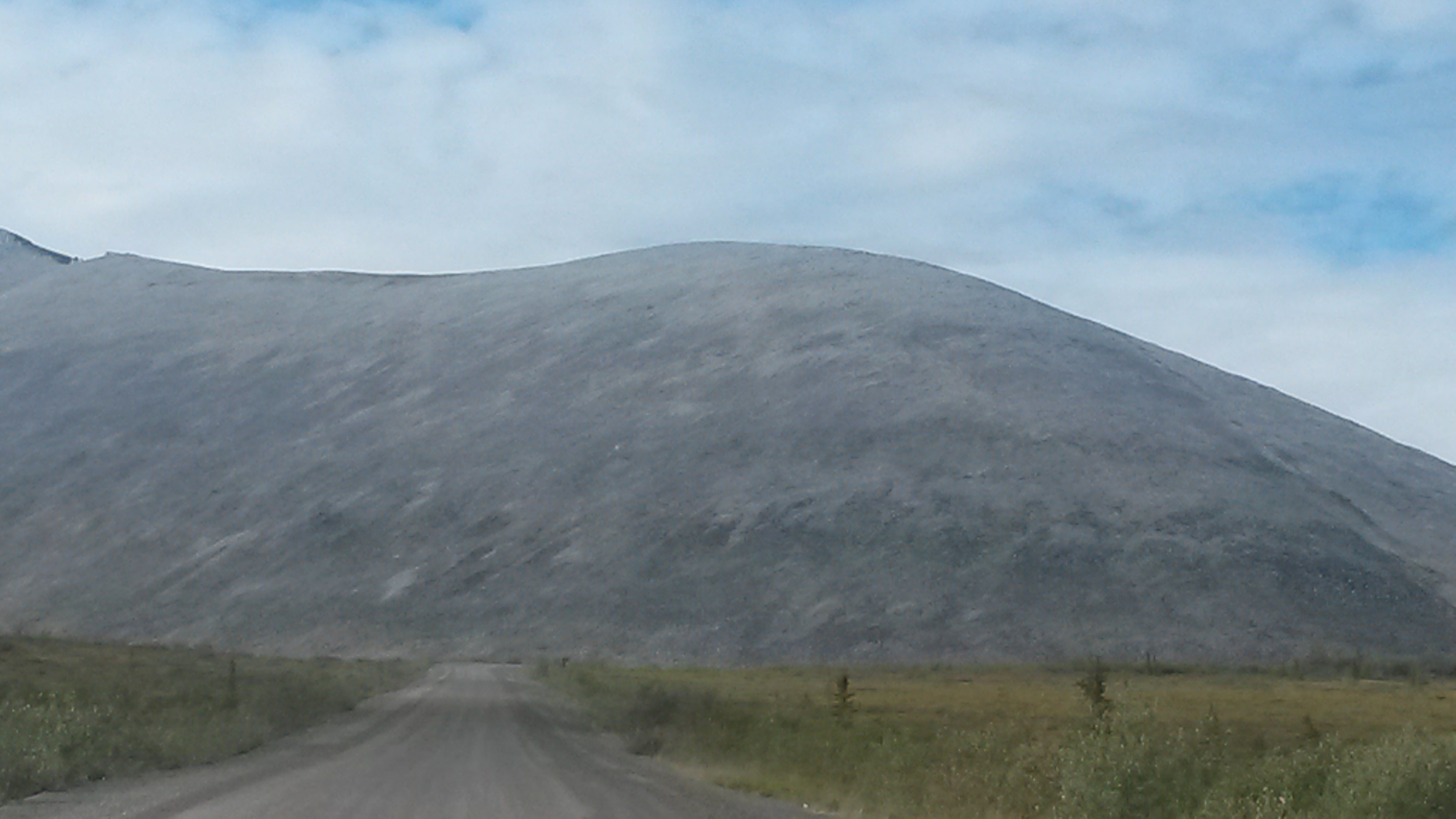
Tombstone Park is named after the Tombstone Mountain, the spike mountain at the very end of this beautiful valley.
The tundra and landscapes were pretty special as we drove up the Dempster Highway. The tundra reminds us of the southwest desert, very remote and beautiful. I got my hair cut in Anchorage by a lady who moved to Alaska from the Phoenix area. She said the Arctic is the same, but different from the desert, which I totally understand. It’s cold versus hot, but both are remote with tremendous vistas, incredible beautiful, teaming with life if you know where to look, and can be very unforgiving for the ill prepared – the same, but different.

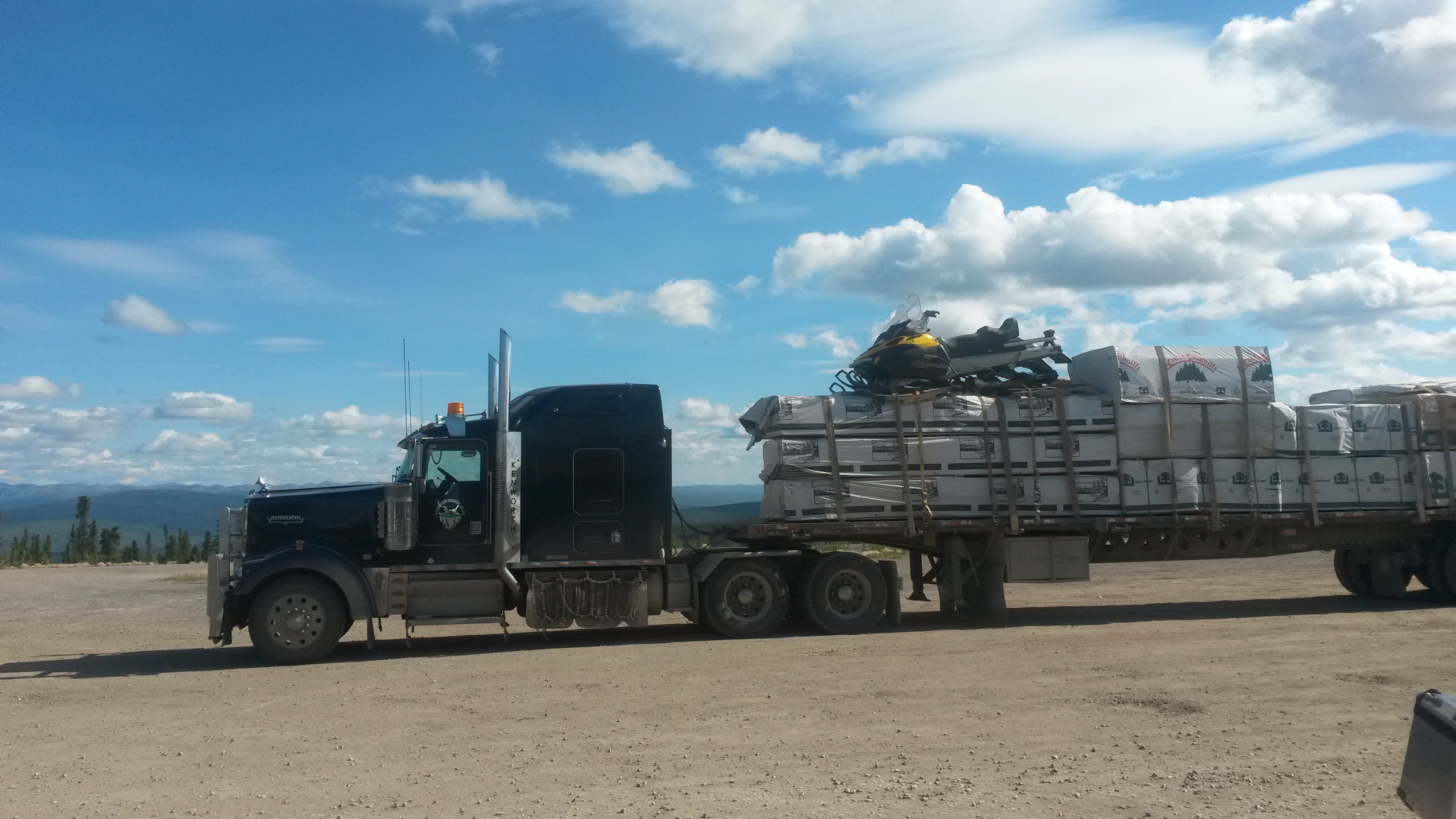
At one of the few stops along the highway for food and gas you get to see some interesting truck loads that are being delivered to the north. I wonder what the story behind this was, “send me the building materials I ordered and throw on my snowmobile”.
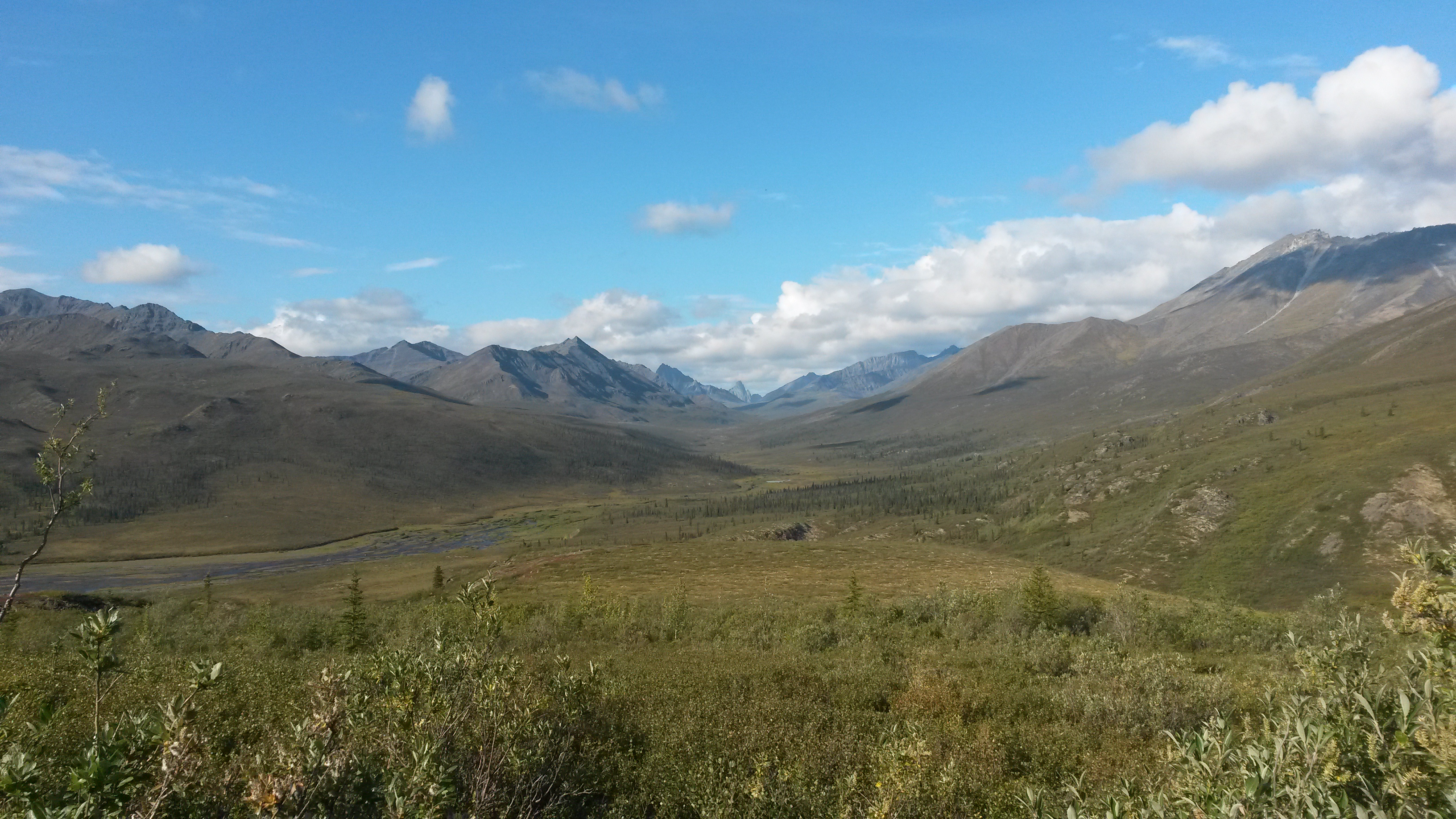
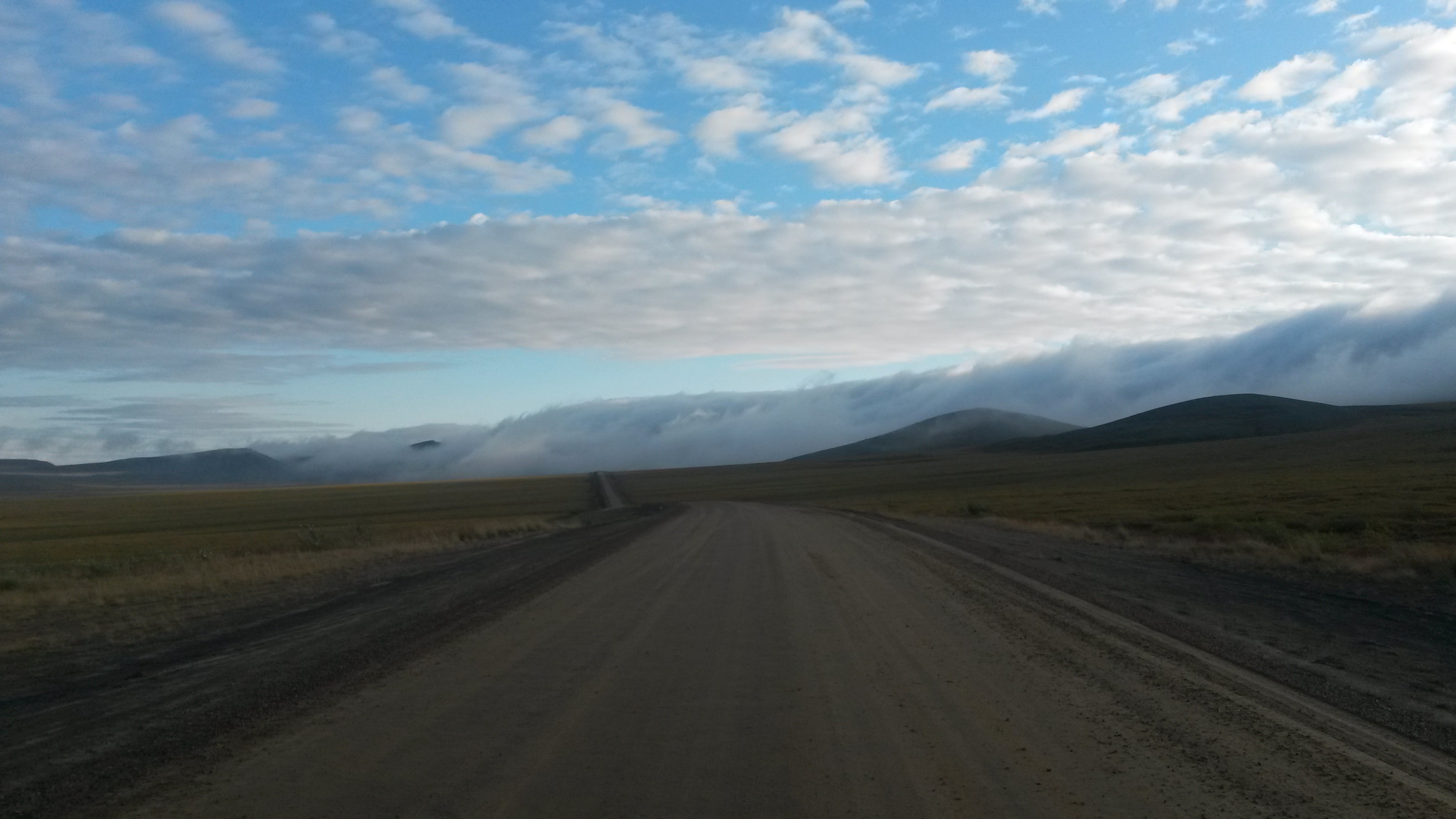
We made it to the Arctic Circle for the second time this trip, and the area was more like I expected with tundra all around. The Porcupine Caribou herd of more than 100,000 caribou pass through this area, but we didn’t see any – must have been hiding.

We then continued further north until we entered the Northwest Territories.
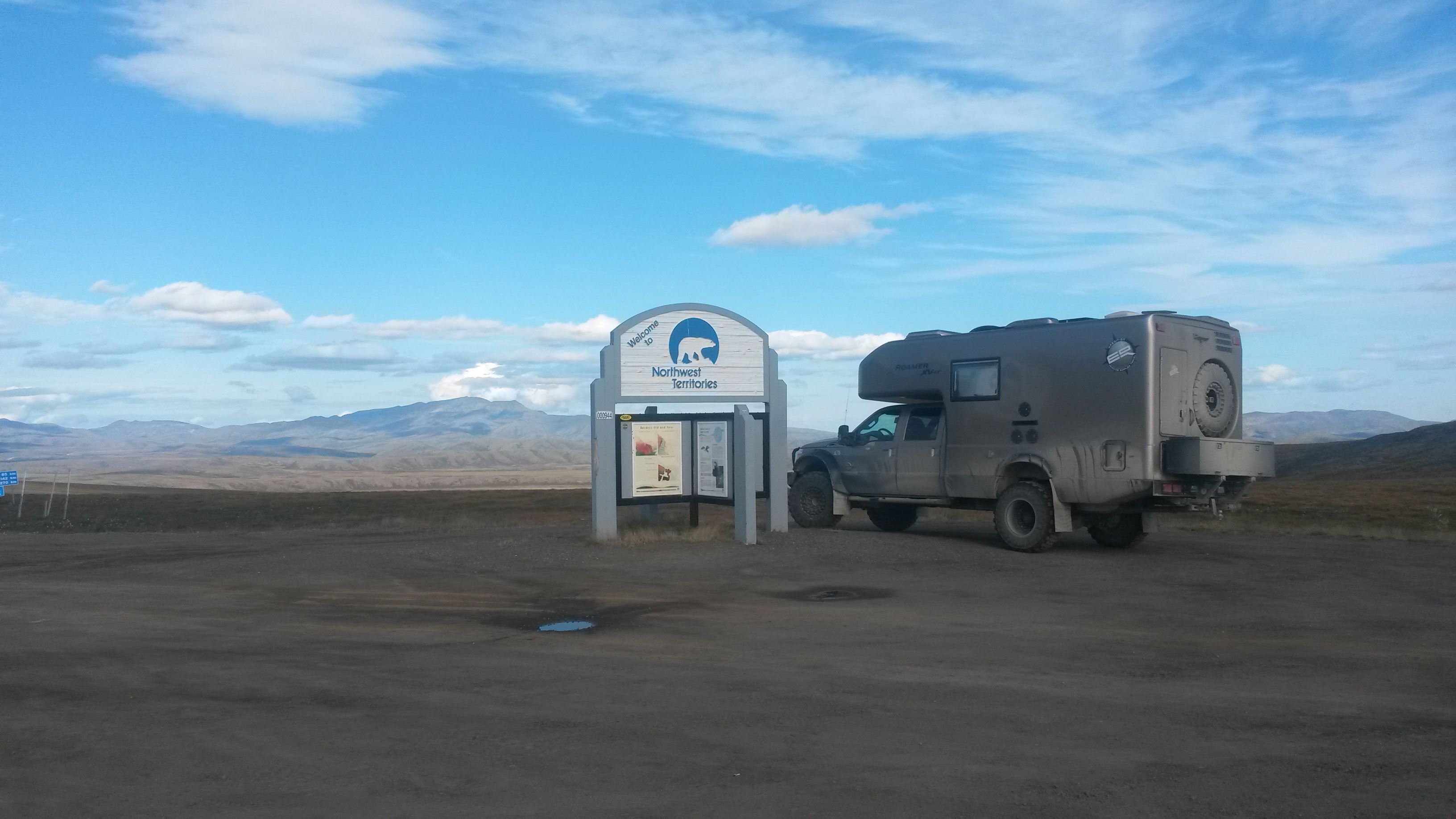
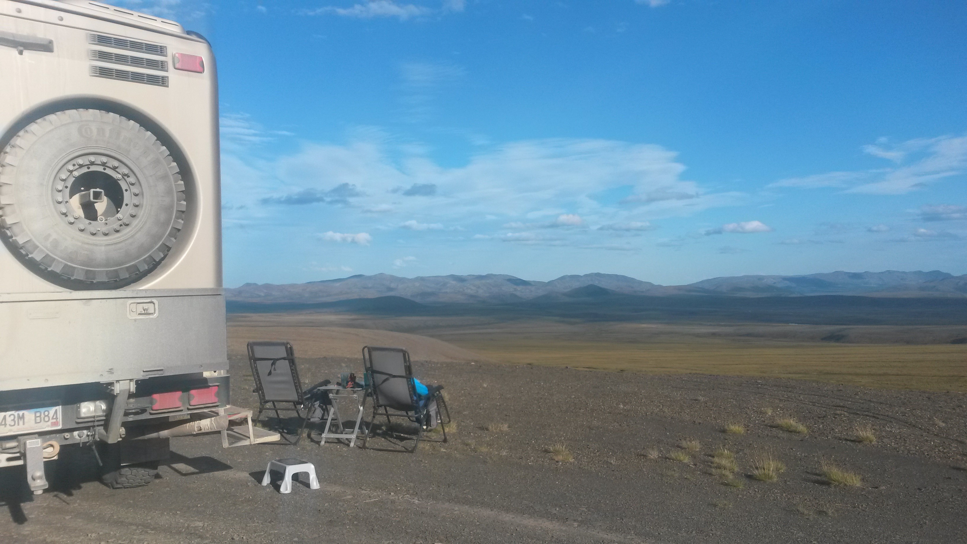
We camped at milepost 4km into NWT on a hill overlooking a beautiful tundra-covered valley.
The road continues on to Fort McPherson and Inuvik in the NWT. You can see the dust that is kicked up by the occasional traffic on the road.

I cooked up some caribou meat patties we picked up in Anchorage. Pam equated the taste and consistency to another mechanically separated meat product, but I liked them. But then again, I like Slim Jims too.
After dinner Pam spotted a Muskox grazing across the tundra below us. We watched it for some time making its way across the tundra. However, subsistence hunting season in NWT opened in early August. A pickup popped over the horizon about a half-mile away from us and also spotted the muskox moving towards their position. They stopped and three guys jumped out. One had a gun and we watched as he closed on the muskoxen and took it down from about 50 yards with 6 shots (obviously shooting is not his strength). Another pickup stopped and four more folks jumped out and we watched over the next hour as the seven hauled 11 large loads of sectioned muskoxen to the trucks, probably around 400 pounds of meat.
After they left the clouds slowly descended onto the hilltop and we spent the arctic twilight in fog that was still there in the morning. It was so quiet there you could hear the mist as a very light drizzly on the tundra. I guess this was the original “white noise”.
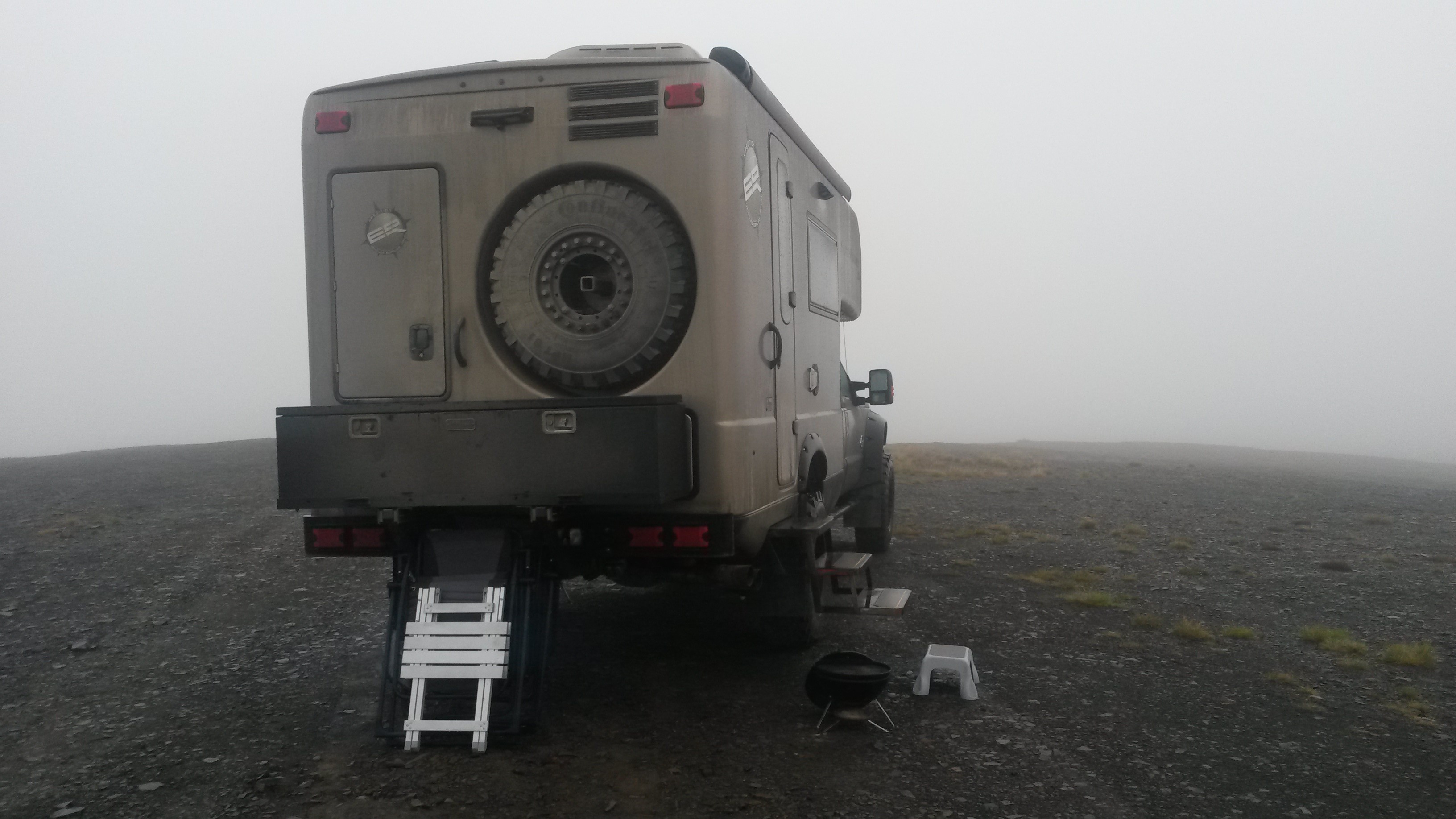
When turned south and dropped off the mountain in NWT and back into the Yukon. Looking back we could no longer see the mountain range up where we were camped. The mountain range and fog roll ran for many miles along the horizon and looked like a spectacular, slow-motion, 1000-foot high wave breaking over the range.
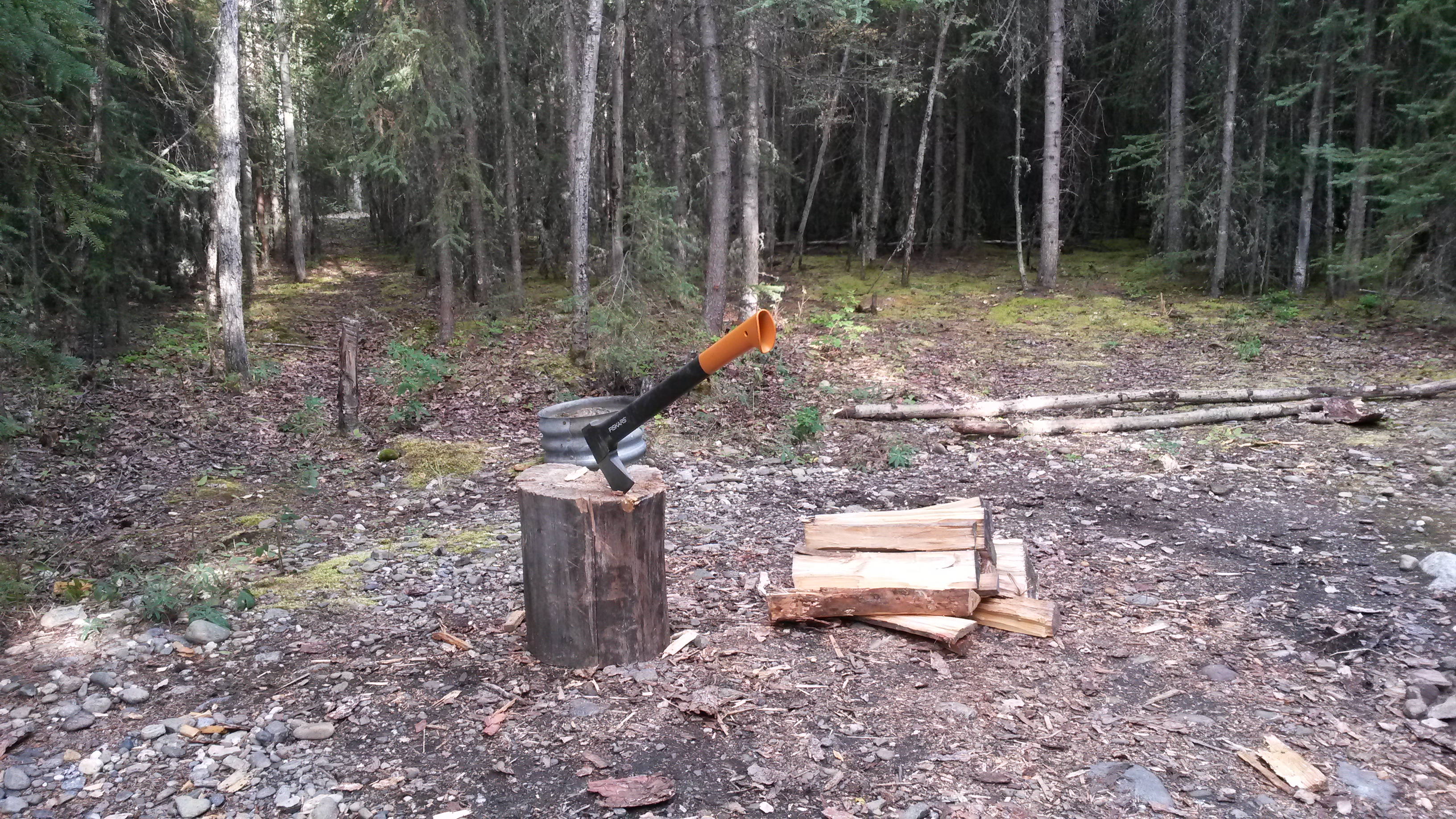
We dropped back down the Dempster Highway and then headed south towards Whitehorse. We camped at the Moose Creek campground, a Yukon provincial run campground about halfway between Dawson City and Whitehorse. Firewood is free at these campgrounds, but the wood is provided in entire tree cross-sections. I had to break out the Roamer’s axe and split some wood for the first time in a long time for our fire.
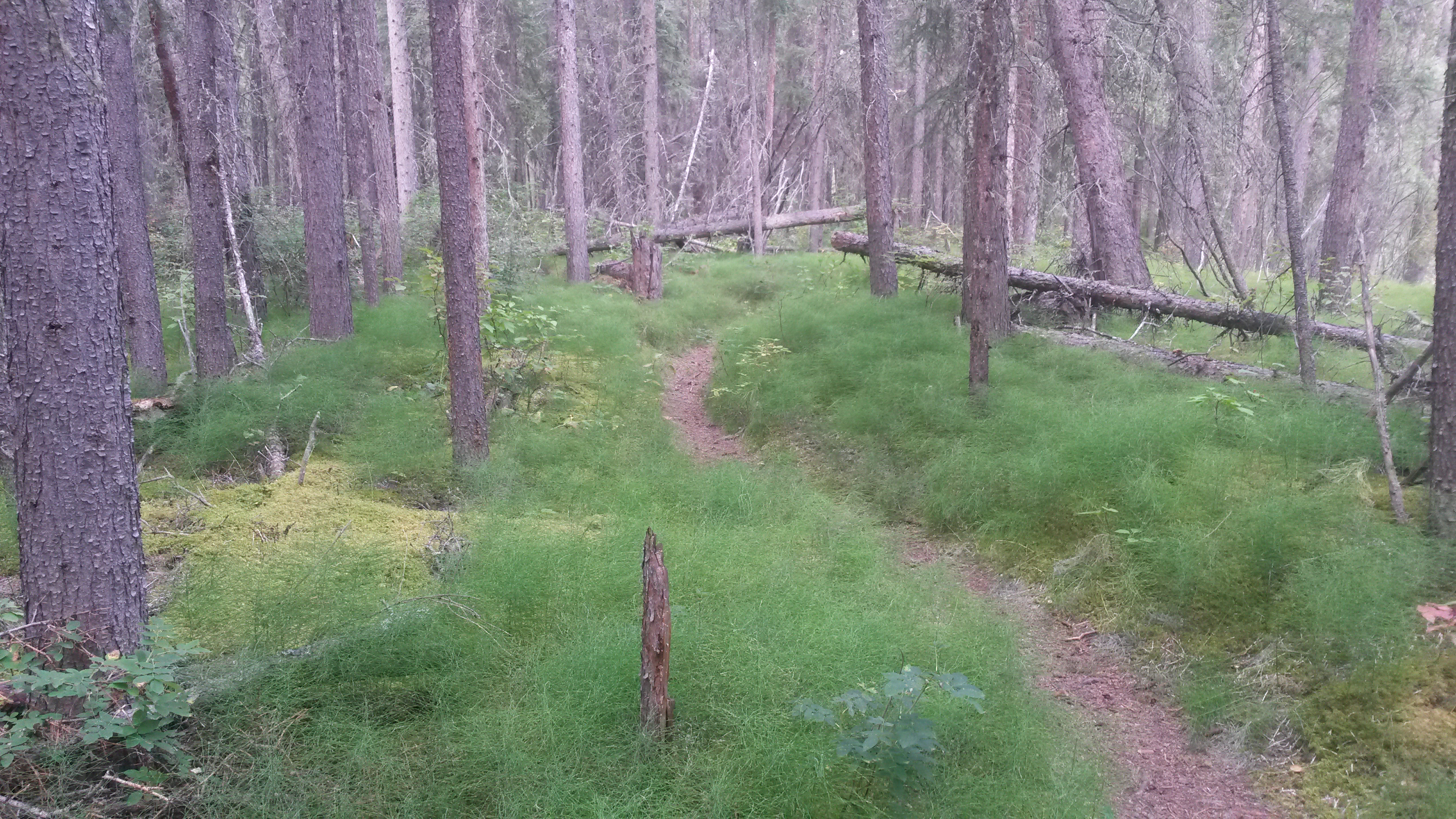
We also hiked a nice trail up Moose Creek to Stewart River at the campground. The path was a forest path with many squirrels giving alarm as we passed, and several spruce grouse appearing along the way.
It’s much greener as we drop south, and the nights are much darker. I saw my first star at night in quite some time. The road to Whitehorse passes through some heavily forested areas. Occasionally, the scenery breaks into a vista like the Five Finger Rapids along the Yukon River, a narrow path between the near bank and the island the big stern-wheeler ships needed to navigate to get from Dawson City to Whitehorse.

Whitehorse is the capital of the Yukon Territory. We stopped there for a couple days to restock, clean the calcium chloride grime off the Roamer again, do laundry and sight-see. We also had an oil change for the Roamer and the other light bracket welded back on similar to Valdez after it failed sometime while in Whitehorse. It was just a matter of time before it failed like the other bracket and I guess the Denali, Taylor and Dempster Highways helped to even out the lives between the two brackets.
We camped next to a group from lower BC that took many of the same routes we took, but had four blown tires and two broken suspension springs on their three rigs. So a couple of broken attach brackets is not so bad.
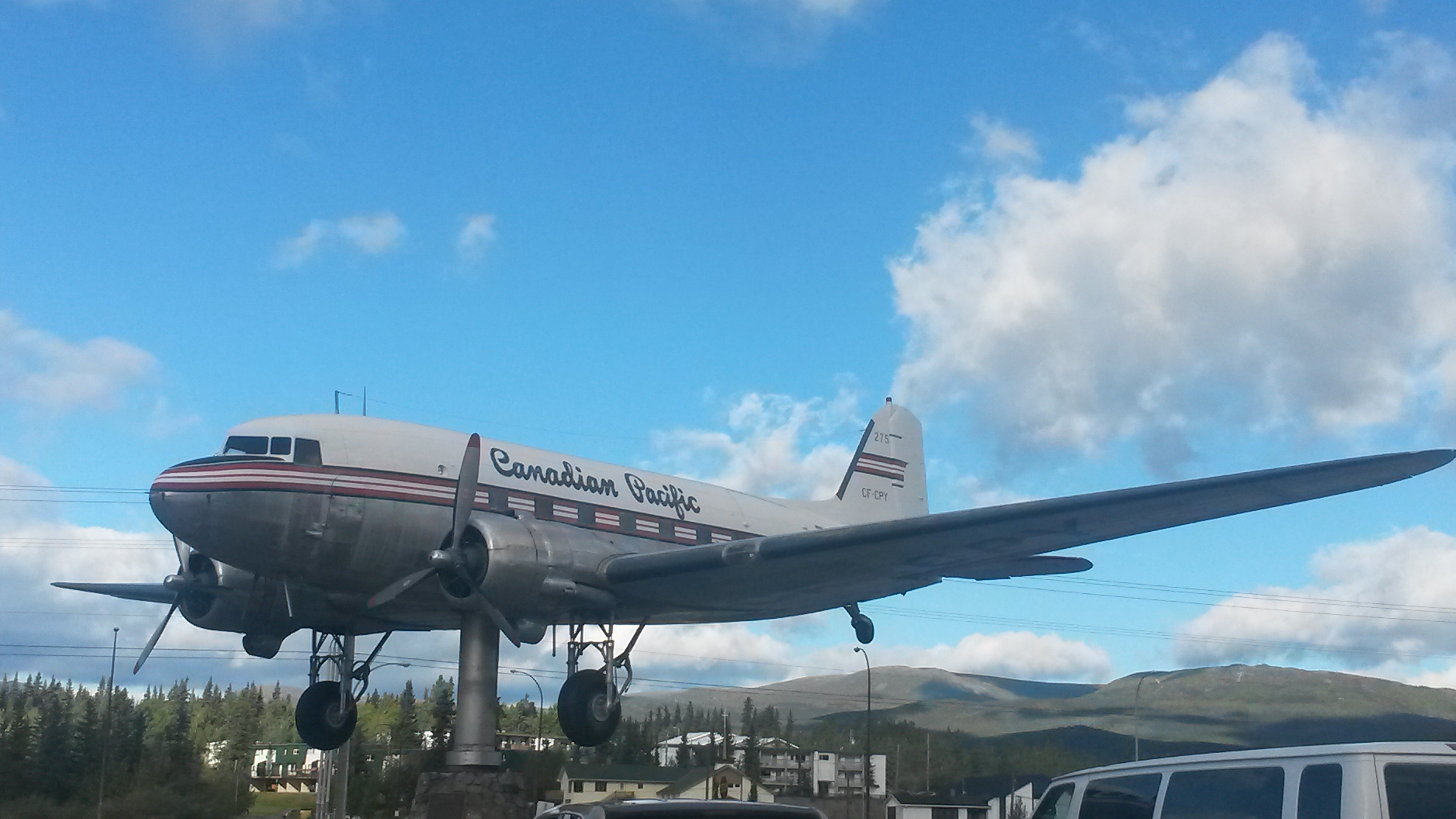
Whitehorse has a transportation museum with the world’s largest weather vane, a DC-3. The bearing must be incredibly low friction because a light wind causes the huge plane to smoothly spin and align itself with the wind.
We also found the next Roamer upgrade in all-terrain vehicles. Instead of a tire spoon to maneuver the spares around you may need a tire backhoe. I wonder if it’s WIFI enabled? You could probably pass a Prius with this thing while still in the same lane.

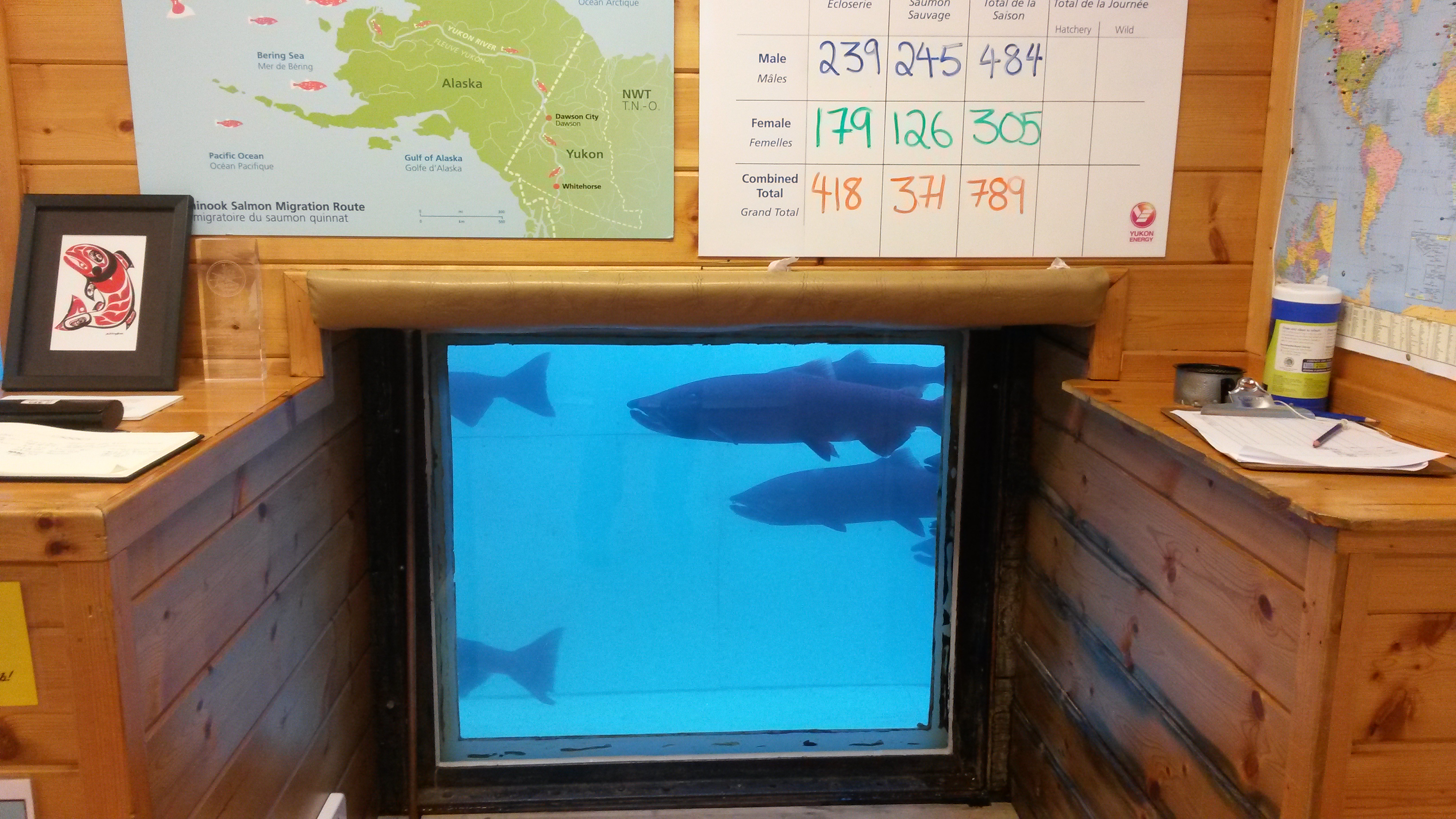
We also visited the world’s largest fish ladder that provides a path for the Chinook Salmon to get to their spawning grounds around the hydro-electric plant on the Yukon River.

The salmon pass through a section where they are counted and documented. It’s incredible to think that these fish travel nearly 2000 miles up the Yukon River, which is a very fast moving river, from the Bering Sea to the Yukon River headwaters just outside Whitehorse to spawn. They cover nearly 20 miles a day during this journey with everything in the world trying to eat them along the way.
We also visited the Yukon Brewing Company here in Whitehorse. Yukon Red is a rather nice beer that both Pam and I enjoy. The price of gas and beer is still high, but with the Canadian dollar at 76 cent to the US dollar the sting is not as bad.
We’ll be heading to Watson Lake and south into BC. We both miss the tundra, but other travelers have told us great places to stop on our way south.
